Church Rock, New Mexico
| Church Rock, New Mexico | |
|---|---|
| CDP | |
| Nickname(s): Churchrock Chapter | |
 Location of Church Rock, New Mexico | |
 Church Rock, New Mexico Location in the United States | |
| Coordinates: 35°32′6″N 108°36′42″W / 35.53500°N 108.61167°WCoordinates: 35°32′6″N 108°36′42″W / 35.53500°N 108.61167°W | |
| Country | United States |
| State | New Mexico |
| County | McKinley |
| Government | |
| • Type | Chapter Government |
| • President | Johnnie Henry Jr. |
| • Vice-President | Sherman Woody |
| • Secretary-Treasurer | Louise Jim |
| • Tribal Council Member | Edmund Yazzie |
| Area[1] | |
| • Total | 2.3 sq mi (6 km2) |
| • Land | 2.3 sq mi (6 km2) |
| • Water | 0.0 sq mi (0 km2) |
| Elevation | 6,686 ft (2,038 m) |
| Population (2010)[1] | |
| • Total | 1,128 |
| • Density | 490/sq mi (190/km2) |
| Time zone | UTC-7 (Mountain (MST)) |
| • Summer (DST) | UTC-6 (MDT) |
| ZIP code | 87311 |
| Area code(s) | 505 |
| FIPS code | 35-15370 |
| GNIS feature ID | 0902212 |
| Website | http://churchrock.navajochapters.org |
_Navajo_Church_near_Fort_Wingate%2C_McKinley_County%2C_New_Mexico.%2C_1871_-_1878_-_NARA_-_517770.jpg)
Church Rock (Navajo: Kinłitsosinil) is a census-designated place (CDP) in McKinley County, New Mexico, United States. The population was 1,128 at the 2010 census.[1] Church Rock is named for Church Rock, a prominent natural landmark with the same name.
Navajo Nation government
| 2004-2008 Chapter Official | 2004-2008 Council Delegate | 2004-2008 Administration |
|---|---|---|
| Johnny Livingston, President | Charles S. Damon II | Alice Largo, Coordinator |
| Robinson Kelly, Vice-President | Ernest D. Yazzie Jr. | Deeanna Washee, |
| Sherman Woody, Secretary/Treasurer | ||
| Vanessa Begay-Lee, Grazing Official |
| 2008-2012 Chapter Official | 2008-2012 Council Delegate | 2008-2011 Administration | 2011-2012 Administration |
|---|---|---|---|
| Johnnie Henry Jr., President | Charles S. Damon II | Brian H. Chee, Coordinator | Alvin Billie, Coordinator |
| Robinson Kelly, Vice-President | Ernest D. Yazzie Jr. | Deeanna Washee, Office Specialist | Deeanna Washee, AMS |
| Louise Jim, Secretary/Treasurer | ** Edmund Yazzie | Michelle Johns, Office Assistant | Michelle Johns, Office Assistant |
| Emery Chee, Grazing Official | ** Member of 22nd NN Council |
Geography
Church Rock is located at 35°32′6″N 108°36′42″W / 35.53500°N 108.61167°W (35.534961, -108.611593).[2]
According to the United States Census Bureau, the CDP has a total area of 2.3 square miles (6.0 km2), of which 2.3 square miles (6.0 km2) is land and 0.03 square miles (0.078 km2) (1.2%) is water.[1]
Demographics
| Languages (2000) [3] | Percent |
|---|---|
| Spoke Navajo at home | 63.31% |
| Spoke English at home | 36.69% |
As of the census[4] of 2000, there were 1,077 people, 258 households, and 214 families residing in the CDP. The population density was 450.7 people per square mile (174.0/km²). There were 299 housing units at an average density of 125.1 per square mile (48.3/km²). The racial makeup of the CDP was 98.14% Native American, 0.65% White, 0.09% African American, 0.28% from other races, and 0.84% from two or more races. Hispanic or Latino of any race were 1.39% of the population.
There were 258 households out of which 56.2% had children under the age of 18 living with them, 43.4% were married couples living together, 31.0% had a female householder with no husband present, and 16.7% were non-families. 15.1% of all households were made up of individuals and 3.5% had someone living alone who was 65 years of age or older. The average household size was 4.17 and the average family size was 4.65.
In the CDP, the population was spread out with 42.2% under the age of 18, 11.7% from 18 to 24, 26.0% from 25 to 44, 15.6% from 45 to 64, and 4.5% who were 65 years of age or older. The median age was 22 years. For every 100 females, there were 92.0 males. For every 100 females age 18 and over, there were 87.3 males.
The median income for a household in the CDP was $27,917, and the median income for a family was $28,958. Males had a median income of $23,529 versus $21,016 for females. The per capita income for the CDP was $6,780. About 34.3% of families and 36.0% of the population were below the poverty line, including 47.5% of those under age 18 and none of those age 65 or over.
Uranium mining
On July 16, 1979, the dam at a United Nuclear Corporation (based in Virginia) Church Rock uranium mill was breached and spilled 1,100 tons of milled uranium ore and 94 million US gallons (360,000 m3) of heavy metal effluent into the Puerco River.[5] This was the largest release of radioactive waste in U.S. history, but until recently, no epidemiological studies were undertaken of the effects on the population.[6] With the declining uranium market, two of the mines closed in 1983 and the third closed in February 1986.[7]
In 2003 the Church Rock Uranium Monitoring Project was initiated by the Churchrock Chapter of the Navajo Nation to assess environmental impacts of abandoned uranium mines and build capacity to conduct community-based research with policy implications.[8] Its May 2007 report found that significant radiation from both natural and mining sources remains in the area; the community is dedicated to remedy the problem as much as possible.[8]
In 2005 the Navajo Nation prohibited any further uranium mining in the nation. In 2008 the US EPA and the Navajo EPA began a five-year plan to identify and ameliorate areas contaminated by uranium mining; their priority has been water sources and structures.[9]
In 2013 the Churchrock Chapter passed a resolution supporting a demonstration in-situ mining at Section 8 and 17. The resolution passed with 68 in support 26 opposed and 16 abstained. Minority of community members continue to oppose mining operations as well as outside residents who reside in other chapters and non-Navajos.[10][11]
Culture
Inter Tribal Ceremonial (August) brings thousands of visitors and members of almost all Indian tribes to Red Rock State Park.
Churchrock Chapter celebrates the annual, Treaty Day Festival on June 1. The first event took place on June 1, 2010. The event is to commemorate the signing of the Treaty of 1868 between the Navajo Tribe and United States Government to emancipate the Navajo people from Fort Sumner, New Mexico (Bosque Redondo).
Economy
Church Rock is the location of Fire Rock Casino, which opened on November 19, 2008.
References
- 1 2 3 4 "2010 Census Gazetteer Files - Places: New Mexico". U.S. Census Bureau. Retrieved October 20, 2017.
- ↑ "US Gazetteer files: 2010, 2000, and 1990". United States Census Bureau. 2011-02-12. Retrieved 2011-04-23.
- ↑ "Archived copy". Archived from the original on 2017-05-25. Retrieved 2017-03-24.
- ↑ "American FactFinder". United States Census Bureau. Archived from the original on 2013-09-11. Retrieved 2008-01-31.
- ↑ Wasserman, Harvey; Norman Solomon (1982). "KILLING OUR OWN: The Disaster of America's Experience with Atomic Radiation". Delta Book. Retrieved 13 October 2017.
- ↑ Brugge, D; Bui, C (September 2007). "The Sequoyah corporation fuels release and the Church Rock spill: unpublicized nuclear releases in American Indian communities". Am J Public Health. 97: 1595–600. doi:10.2105/AJPH.2006.103044. PMC 1963288. PMID 17666688.
- ↑ Shuey, Chris (1992). "Contaminant Loading on the Puerco River: A Historical Overview", Southwest Research and Information Center Albuquerque, New Mexico, 14 October 1992. "Archived copy". Archived from the original on 2008-10-14. Retrieved 2008-10-29.
- 1 2 Shuey, Chris; et al. (2007). "REPORT OF THE CHURCH ROCK URANIUM MONITORING PROJECT 2003-2007, CHURCHROCK CHAPTER, NAVAJO NATION, SOUTHWEST RESEARCH AND INFORMATION CENTER and NAVAJO EDUCATION AND SCHOLARSHIP FOUNDATION" (PDF). Window Rock, Navajo Nation (Arizona), USA. Retrieved 13 October 2017.
- ↑ Felicia Fonseca, "Navajo woman helps prompt uranium mine cleanup", Associated Press, carried in Houston Chronicle, 5 September 2011, accessed 5 October 2011
- ↑ "Uranium project given green light on Navajo Nation" Archived 2014-07-26 at the Wayback Machine., Farmington Daily Times, carried in "Farmington Daily Times", 24 December 2013, accessed 16 July 2014
- ↑ "Churchrock supports uranium mining", Gallup Independent, carried in "Gallup Independent", 9 February 2013, accessed 16 July 2014
External links
- "Home Page". Churchrock.navajochapters.org. Retrieved 13 October 2017.
- "Puerco River Spill, Historical Overview". Web.archive.org. 14 October 2008. Retrieved 13 October 2017.
- "Chapter 9: Uranium Milling and the Church Rock Disaster, "KILLING OUR OWN", 1982". Ratical.org. Retrieved 13 October 2017.
Municipalities and communities of McKinley County, New Mexico, United States | ||
|---|---|---|
| City | 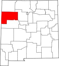 | |
| CDPs | ||
| Unincorporated communities | ||
| Indian reservation | ||
| Footnotes | ‡This populated place also has portions in an adjacent county or counties | |