Doney Park, Arizona
| Doney Park | |
|---|---|
| Unincorporated town CDP | |
 View of San Francisco Peaks from Doney Park | |
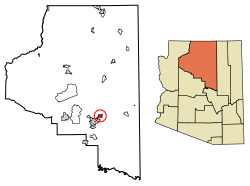 Location of Doney Park in Coconino County, Arizona | |
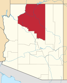
 Doney Park Location in the United States | |
| Coordinates: 35°16′12.04″N 111°31′2.57″W / 35.2700111°N 111.5173806°WCoordinates: 35°16′12.04″N 111°31′2.57″W / 35.2700111°N 111.5173806°W | |
| Country | United States |
| State | Arizona |
| County | Coconino |
| Area[1] | |
| • Total | 14.96 sq mi (38.73 km2) |
| • Land | 14.96 sq mi (38.73 km2) |
| • Water | 0.00 sq mi (0.00 km2) |
| Population (2010) | |
| • Total | 3,894 |
| • Estimate (2016)[2] | N/A |
| Time zone | UTC-7 (MST) |
| • Summer (DST) | UTC-7 (MST) |
| ZIP code | 86004 |
| Area code | 928 |
| FIPS code | 04-76010 |
| GNIS feature ID | 0012802 |
Doney Park is a census-designated place[3] in Coconino County, Arizona, United States. It is a residential area northeast of Flagstaff, located off U.S. Route 89. It is located in the 86004 zip code.
The area is named for Ben Doney, a Northern Arizona pioneer. Many of the homes in this community are located on lots of an acre or more. The area is known for its views of the San Francisco Peaks and Sunset Crater Volcano.
As of the 2010 census,[4] the population of Doney Park was 5,395.
Demographics
| Historical population | |||
|---|---|---|---|
| Census | Pop. | %± | |
| U.S. Decennial Census[5] | |||
References
- ↑ "2016 U.S. Gazetteer Files". United States Census Bureau. Retrieved Jul 18, 2017.
- ↑ "Population and Housing Unit Estimates". Retrieved June 9, 2017.
- ↑ "Archived copy". Archived from the original on 2011-07-21. Retrieved 2011-04-23.
- ↑ "Archived copy". Archived from the original on 2011-07-21. Retrieved 2011-04-23.
- ↑ "Census of Population and Housing". Census.gov. Retrieved June 4, 2016.
| Wikimedia Commons has media related to Doney Park, Arizona. |
This article is issued from
Wikipedia.
The text is licensed under Creative Commons - Attribution - Sharealike.
Additional terms may apply for the media files.