Marble Canyon, Arizona
| Marble Canyon, Arizona | |
|---|---|
| Populated place | |
 Marble Canyon, Arizona  Marble Canyon, Arizona | |
| Coordinates: 36°48′56″N 111°38′16″W / 36.81556°N 111.63778°WCoordinates: 36°48′56″N 111°38′16″W / 36.81556°N 111.63778°W | |
| Country | United States |
| State | Arizona |
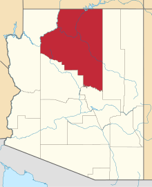
| County | Coconino |
| Elevation | 3,573 ft (1,089 m) |
| Time zone | UTC-7 (Mountain (MST)) |
| ZIP code | 86036 |
| Area code(s) | 928 |
| GNIS feature ID | 25252[1] |
Marble Canyon is a populated place in Coconino County, Arizona, United States. Marble Canyon is located on U.S. Route 89A at the Navajo Bridge, 12 miles (19 km) southwest of Page. Marble Canyon has a post office with ZIP code 86036.[2] Marble Canyon is near Lee's Ferry, the former location of a ferry established by John D. Lee, a Mormon settler. It is often used by people entering the Colorado River for fishing and rafting trips.
Climate
According to the Köppen Climate Classification system, Marble Canyon has a semi-arid climate, abbreviated "BSk" on climate maps.[3]
References
This article is issued from
Wikipedia.
The text is licensed under Creative Commons - Attribution - Sharealike.
Additional terms may apply for the media files.