Bielsko-Biała
| Bielsko-Biała | |||
|---|---|---|---|
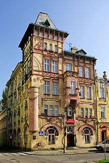
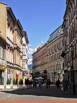 11th November Street in Bielsko-Biała | |||
| |||
 Bielsko-Biała  Bielsko-Biała | |||
| Coordinates: 49°49′21″N 19°2′40″E / 49.82250°N 19.04444°E | |||
| Country |
| ||
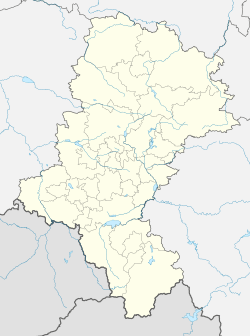
| Voivodeship |
| ||
| County | city county | ||
| Town rights |
1312 Bielsko 1723 Biała | ||
| Government | |||
| • Mayor | Jacek Krywult | ||
| Area | |||
| • City | 124.51 km2 (48.07 sq mi) | ||
| Highest elevation | 1,117 m (3,665 ft) | ||
| Lowest elevation | 262 m (860 ft) | ||
| Population (2013) | |||
| • City | 173,699 | ||
| • Density | 1,400/km2 (3,600/sq mi) | ||
| • Urban | 325,000 | ||
| • Metro | 5,294,000 | ||
| Time zone | UTC+1 (CET) | ||
| • Summer (DST) | UTC+2 (CEST) | ||
| Postal code | 43-300 to 43-382 | ||
| Area code(s) | (+48) 033 | ||
| Car plates | SB | ||
| Website | http://www.um.bielsko.pl | ||


Bielsko-Biała [ˈbʲɛlskɔ ˈbʲawa] (![]()
History
Both city names, Bielsko and Biała refer to the Biała River, with etymology stemming from either biel or biała, which means "white" in Polish.
Bielsko
The remnants of a fortified settlement in what is now the Stare Bielsko (Old Bielsko) district of the city were discovered between 1933 and 1938 by a Polish archaeological team. The settlement was dated to the 12th - 14th centuries. Its dwellers manufactured iron from ore and specialized in smithery. The current centre of the town was probably developed as early as the first half of the 13th century. At that time a castle (which still survives today) was built on a hill.
In the second half of the 13th century, the Piast dukes of Opole invited German settlers to colonize the Silesian Foothills. As the dukes then also ruled over the Lesser Polish lands east of the Biała River, settlements arose on both banks like Bielitz (now Stare Bielsko), Nickelsdorf (Mikuszowice Śląskie), Kamitz (Kamienica), Batzdorf (Komorowice Śląskie) and Kurzwald in the west as well as Kunzendorf (Lipnik), Alzen (Hałcnów) and Wilmesau (Wilamowice) in the east. Nearby settlements in the mountains were Lobnitz (Wapienica) and Bistrai (Bystra).
After the partition of the Duchy of Oppeln in 1281, Bielsko passed to the Dukes of Cieszyn (Teschen). The town was first documented in 1312 when Duke Mieszko I of Cieszyn granted a town charter. The Biała again became a border river, when in 1315 the eastern Duchy of Oświęcim split off from Cieszyn as a separate under Mieszko's son Władysław. After the Dukes of Cieszyn had become vassals of the Bohemian kings in 1327 and the Duchy of Oświęcim was sold to the Polish Crown in 1457, the Biała River for centuries marked the border between the Bohemian crown land of Silesia within the Holy Roman Empire and the Lesser Polish region of the Kingdom of Poland and the Polish–Lithuanian Commonwealth.
With Bohemia and the Upper Silesian Duchy of Cieszyn, Bielsko in 1526 was inherited by the Austrian House of Habsburg and incorporated into the Habsburg Monarchy. From 1560 Bielsko was held by Frederick Casimir of Cieszyn, son of Duke Wenceslaus III Adam, who due to the enormous debts his son left upon his death in 1571, had to sell it to the Promnitz noble family at Pless. With the consent of Emperor Maximilian II, the Promnitz dynasty and their Schaffgotsch successors ruled the Duchy of Bielsko as a Bohemian state country; acquired by the Austrian chancellor Count Friedrich Wilhelm von Haugwitz in 1752, the ducal status was finally confirmed by Empress Maria Theresa in 1754.
After the Prussian king Frederick the Great had invaded Silesia, Bielsko remained with the Habsburg Monarchy as part of Austrian Silesia according to the 1742 Treaty of Breslau.
In late 1849 Bielsko became a seat of political district. In 1870 it became a statutory city.
Biała
The opposite bank of the Biała River, again Polish since 1475, had been sparsely settled since the mid-16th century. A locality was first mentioned in a 1564 deed, it received the name Biała in 1584, and belonged at that time to Kraków Voivodeship. Its population increased during the Counter-Reformation in the Habsburg lands, when many Protestant artisans from Bielsko (which did not belong to Poland) moved across the river. Though already named a town in the 17th century, Biała officially was granted city rights by the Polish king Augustus II the Strong in 1723.
In the course of the First Partition of Poland in 1772, Biała was annexed by the Austrian Habsburg Monarchy and incorporated into the crownland of Galicia. The Protestant citizens received the right to establish parishes according to the 1781 Patent of Toleration by Emperor Joseph II. BIALA was head of the district with the same name, one of the 78 Bezirkshauptmannschaften in the Galicia crownland.[2]
Modern times
With the dissolution of Austria–Hungary in 1918 according to the Treaty of Saint-Germain-en-Laye, both cities became part of the reconstituted Polish state, though a significant part of the population was ethnic German[3], forming a German language island. [4] The ethnic German citizens formed an aggressively anti-Polish, rabidly racist and anti-Jewish Jungdeutsche Partei sponsored financially by the Ministry of Foreign Affairs of the Third Reich and trained in propaganda, sabotage and espionage activities against the Polish state.[5] Its members smuggled military weapons,[6] and waged a campaign of intimidating other members of the community to leave for Nazi Germany, with tangible incentives.[5] A considerable number of young ethnic Germans joined the rank-and-file of the Party during the mid-1930s as a result of the Nazi indoctrination and aggressive recruitment.[7] During World War II the city was annexed by Nazi Germany. Many of its Jewish population was sent aboard Holocaust trains to nearby Auschwitz extermination camp never to return. After the defeat of Nazism in 1945, the remaining German population fled westward or were expelled by the Soviet-installed communist government.
Two well-known Holocaust survivors from Bielsko-Biała are Roman Frister and Gerda Weissmann Klein. Both have written an autobiography about their experiences during World War II.
The combined city of Bielsko-Biała was created administratively on 1 January 1951 when the two cities of Bielsko, and Biała (known until 1951 as Biała Krakowska), were unified.
Geography
The city is situated on the border of historic Upper Silesia and Lesser Poland at the eastern rim of the smaller Cieszyn Silesia region, about 60 km (37 mi) south of Katowice. Administrated within Silesian Voivodeship since 1999, the city was previously capital of Bielsko-Biała Voivodeship (1975–1998).
Bielsko-Biała is one of the most important cities of the Beskidy Euroregion and the main city of the Bielsko Industrial Region (Polish: Bielski Okręg Przemysłowy), part of the Upper Silesian metropolitan area.
Climate
Bielsko-Biała has a transitional humid continental/oceanic climate (Köppen climate classification Cfb/Dfb) with cold, damp winters and warm, wet summers.
| Climate data for Bielsko-Biała (1980-2012) | |||||||||||||
|---|---|---|---|---|---|---|---|---|---|---|---|---|---|
| Month | Jan | Feb | Mar | Apr | May | Jun | Jul | Aug | Sep | Oct | Nov | Dec | Year |
| Record high °C (°F) | 16.5 (61.7) |
18.5 (65.3) |
23.0 (73.4) |
28.0 (82.4) |
30.7 (87.3) |
32.2 (90) |
38.1 (100.6) |
34.2 (93.6) |
31.5 (88.7) |
27.3 (81.1) |
23.1 (73.6) |
17.6 (63.7) |
38.1 (100.6) |
| Average high °C (°F) | 1.7 (35.1) |
1.9 (35.4) |
6.9 (44.4) |
12.8 (55) |
18.0 (64.4) |
20.4 (68.7) |
22.7 (72.9) |
22.6 (72.7) |
17.8 (64) |
12.9 (55.2) |
6.8 (44.2) |
2.7 (36.9) |
12.3 (54.1) |
| Daily mean °C (°F) | −1.3 (29.7) |
−0.8 (30.6) |
3.2 (37.8) |
8.2 (46.8) |
13.1 (55.6) |
15.7 (60.3) |
17.8 (64) |
17.6 (63.7) |
13.6 (56.5) |
9.1 (48.4) |
3.8 (38.8) |
−0.2 (31.6) |
8.3 (47) |
| Average low °C (°F) | −4.2 (24.4) |
−3.4 (25.9) |
−0.5 (31.1) |
3.5 (38.3) |
8.1 (46.6) |
11.0 (51.8) |
12.9 (55.2) |
12.6 (54.7) |
9.3 (48.7) |
5.2 (41.4) |
0.7 (33.3) |
−3.1 (26.4) |
4.3 (39.8) |
| Record low °C (°F) | −27.4 (−17.3) |
−24.5 (−12.1) |
−17.5 (0.5) |
−8.5 (16.7) |
−4.0 (24.8) |
0.0 (32) |
−0.7 (30.7) |
1.0 (33.8) |
0.0 (32) |
−9.0 (15.8) |
−15.9 (3.4) |
−26.0 (−14.8) |
−27.4 (−17.3) |
| Average precipitation mm (inches) | 28.6 (1.126) |
35.3 (1.39) |
38.6 (1.52) |
53.9 (2.122) |
74.5 (2.933) |
108.9 (4.287) |
116.7 (4.594) |
72.9 (2.87) |
74.1 (2.917) |
50.5 (1.988) |
53.9 (2.122) |
37.3 (1.469) |
745.2 (29.338) |
| Average precipitation days | 10.1 | 11.7 | 11.5 | 10.6 | 12.1 | 13.3 | 12.5 | 10.5 | 10.2 | 11.0 | 11.3 | 11.6 | 136.4 |
| Source: climatebase.ru [8] | |||||||||||||
Economy and Industry
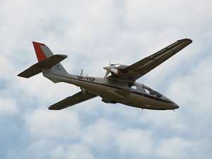
Bielsko-Biała is one of the most business friendly medium size cities in Poland. In the 2014 ranking of the 'Most Attractive Cities for Business' published yearly by Forbes the city was ranked 3rd in the category of cities with 150,000–300,000 inhabitants.[9] About 5% of people are unemployed (compared 9,6% for Poland). Bielsko-Biała is famous for its textile, machine-building, and especially automotive industry. Four areas in the city belong to the Katowice Special Economic Zone. The city region is a home for several manufacturers of high-performance gliders and aircraft.
Transport
.jpg)
Road transport
Bielsko-Biała is located within a short distance to Czech and Slovakian borders on the crossroads of two Expressways (S1 and S69) connecting Poland with Southern Europe:
- Expressway S1 connects the city with Czech Republic via the border town Cieszyn.
- Expressway S69 connects the city with Slovakia via the border town Zwardoń. The road is currently under construction (November 2014).
Bielsko-Biała is connected with the rest of Poland by the dual carriageway DK1 road running to Tychy where it intersects the Expressway S1 and further to Katowice where it intersects the Motorway A4.
It is planned to extend S1 north along the existing dual carriageway DK1 from Bielsko-Biała to Tychy and Katowice, thus building an expressway connection of the city with the national motorway network of Poland. National Road DK52 connects Bielsko-Biała with Kraków in the east. The most important interchange in the area is the cloverleaf north of Bielsko-Biała where S1, DK1 and DK52 meet.
Rail transport
Bielsko-Biała is connected by direct train services with the following large Polish cities (November 2014): Bydgoszcz, Gdańsk, Gdynia, Katowice, Kraków (Cracow), Łódź, Olsztyn, Opole, Szczecin, Toruń, Warszawa (Warsaw), Wrocław.
Airports
There are 3 international airports within the 90 km distance from Bielsko-Biała, all serving connections with major European cities: Katowice International Airport, Kraków John Paul II International Airport, Ostrava Leoš Janáček Airport.
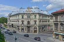
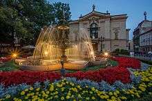
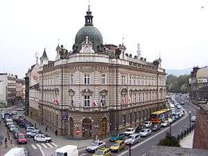
Sights


Bielsko-Biała is a beautiful city, as are the surrounding landscapes. It is abundant in stunning Art Nouveau architecture and is often referred to as Little Vienna. It is also a vibrant student city with enjoyable nightlife, rich in both historical and natural sights, some of them listed below:
- The Bielsko-Biała Museum, housed in the castle of the Dukes of Cieszyn from 15th century, later Castle of the Sułkowski princes
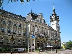
- Bielsko-Biała City Hall built in 1897
- Bielsko-Biała Central Railway Station built in 1888
- BWA Bielsko-Biała Gallery of Art
- Polish Theatre built in 1890
- St. Nicholas Cathedral built in 1447 and rebuilt in 1909 - 1910
- Jewish Cemetery founded in 1849
- The House of Frogs, an Art Nouveau mansion
- Weaver's House Museum, Dom Tkacza, reconstructed workshop of a draper
- Szyndzielnia mountain located within the city borders and the Szyndzielnia Cable Car
- Dębowiec ski slope [10]
Apart from being an attractive destination itself the city is a convenient base for hiking in Silesian Beskids and Żywiec Beskids as well as for skiing in one of the most popular Polish ski resorts Szczyrk (located 18 km (11 mi) from the city centre) and in a couple of smaller nearby ski resorts.
Boroughs
- Aleksandrowice
- Biała
- Hałcnów
- Kamienica
- Komorowice Śląskie i Komorowice Krakowskie
- Leszczyny
- Lipnik
- Mikuszowice Śląskie and Mikuszowice Krakowskie
- Olszówka Dolna and Olszówka Górna
- Stare Bielsko
- Straconka
- Wapienica
Education
- University of Bielsko-Biała [11]
- The Academy of Computer Science and Management
- Bielska Wyższa Szkoła im. Józefa Tyszkiewicza w Bielsku-Białej
- The School of Administration in Bielsko-Biała [12]
- Bielsko-Biała School of Finances and Law [13]
- Wyższa Szkoła Ekonomiczno-Humanistyczna
- Teacher Training College of Bielsko-Biała
Politics
Bielsko-Biała constituency
Senators from Bielsko-Biała constituency:
- Sławomir Kowalski (Civic Platform)
- Rafał Muchacki (Civic Platform)
Members of Sejm from Bielsko-Biała constituency:
- Jacek Falfus (Law and Justice)
- Tadeusz Kopeć (Civic Platform)
- Bożena Kotkowska (Democratic Left Alliance)
- Kazimierz Matuszny (Law and Justice)
- Mirosława Nykiel (Civic Platform)
- Stanisław Pięta (Law and Justice)
- Stanisław Szwed (Law and Justice)
- Tomasz Tomczykiewicz (Civic Platform)
- Adam Wykręt (Civic Platform)
Municipal politics
- Mayor - Jacek Krywult
- Deputy Mayor - Waldemar Jędrusiński
- Deputy Mayor - Lubomir Zawierucha
- Deputy Mayor - Przemysław Kamiński
Sports
The city will host some matches for the 2019 FIFA U-20 World Cup taking Lubin's place.
Major teams and athletes
- TS Podbeskidzie Bielsko-Biała - men's football team playing in Polish I liga.
- Rekord Bielsko-Biała - men's futsal team playing in Polish Futsal Ekstraklasa, Polish Champions 2013/2014, Polish Cup and Supercup winners 2012/2013.
- BKS Stal Bielsko-Biała - women's volleyball team playing in Polish ORLEN Liga, Polish Champions 1988, 1989, 1990, 1991, 1996, 2003, 2004, 2010; Polish Cup winners 1955, 1979, 1988, 1989, 1990, 2004, 2006, 2009.
- BBTS Siatkarz Original Bielsko-Biała - men's volleyball team playing in Polish Plus Liga.
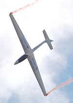
- Sebastian Kawa, member of the local aeroclub, is the eight times World Champion, World's most accomplished glider competition pilot in history, World's (FAI) leading glider competition pilot (currently[14] number two in the world rankings of the FAI Gliding Commission) and the current World Champion in Standard Class and 15m Class.
- Trauda (Gertruda) Dawidowicz married Fuchs, pre-war multichampion swimmer free-style.[15]
International relations
Twin towns - Sister cities
Bielsko-Biała is twinned with the following cities:[16]
|
Notable residents
Zaneta Wille - formerly of Bielsko-Biala
See also
References
- ↑ GUS Central Statistical Office, Polish cities with the largest populations Archived 2014-11-07 at the Wayback Machine.
- ↑ Die postalischen Abstempelungen auf den österreichischen Postwertzeichen-Ausgaben 1867, 1883 und 1890, Wilhelm KLEIN, 1967
- ↑ "Municipal website".
- ↑ Kuhn, Walter (1981). Geschichte der deutschen Sprachinsel Bielitz (Schlesien). Holzner.
- 1 2 Sir H. Kennard to Viscount Halifax (August 24, 1939). "The British War Bluebook". 2008 Lillian Goldman Law Library. Retrieved 11 September 2014.
- ↑ Wacław Uruszczak (2012). Krakowskie Studia z Historii Państwa i Prawa Vol. 5. Wydawnictwo UJ. p. 339. ISBN 8323388687.
- ↑ Karol Grünberg (1963). Nazi Front Schlesien: niemieckie organizacje polityczne w województwie Śląskim w latach 1933-1939. Wydawnictwo Śląsk, Katowice. Retrieved 11 September 2014.
Historic photos.
- ↑ "Архив климатических данных". climatebase.ru.
- ↑ WP.PL, Ranking miast najlepszych do inwestowania. Finanse.wp.pl: „Forbes” i Centralny Ośrodek Informacji Gospodarczych (COIG).
- ↑ BBOSiR Bielsko-Biała Municipal Centre of Sports and Leisure, Dębowiec Resort official website
- ↑ University of Bielsko-Biała official website in English
- ↑ The School of Administration in Bielsko-Biała official website in English
- ↑ Bielsko-Biała School of Finances and Law official website in English
- ↑ Current FAI ranking of Sebastian Kawa Archived 2014-03-06 at the Wayback Machine., retrieved on: August 22, 2012
- ↑ Statue in the swimming pool
- 1 2 3 4 5 6 7 8 9 10 11 12 13 14 15 16 17 18 "Bielsko-Biała - Partner Cities". Urzędu Miejskiego w Bielsku-Białej. Retrieved 2008-12-10.
- ↑ "Kragujevac Twin Cities". ©2009 Information service of Kragujevac City. Retrieved 2009-02-21.
- ↑ "Žilina - oficiálne stránky mesta: Partnerské mestá Žiliny (Žilina: Official Partner Cities)". © 2008 MaM Multimedia, s.r.o.. Retrieved 2009-07-08.
External links
| Wikivoyage has a travel guide for Bielsko-Biała. |
| Wikimedia Commons has media related to Bielsko-Biała. |
- Bielsko-Biała - Municipal website
- Bielsko - Aerial photos
- Bielsko-Biała Museum
- Jewish Community in Bielsko-Biała on Virtual Shtetl
| 1,000,000+ | ||
|---|---|---|
| 750,000+ | ||
| 500,000+ | ||
| 200,000+ | ||
| 100,000+ | ||
| City counties |  | |
|---|---|---|
| Land counties | ||

_Dawidowicz_married_Fuchs.jpg)
Seat (not part of the county): Bielsko-Biała | ||
| Urban gmina | _COA.svg.png) | |
| Urban-rural gminas | ||
| Rural gminas | ||
Coordinates: 49°49′21″N 19°02′40″E / 49.82250°N 19.04444°E
| Authority control |
|---|