Bheemunipatnam
| Bheemunipatnam Bheemili | |
|---|---|
| Neighbourhood | |
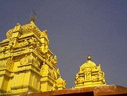
 Hill-top view of Bheemunipatnam town | |
 Bheemunipatnam Location in Andhra Pradesh, India | |
| Coordinates: 17°53′11″N 83°26′50″E / 17.886385°N 83.447109°ECoordinates: 17°53′11″N 83°26′50″E / 17.886385°N 83.447109°E | |
| Country | India |
| State | Andhra Pradesh |
| District | Visakhapatnam |
| Founded by | Government of Andhra Pradesh |
| Area | |
| • Total | 18.88 km2 (7.29 sq mi) |
| Population | |
| • Total | 68,128 |
| • Density | 3,600/km2 (9,300/sq mi) |
| Languages | |
| • Official | Telugu |
| Time zone | UTC+5:30 (IST) |
| PIN | 531163 /62 |
| Vidhan Sabha constituency | Bheemili |
| Lok Sabha constituency | Visakhapatnam |
Bheemunipatnam popularly known by its abbreviated form Bheemili, is a neighbourhood in the city of Visakhapatnam, India. The town was named after Bhima a character in the Hindu epic Mahabharata. Bheemunipatnam municipality was merged into Greater Visakhapatnam Municipal Corporation
Bheemunipatnam mandal is one of the 46 mandals in Visakhapatnam District . It is under the administration of Visakhapatnam revenue division and the headquarters is located at Bheemunipatnam. The Mandal is bounded by Padmanabham, Anandapuram mandals in Visakhapatnam District and Bhogapuram mandal in Vizianagaram District.
Politics
| Year | Candiate | Party |
|---|---|---|
| 1951 | Kaligotla Suryanarayana | |
| 1955 | Gottumukkala Jagannadha Raju | |
| 1972 | Raja Sagi Soma Sundara Suryanarayana Raju | INC |
| 1978 | Datla Jagannadha Raju | INC(I) |
| 1983 | Pusapati Ananda Gajapati Raju | TDP |
| 1985 | Raja Sagi Devi Prasanna Appala Narasimha Raju | TDP |
| 1989 | Raja Sagi Devi Prasanna Appala Narasimha Raju | TDP |
| 1994 | Raja Sagi Devi Prasanna Appala Narasimha Raju | TDP |
| 1999 | Raja Sagi Devi Prasanna Appala Narasimha Raju | TDP |
| 2004 | Karri Seetharamu | INC |
| 2009 | Muttamsetti Srinivasa Rao | PRP |
| 2014 | Ganta Srinivasa Rao | TDP |
Transport
Bheemili is well connected by road. NH16 or AH45 passes through the mandal. It also has major District roads and State Highways connecting it to nearby mandals and Visakhapatnam. APSRTC runs bus services from Visakhapatnam bus station to Bheemili.
- APSRTC routes
| Route Number | Start | End | Via |
|---|---|---|---|
| 900K | Railway Station | Bheemili | RTC Complex, Siripuram, Pedawaltair, Appughar, Sagarnagar, Rushikonda, Thimmapuram, mangamaripeta,INS Kalinga |
| 900T | Railway Station | Tagarapuvalasa | RTC Complex, Siripuram, Pedawaltair, Appughar, Sagarnagar, Rushikonda, Thimmapuram,Mangamaripeta, INS Kalinga |
| 999 | RTC Complex | Bheemili | Maddilapalem, Hanumanthwaka, Yendada, Madhurawada, Anandapuram |
| 17K | Old Head Post Office | Bheemili | Town Kotharoad, Jagadamba Centre, RTC Complex, Siripuram, Pedawaltair, Appughar, Sagarnagar, Rushikonda, Thimmapuram, Mangamaripeta,INS Kalinga |
Location and Geography
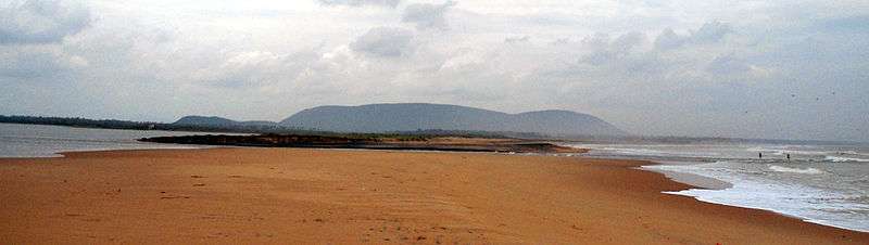
Bheemunipatnam is located about 40 km from Visakhapatnam Airport, about 31 km from Visakhapatnam railway station and 29 km from Visakhapatnam city central bus station. It lies to the north of Visakhapatnam City and is loosely bordered by Rushikonda to the south and Bay of Bengal to the east, Madhurawada to the west, Bhogapuram to the north.
History
Buddhism
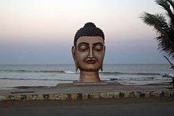
Historical evidences of Buddhist Culture have been noticed at Bheemunipatnam dating back to 3rd century BCE on the hillock Pavurallakonda[1] (also known as Narsimhaswami konda locally) in the town. Buddhist remains were found during the excavations here along with Relic caskets. Both the schools of Buddhism Hinayana and Mahayana were propagated in this land and also to the far east lands from the port of River Gosthani. See pavurallakonda page for more details.
Narasimha temple
There is a Hindu temple dedicated to Lord Narasimha on the eastern side of Pavurallakonda facing the sea. As per the historical evidences the temple is constructed around 14th century by Mindi[2] Kings. There are two more temples in the town of Bhimili, which date back to the times of Chola's as Bheemeswaralayam and Choleswaralayam.
Dutch settlements
Known to the Dutch as Bimilipatnam, Bheemunipatnam was one among the major Dutch settlements[3] of the Dutch Coromandel coast in the 17th century. There are remnants of the Dutch East India Company trading post when the town was a port. The town contains one of the oldest Christian cemeteries on the coast.[4] Bhimili also had a currency mint[5] during the times of Dutch.
East India Company
The British East India Company made Bheemunipatnam their main trading base of the east coast. The Bhimili port used to operate passenger vessels to Madras and Calcutta during the British Raj. The big clock tower in the town was built by British.
Demographics
According to Imperial Gazetteer of India,[6] Bimlipatam tahsil had an area of 207 square miles (540 km2) with 117 villages. The population in 1901 was 126,354 compared with 114,834 in 1891. It was entirely Zamindari land belonging to the Vizianagram estate.
As of 2001 India census,[7] Bheemunipatnam had a population of 44,156. Males constitute 49% of the population and females 51%. Bheemunipatnam has an average literacy rate of 60%, higher than the national average of 59.5%; with male literacy of 67% and female literacy of 54%. 11% of the population is under 6 years of age.
Landmarks
The lighthouse dated to 1868 was built during Dutch settlement on the shores of Bheemili Beach.[8] Some of the Buddhist sites are Bojjannakonda, Bavikonda, Lingalakonda, Pavurallakonda, Salihundam and Thotlakonda.
Education
The primary and secondary school education is imparted by government, aided and private schools, under the School Education Department of the state.[9][10] The medium of instruction followed by different schools are English,
List of schools in Bheemili:
- The Sun School
- Catherine International school
- St. Ann's aided High School
- CBM Aided High School
- Ameya World School
- St. Ann's Aided Primary School
- St. Ann's English Medium School
- Govt. High School
- Pandit Nehru Municipal High School
- Potti Sriramulu Municipal High School
- CBM English Medium School
- CBM Aided Elementary School
- Pandit Nehru Municipal Elementary
School
- Janshi Laxmi Bai Municipal Upper Primary School
- Andhra Pradesh Residential School
- Oakridge international school
References
- ↑ "Dept. of Archaeology & Museums". Museums.ap.nic.in. Archived from the original on February 9, 2012. Retrieved 2012-10-24.
- ↑ Sudhakar (2008-06-25). "Incredible India: Bhimili". Vishakapatnamonline.blogspot.in. Retrieved 2012-10-24.
- ↑ "It is a ruin of colonial legacy | BayNews | The New Voice Of Vizag". Baynews.in. 2010-09-24. Retrieved 2012-10-24.
- ↑ "Andhra Pradesh / Visakhapatnam News : Bhimili: lost in time and tide". The Hindu. 2007-04-12. Retrieved 2012-10-24.
- ↑ Ramani M. "The History of Vizag: copper coins". Heavydutytravel.blogspot.in. Retrieved 2012-10-24.
- ↑ Bimlipatnam tahsil in Imperial Gazetteer of India, Vol. 8; pp: 238.
- ↑ "Census of India 2001: Data from the 2001 Census, including cities, villages and towns (Provisional)". Census Commission of India. Archived from the original on 2004-06-16. Retrieved 2008-11-01.
- ↑ "Bhimili lighthouse to be demolished". The Hindu. 1 February 2013. Retrieved 7 June 2016.
- ↑ "School Education Department" (PDF). School Education Department, Government of Andhra Pradesh. Archived from the original (PDF) on 27 December 2015. Retrieved 7 November 2016.
- ↑ "The Department of School Education - Official AP State Government Portal | AP State Portal". www.ap.gov.in. Archived from the original on 7 November 2016. Retrieved 7 November 2016.
External links
| Wikimedia Commons has media related to Bheemunipatnam. |
