Naidu Thota
| Naidu Thota నాయుడు తోట | |
|---|---|
| Neighbourhood | |
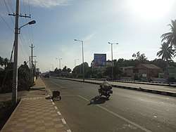 Road at Naidu thota | |
 Naidu Thota Location in Andhra Pradesh, India  Naidu Thota Naidu Thota (India) | |
| Coordinates: 17°45′49″N 83°12′44″E / 17.763476°N 83.212255°ECoordinates: 17°45′49″N 83°12′44″E / 17.763476°N 83.212255°E | |
| Country |
|
| State | Andhra Pradesh |
| District | Visakhapatnam |
| Government | |
| • Body | Greater Visakhapatnam Municipal Corporation |
| Languages | |
| • Official | Telugu |
| Time zone | UTC+5:30 (IST) |
| PIN | 530029 |
| Vehicle registration | AP-31 |
Naidu thota is a suburb of the city of Visakhapatnam state of Andhra Pradesh, India. [1].
About
its one of the suburb in Visakhapatnam and good residential area real estate all so well established hear.[2].
Transport
its is well connected with Gajuwaka,NAD X Road, Malkapuram,Dwaraka Nagar and Visakhapatnam Steel Plant.
- APSRTC routes
| Route Number | Start | End | Via |
|---|---|---|---|
| 28K/28A | RK Beach | Kothavalasa/Pendurthi | Jagadamba Centre, RTC Complex, Kancharapalem, NAD Kotharoad, Gopalapatnam, Vepagunta |
| 6K | Old Head Post Office | Kothavalasa | Jagadamba Centre, RTC Complex, Kancharapalem, NAD Kotharoad, Gopalapatnam, Vepagunta, Pendurthi |
| 300C/300M | RTC Complex | Chodavaram/Madugula | Railway Newcolony, Kancharapalem, NAD Kotharoad, Gopalapatnam, Vepagunta, Sabbavaram |
| 555 | RTC Complex | Chodavaram | Gurudwara, NAD Kotharoad, Gopalapatnam, Vepagunta, Sabbavaram |
| 55K | Scindia | Kothavalasa | Malkapuram, Sriharipuram, New Gajuwaka, Old Gajuwaka, BHPV, NAD Kotharoad, Gopalapatnam, Vepagunta |
| 541 | Maddilapalem | Kothavalasa | Gurudwara, NAD Kotharoad, Gopalapatnam, Vepagunta, Pendurthi |
| 333K | Town Kotharoad | K.Kotapadu | Railway Station, Kancharapalem, NAD Kotharoad, Gopalapatnam, Vepagunta, Pinagadi |
References
This article is issued from
Wikipedia.
The text is licensed under Creative Commons - Attribution - Sharealike.
Additional terms may apply for the media files.