Ravindra Nagar
| Ravindra Nagar | |
|---|---|
| Neighbourhood | |
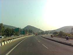 NH Road near Ravindranagar | |
 Ravindra Nagar Location in Andhra Pradesh, India  Ravindra Nagar Ravindra Nagar (India) | |
| Coordinates: 17°45′58″N 83°19′19″E / 17.766192°N 83.321952°ECoordinates: 17°45′58″N 83°19′19″E / 17.766192°N 83.321952°E | |
| Country |
|
| State | Andhra Pradesh |
| District | Visakhapatnam |
| Government | |
| • Body | Greater Visakhapatnam Municipal Corporation |
| Languages | |
| • Official | Telugu |
| Time zone | UTC+5:30 (IST) |
| PIN | 530040 |
| Vehicle registration | AP-31 |
Ravindra Nagar is a neighborhood situated on the northern part of Visakhapatnam City, India. The area, which falls under the local administrative limits of Greater Visakhapatnam Municipal Corporation, is about 7 km from the Dwaraka Nagar which is city centre.[1] Ravindra Nagar is located Near to Arilova and surrounded by Kambalakonda Wildlife Sanctuary.[2]. its well connected with One Town
Transport
- APSRTC routes
| Route Number | Start | End | Via |
|---|---|---|---|
| 52D | Ravindra Nagar | Old Head Post Office | Adarshanagar, Hanumanthuwaka, Maddilapalem, RTC Complex, Jagadamba Centre, Town Kotharoad |
| 210 | Ravindra Nagar | Gantyada HB Colony | Adarshanagar, Hanumanthuwaka, Appughar, Pedawaltair, Siripuram, RK Beach, Jagadamba Centre, Town Kotharoad, Convent, Scindia, Malkapuram, New Gajuwaka |
References
- ↑ "location". the hans india. 22 July 2017. Retrieved 12 June 2017.
- ↑ "about". telangana today. 25 August 2017. Retrieved 21 September 2017.
This article is issued from
Wikipedia.
The text is licensed under Creative Commons - Attribution - Sharealike.
Additional terms may apply for the media files.