Pandurangapuram, Visakhapatnam
| Pandurangapuram పాండురంగాపురం | |
|---|---|
| Neighbourhood | |
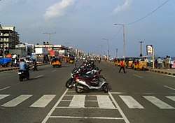 Beach road at Pandurangapuram | |
 Pandurangapuram Location in Andhra Pradesh, India  Pandurangapuram Pandurangapuram (India) | |
| Coordinates: 17°42′57″N 83°19′21″E / 17.715738°N 83.322434°ECoordinates: 17°42′57″N 83°19′21″E / 17.715738°N 83.322434°E | |
| Country |
|
| State | Andhra Pradesh |
| District | Visakhapatnam |
| Government | |
| • Body | Greater Visakhapatnam Municipal Corporation |
| Languages | |
| • Official | Telugu |
| Time zone | UTC+5:30 (IST) |
| PIN | 530003 |
| Vehicle registration | AP-31 |
Pandurangapuram is a neighborhood situated on the coastal part of Visakhapatnam City, India. The area, which falls under the local administrative limits of Greater Visakhapatnam Municipal Corporation, is about 4 km from the Dwaraka Nagar which is city centre.[1] Pandurangapuram is located at the besides of Bay of Bengal and its totally surrounded by Maharanipeta, Kirlampudi Layout and Daspalla Hills.[2]
Overview
This area is one of the more affluent residential areas in city.[3]
Transport
- APSRTC routes
| Route Number | Start | End | Via |
|---|---|---|---|
| 210 | Ravindra Nagar | Gantyada HB Colony | Hanumanthuwaka, Appughar, MVP Colony, Pedawaltair, Siripuram, RK Beach, Jagadamba Centre, Town Kotharoad, Convent, Scindia, Malkapuram, New Gajuwaka, Pedagantyada |
References
- ↑ "location". the hans india. 14 July 2017. Retrieved 23 September 2017.
- ↑ "about". the hindu. 29 August 2017. Retrieved 21 September 2017.
- ↑ "overview". deccan chronicle. 14 May 2017. Retrieved 21 September 2017.
This article is issued from
Wikipedia.
The text is licensed under Creative Commons - Attribution - Sharealike.
Additional terms may apply for the media files.