Beaulac-Garthby, Quebec
| Beaulac-Garthby | ||
|---|---|---|
| Municipality | ||
.JPG) | ||
| ||
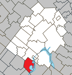 Location within Les Appalaches RCM | ||
 Beaulac-Garthby Location in province of Quebec | ||
| Coordinates: 45°50′N 71°23′W / 45.83°N 71.38°WCoordinates: 45°50′N 71°23′W / 45.83°N 71.38°W[1] | ||
| Country |
| |
| Province |
| |
| Region | Chaudière-Appalaches | |
| RCM | Les Appalaches | |
| Constituted | March 15, 2000 | |
| Government[2] | ||
| • Mayor | Loic Lenoir | |
| • Federal riding | Mégantic—L'Érable | |
| • Prov. riding | Mégantic | |
| Area[2][3] | ||
| • Total | 93.90 km2 (36.25 sq mi) | |
| • Land | 75.13 km2 (29.01 sq mi) | |
| Population (2011)[3] | ||
| • Total | 878 | |
| • Density | 11.7/km2 (30/sq mi) | |
| • Pop 2006-2011 |
| |
| • Dwellings | 848 | |
| Time zone | UTC−5 (EST) | |
| • Summer (DST) | UTC−4 (EDT) | |
| Postal code(s) | G0Y 1B0 | |
| Area code(s) | 418 and 581 | |
| Highways |
| |
| Website |
www | |
Beaulac-Garthby is a municipality in Municipalité régionale de comté des Appalaches in Quebec, Canada. It is part of the Chaudière-Appalaches region and the population is 927 as of 2009. The municipality, located on Lake Aylmer, was created in 2000 following the amalgamation of the village of Beaulac and the township of Garthby.
References
External links

Places adjacent to Beaulac-Garthby, Quebec | ||||||||||
|---|---|---|---|---|---|---|---|---|---|---|
| ||||||||||
| Cities & Towns | |
|---|---|
| Municipalities | |
| Parishes | |
| |
This article is issued from
Wikipedia.
The text is licensed under Creative Commons - Attribution - Sharealike.
Additional terms may apply for the media files.