Saints-Martyrs-Canadiens
| Saints-Martyrs-Canadiens | |
|---|---|
| Parish municipality | |
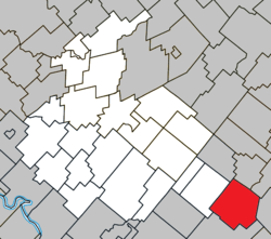 Location within Arthabaska RCM. | |
 Saints-Martyrs-Canadiens Location in southern Quebec. | |
| Coordinates: 45°51′N 71°32′W / 45.850°N 71.533°WCoordinates: 45°51′N 71°32′W / 45.850°N 71.533°W[1] | |
| Country |
|
| Province |
|
| Region | Centre-du-Québec |
| RCM | Arthabaska |
| Constituted | January 1, 1943 |
| Government[2] | |
| • Mayor | André Henri |
| • Federal riding | Richmond—Arthabaska |
| • Prov. riding | Drummond–Bois-Francs |
| Area[2][3] | |
| • Total | 117.70 km2 (45.44 sq mi) |
| • Land | 111.47 km2 (43.04 sq mi) |
| Population (2011)[3] | |
| • Total | 227 |
| • Density | 2.0/km2 (5/sq mi) |
| • Pop 2006-2011 |
|
| Postal code(s) | G0P 1A1 |
| Area code(s) | 819 |
| Highways |
|
| Website |
www.saints- martyrs-canadiens.ca |
Saints-Martyrs-Canadiens is a parish municipality located in the Centre-du-Québec region of Quebec, Canada.
References
Places adjacent to Saints-Martyrs-Canadiens | ||||||||||
|---|---|---|---|---|---|---|---|---|---|---|
| ||||||||||
| Cities | |
|---|---|
| Municipalities | |
| Parishes | |
| Townships | |
| |
This article is issued from
Wikipedia.
The text is licensed under Creative Commons - Attribution - Sharealike.
Additional terms may apply for the media files.