Barkly Highway
| Barkly Highway Northern Territory–Queensland | |
|---|---|
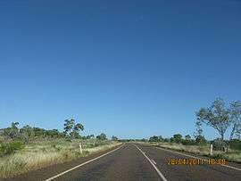 | |
| Barkly Highway in Queensland | |
| General information | |
| Type | Highway |
| Length | 754 km (469 mi) |
| Route number(s) |
|
| Former route number |
|
| Major junctions | |
| West end |
|
| |
| East end |
|
| Location(s) | |
| Major settlements | Camooweal, Mount Isa |
| Highway system | |
The Barkly Highway is a national highway of both Queensland and the Northern Territory.[1]
Description
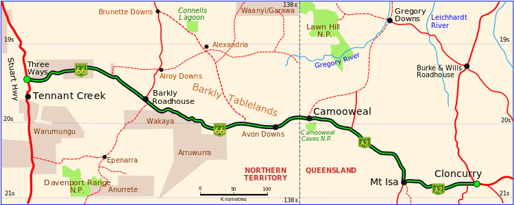
The highway runs between Cloncurry and the junction with the Stuart Highway north of Tennant Creek, known as the "Threeways". The entire highway is part of the National Highway system: in the Northern Territory it is assigned National Route 66; the Queensland portion is designated as National Route A2.
An upgrade of the Queensland section of the highway between Mount Isa and Camooweal was completed in 2008 and despite floods of 2009, 2010 and 2011, the Queensland sections of road were in good condition (as of 2015).
The Northern Territory section has a speed limit of 130 km per hour along most of its length.[2] It is the main transport route between Queensland and the Northern Territory, consequently many road trains use it.
 Barkly Highway in Queensland and the Northern Territory (green and black)
.png)
List of towns along the Barkly Highway
Major intersections
| State | LGA | Location | km[3] | mi | Destinations | Notes |
|---|---|---|---|---|---|---|
| Northern Territory | Barkly | Warumungu | 0 | 0.0 | south – Alice Springs | Barkly Highway western terminus - continues east as National Highway 66 |
| Tablelands | 186 | 116 | ||||
| Northern Territory – Queensland state border | 433 | 269 | Northern Territory – Queensland state border | Barkly Highway continues east as National Highway A2 | ||
| Queensland | Mount Isa | Camooweal | 446 | 277 | Camooweal Urandangie Road - south – Urandangi | |
| 448 | 278 | |||||
| Mount Isa | 635 | 395 | Barkly Highway continues east as National Highway A2 duplexed with National Route 83. Western concurrency terminus with National Route 83. | |||
| Leichhardt River | 635 | 395 | Sir James Foots Bridge | |||
| Cloncurry | Cloncurry | 754 | 469 | Eastern end of Barkly Highway. Eastern concurrency terminus with National Route 83. | ||
1.000 mi = 1.609 km; 1.000 km = 0.621 mi
| ||||||
See also
![]()
References
- ↑ Hema, Maps (2005). Australia’s Great Desert Tracks NE Sheet (Map). Eight Mile Plains Queensland: Hema Maps. ISBN 978-1865005461.
- ↑ "Northern Territory Information". Gondwananet.
- ↑ Google (24 Dec 2017). "Barkly Highway" (Map). Google Maps. Google. Retrieved 24 Dec 2017.
External links
![]()
Road infrastructure in Northern Territory | ||
|---|---|---|
| National highways | ||
| Highways | ||
| Major urban roads | ||
| Outback tracks and numbered state routes | ||