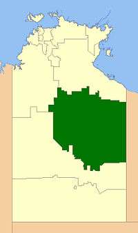
Barkly Region
| Barkly Regional Council Northern Territory | |||||||||||||||
|---|---|---|---|---|---|---|---|---|---|---|---|---|---|---|---|
 | |||||||||||||||
| Population | 6,655 (2016 census)[1] | ||||||||||||||
| • Density | 0.0206348/km2 (0.053444/sq mi) | ||||||||||||||
| Established | 2008 | ||||||||||||||
| Area | 322,514 km2 (124,523.4 sq mi) | ||||||||||||||
| Council seat | Tennant Creek | ||||||||||||||
| Region | Barkly Tableland | ||||||||||||||
| Territory electorate(s) | Barkly | ||||||||||||||
| Federal Division(s) | Lingiari | ||||||||||||||
|
| |||||||||||||||
| Website | Barkly Regional Council | ||||||||||||||
| |||||||||||||||
The Barkly Regional Council is a local government area of the Northern Territory, Australia. The region's main town is Tennant Creek. The region covers an area of 322,514 square kilometres (124,523 sq mi) and had a population of over 6,500 as at the 2016 Census.
History
In October 2006 the Northern Territory Government announced the reform of local government areas. The intention of the reform was to improve and expand the delivery of services to towns and communities across the Northern Territory by establishing eleven new shires. The Barkly Shire was created on 1 July 2008 as were the remaining ten shires. On 1 January 2014, it was renamed Barkly Region.
The most recent elections of Councillors were held on 26 August 2017. The current President (Mayor) of the Region is Steve Edgington.
Wards
The Barkly Regional Council is divided into 4 wards, which is governed by a President and 12 councillors across four wards:
- Alyawarr Ward (4)
- Patta Ward (5)
- Yapakurlangu (2)
- Alpururrulam Ward (1)
Towns
- Ali Curung
- Alpurrurulam
- Ampilatwatja
- Canteen Creek
- Elliott
- Tennant Creek
- Urapuntja Outstations
- Wutunugurra
References
- ↑ Australian Bureau of Statistics (27 June 2017). "Barkly (R)". 2016 Census QuickStats. Retrieved 9 December 2017.

External links
Coordinates: 26°35′35″S 118°29′28″E / 26.5931°S 118.4911°E