Ataşehir
| Ataşehir | |
|---|---|
| District | |
 View of Ataşehir | |
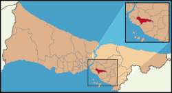 Location of Ataşehir in Istanbul | |
 Ataşehir Location of Ataşehir in Istanbul | |
| Coordinates: 40°59′00″N 29°07′40″E / 40.98333°N 29.12778°ECoordinates: 40°59′00″N 29°07′40″E / 40.98333°N 29.12778°E- | |
| Country | Turkey |
| City | Istanbul |
| Government | |
| • Mayor | Battal İlgezdi (CHP) |
| • Governor | Turgut Çelenkoğlu |
| Population (2012)[1] | |
| • Urban | 395,758 |
| • District | 395,758 |
| Time zone | UTC+2 (EET) |
| • Summer (DST) | UTC+3 (EEST) |
| Area code(s) | 0-216 |
| Website |
www |
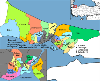
Ataşehir is a modern suburban district of Istanbul, Turkey.[2] It is located at the junction of the O-2 and O-4 motorways in the Anatolian part of Istanbul. Before 2009, present district was divided between ones of Kadıköy, Üsküdar, Ümraniye and Kartal. Its neighbours are Ümraniye from north, Sancaktepe from northeast, Maltepe from east, Kadıköy from south and Üsküdar from west.
The housing development is designed to include 18,000 skyscraper condominiums offering luxury residences for 80,000 people with higher incomes. Ataşehir, hosting headquarters and offices of companies, is also a business and trading centre. Facilities such as tennis courts, gyms and cinemas make it a popular sports and leisure place. Ataşehir was awarded the Habitat prize.[3]
As of 2006, 8596 housing units were present within the site, housing approximately 35,000 people. Completed projects in the area are the Kentplus Ataşehir, Agaoglu MyWorld, UpHill and Ataşehir Residence blocks.
New investments still continue on last empty sites of the district. The İstanbul Finance Center will be in Ataşehir.[4]
Unlike in Bahçeşehir, another satellite city in West side of Istanbul, no single-family house types are designed for the site. Most buildings are high rise blocks, and some around the main public square can be considered skyscrapers. Another difference between the two developments is that Ataşehir lacks recreational areas on the same scale as Bahçeşehir.
Transportation
The area is very favourable for transportation by private car, as choices of public transport are very limited, though, they are becoming more available (e.g. M4 (Istanbul Metro)).
For private car owners the subdivision is: 10 minutes from the Fatih Sultan Mehmet Bridge, 3 minutes from Highway D-100 and the İzmit-Ankara Trans-European Motorway (TEM), 15 minutes from Bağdat Avenue, the upper-class high street of Kadıköy district, and 20 minutes from Sabiha Gökçen Airport, the second international airport of Istanbul.
Sports
The women's football club Ataşehir Belediyespor plays in the Turkish Women's First Football League. The team was the champion in the seasons 2010–11 and 2011–12.
Libraries
There is a public library in the district that anyone can use, namely Ahmet Telli Çocuk ve Halk Kütüphanesi.
Photos
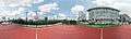 A school in Ataşehir
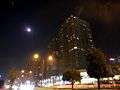 Ataşehir's first buildings
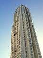 Ataşehir's new buildings
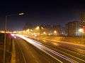 Motorway
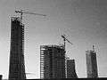 Construction at West Ataşehir
Notes
- ↑ "Population of province/district centers and towns/villages by districts - 2012". Address Based Population Registration System (ABPRS) Database. Turkish Statistical Institute. Retrieved 2013-02-27.
- ↑ "İstanbul'un yeni 'İlçe' haritası çizildi" (in Turkish). Municipality of Istanbul. 2008. Retrieved 2009-08-11.
- ↑ http://v3.arkitera.com/news.php?action=displayNewsItem&ID=1454
- ↑ http://www.bloomberght.com/haberler/haber/1424509-istanbul-finans-merkezi-icin-geri-sayim
References
- "Information on Ataşehir district" (in Turkish). Governorship of Istanbul. 2009. Archived from the original on 2010-02-21. Retrieved 2009-08-11.
External links
| Wikimedia Commons has media related to Ataşehir. |
- District municipality's official website (in Turkish)
- Library website