Al-Janiya
| al-Janiya | |
|---|---|
| Other transcription(s) | |
| • Arabic | الجانيه |
 | |
 al-Janiya Location of al-Janiya within Palestine | |
| Coordinates: 31°56′18″N 35°07′19″E / 31.93833°N 35.12194°ECoordinates: 31°56′18″N 35°07′19″E / 31.93833°N 35.12194°E | |
| Palestine grid | 161/149 |
| Governorate | Ramallah & al-Bireh |
| Government | |
| • Type | Village council |
| Population (2006) | |
| • Jurisdiction | 1,170 |
| Name meaning | "to gather fruit"[1] |
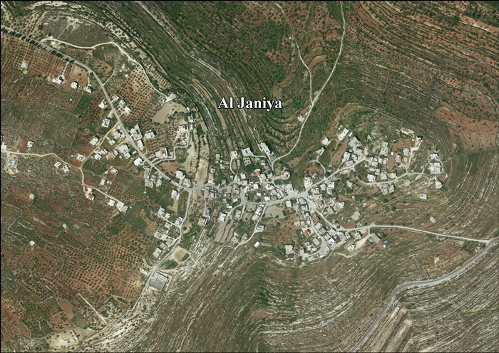
Al-Janiya (Arabic: الجانيه) is a Palestinian village in the Ramallah and al-Bireh Governorate located 8 kilometers northwest of Ramallah in the northern West Bank. According to the Palestinian Central Bureau of Statistics (PCBS), the village had a population of 1,400 inhabitants by late 2014.[2]
Location
Al Janiya is located 8.5 km west of Ramallah. It is bordered by Al-Zaytouneh and Ein Qiniya to the east, Ras Karkar and Kafr Ni'ma to the west, Al-Zaytouneh and Al-Itihad to the north, and Deir Ibzi to the south.[3]
History
Shards from the Iron Age II,[4] Hellenistic,[4] Roman[4] and Byzantine[4][5] era have been found here. It has been suggested that this was Ganta, a village which belonged to Byzantine empress Eudocia (c. 401–460), who gave it to the Church of Jerusalem.[6][7]
It has also been suggested that Al-Janiya was the Crusader site named Megina.[8] Shards have also been found here from the Crusader/Ayyubid and Mamluk eras.[4] There are Arabic and Greek inscriptions in the village mosque, which has been dated to 731 A.H., that is, 1330-31 C.E.[4][9][10][11][7]
Ottoman era
Shards have been found here from the early Ottoman era.[4] In the Ottoman census of 1500s, Dajjaniyya was located in the nahiya of Quds.[12]
In 1838 el-Janieh was noted as partly a Greek Christian and partly a Muslim village, part of Beni Harith area, located north of Jerusalem.[13][14]
Al-Janiya, together with er-Ras, were the chief towns for the ruling family of Simhan. The chief Sheikh of the Simhan family was Isma'il, who was killed by Ibrahim Pasha in the 1834 uprising. After Isma'il, Hasan es-Sa'id and Mohammah ibn Isma'il became the rulers.[15]
In 1870, Victor Guérin found it to be a village of 400 inhabitants, all Muslims except a few "Grec schismatique". He also suggested that the mosque stood on the site of a previous church.[16] An Ottoman village list from about same year found that the village had a population of 29 "Greeks" in 8 houses, and 268 Muslims in 58 houses, though the population count included men, only. It was noted that it was located NWW of Ramallah.[17][18]
In 1882, the Palestine Exploration Fund's Survey of Western Palestine (SWP) described it: "A small village on high ground, with two Mukams and a well on the east; on the north is a modern graveyard. Olives exist round."[19]
Two different estimates were given of the population of Ed-dschanije in 1896, one gave a population of 528,[20] while another estimate gave the population to be 342 Muslims and 36 Christians.[21]
British Mandate era
In the 1922 census of Palestine conducted by the British Mandate authorities, Al-Janiya had a population of 180; 177 Muslims and 3 Orthodox Christians.[22][23] This had increased by the time of the 1931 census to 250, 245 Muslims and 5 Christians, in 60 houses.[24]
In the 1945 statistics the population was 300, all Muslims,[25] while the total land area was 7,565 dunams, according to an official land and population survey.[26] Of this, 2,961 were plantations and irrigable land, 2,423 for cereals,[27] while 40 dunams were classified as built-up areas.[28]
Jordanian era
In the wake of the 1948 Arab–Israeli War, and after the 1949 Armistice Agreements, Al-Janiya came under Jordanian rule.
The Jordanian census of 1961 found 451 inhabitants in Janiya.[29]
Post-1967
After the Six-Day War in 1967, Al-Janiya has been under Israeli occupation.
After the 1995 accords, 7.9% of village land is defined as Area B land, while the remaining 92.1% is defined as Area C. 867 dunam of land was confiscated for the Israeli settlement of Dolev, while 1,667 dunham was confiscated of the settlement of Talmon.[30]
In 1989, 4,000 acres of privately owned land in Al-Janiya was confiscated and given to the Israeli settlement of Talmon.[31] By 2010, Al-Janiya had lost 10,000 acres due to Israeli confiscations.[32][33]
By 2012, Israeli settlers regularly came armed, taking control of a local water source.[34] The spring, Ein El Masraj, earlier used for irrigation by Al-Janiya, had been physically taken over by Israeli settlers from Talmon, who had renamed it Ein Talmon. The spring Ein El Mallah, used by Al-Janiya both for domestic use and irrigation, was in danger of being taken over.[35]
By 2014, farming on local land was difficult, since Israeli authorities have declared much of it, enclosing olive groves, a 'closed military zone', which Palestinian farmers are allowed to access on average only two days a year, and many of the trees are uprooted by settlers.[2]
In November, 2016, a dozen Israeli settlers attacked 5 Palestinian farmers while they were harvesting their olives. The settlers shouted 'death to Arabs', and were armed with knives and clubs. After beating them up, as part of their Oneg Shabbat, they returned to an outpost below Neria, Mateh Binyamin.[36]
References
- ↑ Palmer, 1881, p. 229
- 1 2 'Denied land access, Palestinians miss olive harvest,' Ma'an News Agency 29 October 2014.
- ↑ Al Janiya Village Profile, ARIJ, p. 4
- 1 2 3 4 5 6 7 Finkelstein et al., 1997, p. 314
- ↑ Dauphin, 1998, p. 833
- ↑ Clermont-Ganneau, 1900, RAO 3, p. 230
- 1 2 Sharon, 2016, pp. 167-171
- ↑ de Roziére, 1849, pp. 223-224, No. 120; cited in Röhricht, 1893, RRH, p. 50, No 200; cited in Finkelstein et al., 1997, p. 314
- ↑ Wright, 1903, pp. 180–181
- ↑ Peters, 1903, pp. 30-31
- ↑ Peters, 1904, pp. 384–385
- ↑ Toledano, 1984, p. 292, has Dajjaniyya at location 31°57′20″N 35°05′55″E
- ↑ Robinson and Smith, 1841, vol 2, p. 133
- ↑ Robinson and Smith, 1841, vol 3, p. 66, Appendix 2, p. 124
- ↑ Macalister and Masterman, 1905, p. 354
- ↑ Guérin, 1875, p. 83
- ↑ Socin, 1879, p. 153 It was also noted that it was in the Beni Harit area
- ↑ Hartmann, 1883, p. 126, noted 63 houses
- ↑ Conder and Kitchener, 1882, SWP II, p. 294
- ↑ Schick, 1896, p. 122
- ↑ Schick, 1896, p. 124
- ↑ Barron, 1923, Table VII, Sub-district of Ramallah, p. 16
- ↑ Barron, 1923, Table XIV, p. 45
- ↑ Mills, 1932, p. 49.
- ↑ Government of Palestine, Department of Statistics, 1945, p. 26
- ↑ Government of Palestine, Department of Statistics. Village Statistics, April, 1945. Quoted in Hadawi, 1970, p. 64
- ↑ Government of Palestine, Department of Statistics. Village Statistics, April, 1945. Quoted in Hadawi, 1970, p. 112
- ↑ Government of Palestine, Department of Statistics. Village Statistics, April, 1945. Quoted in Hadawi, 1970, p. 162
- ↑ Government of Jordan, Department of Statistics, 1964, p. 24
- ↑ Al Janiya Village Profile, ARIJ, pp. 15-16
- ↑ A walk in the hills, by Raja Shehadeh, December 1, 2008
- ↑ Separate and Unequal: Israel’s Discriminatory Treatment of Palestinians in the Occupied Palestinian Territories, HRW, 2010
- ↑ Seven days, five years: A week visiting my family in Israel, David Meir Grossman, July 28, 2014, Tablet
- ↑ West Bank farmers frightened away from water springs by Israeli settlers, 22 March 2012, Al Arabiya
- ↑ How dispossession happens. The humanitarian impact of the takeover of Palestinian springs by Israeli settlers, March 2012, United Nations Office for the Coordination of Humanitarian Affairs occupied Palestinian territory, p. 23
- ↑ A pogrom shakes a Palestinian village strangled by Israeli settlements, By Gideon Levy and Alex Levac, Nov. 11, 2016, Haaretz
Bibliography
- Barron, J.B., ed. (1923). Palestine: Report and General Abstracts of the Census of 1922. Government of Palestine.
- Clermont-Ganneau, C.S. (1900). Recueil d'archéologie orientale (in French). 3. Paris: Ernest Leroux.
- Conder, C.R.; Kitchener, H.H. (1882). The Survey of Western Palestine: Memoirs of the Topography, Orography, Hydrography, and Archaeology. 2. London: Committee of the Palestine Exploration Fund.
- Dauphin, Claudine (1998). La Palestine byzantine, Peuplement et Populations. BAR International Series 726 (in French). III : Catalogue. Oxford: Archeopress. ISBN 0-860549-05-4.
- Finkelstein, I.; Lederman, Zvi, eds. (1997). Highlands of many cultures. Tel Aviv: Institute of Archaeology of Tel Aviv University Publications Section. ISBN 965-440-007-3.
- Government of Jordan, Department of Statistics (1964). First Census of Population and Housing. Volume I: Final Tables; General Characteristics of the Population (PDF).
- Government of Palestine, Department of Statistics (1945). Village Statistics, April, 1945.
- Guérin, V. (1875). Description Géographique Historique et Archéologique de la Palestine (in French). 2: Samarie, pt. 2. Paris: L'Imprimerie Nationale.
- Hadawi, S. (1970). Village Statistics of 1945: A Classification of Land and Area ownership in Palestine. Palestine Liberation Organization Research Center.
- Hartmann, M. (1883). "Die Ortschaftenliste des Liwa Jerusalem in dem türkischen Staatskalender für Syrien auf das Jahr 1288 der Flucht (1871)". Zeitschrift des Deutschen Palästina-Vereins. 6: 102–149.
- Macalister, R A.S; Mastermind, E.W.G. (1905). "The modern inhabitants of Palestine". Quarterly statement - Palestine Exploration Fund. 37: 343–356.
- Mills, E., ed. (1932). Census of Palestine 1931. Population of Villages, Towns and Administrative Areas. Jerusalem: Government of Palestine.
- Palmer, E.H. (1881). The Survey of Western Palestine: Arabic and English Name Lists Collected During the Survey by Lieutenants Conder and Kitchener, R. E. Transliterated and Explained by E.H. Palmer. Committee of the Palestine Exploration Fund.
- Peters, J.P. (1903). "Palestinian exploration". JBL. 22: 15–31.
- Peters, J.P. (1904). "Visit to Kefr Shiyan, Janieh, and neighbourhoods". Quarterly statement - Palestine Exploration Fund. 36: 377–385.
- Robinson, E.; Smith, E. (1841). Biblical Researches in Palestine, Mount Sinai and Arabia Petraea: A Journal of Travels in the year 1838. 2. Boston: Crocker & Brewster.
- Robinson, E.; Smith, E. (1841). Biblical Researches in Palestine, Mount Sinai and Arabia Petraea: A Journal of Travels in the year 1838. 3. Boston: Crocker & Brewster.
- de Roziére, ed. (1849). Cartulaire de l'église du Saint Sépulchre de Jérusalem: publié d'après les manuscrits du Vatican (in Latin and French). Paris: Imprimerie nationale.
- Röhricht, R. (1893). (RRH) Regesta regni Hierosolymitani (MXCVII-MCCXCI) (in Latin). Berlin: Libraria Academica Wageriana.
- Schick, C. (1896). "Zur Einwohnerzahl des Bezirks Jerusalem". Zeitschrift des Deutschen Palästina-Vereins. 19: 120–127.
- Sharon, M. (2016). Corpus Inscriptionum Arabicarum Palaestinae, J (I). 6. BRILL. ISBN 90-04-32479-8.
- Socin, A. (1879). "Alphabetisches Verzeichniss von Ortschaften des Paschalik Jerusalem". Zeitschrift des Deutschen Palästina-Vereins. 2: 135–163.
- Toledano, E. (1984). "The Sanjaq of Jerusalem in the Sixteenth Century: Aspects of Topography and Population". Archivum Ottomanicum. 9: 279–319.
- Wright, T.F. (1904). "Inscription at Janiah". Quarterly statement - Palestine Exploration Fund. 36: 180–181.
External links
- Welcome To al-Janiya
- Survey of Western Palestine, Map 14: IAA, Wikimedia commons
- Al Janiya Village (Fact Sheet), Applied Research Institute–Jerusalem, ARIJ
- Al Janiya Village Profile, ARIJ
- Al Janiya, aerial photo, ARIJ
- Locality Development Priorities and Needs in Al Janiya Village, ARIJ
