Al-Zaitounah
| al-Zaitounah | |
|---|---|
| Other transcription(s) | |
| • Arabic | الزيتونة |
| • Also spelled | al-Zaytouneh[1] (official) |
 al-Zaitounah | |
 al-Zaitounah Location of al-Zaitounah within Palestine | |
| Coordinates: 31°57′24″N 35°9′55″E / 31.95667°N 35.16528°ECoordinates: 31°57′24″N 35°9′55″E / 31.95667°N 35.16528°E | |
| Palestine grid | 166/152, 164/151 |
| Governorate | Ramallah & al-Bireh |
| Founded | 2005 |
| Government | |
| • Type | Municipality |
| • Head of Municipality | Abdullah Ladadwa |
| Area | |
| • Jurisdiction | 15,500 dunams (15.5 km2 or 6.0 sq mi) |
| Elevation[2] | 579 m (1,900 ft) |
| Population (2013) | |
| • Jurisdiction | 8,105 |
| Name meaning | "the Olive" |
| Website | www.alzeitona-mun.org |
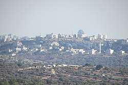
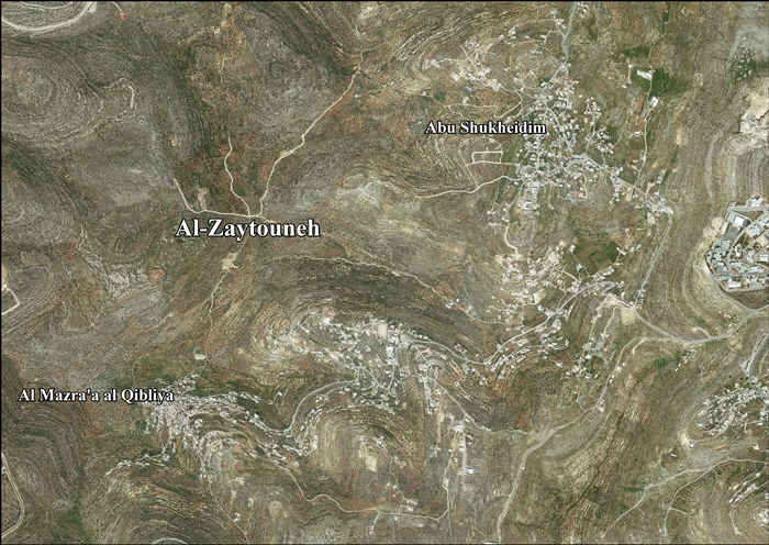
Al-Zaitounah (Arabic: الزيتونة, meaning "the Olive") is a Palestinian town in the Ramallah and al-Bireh Governorate. It was formed in 2005 as the result of a merger of the villages of Abu Shukheidim and al-Mazra'a al-Qibliya. In 2007, al-Zaitounah had a population of 6,190, according to the Palestinian Central Bureau of Statistics.[1]
Location
AL-Zaytouneh is located 7.76 kilometers (4.82 mi) from Ramallah. It is bordered by Bir Zeit and Abu Qash to the east, Kobar to the north, Al-Itihad and Al Janiya to the west, and 'Ein Qiniya, Ramallah and Al Janiya to the south.[2]
History
Al-Zaitounah was formed in 2005 as the result of a merger of the villages of Abu Shukheidim and al-Mazra'a al-Qibliya.
After the Oslo II Accord, 54.2% of Al-Zaitounah land is defined as Area B land, while the remaining 45.8% is defined as Area C. Israel has confiscated 308 dunams of land from Al-Zaitounah for the construction of 2 Israeli settlements: 289 dunams were taken for Talmon, while 19 dunams were taken for Nahl'iel.[3]
References
- 1 2 2007 Census Final Results. Palestinian Central Bureau of Statistics.
- 1 2 AL-Zaytouneh Town Profile, ARIJ, p. 4
- ↑ AL-Zaytouneh Town Profile, ARIJ, p. 18
External links
- Official website (in Arabic)
- Official website
- Survey of Western Palestine, Map 14: IAA, Wikimedia commons
- AL-Zaytouneh town (fact sheet), Applied Research Institute–Jerusalem (ARIJ)
- AL-Zaytouneh town profile, (ARIJ)
- AL-Zaytouneh aerial photo, (ARIJ)
- Locality Development Priorities and Needs in AL-Zaytouneh Town, (ARIJ)
