Ein Yabrud
| Ein Yabrud | |
|---|---|
| Other transcription(s) | |
| • Arabic | عين يبرود |
| • Also spelled |
'Ein Yabrud (official) Ayn Yabrood (unofficial) |
 | |
 Ein Yabrud Location of Ein Yabrud within Palestine | |
| Coordinates: 31°56′51″N 35°14′55″E / 31.94750°N 35.24861°ECoordinates: 31°56′51″N 35°14′55″E / 31.94750°N 35.24861°E | |
| Palestine grid | 173/151 |
| Governorate | Ramallah & al-Bireh |
| Government | |
| • Type | Municipality |
| • Head of Municipality | Awni Hasan Sha'ib |
| Area | |
| • Jurisdiction | 11,488 dunams (11.5 km2 or 4.4 sq mi) |
| Population (2007) | |
| • Jurisdiction | 3,000 |
| Name meaning | The spring of Yebrud[1] |
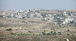
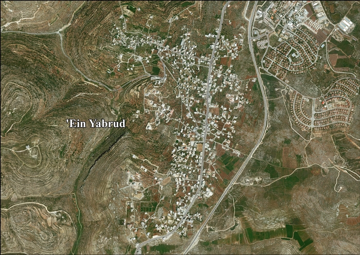
Ein Yabrud (Arabic: عين يبرود) is a Palestinian town in the Ramallah and al-Bireh Governorate in the central West Bank. It is located approximately 7 km northeast of the city of Ramallah and its elevation is 800 m. According to the Palestinian Central Bureau of Statistics (PCBS) the town had a population of 3,000 in 2007.[2]
Location
Ein Yabrud is located (horizontally) 6.8 kilometers (4.2 mi) west of Ramallah. It is bordered by Rammun and Taybeh to the east, Yabrud and Silwad to the north, Dura al-Qar' to the west, and Deir Dibwan, Beitin and Al-Bireh to the south.[3]
History
Sherds from the Hellenistic, Roman and Byzantine eras have been found here.[4] A grave, with three arcosolia, and with coins from the reign of Constantine the Great have been excavated here.[5]
Sherds from the Umayyad, Crusader/Ayyubid and Mamluk eras have also been found.[4]
Yaqut noted about Ein Yabrud and Yabrud: "A village lying north of Jerusalem, on the road from the Holy City to Nabulus, between which and Yabrud is Kafar Natha. It possesses orchards and vineyards, and olives and Sumach trees."[6]
Ottoman era
Ein Yabrud, like the rest of Palestine, was incorporated into the Ottoman Empire in 1517, and in the census of 1596, the village was noted in the Nahiya of Quds of the Liwa of Quds under the name of 'Ayn Ibrud. The population was 24 households, all Muslim. The villagers paid a fixed tax rate of 33,3% on various agricultural products, such as wheat, barley, olive trees, vineyards, fruit trees, goats and/or beehives, in addition to "occasional revenues"; a total of 8,700 akçe.[7][8]
In 1838, Edward Robinson noted Ein Yabrud "on the top of a hill".[9] It was further noted as Muslim village, located in the Beni Murrah region, north of Jerusalem.[10]
In 1863 Victor Guérin found it to have 800 inhabitants. He further noted that a number of houses were built with antique materials.[11]
Socin found from an official Ottoman village list from about 1870 that the village had 66 houses and a population of 282, though the population count included men, only. It was further noted that it was located one hour north of Beitin.[12][13]
In 1882 the Palestine Exploration Fund's Survey of Western Palestine (SWP) described 'Ain Yebrud as: "A village of moderate size on the top of a hill, well built, surrounded with fine groves of olives, with a well on the north-east."[14]
In 1896 the population of 'Ain jabrud was estimated to be about 573 persons.[15]
British Mandate era
In the 1922 census of Palestine, conducted by the British Mandate authorities, the population numbered 576 Muslims,[16] increasing in the 1931 census to 788 inhabitants, in 178 houses.[17]
In the 1945 statistics Ein Yabrud had a population of 930 Muslims,[18] and a total land area of 11,488 dunams.[19] 3,151 dunams were for plantations and irrigable land, 3,632 for cereals,[20] while 88 dunams were built-up areas.[21]
Jordanian era
In the wake of the 1948 Arab–Israeli War, and after the 1949 Armistice Agreements, Ein Yabrud came under Jordanian rule. Jordan confiscated lands of Ein Yabrud and nearby Silwad for the construction of a military camp before the Six-Day War.[22]
The Jordanian census of 1961 found 1,501 inhabitants in Ein Yabrud.[23]
Post-1967
After the Six-Day War in 1967, Ein Yabrud has been under Israeli occupation.
After the 1995 accords, 34.3% of village land is defined as Area B land, while the remaining 65.7% is defined as Area C.[24]
1252 dunham of village land has been confiscated by Israel for the Israeli settlement of Ofra, while 137 dunham of village land has been confiscated for the Israeli settlement of Beit El.[25]
The Jordanian buildings formed the initial basis of the Israeli settlement of Ofra founded in 1975.[22] Plans for further expansion of Ofra in this land in 2011 resulted in legal challenges and public dispute.[22] Land belonging to the residents of the village has been used to construct hundreds of structures in the neighbouring Israeli settlement of Ofra.[26]
Ein Yabrud is the home village of Hamas military commander Maher Udda.[27]
References
- ↑ Palmer, 1881, p. 224
- ↑ 2007 PCBS Census Archived December 10, 2010, at the Wayback Machine.. Palestinian Central Bureau of Statistics. p.114.
- ↑ ‘Ein Yabrud village profile, ARIJ, p. 4
- 1 2 Finkelstein et al, 1997, p. 563
- ↑ Dauphin, 1998, p. 832
- ↑ le Strange, 1890, p. 550
- ↑ Hütteroth and Abdulfattah, 1977, p. 121
- ↑ Toledano, 1984, p. 289, gives the location as 31°57′15″N 35°14′20″E, noting a spring called Ayn Abrud located nearby, at 31°57′00″N 35°13′40″E
- ↑ Robinson and Smith, 1841, vol 2, p. 80
- ↑ Robinson and Smith, 1841, vol 3, Appendix 2, p. 125
- ↑ Guérin, 1869, pp. 42 -43
- ↑ Socin, 1879, p. 143 Also noted it in the Beni Murra region
- ↑ Hartmann, 1883, p. 115 noted 67 houses
- ↑ Conder and Kitchener, 1882, SWP II, p. 291
- ↑ Schick, 1896, p. 121
- ↑ Barron, 1922, Table VII, Sub-district of Ramalllah, p. 16
- ↑ Mills, 1932, p.49
- ↑ Government of Palestine, Department of Statistics, 1945, p. 26
- ↑ Government of Palestine, Department of Statistics. Village Statistics, April, 1945. Quoted in Hadawi, 1970, p. 64.
- ↑ Government of Palestine, Department of Statistics. Village Statistics, April, 1945. Quoted in Hadawi, 1970, p. 112
- ↑ Government of Palestine, Department of Statistics. Village Statistics, April, 1945. Quoted in Hadawi, 1970, p. 162
- 1 2 3 State moves to expand settlement on Palestinian land confiscated by Jordan, Chaim Levinson, Jun 17, 2011, Haaretz.
- ↑ Government of Jordan, Department of Statistics, 1964, p. 24
- ↑ ‘Ein Yabrud village profile, ARIJ, p. 18
- ↑ ‘Ein Yabrud village profile, ARIJ, p. 19
- ↑ Israel's 'Ulpana neighborhood is built on years of land theft and forgery, Akiva Eldar, 24 April 2012, Haaretz
- ↑ Israel arrests Hamas leader March 15, 2010, Al Jazeera
Bibliography
- Barron, J. B., ed. (1923). Palestine: Report and General Abstracts of the Census of 1922. Government of Palestine.
- Conder, C.R.; Kitchener, H. H. (1882). The Survey of Western Palestine: Memoirs of the Topography, Orography, Hydrography, and Archaeology. 2. London: Committee of the Palestine Exploration Fund.
- Dauphin, Claudine (1998). La Palestine byzantine, Peuplement et Populations. BAR International Series 726 (in French). III : Catalogue. Oxford: Archeopress. ISBN 0-860549-05-4.
- Finkelstein, I.; Lederman, Zvi, eds. (1997). Highlands of many cultures. Tel Aviv: Institute of Archaeology of Tel Aviv University Publications Section. ISBN 965-440-007-3.
- Government of Jordan, Department of Statistics (1964). First Census of Population and Housing. Volume I: Final Tables; General Characteristics of the Population (PDF).
- Government of Palestine, Department of Statistics (1945). Village Statistics, April, 1945.
- Guérin, V. (1869). Description Géographique Historique et Archéologique de la Palestine (in French). 1: Judee, pt. 3. Paris: L'Imprimerie Nationale.
- Hadawi, S. (1970). Village Statistics of 1945: A Classification of Land and Area ownership in Palestine. Palestine Liberation Organization Research Center.
- Hartmann, M. (1883). "Die Ortschaftenliste des Liwa Jerusalem in dem türkischen Staatskalender für Syrien auf das Jahr 1288 der Flucht (1871)". Zeitschrift des Deutschen Palästina-Vereins. 6: 102–149.
- Hütteroth, Wolf-Dieter; Abdulfattah, Kamal (1977). Historical Geography of Palestine, Transjordan and Southern Syria in the Late 16th Century. Erlanger Geographische Arbeiten, Sonderband 5. Erlangen, Germany: Vorstand der Fränkischen Geographischen Gesellschaft. ISBN 3-920405-41-2.
- Mills, E., ed. (1932). Census of Palestine 1931. Population of Villages, Towns and Administrative Areas. Jerusalem: Government of Palestine.
- Palmer, E. H. (1881). The Survey of Western Palestine: Arabic and English Name Lists Collected During the Survey by Lieutenants Conder and Kitchener, R. E. Transliterated and Explained by E.H. Palmer. Committee of the Palestine Exploration Fund.
- Robinson, E.; Smith, E. (1841). Biblical Researches in Palestine, Mount Sinai and Arabia Petraea: A Journal of Travels in the year 1838. 2. Boston: Crocker & Brewster.
- Robinson, E.; Smith, E. (1841). Biblical Researches in Palestine, Mount Sinai and Arabia Petraea: A Journal of Travels in the year 1838. 3. Boston: Crocker & Brewster.
- Schick, C. (1896). "Zur Einwohnerzahl des Bezirks Jerusalem". Zeitschrift des Deutschen Palästina-Vereins. 19: 120–127.
- Socin, A. (1879). "Alphabetisches Verzeichniss von Ortschaften des Paschalik Jerusalem". Zeitschrift des Deutschen Palästina-Vereins. 2: 135–163.
- Strange, le, G. (1890). Palestine Under the Moslems: A Description of Syria and the Holy Land from A.D. 650 to 1500. Committee of the Palestine Exploration Fund.
- Toledano, E. (1984). "The Sanjaq of Jerusalem in the Sixteenth Century: Aspects of Topography and Population". Archivum Ottomanicum. 9: 279–319.
External links
- Welcome to 'Ayn Yabrud
- Survey of Western Palestine, Map 14: IAA, Wikimedia commons
- 'Ein Yabrud village (fact sheet), Applied Research Institute–Jerusalem (ARIJ)
- ‘Ein Yabrud village profile, ARIJ
- ‘Ein Yabrud, aerial photo, ARIJ
