Ahlat
| Ahlat | |
|---|---|
 Ahlat | |
| Coordinates: 38°45′10″N 42°29′40″E / 38.75278°N 42.49444°ECoordinates: 38°45′10″N 42°29′40″E / 38.75278°N 42.49444°E | |
| Country | Turkey |
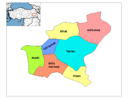
| Province | Bitlis |
| Government | |
| • Mayor | Abdulalim Mümtaz Çoban (AKP) |
| • Kaymakam | Bülent TEKBIYIKOĞLU[1] |
| Area[2] | |
| • District | 989.26 km2 (381.96 sq mi) |
| Elevation | 1,650 m (5,410 ft) |
| Population (2012)[3] | |
| • Urban | 21,122 |
| • District | 37,358 |
| • District density | 38/km2 (98/sq mi) |
| Post code | 13400 |
| Website | www.ahlat.bel.tr |
Ahlat (Armenian: Խլաթ, Khlat; Ottoman Turkish: اخلاط; Kurdish: Xelat; Medieval Greek: Χαλάτα, Chalata), is a historic town and district in Turkey's Bitlis Province in Eastern Anatolia Region. From 1929-1936, it had been included as a district of Van Province. The town of Ahlat is situated on the northwestern shore of Lake Van. The mayor is Abdulalim Mümtaz Çoban (AKP).
History
Ahlat, known by its Armenian name of Khlat in the ancient and medieval period, was once a part of the district of Bznunik'.[4] During the early eighth century, Arab tribes settled in the region, which lay on the frontier with Byzantium, and it became part of the Arab Kaysite principality.[5] Ibn Hawqal mentioned it as an important stopover point on the Urmia-Mayyafariqin trade route. During the next four centuries, Ahlat was ruled by "Arab governors, Armenian princes, and Arab emirs of the Qays tribe".[4] In about 983, Ahlat was controlled by a Kurdish chief named "Bāḏ" (in Armenian spelled as "Bat"); "thereafter", Ahlat was linked with the Kurdish Marwanids (centered in Diyar Bakr), "which sprang from Bāḏ".[4] In the winter of 998, the Curopalates David III of Tao besieged Khlat but was unable to capture it, partly because of his contemptuous treatment towards its Armenian population.[6]
After the Battle of Manzikert (1071), the Seljuk army, led personally by Sultan Alp Arslan (r. 1063-1072), took possession of the town.[4] The Seljuks then gave control over the town to the Turkmen slave commander Sökmen el-Kutbî (or al-Qutbi).[4] Sökmen, and the Turkmen rulers of Ahlat that succeeded him, were known as the Shah-Armens (or Ahlat-Shahs).[4] The Shah-Armens were centered on the northwestern shores of the Lake Van.
In the 11th century accounts of Nasir Khusraw the town of "Akhlat" is mentioned once: "And from there (Van) we arrived at Akhlat on the 18th of Jumada al-awwal and this town marks the borders of Armenians and Muslims, ... an Emir ruled there whom they called Nassr-ol-dolat and had many sons and had appointed them as district governors within his kingdom. In this town three languages are spoken: Taazi (Arabic), Persian, and Armenian and I think that's why they call this town Akhlat (Arabic word from the roots 'Kha-la-ta' which means 'mix, to mix'). They used coins worth 300 Dirhams each."
With the decline of the Seljuks, and the new political upheaval presented by the invasions of the Khwarezmian Empire and the Mongol Empire, Ahlat became briefly disputed between the Ayyubids, the Kingdom of Georgia and a branch of the main Seljuk Empire; the Sultanate of Rum.[4] In the 12th century, Ahlat and its adjacent territory was conquered and vassalized by the Kingdom of Georgia. In this period the city was referred to by the Georgian name Khlati.[7]
Following the Battle of Köse Dağ (1243), another major portion of Anatolia (which included Ahlat), became part of the Mongol Empire.[4] The Mongols added Ahlat to the Ilkhanate division.[4] In the ensuing period, the Ilkhanids minted coins in Ahlat.[4] According to Hamdallah Mustawfi, the revenues provided by Ahlat under the Ilkhanids, amounted up to 51,500 dinars.[4] After the Ilkhanate, Ahlat became part of the Jalayirids and then the Ak Koyunlu.[4]
In the early 16th century, the Ottomans expanded into Eastern Anatolia (Western Armenia), and took the town for the first time under Sultan Selim I (r. 1512-1520).[4] Nevertheless, Ahlat remained only loosely under Ottoman control at the time, and it was considered to be a border district with the neighboring Safavid Empire.[4][8] In 1526, during the reign of king (shah) Tahmasp I (r. 1524-1576), Ahlat was in Safavid hands, and its governor was Delu Montasha Ustajlu.[8] In 1548, Ahlat was recaptured by the Safavids, who then sacked it.[4] Under Suleiman the Magnificent's reign (1520-1566), Ahlat eventually became firmly part of the Ottoman Empire.[4] However, "in practise", Ahlat was de facto under the control of various local Kurdish chiefs, until the mid-19th century, when direct rule from the central government was imposed on Ahlat.[4] Vital Cuinet estimated the population of Ahlat at end of the 19th century at 23,700.[4] According to him, seventy percent were Muslims, whereas the rest were Christians, mostly Armenians.[4] When Cuinet passed through the city during this time period, ancient Ahlat was considered to be "abandoned", and was referred to as Kharab Şehir, i.e. "the ruined town".[4] Later, a new town, which had a population of 5,018 in 1961, grew some two kilometers to the east, "on the lake shore".[4]
Ahlat today
Ahlat and its surroundings are known for a large number of historic tombstones left by the Ahlatshah dynasty, also known as the Shah-Armen, Shah-i-Arman, or Ahlat-Shah dynasty. Efforts are presently being made by local authorities with a view to including the tombstones on UNESCO's World Heritage List,[9] where they are currently listed tentatively.[10]
In recent years, Ahlat also came to be known for the quality of its potatoes, which carved themselves a sizable share in the Turkish agricultural products market.[11]
Climate
| Climate data for Ahlat | |||||||||||||
|---|---|---|---|---|---|---|---|---|---|---|---|---|---|
| Month | Jan | Feb | Mar | Apr | May | Jun | Jul | Aug | Sep | Oct | Nov | Dec | Year |
| Average high °C (°F) | 1 (33) |
2 (35) |
5 (41) |
11 (51) |
16 (60) |
22 (71) |
27 (80) |
27 (80) |
23 (73) |
16 (60) |
9 (48) |
3 (37) |
13 (55) |
| Average low °C (°F) | −4 (24) |
−4 (24) |
−2 (28) |
2 (35) |
6 (42) |
10 (50) |
15 (59) |
14 (57) |
11 (51) |
6 (42) |
1 (33) |
−2 (28) |
4 (39) |
| Average precipitation cm (inches) | 5 (2) |
6.4 (2.5) |
6.9 (2.7) |
8.6 (3.4) |
8 (3) |
3.3 (1.3) |
0.5 (0.2) |
0.8 (0.3) |
1.5 (0.6) |
6.4 (2.5) |
6.6 (2.6) |
5 (2) |
58.2 (22.9) |
| Source: Weatherbase [12] | |||||||||||||
See also
External links
References
- ↑ "{title}". Archived from the original on 2015-04-01. Retrieved 2017-02-13.
- ↑ "Area of regions (including lakes), km²". Regional Statistics Database. Turkish Statistical Institute. 2002. Retrieved 2013-03-05.
- ↑ "Population of province/district centers and towns/villages by districts - 2012". Address Based Population Registration System (ABPRS) Database. Turkish Statistical Institute. Retrieved 2013-02-27.
- 1 2 3 4 5 6 7 8 9 10 11 12 13 14 15 16 17 18 19 20 21 Bosworth & Crane 1984, pp. 725-727.
- ↑ Ter-Ghewondyan, Aram N. The Arab Emirates in Bagratid Armenia. Trans. Nina G. Garsoïan. Lisbon: Calouste Gulbenkian Foundation, 1976, pp. 32, 144.
- ↑ Ter-Ghewondyan, ''The Arab Emirates in Bagratid Armenia, pp. 113, 139.
- ↑ Lordkipanidze, Mariam; B. Hewitt, George (1987). Georgia in the XI-XII Centuries. Ganatleba Publishers. p. 41.
- 1 2 Floor 2008, p. 140.
- ↑ Yüksel Oktay. "On the Roads of Anatolia - Van". Los Angeles Chronicle. Archived from the original on 2007-09-28.
- ↑ "Tentative World Heritage Sites". UNESCO.
- ↑ "Türkiye'nin en kaliteli patatesi Ahlat'ta (Turkey's best quality potatoes are in Ahlat". Kenthaber Association of Local Newspapers of Turkey. Archived from the original on January 10, 2008.
- ↑ "Weatherbase: Historical Weather for Ahlat, Turkey". Weatherbase. 2011. Retrieved on November 24, 2011.
Sources
- Bosworth, C.E.; Crane, H. (1984). "AḴLĀṬ". Encyclopaedia Iranica, Vol. I, Fasc. 7. pp. 725–727.
- Floor, Willem M. (2008). Titles and Emoluments in Safavid Iran: A Third Manual of Safavid Administration, by Mirza Naqi Nasiri. Washington, DC: Mage Publishers. ISBN 978-1933823232.