Şereflikoçhisar
| Şereflikoçhisar | ||
|---|---|---|
| District | ||
.jpg) Castle of Şereflikoçhisar | ||
| ||
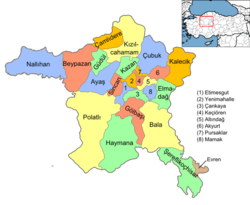 Location of Şereflikoçhisar within Turkey. | ||
 Şereflikoçhisar Location of Şereflikoçhisar within Turkey. | ||
| Coordinates: 38°57′N 33°33′E / 38.950°N 33.550°E | ||
| Country |
| |
| Region | West Anatolia | |
| Subregion | Ankara | |
| Province | Ankara | |
| Government | ||
| • District governor | Erol Karaömeroğlu | |
| • Municipality mayor | Ferda Polat (AK Party) | |
| Area[1] | ||
| • District | 2,127.79 km2 (821.54 sq mi) | |
| Elevation | 900-1,200 m (2,950-3,940 ft) | |
| Population (2016) | ||
| • Urban | 33,420 | |
| • Rural | 0 | |
| Time zone | UTC+3 (FET) | |
| Postal code | 06xxx | |
| Area code(s) | 0312 | |
| Licence plate | 06 | |
| Website | www.sereflikochisar.gov.tr | |

Şereflikoçhisar is a town and district of Ankara Province in the Central Anatolia region of Turkey, 148 km south of the city of Ankara. According to 2010 census, population of the district is 35898 of which 29,091 live in the town of Şereflikoçhisar and the remainder in surrounding villages.[2][3] The district covers an area of 2,034 km², and the average elevation varies between 900 and 1,200 m, with the highest point being Mt. Karasenir at 1,650 m.
The area is a flat dry plain, the only water being Hirfanlı reservoir and the salt lake Lake Tuz. The countryside is inhospitable, with minerals extracted from the salt lake being a major source of income. Therefore, the rural population is migrating to nearby towns or abroad.
Demographics
| Historical population[4] | ||
|---|---|---|
| Year | Pop. | ±% p.a. |
| 1965 | 69,201 | — |
| 1970 | 75,675 | +1.80% |
| 1975 | 82,207 | +1.67% |
| 1980 | 79,330 | −0.71% |
| 1985 | 87,893 | +2.07% |
| 1990 | 60,701 | −7.14% |
| 2000 | 59,128 | −0.26% |
| 2007 | 34,808 | −7.29% |
| 2008 | 35,353 | +1.57% |
| 2009 | 35,978 | +1.77% |
| 2010 | 35,989 | +0.03% |
| 2011 | 36,071 | +0.23% |
| 2012 | 35,042 | −2.85% |
| 2013 | 34,577 | −1.33% |
| 2014 | 33,946 | −1.82% |
| 2015 | 33,729 | −0.64% |
| 2016 | 33,420 | −0.92% |
Name
The name derives from the Seljuk Turkish castle of Koçhisar. The prefix Şerefli meaning "honourable" was added by Atatürk in recognition of the men of the town lost at the battle of Gallipoli.
History
Şereflikoçhisar is believed to have been inhabited since the time of the Hittites and was a thriving town in the Seljuk and Ottoman Empire periods.
Neighbourhoods
There are 64 neighbourhoods in Şereflikoçhisar as of 2017.[5]
- Acıkuyu
- Acıöz
- Akarca
- Akseki
- Akin
- Aktaş
- Aliuşağı
- Baltalı
- Bağobası
- Boğaziçi
- Büyükdamlacık
- Büyükkışla
- Çalören
- Çatçat
- Çavuşköy
- Çayırönü
- Çıngıl
- Deliler
- Devekovan
- Doğankaya
- Ekici
- Eley
- Emek
- Fadıllı
- Geçitli
- Gülhüyük
- Hacıbektaşlı
- Hacıembiya
- Hamzalı
- Haydarlı
- Hürriyet
- İstiklal
- Kaçarlı
- Kadıncık
- Kadıobası
- Kale
- Karabük
- Karamollauşağı
- Karandere
- Küçükdamlacık
- Mehmet Akif Ersoy
- Musular
- Mustafacık
- Odunboğazı
- Palazobası
- Parlasan
- Sadıklı
- Sanayi
- Sarıkaya
- Seymenli
- Şanlıkışla
- Şekerköy
- Şereflidavutlu
- Şeyhli
- Tuzla
- Üzengilik
- Yanlızpınar
- Yazısöğüt
- Yeni
- Yeşilova
- Yeşilyurt
- Yusufkuyusu
Notes
- ↑ "Area of regions (including lakes), km²". Regional Statistics Database. Turkish Statistical Institute. 2002. Retrieved 2013-03-05.
- ↑ Statistical Institute
- ↑ GeoHive. "Statistical information on Turkey's administrative units". Retrieved March 26, 2008.
- ↑ Turkish Statistical Institute
- ↑ Turkish Ministry of the Interior. "Civilian Administrative Units in Turkey" (in Turkish). Retrieved 2017-02-01.
References
- Falling Rain Genomics, Inc. "Geographical information on Şereflikoçhisar, Turkey". Retrieved March 26, 2008.
- Governorship of Şereflikoçhisar, Turkey. "Geographical information on Şereflikoçhisar district of Ankara" (in Turkish). Archived from the original on September 24, 2015. Retrieved March 26, 2008.
External links
- District governor's official website (in Turkish)
- District municipality's official website (in Turkish)
Coordinates: 38°56′40″N 33°32′31″E / 38.94444°N 33.54194°E