Çubuk, Ankara
| Çubuk | |
|---|---|
| District | |
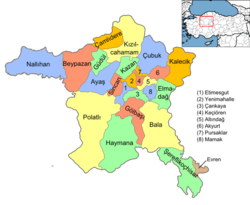 Location of Çubuk, Ankara within Turkey. | |
 Çubuk Location of Çubuk, Ankara within Turkey. | |
| Coordinates: 40°14′N 33°02′E / 40.233°N 33.033°E | |
| Country |
|
| Region | Central Anatolia |
| Province | Ankara |
| Government | |
| • Governor | Cemal Şahin |
| • Mayor | Lokman Özden (AKP) |
| Area[1] | |
| • District | 1,361.60 km2 (525.72 sq mi) |
| Elevation | 1,100 m (3,600 ft) |
| Population (2012)[2] | |
| • Urban | 77,958 |
| • District | 82,614 |
| • District density | 61/km2 (160/sq mi) |
| Time zone | UTC+2 (EET) |
| • Summer (DST) | UTC+3 (EEST) |
| Postal code | 06xxx |
| Area code(s) | 0312 |
| Licence plate | 06 |
| Website | cubuk.gov.tr |
Çubuk is a town and district of Ankara Province in the Central Anatolia region of Turkey, outside the city of Ankara. Çubuk is the flat plain 38 km north of the city where Ankara airport is located. According to 2000 census, population of the district is 81,747 of which 76,716 live in the town of Çubuk.[3] The district covers an area of 1,362 km2 (526 sq mi),[4] and the average elevation is 1,100 m (3,609 ft).
History
There has long been a Turkish presence in this area. The area was settled by Seljuk Turks in the 14th century and in 1402 the Battle of Ankara was fought here between the Ottoman Empire and Timur.
Today the district is farmland irrigated from the Çubuk reservoir and famous for its pickled cucumbers and its cherries. Cubuk is a sister city of Sabinov, Slovakia.
Demographics
| Historical population[5] | ||
|---|---|---|
| Year | Pop. | ±% p.a. |
| 2007 | 83,826 | — |
| 2008 | 80,123 | −4.42% |
| 2009 | 81,270 | +1.43% |
| 2010 | 81,747 | +0.59% |
| 2011 | 82,156 | +0.50% |
| 2012 | 82,614 | +0.56% |
| 2013 | 83,449 | +1.01% |
| 2014 | 84,636 | +1.42% |
| 2015 | 86,055 | +1.68% |
| 2016 | 87,603 | +1.80% |
| 2017 | 90,063 | +2.81% |
Villages
- Abadan
- Ağılcık
- Akbayır
- Akkuzulu
- Aşağıçavundur
- Aşağıemirler
- Aşağıobruk
- Avcıova
- Camili
- Çatköy
- Çitköy
- Dağkalfat
- Dalyasan
- Dedeler
- Demirci
- Dumlupınar
- Durhasan
- Eğriekin
- Esenboğa
- Eskiçöte
- Gökçedere
- Güldarbı
- Gümüşyayla
- Hacılar
- İkipınar
- İmamhüseyin
- Kapaklı
- Karaağaç
- Karaçam
- Karadana
- Karaköy
- Karaman
- Karataş
- Kargın
- Karşıyaka
- Kavaklı
- Kışlacık
- Kızılca
- Kızılören
- Kızılöz
- Kösrelik
- Kösrelikkızığı
- Küçükali
- Kuruçay
- Kutuören
- Kuyumcuköy
- Mahmutoğlan
- Melikşah
- Meşeli
- Mutlu
- Nusratlar
- Okçular
- Ömercik
- Ovacık
- Oyumiğde
- Özlüce
- Saraycık
- Sarıkoz
- Sarısu
- Sele
- Sığırlıhacı
- Sirkeli
- Sünlü
- Susuz
- Tahtayazı
- Taşpınar
- Tuğlaköy
- Uluağaç
- Yakuphasan
- Yaylak
- Yazır
- Yazlıca
- Yenice
- Yeşilkent
- Yiğitli
- Yıldırımaydoğan
- Yıldırımelören
- Yıldırımevci
- Yılmazköy
- Yukarıçavundur
- Yukarıemirler
- Yukarıobruk
- Yuva
Places of interest
- Karagöl rocks, picnic area
Notes
- ↑ "Area of regions (including lakes), km²". Regional Statistics Database. Turkish Statistical Institute. 2002. Retrieved 2013-03-05.
- ↑ "Population of province/district centers and towns/villages by districts - 2012". Address Based Population Registration System (ABPRS) Database. Turkish Statistical Institute. Retrieved 2013-02-27.
- ↑ Statistical Institute
- ↑ Statoids. "Statistical information on districts of Turkey". Retrieved 2008-04-23.
- ↑ Turkish Statistical Institute
References
- Falling Rain Genomics, Inc. "Geographical information on Çubuk, Turkey". Retrieved 2008-03-28.
- Kenthaber.com. "General information on Çubuk district of Ankara" (in Turkish). Retrieved 2008-03-28.
- Governorship of Çubuk, Turkey. "Physical structure and map of Çubuk" (in Turkish). Archived from the original on 2007-12-05. Retrieved 2008-03-28.
External links
- District governor's official website (in Turkish)
- District municipality's official website (in Turkish)
Coordinates: 40°14′19″N 33°01′59″E / 40.23861°N 33.03306°E