Çankaya, Ankara (district)
| Çankaya | |
|---|---|
| District | |
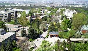
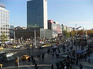 A view of Kızılay Square from the northwest, with the Emek Business Center (1959–1965). | |
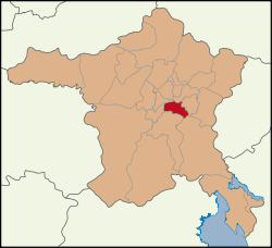 Location of Ankara Çankaya within Turkey. | |
 Çankaya Location of Ankara Çankaya within Turkey. | |
| Coordinates: 39°55′28″N 32°53′08″E / 39.92444°N 32.88556°ECoordinates: 39°55′28″N 32°53′08″E / 39.92444°N 32.88556°E | |
| Country |
|
| Region | West Anatolia |
| Subregion | Ankara |
| Province | Ankara |
| Government | |
| • District governor | Kadir Çakır |
| • District municipality mayor | Alper Taşdelen (CHP) |
| Area[1] | |
| • District | 267.61 km2 (103.32 sq mi) |
| Elevation | 986 m (3,235 ft) |
| Population (2012)[2] | |
| • District | 914,501 |
| • District density | 3,400/km2 (8,900/sq mi) |
| Time zone | UTC+2 (EET) |
| • Summer (DST) | UTC+3 (EEST) |
| Postal code | 06xxx |
| Area code(s) | 0312 |
| Licence plate | 06 |
| Website | cankayakaymakamligi.gov.tr |
Çankaya is a district of Ankara, Turkey. It is home to many government buildings, including the Grand National Assembly of Turkey, as well as nearly all foreign embassies to Turkey. Çankaya is a cosmopolitan district and considered the cultural and financial center of Ankara.
Demographics
The population of the central province is close to 1 million in 2016.[3]
| Historical population[4] | ||
|---|---|---|
| Year | Pop. | ±% p.a. |
| 2007 | 792,189 | — |
| 2008 | 785,330 | −0.87% |
| 2009 | 794,288 | +1.14% |
| 2010 | 797,109 | +0.36% |
| 2011 | 813,339 | +2.04% |
| 2012 | 832,075 | +2.30% |
| 2013 | 914,501 | +9.91% |
| 2014 | 913,715 | −0.09% |
| 2015 | 922,536 | +0.97% |
| 2016 | 919,119 | −0.37% |
History
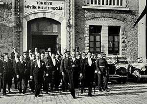
Until the founding of the Republic of Turkey in 1923, Çankaya was a hillside of orchards and gardens to the south of the city, which had grown up in time, surrounding the Ankara Castle (Kale) on the opposite hill. Everything changed in the 1920s when Mustafa Kemal Atatürk came to stay in one of the garden houses. Atatürk selected Ankara as capital of the new republic and in the 1920s and 30s the city quickly grew, especially in the direction of Çankaya. In 1934 the writer Yakup Kadri Karaosmanoğlu described the area as "a wooden bridge, a dirt road, and when you come round the hill you see a hillside, green in gentle contours. That's Çankaya." Çankaya eventually developed into one of the largest central districts of Ankara in later years.
Climate
The climate in Çankaya is cold and temperate. The winter months are much rainier than the summer months in Çankaya. The Köppen-Geiger climate classification is Dsa. The average annual temperature in Çankaya is 11.5 °C. In a year, the average rainfall is 384 mm.
| Climate data for Çankaya (1950 - 2014) | |||||||||||||
|---|---|---|---|---|---|---|---|---|---|---|---|---|---|
| Month | Jan | Feb | Mar | Apr | May | Jun | Jul | Aug | Sep | Oct | Nov | Dec | Year |
| Average high °C (°F) | 3.8 (38.8) |
6.6 (43.9) |
12.1 (53.8) |
17.4 (63.3) |
22.2 (72) |
26.4 (79.5) |
30.1 (86.2) |
29.6 (85.3) |
25.7 (78.3) |
19.7 (67.5) |
13.2 (55.8) |
6.4 (43.5) |
17.7 (63.9) |
| Daily mean °C (°F) | −0.1 (31.8) |
2.2 (36) |
6.3 (43.3) |
11.1 (52) |
15.4 (59.7) |
19.0 (66.2) |
22.4 (72.3) |
21.8 (71.2) |
17.8 (64) |
12.5 (54.5) |
7.3 (45.1) |
2.6 (36.7) |
11.5 (52.7) |
| Average low °C (°F) | −4.0 (24.8) |
−2.1 (28.2) |
0.5 (32.9) |
4.8 (40.6) |
8.6 (47.5) |
11.6 (52.9) |
14.7 (58.5) |
14.0 (57.2) |
10.0 (50) |
5.3 (41.5) |
1.4 (34.5) |
−1.1 (30) |
5.9 (42.6) |
| Average precipitation mm (inches) | 42.2 (1.661) |
37.0 (1.457) |
38.8 (1.528) |
47.7 (1.878) |
49.7 (1.957) |
35.0 (1.378) |
14.5 (0.571) |
10.5 (0.413) |
19.2 (0.756) |
29.4 (1.157) |
32.6 (1.283) |
45.4 (1.787) |
402 (15.826) |
| Average precipitation days | 12.2 | 11.0 | 10.9 | 11.9 | 12.5 | 8.6 | 3.7 | 2.8 | 3.9 | 6.8 | 8.5 | 11.8 | 104.6 |
| Mean monthly sunshine hours | 77.5 | 98.9 | 161.2 | 189.0 | 260.4 | 306.0 | 350.3 | 328.6 | 276.0 | 198.4 | 132.0 | 71.3 | 2,449.6 |
| Source: "Resmi İstatistikler (İl ve İlçelerimize Ait İstatistiki Veriler)". en.climate-data.org. Retrieved 21 May 2013. | |||||||||||||
Culture
The early buildings of the republic were in grand Ottoman style, but today Çankaya also contains a number of impressive modern buildings. The district is home to a great number of museums, theatres, cinemas, cultural associations, booksellers, publishers and libraries, including the National Library in a new building. Many of the streets in the district are named after poets, writers and thinkers.
Most of Ankara's best-known high schools and a great number of university buildings are in the district, including the large campuses of METU, Bilkent University and (most of) Hacettepe University. Çankaya University, a private institution owned by businessman Sıtkı Alp, was opened in a number of former school buildings in 1997.
Neighbourhoods
There are 124 neighbourhoods in Çankaya as of 2017.[5]
- 100.Yıl
- 50.Yıl
- Ahlatlıbel
- Ahmet Taner Kışlalı
- Akarlar
- Akpınar
- Alacaatlı
- Anıttepe
- Aşağı Dikmen
- Aşağı İmrahor
- Aşağı Öveçler
- Aşağı Topraklık
- Aşıkpaşa
- Ata
- Aydınlar
- Ayrancı
- Aziziye
- Bademlidere
- Bağcılar
- Bahçelievler
- Balgat
- Barbaros
- Bayraktar
- Beytepe
- Birlik
- Boztepe
- Büyükesat
- Cebeci
- Cevizlidere
- Cumhuriyet
- Çamlıtepe
- Çankaya
- Çavuşlu
- Çayyolu
- Çiğdem
- Çukurambar
- Devlet
- Dilekler
- Dodurga
- Doğuş
- Ehlibeyt
- Emek
- Ertuğrulgazi
- Erzurum
- Esatoğlu
- Eti
- Evciler
- Fakülteler
- Fidanlık
- Gaziosmanpaşa
- Gökkuşağı
- Göktürk
- Güvenevler
- Güzeltepe
- Harbiye
- Hilal
- Huzur
- İleri
- İlkadım
- İlkbahar
- İlker
- İncesu
- İşçi Blokları
- Karahasanlı
- Karapınar
- Karataş
- Kavaklıdere
- Kazım Özalp
- Keklikpınarı
- Kırkkonaklar
- Kızılay
- Kızılırmak
- Kocatepe
- Konutkent
- Korkutreis
- Koru
- Kömürcü
- Küçükesat
- Kültür
- Malazgirt
- Maltepe
- Mebusevleri
- Meşrutiyet
- Metin Akkuş
- Metin Oktay
- Mimar Sinan
- Muhsin Ertuğrul
- Murat
- Mustafa Kemal
- Mutlukent
- Mürsel Uluç
- Naci Çakır
- Namık Kemal
- Nasuh Akar
- Oğuzlar
- Oran
- Orta İmrahor
- Osman Temiz
- Ön Cebeci
- Öveçler
- Remzi Oğuz Arık
- Sağlık
- Sancak
- Seyranbağları
- Sokullu Mehmet Paşa
- Söğütözü
- Şehit Cengiz Karaca
- Şehit Cevdet Özdemir
- Tınaztepe
- Tohumlar
- Topraklık
- Umut
- Ümit
- Üniversiteler
- Yakupabdal
- Yaşamkent
- Yayla
- Yeşilkent
- Yıldızevler
- Yukarı Bahçelievler
- Yukarı Dikmen
- Yukarı Öveçler
- Yücetepe
- Zafertepe

Places of interest
- The Museum of Anatolian Civilizations
- Anıtkabir the mausoleum of Atatürk
- Ankara Ethnography Museum
- Atakule Tower
- Çankaya Köşkü - the residence of the President of Turkey
- Pembe Köşk - the residence of Turkish President Ismet Inönü from 1925 to 1973
- THF Sport Hall
Notes
- ↑ "Area of regions (including lakes), km²". Regional Statistics Database. Turkish Statistical Institute. 2002. Retrieved 2013-03-05.
- ↑ "Population of province/district centers and towns/villages by districts - 2012". Address Based Population Registration System (ABPRS) Database. Turkish Statistical Institute. Retrieved 2013-02-27.
- ↑ "Çankaya Nüfusu - Ankara" (in Turkish). nufusu.com. Retrieved 2017-02-13.
- ↑ Turkish Statistical Institute
- ↑ Turkish Ministry of the Interior. "Civilian Administrative Units in Turkey" (in Turkish). Retrieved 2017-01-31.
References
- Falling Rain Genomics, Inc. "Geographical information on Çankaya, Turkey". Retrieved 2008-03-28.
External links
| Wikimedia Commons has media related to Çankaya. |
- Presidency of Turkey, official website (in Turkish) / (in English)
- District governor's official website (in Turkish) / (in English)
- District municipality's official website (in Turkish) / (in English)
- The Kavaklıdere resident's association (in Turkish)
Çankaya, Ankara (district) in Ankara Province of Turkey | |||||||||||||||||||||||||||
|---|---|---|---|---|---|---|---|---|---|---|---|---|---|---|---|---|---|---|---|---|---|---|---|---|---|---|---|
| Districts | 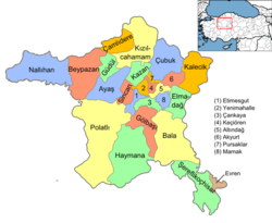 | ||||||||||||||||||||||||||
|
Metropolitan municipalities are bolded. | |||||||||||||||||||||||||||