Richland County (Ohio)
Richland County is een van de 88 county's in de Amerikaanse staat Ohio.
| County in de Verenigde Staten | |||
 | |||
| Situering | |||
| Staat | Ohio | ||
| Tijdzone | Eastern Standard Time (UTC−5) | ||
| Coördinaten | 40°46'48"NB, 82°32'24"WL | ||
| Algemeen | |||
| Oppervlakte | 1.296 km² | ||
| - land | 1.287 km² | ||
| - water | 9 km² | ||
| Inwoners (2000) | 128.852 (100 inw./km²) | ||
| Overig | |||
| Zetel | Mansfield | ||
| FIPS-code | 39139 | ||
| Opgericht | 1808 | ||
| Detailkaart | |||
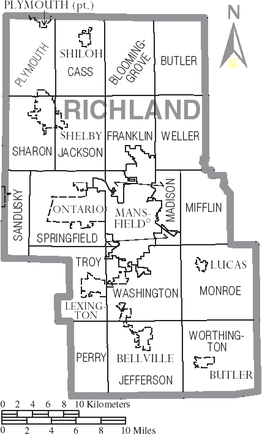 | |||
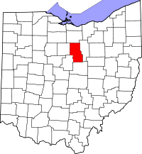
| Overzichtskaart van Richland County | |||
| Foto's | |||
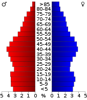 Bevolkingspiramide Richland County | |||
| Statistieken volkstelling Richland County | |||
| |||
De county heeft een landoppervlakte van 1.287 km² en telt 128.852 inwoners (volkstelling 2000). De hoofdplaats is Mansfield.
Bevolkingsontwikkeling
| Historische inwonertallen | |||
|---|---|---|---|
| Jaar | Inwoners | % ± | |
| 1900 | 44.289 | ||
| 1910 | 47.667 | 7,6% | |
| 1920 | 55.178 | 15,8% | |
| 1930 | 65.902 | 19,4% | |
| 1940 | 73.853 | 12,1% | |
| 1950 | 91.305 | 23,6% | |
| 1960 | 117.761 | 29,0% | |
| 1970 | 129.997 | 10,4% | |
| 1980 | 131.205 | 0,9% | |
| 1990 | 126.137 | −3,9% | |
| 2000 | 128.852 | 2,2% | |
| Bron: (en) Historical Decennial Census Population | |||
This article is issued from
Wikipedia.
The text is licensed under Creative
Commons - Attribution - Sharealike.
Additional terms may apply for the media files.