Geauga County
Geauga County is een van de 88 county's in de Amerikaanse staat Ohio.
| County in de Verenigde Staten | |||
 | |||
| Situering | |||
| Staat | Ohio | ||
| Tijdzone | Eastern Standard Time (UTC−5) | ||
| Coördinaten | 41°30'0"NB, 81°10'12"WL | ||
| Algemeen | |||
| Oppervlakte | 1.057 km² | ||
| - land | 1.045 km² | ||
| - water | 12 km² | ||
| Inwoners (2000) | 90.895 (87 inw./km²) | ||
| Overig | |||
| Zetel | Chardon | ||
| FIPS-code | 39055 | ||
| Opgericht | 1805 | ||
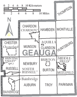
| Detailkaart | |||
 | |||
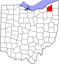
| Overzichtskaart van Geauga County | |||
| Foto's | |||
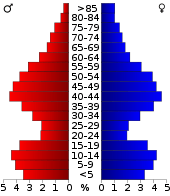 Bevolkingspiramide Geauga County | |||
| Statistieken volkstelling Geauga County | |||
| |||
De county heeft een landoppervlakte van 1.045 km² en telt 90.895 inwoners (volkstelling 2000). De hoofdplaats is Chardon.
Bevolkingsontwikkeling
| Historische inwonertallen | |||
|---|---|---|---|
| Jaar | Inwoners | % ± | |
| 1900 | 14.744 | ||
| 1910 | 14.670 | −0,5% | |
| 1920 | 15.036 | 2,5% | |
| 1930 | 15.414 | 2,5% | |
| 1940 | 19.430 | 26,1% | |
| 1950 | 26.646 | 37,1% | |
| 1960 | 47.573 | 78,5% | |
| 1970 | 62.977 | 32,4% | |
| 1980 | 74.474 | 18,3% | |
| 1990 | 81.129 | 8,9% | |
| 2000 | 90.895 | 12,0% | |
| Bron: (en) Historical Decennial Census Population | |||
| Zie de categorie Geauga County, Ohio van Wikimedia Commons voor mediabestanden over dit onderwerp. |
This article is issued from
Wikipedia.
The text is licensed under Creative
Commons - Attribution - Sharealike.
Additional terms may apply for the media files.