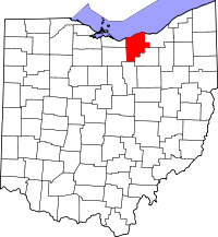
Lorain County
Lorain County is een van de 88 county's in de Amerikaanse staat Ohio. Lorain County is vernoemd naar de Franse streek Lorraine.
| County in de Verenigde Staten | |||
 | |||
| Situering | |||
| Staat | Ohio | ||
| Tijdzone | Eastern Standard Time (UTC−5) | ||
| Coördinaten | 41°28'12"NB, 82°9'0"WL | ||
| Algemeen | |||
| Oppervlakte | 2.391 km² | ||
| - land | 1.276 km² | ||
| - water | 1.115 km² | ||
| Inwoners (2010) | 301.356 (236 inw./km²) | ||
| Overig | |||
| Zetel | Elyria | ||
| FIPS-code | 39093 | ||
| Opgericht | 1822 | ||
| Foto's | |||
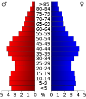 Bevolkingspiramide Lorain County | |||
| Statistieken volkstelling Lorain County | |||
| |||
De county ligt aan het Eriemeer en heeft een landoppervlakte van 1.276 km² en telt 301.356 inwoners (volkstelling 2010). De hoofdplaats is Elyria.
Bevolkingsontwikkeling
| Historische inwonertallen | |||
|---|---|---|---|
| Jaar | Inwoners | % ± | |
| 1900 | 54.857 | ||
| 1910 | 76.037 | 38,6% | |
| 1920 | 90.612 | 19,2% | |
| 1930 | 109.206 | 20,5% | |
| 1940 | 112.390 | 2,9% | |
| 1950 | 148.162 | 31,8% | |
| 1960 | 217.500 | 46,8% | |
| 1970 | 256.843 | 18,1% | |
| 1980 | 274.909 | 7,0% | |
| 1990 | 271.126 | −1,4% | |
| 2000 | 284.664 | 5,0% | |
| 2010 | 301.356 | 5,9% | |
| Bron: (en) Historical Decennial Census Population | |||
Bekende snelwegen


Dorpen
Scheepsdorpen
|
|
|
|
This article is issued from
Wikipedia.
The text is licensed under Creative
Commons - Attribution - Sharealike.
Additional terms may apply for the media files.