Monroe County (Ohio)
Monroe County is een van de 88 county's in de Amerikaanse staat Ohio.
| County in de Verenigde Staten | |||
 | |||
| Situering | |||
| Staat | Ohio | ||
| Tijdzone | Eastern Standard Time (UTC−5) | ||
| Coördinaten | 39°43'48"NB, 81°4'48"WL | ||
| Algemeen | |||
| Oppervlakte | 1.185 km² | ||
| - land | 1.180 km² | ||
| - water | 5 km² | ||
| Inwoners (2000) | 15.180 (13 inw./km²) | ||
| Overig | |||
| Zetel | Woodsfield | ||
| FIPS-code | 39111 | ||
| Opgericht | 1813 | ||
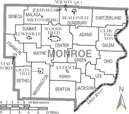
| Detailkaart | |||
 | |||
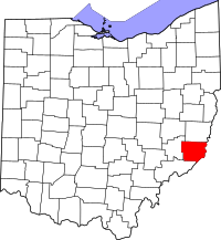
| Overzichtskaart van Monroe County | |||
| Foto's | |||
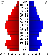 Bevolkingspiramide Monroe County | |||
| Statistieken volkstelling Monroe County | |||
| |||
De county heeft een landoppervlakte van 1.180 km² en telt 15.180 inwoners (volkstelling 2000). De hoofdplaats is Woodsfield.
Bevolkingsontwikkeling
| Historische inwonertallen | |||
|---|---|---|---|
| Jaar | Inwoners | % ± | |
| 1900 | 27.031 | ||
| 1910 | 24.244 | −10,3% | |
| 1920 | 20.660 | −14,8% | |
| 1930 | 18.426 | −10,8% | |
| 1940 | 18.641 | 1,2% | |
| 1950 | 15.362 | −17,6% | |
| 1960 | 15.268 | −0,6% | |
| 1970 | 15.739 | 3,1% | |
| 1980 | 17.382 | 10,4% | |
| 1990 | 15.497 | −10,8% | |
| 2000 | 15.180 | −2,0% | |
| Bron: (en) Historical Decennial Census Population | |||
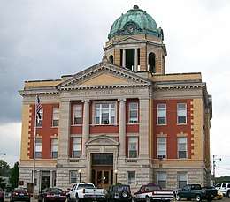
Monroe County Courthouse
This article is issued from
Wikipedia.
The text is licensed under Creative
Commons - Attribution - Sharealike.
Additional terms may apply for the media files.