Washington County, Maine
Washington County is a county located in the U.S. state of Maine. As of the 2010 census, its population was 32,856,[1] making it the third-least populous county in Maine. Its county seat is Machias.[2] The county was established on June 25, 1789. It borders the Canadian province of New Brunswick.
Washington County | |
|---|---|
 Washington County Courthouse | |
 Flag | |
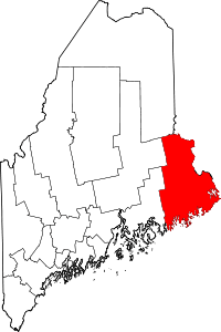 Location within the U.S. state of Maine | |
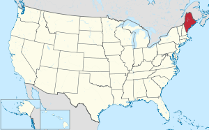 Maine's location within the U.S. | |
| Coordinates: 44°56′24″N 67°33′01″W | |
| Country | |
| State | |
| Founded | June 25, 1789 |
| Named for | George Washington |
| Seat | Machias |
| Largest city | Calais |
| Area | |
| • Total | 3,258 sq mi (8,440 km2) |
| • Land | 2,563 sq mi (6,640 km2) |
| • Water | 695 sq mi (1,800 km2) 21%% |
| Population (2010) | |
| • Total | 32,856 |
| • Estimate (2019) | 31,379 |
| • Density | 10/sq mi (3.9/km2) |
| Time zone | UTC−5 (Eastern) |
| • Summer (DST) | UTC−4 (EDT) |
| Congressional district | 2nd |
| Website | washingtoncountymaine |
It is sometimes referred to as "Sunrise County" because it includes the easternmost point in the United States, and claims have been made that Washington County is where the sun first rises on the 48 contiguous states.[3] Many small seaside communities have small-scale fishing-based economies. Tourism is also important along the county's shoreline, but it is not as important as elsewhere in the state. The blueberry crop plays a major role in the county's economy.
Geography
According to the U.S. Census Bureau, the county has a total area of 3,258 square miles (8,440 km2), of which 2,563 square miles (6,640 km2) is land and 695 square miles (1,800 km2) (21%) is water.[4]
Adjacent counties
- Hancock County – southwest
- Aroostook County – northwest
- Penobscot County – northwest
- York County, New Brunswick, Canada – northeast
- Charlotte County, New Brunswick, Canada – east
National protected areas
- Cross Island National Wildlife Refuge
- Moosehorn National Wildlife Refuge
- Petit Manan National Wildlife Refuge
- Saint Croix Island International Historic Site
Demographics
| Historical population | |||
|---|---|---|---|
| Census | Pop. | %± | |
| 1790 | 2,760 | — | |
| 1800 | 4,461 | 61.6% | |
| 1810 | 7,870 | 76.4% | |
| 1820 | 12,744 | 61.9% | |
| 1830 | 21,294 | 67.1% | |
| 1840 | 28,327 | 33.0% | |
| 1850 | 38,811 | 37.0% | |
| 1860 | 42,534 | 9.6% | |
| 1870 | 43,343 | 1.9% | |
| 1880 | 44,484 | 2.6% | |
| 1890 | 44,482 | 0.0% | |
| 1900 | 45,232 | 1.7% | |
| 1910 | 42,905 | −5.1% | |
| 1920 | 41,709 | −2.8% | |
| 1930 | 37,826 | −9.3% | |
| 1940 | 37,767 | −0.2% | |
| 1950 | 35,187 | −6.8% | |
| 1960 | 32,908 | −6.5% | |
| 1970 | 29,859 | −9.3% | |
| 1980 | 34,963 | 17.1% | |
| 1990 | 35,308 | 1.0% | |
| 2000 | 33,941 | −3.9% | |
| 2010 | 32,856 | −3.2% | |
| Est. 2019 | 31,379 | [5] | −4.5% |
| U.S. Decennial Census[6] 1790–1960[7] 1900–1990[8] 1990–2000[9] 2010–2016[1] | |||
2000 census
As of the census[10] of 2000, there were 33,941 people, 14,118 households, and 9,303 families living in the county. The population density was 13 people per square mile (5/km²). There were 21,919 housing units at an average density of 8 per square mile (3/km²). The racial makeup of the county was 93.48% White, 0.26% Black or African American, 4.43% Native American, 0.30% Asian, 0.01% Pacific Islander, 0.44% from other races, and 1.07% from two or more races. 0.81% of the population were Hispanic or Latino of any race. 95.0% spoke English, 1.9% Passamaquoddy, 1.0% Spanish and 1.0% French as their first language.
There were 14,118 households out of which 28.00% had children under the age of 18 living with them, 52.10% were married couples living together, 9.50% had a female householder with no husband present, and 34.10% were non-families. 28.30% of all households were made up of individuals and 13.10% had someone living alone who was 65 years of age or older. The average household size was 2.34 and the average family size was 2.84.
In the county, the population was spread out with 22.90% under the age of 18, 8.00% from 18 to 24, 26.30% from 25 to 44, 25.60% from 45 to 64, and 17.30% who were 65 years of age or older. The median age was 40 years. For every 100 females there were 95.50 males. For every 100 females age 18 and over, there were 93.90 males.
The median income for a household in the county was $25,869, and the median income for a family was $31,657. Males had a median income of $28,347 versus $20,074 for females. The per capita income for the county was $14,119. About 14.20% of families and 19.00% of the population were below the poverty line, including 22.40% of those under age 18 and 19.20% of those age 65 or over.
2010 census
As of the 2010 United States Census, there were 32,856 people, 14,302 households, and 8,847 families living in the county.[11] The population density was 12.8 inhabitants per square mile (4.9/km2). There were 23,001 housing units at an average density of 9.0 per square mile (3.5/km2).[12] The racial makeup of the county was 92.1% white, 4.9% American Indian, 0.5% Asian, 0.4% black or African American, 0.4% from other races, and 1.7% from two or more races. Those of Hispanic or Latino origin made up 1.4% of the population.[11] In terms of ancestry, 30.4% were English, 17.0% were Irish, 7.0% were German, 6.1% were Scottish, and 5.6% were American.[13]
Of the 14,302 households, 25.9% had children under the age of 18 living with them, 47.1% were married couples living together, 9.6% had a female householder with no husband present, 38.1% were non-families, and 31.6% of all households were made up of individuals. The average household size was 2.24 and the average family size was 2.76. The median age was 46.1 years.[11]
The median income for a household in the county was $34,859 and the median income for a family was $43,612. Males had a median income of $35,981 versus $27,336 for females. The per capita income for the county was $19,401. About 14.1% of families and 19.8% of the population were below the poverty line, including 29.3% of those under age 18 and 12.4% of those age 65 or over.[14]
Government
Washington County is considered a swing county in Maine. In 2004, it was one of only two counties (the other being Piscataquis County) in Maine to vote for Republican George W. Bush over Democrat John Kerry. The county has voted for the winning presidential candidate in every election since 1980.
No Democrat has carried a majority of the county since Hubert Humphrey in 1968. The last Republican to do so was Donald Trump in 2016.
In the 2012 Maine Republican Presidential Caucuses, the majority of Washington County voters cast their votes for Republican Ron Paul, but votes from Washington County were not counted because of snow. Mitt Romney ultimately won the state by a narrow margin.
Voter registration
| Voter registration and party enrollment as of May 2019 [15] | |||||
|---|---|---|---|---|---|
| Unenrolled | 8,566 | 36.21% | |||
| Democratic | 6,703 | 28.33% | |||
| Republican | 7,540 | 31.87% | |||
| Green Independent | 846 | 3.58% | |||
| Libertarian | 3 | 0.01% | |||
| Total | 23,658 | 100% | |||
| Year | Republican | Democratic | Third parties |
|---|---|---|---|
| 2016 | 55.6% 9,093 | 37.1% 6,075 | 7.3% 1,197 |
| 2012 | 47.7% 7,550 | 49.3% 7,803 | 3.1% 483 |
| 2008 | 48.5% 8,077 | 49.5% 8,246 | 2.0% 331 |
| 2004 | 49.8% 8,619 | 48.5% 8,391 | 1.7% 300 |
| 2000 | 50.7% 7,958 | 42.7% 6,701 | 6.7% 1,049 |
| 1996 | 31.6% 4,793 | 47.4% 7,198 | 21.1% 3,198 |
| 1992 | 30.9% 5,493 | 35.4% 6,284 | 33.7% 5,988 |
| 1988 | 56.9% 7,872 | 42.2% 5,831 | 0.9% 125 |
| 1984 | 64.4% 9,713 | 35.2% 5,308 | 0.4% 60 |
| 1980 | 48.6% 7,180 | 40.9% 6,050 | 10.5% 1,558 |
| 1976 | 49.5% 7,039 | 46.7% 6,644 | 3.9% 552 |
| 1972 | 67.6% 7,820 | 32.3% 3,742 | 0.1% 12 |
| 1968 | 46.1% 5,523 | 52.2% 6,249 | 1.7% 208 |
| 1964 | 29.1% 3,816 | 70.9% 9,312 | 0.1% 9 |
| 1960 | 65.9% 9,118 | 34.1% 4,716 | 0.0% 0 |
| 1956 | 76.2% 8,181 | 23.8% 2,555 | 0.0% 0 |
| 1952 | 65.9% 7,396 | 33.9% 3,806 | 0.2% 23 |
| 1948 | 58.6% 5,130 | 40.4% 3,538 | 0.9% 80 |
| 1944 | 48.4% 5,380 | 51.4% 5,709 | 0.2% 18 |
| 1940 | 43.7% 6,253 | 56.2% 8,048 | 0.2% 25 |
| 1936 | 44.1% 6,387 | 54.7% 7,925 | 1.3% 183 |
| 1932 | 52.0% 7,507 | 47.3% 6,829 | 0.8% 115 |
| 1928 | 73.3% 8,531 | 26.4% 3,073 | 0.3% 35 |
| 1924 | 69.7% 6,010 | 24.4% 2,106 | 5.9% 505 |
| 1920 | 68.6% 6,768 | 30.4% 2,997 | 1.1% 105 |
| 1916 | 52.2% 3,891 | 46.4% 3,459 | 1.3% 99 |
| 1912 | 26.4% 1,862 | 45.1% 3,178 | 28.5% 2,012 |
| 1908 | 59.5% 3,507 | 38.3% 2,256 | 2.2% 132 |
Communities
Towns
- Addison
- Alexander
- Baileyville
- Baring Plantation
- Beals
- Beddington
- Charlotte
- Cherryfield
- Codyville Plantation
- Columbia
- Columbia Falls
- Cooper
- Crawford
- Cutler
- Danforth
- Deblois
- Dennysville
- East Machias
- Grand Lake Stream
- Harrington
- Jonesboro
- Jonesport
- Lubec
- Machias (county seat)
- Machiasport
- Marshfield
- Meddybemps
- Milbridge
- Northfield
- Pembroke
- Perry
- Princeton
- Robbinston
- Roque Bluffs
- Steuben
- Talmadge
- Topsfield
- Vanceboro
- Waite
- Wesley
- Whiting
- Whitneyville
Unorganized territories
Indian reservations
- Passamaquoddy Pleasant Point Reservation
- Passamaquoddy Indian Township Reservation
Notable people
- Jeremiah O'Brien, (1744-1818) Commander of the sloop Unity during the first naval battle of the Revolutionary War; Machias.
- Henry Plummer (1832–1864), Sheriff and outlaw leader of The Innocents, in Bannock, Montana, Idaho Territory, born and raised in Addison.
- Hiram Burnham (1814-1864), Civil War general; Cherryfield.
- Reuben L. Snowe (1866-1942), Maine state legislator; born in Danforth.
- Theodore Enslin (1925–2011), American poet; resident of Milbridge.
- Carl Willey (1931 - 2009), American professional baseball player; Cherryfield.
- Lyn Mikel Brown (b. 1956), American academic, author, feminist, and community activist; born in Vanceboro.
- Katie Aselton (b. 1978), American actress, film director and producer; born in Milbridge.
References
- "State & County QuickFacts". United States Census Bureau. Retrieved August 19, 2013.
- "Find a County". National Association of Counties. Retrieved June 7, 2011.
- Trotter, Bill. "Where in Maine does the sun rise first?". Bangor Daily News. Retrieved February 6, 2013.
- "2010 Census Gazetteer Files". United States Census Bureau. August 22, 2012. Archived from the original on September 9, 2014. Retrieved September 7, 2014.
- "Population and Housing Unit Estimates". Retrieved July 31, 2019.
- "U.S. Decennial Census". United States Census Bureau. Retrieved September 7, 2014.
- "Historical Census Browser". University of Virginia Library. Retrieved September 7, 2014.
- "Population of Counties by Decennial Census: 1900 to 1990". United States Census Bureau. Retrieved September 7, 2014.
- "Census 2000 PHC-T-4. Ranking Tables for Counties: 1990 and 2000" (PDF). United States Census Bureau. Retrieved September 7, 2014.
- "U.S. Census website". United States Census Bureau. Retrieved January 31, 2008.
- "DP-1 Profile of General Population and Housing Characteristics: 2010 Demographic Profile Data". United States Census Bureau. Archived from the original on February 13, 2020. Retrieved January 21, 2016.
- "Population, Housing Units, Area, and Density: 2010 - County". United States Census Bureau. Archived from the original on February 13, 2020. Retrieved January 21, 2016.
- "DP02 SELECTED SOCIAL CHARACTERISTICS IN THE UNITED STATES – 2006-2010 American Community Survey 5-Year Estimates". United States Census Bureau. Archived from the original on February 13, 2020. Retrieved January 21, 2016.
- "DP03 SELECTED ECONOMIC CHARACTERISTICS – 2006-2010 American Community Survey 5-Year Estimates". United States Census Bureau. Archived from the original on February 13, 2020. Retrieved January 21, 2016.
- Bureau of Corporations, Elections & Commissions (May 5, 2019). "Registered & Enrolled Voters - Statewide" (PDF). Department of the Secretary of State, State of Maine. p. 29. Retrieved November 13, 2019.
- Leip, David. "Dave Leip's Atlas of U.S. Presidential Elections". uselectionatlas.org. Retrieved April 8, 2018.
External links
| Wikimedia Commons has media related to Washington County, Maine. |
Places adjacent to Washington County, Maine | ||||||||||
|---|---|---|---|---|---|---|---|---|---|---|
| ||||||||||
Municipalities and communities of Washington County, Maine, United States | ||
|---|---|---|
| Cities | Washington County map | |
| Towns |
| |
| Plantations | ||
| Unorganized territories | ||
| CDPs | ||
| Other villages | ||
| Indian reservations | ||
Augusta (capital) | ||
| Topics |
| |
| Society |
| |
| Regions | ||
| Counties | ||
| Cities | ||
| Largest towns | ||

| Authority control |
|
|---|