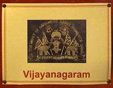
Vizianagaram
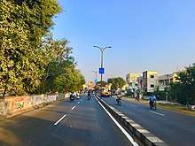
Vizianagaram is a city and the headquarters of Vizianagaram district in the Indian state of Andhra Pradesh.[4] It is central Eastern Ghats, about 24 km (15 mi) west of the Bay of Bengal and 40 km (25 mi) north-northeast of Visakhapatnam. The city has a population of 2,28,025 and was the headquarters of the rajas of Vizianagaram, who played a notable role in the history of Andhra Pradesh in the 18th century and were patrons of education and the fine arts.[5]
Vizianagaram | |
|---|---|
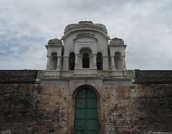
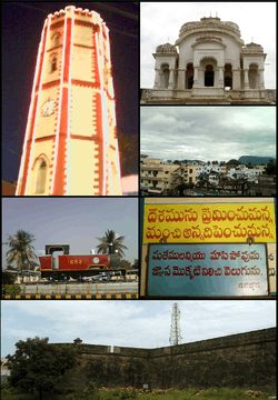 Clockwise from Top Left: Clock Tower (Ganta stambham), Vizianagaram Fort Balcony, View of Vizianagaram Town, Writings of the great writer Gurajada Apparao, Vizianagaram Fort Walls, Replica of a steam engine at Vizianagaram railway station | |
.svg.png) Vizianagaram Location in Andhra Pradesh, India | |
| Coordinates: 18.12°N 83.42°E | |
| Country | India |
| State | Andhra Pradesh |
| District | Vizianagaram |
| Incorporated (Municipality) | 1888 |
| Wards | 38 |
| Government | |
| • Type | Mayor–Council |
| • Body | Vizianagaram Municipal Corporation |
| Area | |
| • Total | 29.27 km2 (11.30 sq mi) |
| Population (2011)[2] | |
| • Total | 228,025 |
| • Rank | 13th (in AP) |
| Literacy | |
| Languages | |
| • Official | Telugu |
| Time zone | UTC+5:30 (IST) |
| Area code(s) | +91–8922 |
| Vehicle registration | AP-39 (from 30 January 2019)[3] |
History
Vizianagaram was ruled by different Hindu emperors of Kalinga and it was an integral part of Kalinga. The area including Srikakulam in the north was under the domain of Eastern Chalukyas of Vengi during the rule of Kubja Vishnuvardhana (624- 641) for short period of time. During this rule the Vengi kingdom had expanded from Srikakulam in the north to Nellore in the south. They patronised Telugu. The area was under the rule of Krishna Deva Raya of Vijayanagara Empire too. After a brief rule from Golconda, the rule of Nizam state of Hyderabad followed. Nizams ruled for the period 1707 to 1753. Srikakulam to the immediate north was the headquarters for revenue collection of Rajahmundry, Eluru, Kondapalli as well as Srikakulam district. The French defeated and ended the rule of Nizam in 1753, all these districts were thereafter part of French India in 1753. However French imperialists too could not hold their sway over here for a long time, and were soon driven out from here by British imperialists, during 1756 in Anglo-French wars. Thereafter the area was soon a part of British – Northern Circars
An important event in the history of the district which occurred at about this time is the war between the Rajas of Vizianagaram and Bobbili, popularly known as Bobbili Yuddam. The war was fought between the MahaRaja of Vizianagaram and the Rajah of Bobbili on 24 January 1757.
Rulers of this princely state belong to the Pusapati family. The village Pooshpadu in Nandigama Taluq was built by Amala Raju. The village later came to be known as Pusapadu, and the Rajus living there came to be known as Pusapatis.
The history of this area is linked with the history of London, specifically the movement to provide drinking fountains. The Maharajah of Vizianagram (Meerza Vijiarama Gajapathi Manea Sultan Bahadoor of Vizianagram) funded the erection of a very elaborate gothic fountain in 1867 very close to Marble Arch on the edge of Hyde Park, which survived until 1964,[6] but was subsequently demolished for a new road system. The architect was Robert Keirle [fl.1862–1902],[7] who also designed the similar (listed) Readymoney Drinking Fountain, which survives in Regent's Park, funded by Sir Jehangir Cowasji Jehangir Readymoney in 1869 sited on the boundary of Westminster and Camden. According to the Dictionary of British Architects,[8] Keirle was the architect appointed by the Metropolitan Drinking Fountain Association, who erected these fountains and whose archive is lodged with the London Metropolitan Archives. Excavations at this town revealed copper coins belonging to the remains of 900 B.C..[9]
Geography
Vizianagaram is located at 18.12°N 83.42°E. It has an average elevation of 74 metres (242 feet). The district is bounded on the east by Srikakulam District, on the west and south by Visakhapatnam district, on the southeast by the Bay of Bengal, and on the northwest by Odisha state. The principal rivers flowing in the district are Nagavali, Vegavathi, Gomukhi, Suvarnamukhi, Champavathi and Gostani. The Nagavali is the main river, which flows in about 112 km in Vizianagaram district. The River Gosthani has its origin in Ananthagiri forest area and flows through Srungavarapukota (S.Kota) and Jami mandals. The Suvarnamukhi River originates in the hills of Saluru mandal, travels in an eastern direction and finally joins the Nagavali at Sangam village in Palakonda mandal of Srikakulam District. Vegavathi originates in pachipenta hills of Pachipenta mandal and flows almost parallel to Suvarnamukhi.
Rivers and irrigation projects
Major Rivers flowing through the city are Nagavali, Vegavathi, Gomukhi, Suvarnamukhi, Champavathi and Gosthani River. Irrigation projects across these rivers include Tatapudi Reservoir across the Gosthani River, Vegavathi project across the river Vegavathi, Vottigedda project across the river Vottigedda, Peda Ankalam Anicut and Vengala Raya Sagaram project across Suvarnamukhi, Seeta Nagaram Anicut, Denkada Anicut, Paradhi at Bobbili, across Suvarnamukhi, a tributary of Nagavali River and Andra Reservoir project across Champavathi River.
Climate
Vizianagaram has a tropical savanna climate (Köppen climate classification Aw) characterised by high humidity nearly all the year round, with oppressive summers and good seasonal rainfall. The summer season extends from March to May, followed by southwest monsoon season, which continues to September. October and November constitute the post-monsoon or retreating monsoon season. The normal rainfall of the district for the year is 1,131.0 mm, as compared to the actual rainfall of 740.6 mm received during 2002–2003. The district gets the benefit of both the southwest and northeast monsoon. The season extending from December to February is of generally fine weather. The climate of the hill parts of the district is different from that of the plain.
| Climate data for Vizianagaram, Andhra Pradesh | |||||||||||||
|---|---|---|---|---|---|---|---|---|---|---|---|---|---|
| Month | Jan | Feb | Mar | Apr | May | Jun | Jul | Aug | Sep | Oct | Nov | Dec | Year |
| Average high °C (°F) | 27.6 (81.7) |
29.4 (84.9) |
32.1 (89.8) |
33.8 (92.8) |
34.8 (94.6) |
33.9 (93.0) |
31.6 (88.9) |
31.5 (88.7) |
31.4 (88.5) |
31.0 (87.8) |
29.0 (84.2) |
27.3 (81.1) |
31.1 (88.0) |
| Average low °C (°F) | 18.2 (64.8) |
20.6 (69.1) |
23.4 (74.1) |
25.8 (78.4) |
27.5 (81.5) |
27.2 (81.0) |
26.0 (78.8) |
25.9 (78.6) |
25.5 (77.9) |
24.4 (75.9) |
21.0 (69.8) |
18.4 (65.1) |
23.7 (74.6) |
| Average rainfall mm (inches) | 11 (0.4) |
7 (0.3) |
11 (0.4) |
19 (0.7) |
77 (3.0) |
132 (5.2) |
157 (6.2) |
172 (6.8) |
204 (8.0) |
245 (9.6) |
57 (2.2) |
5 (0.2) |
1,097 (43) |
| Source: Climate-Data.org[10] | |||||||||||||
Demographics
As of 2011 Census of India, the town had a population of 227,533. The total population constitute, 111,596 males and 115,937 females —a sex ratio of 1039 females per 1000 males, higher than the national average of 940 per 1000.[11][12] 20,487 children are in the age group of 0–6 years, of which 10,495 are boys and 9,992 are girls. The average literacy rate stands at 81.85% with 169,461 literates, significantly higher than the national average of 73.00%.[11][13]
Telugu is the official language.
Governance
Civic administration
Vizianagaram municipal corporation is the civic body of the city, constituted as a municipality in the year 1888.[14] It was upgraded to corporation on 9 December 2015.[15] The jurisdictional area of the corporation is spread over 29.27 km2 (11.30 sq mi) with 38 election wards.[14] During 2010–11, the total expenditure spent by the municipality was ₹1,887.75 crore (US$260 million) and total income generated was ₹2,367.51 crore (US$330 million).[16]
Utility services
The utility services include supply of water, sewer connections, drainage systems, parks, grounds, community centres, healthcare etc. The municipality maintains 458 public taps, 749 bore–wells, 330 km (210 mi) of roads, 243.25 km (151.15 mi) of drains, 32 parks, 2 playgrounds, 49 elementary and 3 secondary schools and 1 maternity and child health centre.[17]
Economy
Vizianagaram is one of the principal towns in Uttarandhra (North of Andhra Pradesh State). There are a number of industries in and around the city. The country's largest ferromanganese plant is situated on the outskirts of Garividi.[18] There are various jute mills in Garividi, including the Hooghly Jute Mills. Vizianagaram is a popular destination for the textile wholesale market.
Maritime resources
Vizianagaram district had a coastal belt of 28 km. Pusapatirega and Bhogapuram are coastal mandals with eight main villages and 16 hamlets. The land of 80.47 acres (32.57 ha) in the coastal villages of these mandals is being used for salt cultivation.
Industries
There are 22 large- and medium-scale industries established with an investment of ₹ 669.09 crores, providing employment to 20,759 people. These industries are primarily engaged in the manufacture of jute twine, ferroalloys, sugar, cement, pharmaceuticals, sponge and iron.
There are 4,653 small-scale units with an investment of ₹ 114.20 crores and providing employment to 32,615 people. These SSI units are mainly engaged in general engineering, motor workshops, groundnut oil mills, rolling mills, RCC spun pipes, sawmills, aluminium utensils, and bus, lorry and cycle rickshow body buildings.
Transport

Roadways
The city has a total road length of 317.80 km.[19] The Andhra Pradesh State Road Transport Corporation operates bus services from Vizianagaram bus station.[20]
Railways
Vizianagaram railway station is on the Khurda Road-Visakhapatnam section of Howrah-Chennai main line and is the terminus for the Jharsuguda-Vizianagaram line. It is an important station in East Coast Railway and many superfast trains have stoppage here.
Airport
The nearest airport is in Visakhapatnam located at 62 km.
Educational
The primary and secondary school education is imparted by government, aided and private schools of the School Education Department of the state.[21][22] The medium of instruction followed by different schools are English, Telugu.
Vizianagaram city has many educational institutions and some of the notable are listed below:
- Maharajah's College (1879)
- Maharajah's Government College of Music and Dance (1919)
- Maharaja's Post Graduate College [23] (1987)
- MVGR College of Engineering (1997)
- Andhra University – Vizianagaram Campus (2006)
- JNTUK-UCEV Vizianagaram [24] (2007)
- Govt. Maharaja Sanskrit High School
Sports
Dr PVG Raju ACA Sports Complex is a cricket ground in Vizianagram that hosts domestic matches.
See also
- List of cities in Andhra Pradesh by population
- List of municipalities in Andhra Pradesh
References
- "Basic Information of Municipality". Commissioner & Director of Municipal Administration. Municipal Administration & Urban Development Department, Govt. of Andhra Pradesh. Archived from the original on 10 August 2014. Retrieved 5 August 2014.
- "Statistical Abstract of Andhra Pradesh, 2015" (PDF). Directorate of Economics & Statistics. Government of Andhra Pradesh. p. 44. Archived from the original (PDF) on 14 July 2019. Retrieved 27 April 2019.
- "New 'AP 39' code to register vehicles in Andhra Pradesh launched". The New Indian Express. Vijayawada. 31 January 2019. Archived from the original on 28 July 2019. Retrieved 9 June 2019.
- "District Census Hand Book : Vizianagaram (Part A)" (PDF). Census of India. Directorate of Census Operations, Andhra Pradesh. 2011. pp. 11, 992–993. Archived (PDF) from the original on 14 November 2016. Retrieved 10 June 2019.
- "Vizianagaram | India". Encyclopedia Britannica. Archived from the original on 27 November 2019. Retrieved 27 November 2019.
- English Heritage Archive MOW negatives R 278 1–3; R 339 1–3; R 350 1–2
- The Builder, 1868 p.79
- Dictionary of British Architects 1834–1914, Vol.1, p.1056
- "http://cdma.ap.gov.in/VIZIANAGARAM/". Municipal Administration & Urban Development Department, Govt. of Andhra Pradesh. Archived from the original on 10 August 2014. Retrieved 23 October 2014. External link in
|title=(help) - "Climate: vizianagaram". Archived from the original on 2 March 2016. Retrieved 19 February 2016.
- "Andhra Pradesh (India): Districts, Cities, Towns and Outgrowth Wards – Population Statistics in Maps and Charts". citypopulation.de. Archived from the original on 24 July 2016. Retrieved 2 October 2015.
- "Sex Ratio". The Registrar General & Census Commissioner, India. Archived from the original on 22 September 2014. Retrieved 2 September 2014.
- "Chapter–3 (Literates and Literacy rate)" (PDF). Registrar General and Census Commissioner of India. Archived (PDF) from the original on 13 November 2013. Retrieved 2 September 2014.
- "Statistical Information of ULBs and UDAs" (PDF). Directorate of Town and Country Planning. Government of Andhra Pradesh. 27 February 2019. p. 1. Archived (PDF) from the original on 17 July 2019. Retrieved 10 June 2019.
- "Masula, Srikakulam, Vizianagaram upgraded into corporations". The Hindu. Vijayawada. 10 December 2015. Archived from the original on 9 April 2016. Retrieved 10 December 2015.
- "Basic Information of Municipality". Commissioner & Director of Municipal Administration. Municipal Administration & Urban Development Department, Govt. of Andhra Pradesh. Archived from the original on 10 August 2014. Retrieved 3 September 2014.
- "Public services/amenities". Commissioner & Director of Municipal Administration. Municipal Administration & Urban Development Department, Govt. of Andhra Pradesh. Archived from the original on 2 December 2014. Retrieved 3 September 2014.
- "About Us". Commissioner & Director of Municipal Administration. Vijayanagaram Municipality, Govt. of Andhra Pradesh. Archived from the original on 4 August 2018. Retrieved 3 August 2018.
- "DETAILS OF ROADS IN EACH ULB OF ANDHRA PRADESH". Archived from the original on 1 August 2016. Retrieved 28 March 2017.
- "Bus Stations in Districts". Andhra Pradesh State Road Transport Corporation. Archived from the original on 22 March 2016. Retrieved 9 March 2016.
- "School Education Department" (PDF). School Education Department, Government of Andhra Pradesh. Archived from the original (PDF) on 19 March 2016. Retrieved 7 November 2016.
- "The Department of School Education – Official AP State Government Portal | AP State Portal". www.ap.gov.in. Archived from the original on 7 November 2016. Retrieved 7 November 2016.
- ":: Maharajah's Post Graduate College ::". mrpgcollege.org. Archived from the original on 9 August 2019. Retrieved 14 February 2020.
- "JNTUK – University College of Engineering Vizianagaram". jntukucev.ac.in. Archived from the original on 14 April 2015. Retrieved 9 April 2015.
External links
| Wikimedia Commons has media related to Vizianagaram. |
| Topics | |
|---|---|
| Regions | |
| Districts | |
| Million-plus cities | |
| Cities (population over 1 lakh) |
|
| Tourism |
|
| Related lists |
|
| |