Troms og Finnmark
Troms og Finnmark (Northern Sami: Romsa ja Finnmárku or Kven: Tromssa ja Finmarkku, lit. Troms and Finnmark in English) is a county in northern Norway that was established on 1 January 2020. The county is the result of a regional reform in Norway. It is the largest county by area in Norway, encompassing about 75,000 square kilometres (29,000 sq mi). It was formed by the merger of the former Finnmark and Troms counties plus Tjeldsund Municipality from Nordland county.[3]
Troms og Finnmark fylke Romsa ja Finnmárku Tromssa ja Finmarkku | |
|---|---|
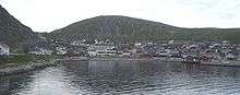
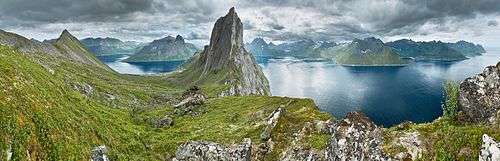 Senja | |
 Coat of arms | |
 Troms og Finnmark within Norway | |
| Coordinates: 69.8178°N 18.7819°E | |
| Country | Norway |
| County | Troms og Finnmark |
| Region | Northern Norway |
| County ID | NO-54 |
| Administrative centres | Tromsø and Vadsø |
| Other towns | List
|
| Government | |
| • Governor | Elisabeth Aspaker (2019–present) |
| • County mayor | Ivar B. Prestbakmo (Sp) |
| Area | |
| • Total | 74,829.68 km2 (28,891.90 sq mi) |
| • Land | 70,929.56 km2 (27,386.06 sq mi) |
| • Water | 3,900.12 km2 (1,505.84 sq mi) 5.2% |
| Area rank | 1 |
| Population (2020)[2] | |
| • Total | 243,311 |
| • Rank | 10 |
| • Density | 3.3/km2 (8.4/sq mi) |
| Time zone | UTC+01:00 (CET) |
| • Summer (DST) | UTC+02:00 (CEST) |
| Official language form | Neutral |
| Website | nyetffk |
The administrative centre of the county is split between two towns. The city of Tromsø (the seat of the old Troms county) is where all the political and administrative offices are based and the county governor is based out of the town of Vadsø (the seat of the old Finnmark county). The two towns are about 800 kilometres (500 mi) apart, approximately a 10-hour drive by car. On 1 January 2019, Elisabeth Aspaker was appointed as the County Governor of Troms og Finnmark. Previously, she had been the County Governor of Troms county.
The merger has not been popular, especially in the old Finnmark county. A county-wide non-binding referendum was held and about 87% of Finnmark residents who voted, voted against the merger,[4] but the Storting did not reverse its decision to merge the county. Some political parties have since been campaigning to reverse the merger in the next parliamentary term.[5]
Geography
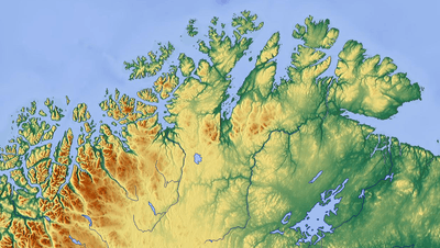
Troms og Finnmark is the northernmost and easternmost county in Norway (Svalbard is not considered a county). By area, it is Norway's largest county, even larger than the neighboring country of Denmark. However, it is also one of the least populated of all Norwegian counties.
Knivskjellodden in Nordkapp Municipality (on the island of Magerøya) sometimes considered the northernmost point of Europe (on an island); Kinnarodden on Nordkinn Peninsula in Lebesby Municipality is the northernmost point on the European mainland. Honningsvåg in Finnmark claims to be the northernmost city of the world, and Vardø is the easternmost town in Norway and is farther east than Istanbul.
The coast is indented by large fjords, many of which (in a strict sense) are false fjords, as they are not carved out by glaciers. Some of Norway's largest sea bird colonies can be seen on the northern coast, the largest are Hjelmsøystauran on the island of Hjelmsøya in Måsøy Municipality and Gjesværstappan in Nordkapp Municipality. The highest point is located on the top of the glacier Øksfjordjøkelen, which has an area of 45 square kilometres (17 sq mi), and it is located in Loppa Municipality. Both Øksfjordjøkelen and Seilandsjøkelen (Seiland glacier) are located in the western part of Finnmark.
The Øksfjord plateau glacier calved directly into the sea (Jøkelfjorden) until 1900, the last glacier in mainland Norway to do so. The central and eastern part of Finnmark is generally less mountainous, and has no glaciers. The land east of Nordkapp is mostly below 300 m (980 ft).
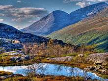
The nature varies from barren coastal areas facing the Barents Sea, to more sheltered fjord areas and river valleys with gullies and tree vegetation. About half of the county is above the tree line, and large parts of the other half is covered with small Downy birch.
The most lush areas are the Alta area and the Tana valleys, and in the east is the lowland area in the Pasvik valley in Sør-Varanger, where the pine and Siberian spruce forest is considered part of the Russian taiga vegetation. This valley has the highest density of Brown bears in Norway, and is the only location in the country with a population of musk-rats. Lynx and moose are common in large parts of Finnmark, but rare on the coast.
The interior parts of the county include part of the great Finnmarksvidda plateau, with an elevation of 300 to 400 m (980 to 1,310 ft), with numerous lakes and river valleys. The plateau is famous for its tens of thousands of reindeer owned by the Sami, and swarms of mosquitos in mid-summer. Finnmarksvidda makes up 36% of the county's area. Stabbursdalen National Park ensures protection for the world's most northern pine forest.
The Tana River, which partly defines the border with Finland, gives the largest catch of salmon of all rivers in Europe, and also has the world record for Atlantic salmon, 36 kg (79 lb). In the east, the Pasvikelva defines the border with Russia.
There are mountains all over the county; the most alpine and striking are probably the Lyngen Alps (Lyngsalpene), with several small glaciers and the highest mountain in the county, Jiekkevarre with a height of 1,833 m (6,014 ft). Several glaciers are located in Kvænangen, including parts of the Øksfjordjøkelen, the last glacier in mainland Norway to drop icebergs directly into the sea (in the Jøkelfjord). The largest river in Troms (waterflow) is Målselva (in Målselv), and the largest (not the highest) waterfall is Målselvfossen at 600 m (2,000 ft) long and 20 m (66 ft) high. Marble is present in parts of Troms, and thus numerous caves, as in Salangen and Skånland.
Climate
| Alta airport/Alta (1961–90) | ||||||||||||||||||||||||||||||||||||||||||||||||||||||||||||
|---|---|---|---|---|---|---|---|---|---|---|---|---|---|---|---|---|---|---|---|---|---|---|---|---|---|---|---|---|---|---|---|---|---|---|---|---|---|---|---|---|---|---|---|---|---|---|---|---|---|---|---|---|---|---|---|---|---|---|---|---|
| Climate chart (explanation) | ||||||||||||||||||||||||||||||||||||||||||||||||||||||||||||
| ||||||||||||||||||||||||||||||||||||||||||||||||||||||||||||
| ||||||||||||||||||||||||||||||||||||||||||||||||||||||||||||
Troms og Finnmark has short, cool summers, but fairly mild winters along the coast due to the temperate sea; Torsvåg Lighthouse in Karlsøy has January 24-hr average of −1 °C (30 °F). Tromsø averages −4 °C (25 °F) in January with a daily high of −2 °C (28 °F), while July averages 12 °C (54 °F) with high of 15 °C (59 °F). Temperatures are typically below freezing for about 5 months (8 months in the mountains), from early November to the beginning of April, but coastal areas are moderated by the sea: with more than 130 years of official weather recordings, the coldest winter temperature ever recorded in Tromsø is −20.1 °C (−4.2 °F) in February 1985.[6] The all-time high for Troms is 33.5 °C (92.3 °F) recorded in Bardufoss July 18, 2018. Thaws can occur even in mid-winter. There is often snow in abundance, and avalanches are not uncommon in winter. With the prevailing westerlies, lowland areas east of mountain ranges have less precipitation than areas west of the mountains.
The Finnmarksvidda plateau in the interior of the county has a continental climate with the coldest winter temperatures in Norway: the coldest temperature ever recorded was −51.4 °C (−60.5 °F) in Karasjok on 1 January 1886. The 24-hour averages for January and July at the same location are −17.1 °C (1.2 °F) and 13.1 °C (55.6 °F), the annual average is −2.4 °C (27.7 °F), and precipitation is only 366 millimetres (14.4 in) per year with summer as the wettest season.[7] Karasjok has recorded up to 32.4 °C (90.3 °F) in July, giving a possible year amplitude of 84 °C (151 °F) (rare in Europe). Finnmarksvidda has annual mean temperatures down to −3 °C (27 °F) (Sihcajavri in Kautokeino), the coldest in mainland Norway (except for higher mountains areas) and even colder than Jan Mayen and Bear Island. However, Sihcajavri has also recorded 34.3 °C (93.7 °F) on 23 June 1920.
Due to the proximity to the ice-free ocean, winters are much milder in coastal areas (and more windy); Loppa Municipality has average January and July temperatures of −2 °C (28 °F) and 11.6 °C (52.9 °F) respectively, with an annual mean of 3.6 °C (38.5 °F),[8] despite being further north. Average annual precipitation is 914 millimetres (36.0 in) and the wettest season is September until December. The year average temperature difference between Loppa and Karasjok (6 °C) is comparable to the difference between Loppa and London.[9]
Skibotn (elevation: 46 m or 151 ft) in Storfjord is the location in Norway which has recorded the most days per year with clear skies (no clouds). Winter temperatures in Målselv and Bardu can get down to −35 °C (−31 °F), while summer days can reach 30 °C (86 °F) in inland valleys and the innermost fjord areas, but 15 to 22 °C (59 to 72 °F) is much more common. Along the outer seaboard, a summer day at 15 °C (59 °F) is considered fairly warm.
In the Köppen climate classification, the climate in Karasjok–and most of the lowland areas in Finnmark–corresponds to the Dfc category (subarctic climate), while the Loppa climate corresponds to the Cfc category. The northeastern coast, from Nordkapp east to Vardø, have arctic tundra climate (Köppen: ET), as the average July temperature is below 10 °C (50 °F).
Furthermore, elevations exceeding approximately 100 to 200 metres (330 to 660 ft) in coastal areas in western Finnmark and 300 to 500 metres (980 to 1,640 ft) in the interior result in an alpine climate, and in the northeast this merges with the Arctic tundra climate.
The climate in sheltered parts of fjord areas (particularly the Altafjorden) is usually considered the most hospitable: winters are not as cold as in the interior, and summer warmth is comparable. Even if winter temperatures are milder in coastal areas, the coast is more exposed to winter storms, which often complicate or shut down road and air communications.
| Climate data for Tromsø, Troms county, Norway 1961-1990 | |||||||||||||
|---|---|---|---|---|---|---|---|---|---|---|---|---|---|
| Month | Jan | Feb | Mar | Apr | May | Jun | Jul | Aug | Sep | Oct | Nov | Dec | Year |
| Average high °C (°F) | −2.2 (28.0) |
−2.1 (28.2) |
−0.4 (31.3) |
2.7 (36.9) |
7.5 (45.5) |
12.5 (54.5) |
15.3 (59.5) |
13.9 (57.0) |
9.3 (48.7) |
4.7 (40.5) |
0.7 (33.3) |
−1.3 (29.7) |
5.1 (41.2) |
| Daily mean °C (°F) | −4.4 (24.1) |
−4.2 (24.4) |
−2.7 (27.1) |
0.3 (32.5) |
4.8 (40.6) |
9.1 (48.4) |
11.8 (53.2) |
10.8 (51.4) |
6.7 (44.1) |
2.7 (36.9) |
−1.1 (30.0) |
−3.3 (26.1) |
2.5 (36.5) |
| Average low °C (°F) | −6.5 (20.3) |
−6.5 (20.3) |
−5.1 (22.8) |
−2.3 (27.9) |
2.0 (35.6) |
6.1 (43.0) |
8.7 (47.7) |
7.8 (46.0) |
4.5 (40.1) |
0.7 (33.3) |
−3.0 (26.6) |
−5.4 (22.3) |
0.1 (32.2) |
| Average precipitation mm (inches) | 95 (3.7) |
87 (3.4) |
72 (2.8) |
64 (2.5) |
48 (1.9) |
59 (2.3) |
77 (3.0) |
82 (3.2) |
102 (4.0) |
131 (5.2) |
108 (4.3) |
106 (4.2) |
1,031 (40.6) |
| Average precipitation days (≥ 1 mm) | 13.7 | 12.8 | 11.9 | 11.2 | 9.9 | 11.4 | 13.4 | 13.1 | 15.5 | 17.1 | 14.8 | 15.1 | 159.9 |
| Mean monthly sunshine hours | 3 | 32 | 112 | 160 | 218 | 221 | 205 | 167 | 92 | 49 | 6 | 0 | 1,265 |
| Source: Norwegian Meteorological Institute[10] | |||||||||||||
Midnight sun
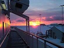
Situated far north of the Arctic Circle, Troms og Finnmark has midnight sun from the middle of May until late July. Conversely, in two months of the winter, from late November to late January, the county experiences polar nights where the sun is always below the horizon. As a consequence, there is continuous daylight from early May to early August. At midwinter, there is only a bluish twilight for a couple of hours around noon, which can almost reach full daylight if there are clear skies to the south.
| Jan | Feb | Mar | Apr | May | Jun | Jul | Aug | Sep | Oct | Nov | Dec |
|---|---|---|---|---|---|---|---|---|---|---|---|
| 11:31 – 12:17 | 08:16 – 15:43 | 06:07 – 17:41 | 04:43 – 20:48 | 01:43 – 23:48 | Midnight sun | Midnight sun | 03:44 – 21:50 | 05:56 – 19:20 | 07:54 – 17:04 | 09:25 – 13:32 | Polar night |
| Source: Almanakk for Norge; University of Oslo, 2010. Note: The sun is below the horizon until 15 January in Tromsø, but the low sun is blocked by mountains and not visible until 21 January. | |||||||||||
Northern lights
The county is situated in the Aurora Borealis zone, and because of the dry climate with frequent clear skies, Alta Municipality was early chosen as a location for the study of this strange light phenomenon. For this reason, Alta is sometimes referred to as the city of the northern lights.
History
People have lived in this area for at least 10,000 years (since the early Stone Age), and there are prehistoric rock carvings at several locations (for instance Ibestad, Balsfjord, Komsa, Pit-Comb Ware culture and Rock carvings at Alta). These people made their living from hunting, fishing and gathering.The destiny of these early cultures is unknown. Three ethnic groups have a long history in the area: the Sami people, the Norwegian people, and the Kven people. Of these, the Sami probably were the first people to explore what is now Troms og Finnmark. Ohthere of Hålogaland was an adventurous Norwegian (Norseman) from Hålogaland, the area roughly corresponding to today's Nordland county. Around 890 AD, he claimed, according to historical sources (see Ohthere of Hålogaland) that he lived "north-most of all the Northmen", and that "no one [lived] to the north of him." Later, Norwegians in the 14th century, and Kvens in the 16th century, settled along the coast. See the articles on Kven people and Vardøhus Fortress for more details.
Southern and mid-Troms was a Norwegian petty kingdom in the Viking Age, and considered part of Hålogaland. Ottar from Hålogaland met King Alfred the Great around 890. The Viking leader Tore Hund had his seat at Bjarkøy. According to the sagas, Tore Hund speared King Olav Haraldsson at the Battle of Stiklestad. He also traded and fought in Bjarmaland, today the area of Arkhangelsk in northern Russia .[11] Trondenes (today's Harstad) was also a central Viking power centre, and seems to have been a gathering place.
Sami
The Sami are the indigenous people of the area, but Norwegians have lived for hundreds of years on the islands' outer parts, where they made up the majority. The Sami people still constitute the majority in Finnmark's interior parts, while the fjord areas have been ethnically mixed for a long time. This essentially holds true today.
The Sami were for many years victims of the Norwegianization policy, which in essence was an attempt by the government to make them "true" Norwegians and forget about their Sami way of life and religion, which was seen as inferior. As a result, the Sami living at the coast and in the fjords gradually lost much of their culture and often felt ashamed by their Sami inheritance. The Sami in the interior managed to preserve more of their culture. In the 1970s, instruction of the Sami language started in schools, and a new sense of consciousness started to grow among the Sami; today most are proud of their background and culture.
In the midst of this awakening (1979), Norway's government decided to build a dam in Alta to produce hydropower, provoking many Sami and environmentalists to demonstrations and civil disobedience (Altasaken). In the end, the dam was built on a much smaller scale than originally intended and the Sami culture was on the government's agenda. The Sami parliament (Sámediggi) was opened in Karasjok in 1989.
Norwegian
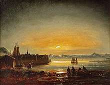
Gjesvær in Nordkapp is mentioned in the Sagas (Heimskringla) as a northern harbor in the Viking Age, especially used by Vikings on the way to Bjarmaland (see Ottar from Hålogaland), and probably also for gathering food in the nearby seabird colony. Coastal areas of Finnmark were colonized by Norwegians beginning in the 10th century, and there are stories describing clashes with the Karelians. Border skirmishes between the Norwegians and Novgorodians continued until 1326, when the Treaty of Novgorod settled the issue.
The first known fortification in Finnmark is Vardøhus festning, first erected in 1306 by King Haakon V Magnusson. This is the world's most northern fortress. In the 17th century, 88 young women were burned as witches in Vardø, an extremely high number compared to the total population in this area at the time.[12] However, the first person burned as witch in Vardø in the 17th century was not a woman, but a man. [Vardø archives]
Finnmark first became subject to increased colonization in the 18th and 19th century. Norway, Sweden, and Russia all claimed control over this area. Finland was part of Russia at that time and had no independent representative. Finnmark was given the status of an Amt (county) in the 19th century. For a time, there was a vibrant trade with Russia (Pomor trade), and many Norwegians settled on the Kola Peninsula (see Kola Norwegians).
Kven
The Finnic Kven residents of Finnmark are largely descendants of Finnish speaking immigrants who arrived in the area in the 18th century from Meänmaa, and later in the 19th century from Finland, suffering from famine and war.[13]
Governance
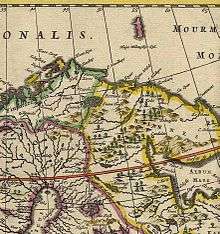
In 1576, the King of Norway established Vardøhus len as a new administrative unit for the kingdom. In 1660, it became Vardøhus amt, a subordinate to the large Trondhjems stiftamt, based in Trondheim. In 1787, the island of Senja and the Troms area were transferred from Nordlandenes amt to Vardøhus amt (an area similar to today's Troms og Finnmark county). In 1866, the island of Senja and the Troms area were separated from Vardøhus to form the new Tromsø amt. In 1919, the names were again changed to Finnmark fylke and Troms fylke.
World War II
Per Fugelli has said that World War II resulted in many persons acquiring psychiatric disorders (psykiske senskadene) which could be from experiencing "bombing, accidents involving mines, burning down of homes, forcible evacuation, illness and starvation during the war and liberation. But it was maybe in particular the treatment of Russian prisoners that left marks on the local population."[14]
Towards the end of World War II, with Operation Nordlicht, the Germans used the scorched earth tactic in Finnmark and northern Troms to halt the Red Army. As a consequence of this, few houses survived the war, and a large part of the population was forcefully evacuated further south (Tromsø was crowded), but many people avoided evacuation by hiding in caves and mountain huts and waited until the Germans were gone, then inspected their burned homes. There were 11,000 houses, 4,700 cow sheds, 106 schools, 27 churches, and 21 hospitals burned. There were 22,000 communications lines destroyed, roads were blown up, boats destroyed, animals killed, and 1,000 children separated from their parents.[15]
However, after taking the town of Kirkenes on 25 October 1944 (as the first town in Norway), the Red Army did not attempt further offensives in Norway. Free Norwegian forces arrived from Britain and liberated the rest of the county. When war was over, more than 70,000 people were left homeless in Finnmark. The government imposed a temporary ban on residents returning to Finnmark because of the danger of landmines. The ban lasted until the summer of 1945 when evacuees were told that they could finally return home.

Cold War
The Cold War was a period with sometimes high tension in eastern Finnmark, at the 196-kilometre (122 mi) long border with the Soviet Union. To keep tensions from getting too high, Norway declared that no NATO exercises would take place in Finnmark.[16] There was, however, a lot of military intelligence activity, and Norwegian P-3 Orion maritime surveillance aircraft were often the first to get pictures of newly built Soviet submarines and aircraft. A purpose built ELINT vessel, Marjata, was always stationed near the border, and the current Marjata (7500 t) is still operating out of the ports in eastern Finnmark. As recently as 2000, Russian generals threatened to target the Globus II Radar in Vardø with nuclear missiles.[17]
Government
A county (fylke) is the chief local administrative area in Norway. The whole country is divided into 11 counties. A county is also an election area, with popular votes taking place every 4 years. In Troms og Finnmark, the government of the county is the Troms og Finnmark County Municipality. It includes 57 members who are elected to form a county council (Fylkesting). Heading the Fylkesting is the county mayor (fylkesordførar). Since 2020, the Troms og Finnmark County Municipality has been led by Jon Askeland, the county mayor.
The county also has a County Governor (fylkesmann) who is the representative of the King and Government of Norway. Lars Sponheim is the current County Governor of Troms og Finnmark.
The municipalities in Troms og Finnmark are divided among several district courts (tingrett): Alta District Court, Hammerfest District Court, Indre Finnmark District Court, Nord-Troms District Court, Senja District Court, Trondenes District Court, and Øst-Finnmark District Court. All of these courts are subordinate to the Hålogaland Court of Appeal district based in Tromsø.
Municipalities
Troms og Finnmark County has a total of 39 municipalities:[18]
| Municipal Number | Name | Adm. Centre | Location in the county | Established | Old Municipal No. (before 2020) | Former County (before 2020) |
|---|---|---|---|---|---|---|
| 5401 | Tromsø | 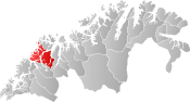 | 1 Jan 1838 | 1902 Tromsø | Troms | |
| 5402 | Harstad | 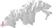 | 1 Jan 1904 | 1903 Harstad | ||
| 5403 | Alta |  | 1 Jan 1863 | 2012 Alta | Finnmark | |
| 5404 | Vardø |  | 1 Jan 1838 | 2002 Vardø | ||
| 5405 | Vadsø |  | 1 Jan 1838 | 2003 Vadsø | ||
| 5406 | Hammerfest |  | 1 Jan 1838 | 2004 Hammerfest 2017 Kvalsund | ||
| 5411 | Borkenes |  | 1 Jan 1838 | 1911 Kvæfjord | Troms | |
| 5412 | Evenskjer |  | 1 Jan 1909 | 1852 Tjeldsund | Nordland | |
| 1913 Skånland | Troms | |||||
| 5413 | Hamnvik | 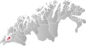 | 1 Jan 1838 | 1917 Ibestad | ||
| 5414 | Årstein | 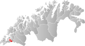 | 1 July 1926 | 1919 Gratangen | ||
| 5415 | Tennevoll |  | 1 Jan 1907 | 1920 Lavangen | ||
| 5416 | Setermoen |  | 1 Jan 1854 | 1922 Bardu | ||
| 5417 | Sjøvegan | 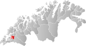 | 1 Jan 1871 | 1923 Salangen | ||
| 5418 | Moen | 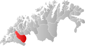 | 1 Jan 1848 | 1924 Målselv | ||
| 5419 | Sørreisa | 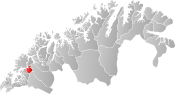 | 1 Sep 1886 | 1925 Sørreisa | ||
| 5420 | Brøstadbotn |  | 1 Sep 1886 | 1926 Dyrøy | ||
| 5421 | Finnsnes |  | 1 Jan 2020 | 1927 Tranøy 1928 Torsken 1929 Berg 1931 Lenvik | ||
| 5422 | Storsteinnes |  | 1 Jan 1860 | 1933 Balsfjord | ||
| 5423 | Hansnes |  | 1 Jan 1838 | 1936 Karlsøy | ||
| 5424 | Lyngseidet |  | 1 Jan 1838 | 1938 Lyngen | ||
| 5425 | Hatteng |  | 1 Jan 1929 | 1939 Storfjord | ||
| 5426 | Olderdalen | 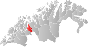 | 1 Jan 1929 | 1940 Kåfjord | ||
| 5427 | Skjervøy | 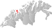 | 1 Jan 1838 | 1941 Skjervøy | ||
| 5428 | Storslett |  | 1 Jan 1886 | 1942 Nordreisa | ||
| 5429 | Burfjord | 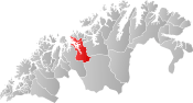 | 1 Jan 1863 | 1943 Kvænangen | ||
| 5430 | Kautokeino |  | 1 Jan 1851 | 2011 Kautokeino | Finnmark | |
| 5432 | Øksfjord | 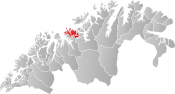 | 1 Jan 1838 | 2014 Loppa | ||
| 5433 | Breivikbotn | 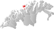 | 1 Jan 1858 | 2015 Hasvik | ||
| 5434 | Havøysund |  | 1 Jan 1838 | 2018 Måsøy | ||
| 5435 | Honningsvåg | 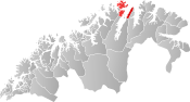 | 1 July 1861 | 2019 Nordkapp | ||
| 5436 | Lakselv |  | 1 Jan 1838 | 2020 Porsanger | ||
| 5437 | Karasjok |  | 1 Jan 1866 | 2021 Karasjok | ||
| 5438 | Kjøllefjord |  | 1 Jan 1838 | 2022 Lebesby | ||
| 5439 | Mehamn |  | 1 Jan 1914 | 2023 Gamvik | ||
| 5440 | Berlevåg |  | 1 Jan 1914 | 2024 Berlevåg | ||
| 5441 | Tana bru |  | 1 Jan 1864 | 2025 Tana | ||
| 5442 | Varangerbotn |  | 1 Jan 1839 | 2027 Nesseby | ||
| 5443 | Båtsfjord |  | 1 Jan 1839 | 2028 Båtsfjord | ||
| 5444 | Kirkenes |  | 1 Jul 1858 | 2030 Sør-Varanger |
References
- "Arealstatistikk for Norge". Kartverket (in Norwegian Bokmål). 8 March 2013. Retrieved 2 January 2020.
- Statistisk sentralbyrå (2020). "Table: 06913: Population 1 January and population changes during the calendar year (M)" (in Norwegian).
- Tjernshaugen, Andreas, ed. (14 September 2019). "Troms og Finnmark". Store norske leksikon (in Norwegian). Kunnskapsforlaget. Retrieved 26 October 2019.
- "Folkeavstemningen i Finnmark: 87 prosent stemte nei". NRK (in Norwegian). 16 May 2018. Retrieved 26 October 2019.
- Vernes, Thomas (6 September 2019). "Det nye storfylket Troms og Finnmark kan bli sprengt i to i 2021". ABC nyheter (in Norwegian). Retrieved 26 October 2019.
- Yr coldest recordings in February
- "Norwegian Meteorological Records". met.no. Archived from the original on 20 November 2007. Retrieved 12 February 2009.
- "Meteorological data". met.no. Archived from the original on 20 November 2007. Retrieved 12 February 2009.
- "Meteorological data". worldclimate.com. 4 February 2007. Archived from the original on 19 June 2008. Retrieved 12 February 2009.
- "eKlima Web Portal". Norwegian Meteorological Institute. Archived from the original on 14 June 2004.
- Bjarmeland (Store norske leksikon)
- "BioOne article". Bioone.org. 1 January 1970. Retrieved 12 February 2009.
- politidepartementet, Justis- og (1 August 1996). "NOU 1994: 21". Regjeringen.no. Archived from the original on 7 November 2017. Retrieved 28 April 2018.
- NRK. "Den glemte krigen". NRK. Archived from the original on 16 June 2015. Retrieved 20 May 2016.
- Zimmerman, Susan (November–December 2010). "World War II Magazine". 25 (4): 31. Cite journal requires
|journal=(help) - German, Robert K. (1982). "Norway and the Bear: Soviet Coercive Diplomacy and Norwegian Security Policy". International Security. 7 (2): 70. doi:10.2307/2538433. JSTOR 2538433.
- "NewsMax Archives". Archived from the original on 11 March 2007. Retrieved 20 May 2016.
- List of Norwegian municipality numbers
Troms og Finnmark county, Norway | |||||||||||||||||||||||
|---|---|---|---|---|---|---|---|---|---|---|---|---|---|---|---|---|---|---|---|---|---|---|---|
 |
|   | |||||||||||||||||||||
||
| |||||||||||||||||||||||||||||||||||||||||||||||||||||||||||||||||||||