Porsanger
Porsanger (Norwegian) or Porsáŋgu (Northern Sami) or Porsanki (Kven)[3] is a municipality in Troms og Finnmark county, Norway. The administrative centre of the municipality is the village of Lakselv. Other villages in the municipality include Børselv, Brenna, Indre Billefjord, Kistrand, Olderfjord, and Skoganvarre.
Porsanger kommune Porsáŋggu gielda Porsangin komuuni | |
|---|---|
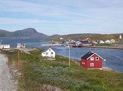 View of Repvåg | |
 Flag  Coat of arms  Troms og Finnmark within Norway | |
 Porsanger within Troms og Finnmark | |
| Coordinates: 70°03′08″N 24°57′21″E | |
| Country | Norway |
| County | Troms og Finnmark |
| District | Vest-Finnmark |
| Established | 1 Jan 1838 |
| Administrative centre | Lakselv |
| Government | |
| • Mayor (2015) | Aina Borch (Ap) |
| Area | |
| • Total | 4,872.58 km2 (1,881.31 sq mi) |
| • Land | 4,640.29 km2 (1,791.63 sq mi) |
| • Water | 232.29 km2 (89.69 sq mi) 4.8% |
| Area rank | 3 in Norway |
| Population (2020) | |
| • Total | 3,998 |
| • Rank | 204 in Norway |
| • Density | 0.9/km2 (2/sq mi) |
| • Change (10 years) | 0.2% |
| Demonym(s) | Porsangværing Porsangerværing[1] |
| Time zone | UTC+01:00 (CET) |
| • Summer (DST) | UTC+02:00 (CEST) |
| ISO 3166 code | NO-5436 |
| Official language form | Bokmål, Sami, and Kven[2] |
| Website | porsanger |
The 4,873-square-kilometre (1,881 sq mi) municipality is the 3rd largest by area out of the 356 municipalities in Norway. Porsanger is the 204th most populous municipality in Norway with a population of 3,998, many of whom have a Kven (Kainu) or Sami background. The municipality's population density is 0.9 inhabitants per square kilometre (2.3/sq mi) and its population has increased by 0.2% over the previous 10-year period.[4][5]
General information
The municipality of Kistrand (renamed Porsanger in 1964) was established on 1 January 1838 (see formannskapsdistrikt). On 1 January 1851, the southern part of Kistrand (population: 869) was separated to become the new Kautokeino Municipality. On 1 January 1861, the northern part of Kistrand (population: 345) was separated to become the new Kjelvik Municipality. On 1 January 1866, the southern part of Kistrand (population: 515) was separated to become the new Karasjok Municipality.[6]
On 1 January 2020, the municipality became part of the newly formed Troms og Finnmark county. Previously, it had been part of the old Finnmark county.[7]
Name
The municipality was originally named Kistrand, after the farm where the main parish church (Kistrand Church) was located. In 1964, the municipality was renamed Porsanger, after the local Porsangerfjorden.
The Old Norse form of the name was Porsangr. The first element is probably the name of the plant pors or finnmarkspors (Rhododendron tomentosum). (Another theory is that is comes from Sami borsi which means "waterfall".) The last word is angr which means "fjord".
Since 2004, the municipality has had three official names: Porsanger, Porsáŋgu, and Porsanki, since it has three official languages: Norwegian, Northern Sami, and Kven.[8][9]
Coat of arms
The coat of arms was granted on 16 June 1967. Porsanger is one of the largest municipalities in the Northern Norway that are not dependent on fishing. Instead the local people historically farmed reindeer, which is still an importance source of income. The arms thus show three silver leaping reindeer on a red background.[10]
Churches
The Church of Norway has one parish (sokn) within the municipality of Porsanger. It is part of the Indre Finnmark prosti (deanery) in the Diocese of Nord-Hålogaland.
| Parish (sokn) | Name | Location | Year built |
|---|---|---|---|
| Porsanger | Brenna Chapel | Brenna | 1971 |
| Børselv Church | Børselv | 1958 | |
| Kistrand Church | Kistrand | 1856 | |
| Lakselv Church | Lakselv | 1963 | |
| Skoganvarre Chapel | Skoganvarre | 1963 |
History
The area has been settled by Sami people since time immemorial. In the 18th century, people from Finland, escaping famine and war, settled along the Porsangerfjorden. These people are today known as Kven. Today, three official languages are in use, and the municipality is named Porsanger, Porsáŋgu, and Porsanki (the name in Norwegian, Northern Sami, and Kven/Finnish respectively).
Government
All municipalities in Norway, including Porsanger, are responsible for primary education (through 10th grade), outpatient health services, senior citizen services, unemployment and other social services, zoning, economic development, and municipal roads. The municipality is governed by a municipal council of elected representatives, which in turn elect a mayor.[11] The municipality falls under the Indre Finnmark District Court and the Hålogaland Court of Appeal.
Municipal council
The municipal council (Kommunestyre) of Porsanger is made up of 19 representatives that are elected to four year terms. The party breakdown of the council is as follows:
| Party Name (in Norwegian) | Number of representatives | |
|---|---|---|
| Labour Party (Arbeiderpartiet) | 5 | |
| Progress Party (Fremskrittspartiet) | 1 | |
| Conservative Party (Høyre) | 5 | |
| Centre Party (Senterpartiet) | 3 | |
| Socialist Left Party (Sosialistisk Venstreparti) | 2 | |
| Cross-Party List in Porsanger (Tverrpolitisk liste i Porsanger) | 3 | |
| Total number of members: | 19 | |
| Party Name (in Norwegian) | Number of representatives | |
|---|---|---|
| Labour Party (Arbeiderpartiet) | 6 | |
| Progress Party (Fremskrittspartiet) | 1 | |
| Conservative Party (Høyre) | 7 | |
| Centre Party (Senterpartiet) | 1 | |
| Socialist Left Party (Sosialistisk Venstreparti) | 1 | |
| Cross-Party List in Porsanger (Tverrpolitisk liste i Porsanger) | 3 | |
| Total number of members: | 19 | |
| Party Name (in Norwegian) | Number of representatives | |
|---|---|---|
| Labour Party (Arbeiderpartiet) | 7 | |
| Progress Party (Fremskrittspartiet) | 3 | |
| Conservative Party (Høyre) | 7 | |
| Centre Party (Senterpartiet) | 1 | |
| Socialist Left Party (Sosialistisk Venstreparti) | 1 | |
| Total number of members: | 19 | |
| Party Name (in Norwegian) | Number of representatives | |
|---|---|---|
| Labour Party (Arbeiderpartiet) | 7 | |
| Progress Party (Fremskrittspartiet) | 5 | |
| Conservative Party (Høyre) | 4 | |
| Centre Party (Senterpartiet) | 2 | |
| Socialist Left Party (Sosialistisk Venstreparti) | 1 | |
| Total number of members: | 19 | |
| Party Name (in Norwegian) | Number of representatives | |
|---|---|---|
| Labour Party (Arbeiderpartiet) | 6 | |
| Progress Party (Fremskrittspartiet) | 2 | |
| Conservative Party (Høyre) | 7 | |
| Centre Party (Senterpartiet) | 2 | |
| Socialist Left Party (Sosialistisk Venstreparti) | 2 | |
| Total number of members: | 19 | |
| Party Name (in Norwegian) | Number of representatives | |
|---|---|---|
| Labour Party (Arbeiderpartiet) | 7 | |
| Progress Party (Fremskrittspartiet) | 2 | |
| Conservative Party (Høyre) | 8 | |
| Christian Democratic Party (Kristelig Folkeparti) | 1 | |
| Centre Party (Senterpartiet) | 4 | |
| Socialist Left Party (Sosialistisk Venstreparti) | 2 | |
| Porsanger List (Porsangerlista) | 1 | |
| Total number of members: | 25 | |
| Party Name (in Norwegian) | Number of representatives | |
|---|---|---|
| Labour Party (Arbeiderpartiet) | 8 | |
| Conservative Party (Høyre) | 4 | |
| Christian Democratic Party (Kristelig Folkeparti) | 1 | |
| Centre Party (Senterpartiet) | 4 | |
| Socialist Left Party (Sosialistisk Venstreparti) | 3 | |
| Liberal Party (Venstre) | 1 | |
| Porsanger List (Porsangerlista) | 4 | |
| Total number of members: | 25 | |
| Party Name (in Norwegian) | Number of representatives | |
|---|---|---|
| Labour Party (Arbeiderpartiet) | 10 | |
| Conservative Party (Høyre) | 6 | |
| Christian Democratic Party (Kristelig Folkeparti) | 1 | |
| Socialist Left Party (Sosialistisk Venstreparti) | 4 | |
| Liberal Party (Venstre) | 1 | |
| Porsanger List (Porsangerlista) | 3 | |
| Total number of members: | 25 | |
| Party Name (in Norwegian) | Number of representatives | |
|---|---|---|
| Labour Party (Arbeiderpartiet) | 13 | |
| Progress Party (Fremskrittspartiet) | 3 | |
| Conservative Party (Høyre) | 5 | |
| Christian Democratic Party (Kristelig Folkeparti) | 1 | |
| Socialist Left Party (Sosialistisk Venstreparti) | 1 | |
| Porsanger Cross-Party List (Porsanger tverrpolitiske liste) | 2 | |
| Total number of members: | 25 | |
| Party Name (in Norwegian) | Number of representatives | |
|---|---|---|
| Labour Party (Arbeiderpartiet) | 14 | |
| Progress Party (Fremskrittspartiet) | 1 | |
| Conservative Party (Høyre) | 4 | |
| Christian Democratic Party (Kristelig Folkeparti) | 1 | |
| Socialist Left Party (Sosialistisk Venstreparti) | 1 | |
| Local list for Indre Porsanger (Kretslista for Indre Porsanger) | 3 | |
| Porsanger Local List (Porsanger Bygdefolkets liste) | 1 | |
| Total number of members: | 25 | |
| Party Name (in Norwegian) | Number of representatives | |
|---|---|---|
| Labour Party (Arbeiderpartiet) | 10 | |
| Conservative Party (Høyre) | 5 | |
| Christian Democratic Party (Kristelig Folkeparti) | 1 | |
| Centre Party (Senterpartiet) | 1 | |
| Local list for Indre Porsanger (Kretslista for Indre Porsanger) | 6 | |
| Common List for Porsanger (Samlingsliste for Porsanger) | 1 | |
| Socialist Unity Liste (Sosialistisk enhetslist) | 1 | |
| Total number of members: | 25 | |
| Party Name (in Norwegian) | Number of representatives | |
|---|---|---|
| Labour Party (Arbeiderpartiet) | 11 | |
| Conservative Party (Høyre) | 4 | |
| Christian Democratic Party (Kristelig Folkeparti) | 2 | |
| Centre Party (Senterpartiet) | 2 | |
| Socialist Left Party (Sosialistisk Venstreparti) | 1 | |
| Local List(s) (Lokale lister) | 5 | |
| Total number of members: | 25 | |
| Party Name (in Norwegian) | Number of representatives | |
|---|---|---|
| Labour Party (Arbeiderpartiet) | 20 | |
| Conservative Party (Høyre) | 3 | |
| Centre Party (Senterpartiet) | 2 | |
| Total number of members: | 25 | |
| Party Name (in Norwegian) | Number of representatives | |
|---|---|---|
| Labour Party (Arbeiderpartiet) | 15 | |
| Conservative Party (Høyre) | 3 | |
| Local List(s) (Lokale lister) | 1 | |
| Total number of members: | 19 | |
| Party Name (in Norwegian) | Number of representatives | |
|---|---|---|
| Labour Party (Arbeiderpartiet) | 15 | |
| Conservative Party (Høyre) | 3 | |
| Socialist People's Party (Sosialistisk Folkeparti) | 1 | |
| Total number of members: | 19 | |
| Party Name (in Norwegian) | Number of representatives | |
|---|---|---|
| Labour Party (Arbeiderpartiet) | 11 | |
| Conservative Party (Høyre) | 3 | |
| Communist Party (Kommunistiske Parti) | 1 | |
| List of workers, fishermen, and small farmholders (Arbeidere, fiskere, småbrukere liste) | 2 | |
| Local List(s) (Lokale lister) | 2 | |
| Total number of members: | 19 | |
| Party Name (in Norwegian) | Number of representatives | |
|---|---|---|
| Labour Party (Arbeiderpartiet) | 10 | |
| Conservative Party (Høyre) | 2 | |
| Communist Party (Kommunistiske Parti) | 2 | |
| List of workers, fishermen, and small farmholders (Arbeidere, fiskere, småbrukere liste) | 1 | |
| Local List(s) (Lokale lister) | 4 | |
| Total number of members: | 19 | |
| Party Name (in Norwegian) | Number of representatives | |
|---|---|---|
| Labour Party (Arbeiderpartiet) | 8 | |
| Communist Party (Kommunistiske Parti) | 1 | |
| Local List(s) (Lokale lister) | 7 | |
| Total number of members: | 16 | |
| Party Name (in Norwegian) | Number of representatives | |
|---|---|---|
| Labour Party (Arbeiderpartiet) | 9 | |
| Communist Party (Kommunistiske Parti) | 2 | |
| List of workers, fishermen, and small farmholders (Arbeidere, fiskere, småbrukere liste) | 3 | |
| Local List(s) (Lokale lister) | 2 | |
| Total number of members: | 16 | |
| Party Name (in Norwegian) | Number of representatives | |
|---|---|---|
| Labour Party (Arbeiderpartiet) | 8 | |
| List of workers, fishermen, and small farmholders (Arbeidere, fiskere, småbrukere liste) | 1 | |
| Local List(s) (Lokale lister) | 7 | |
| Total number of members: | 16 | |
| Party Name (in Norwegian) | Number of representatives | |
|---|---|---|
| Labour Party (Arbeiderpartiet) | 9 | |
| Joint List(s) of Non-Socialist Parties (Borgerlige Felleslister) | 3 | |
| Local List(s) (Lokale lister) | 4 | |
| Total number of members: | 16 | |
Economy
Lakselv Airport, Banak is located on the Banak peninsula, just north of Lakselv village, along the coast of the fjord. The airport has connections to Tromsø and Kirkenes and it is operated by Widerøe. There are also charter flights in the summer season. The airport is also used by the Royal Norwegian Air Force's Station Group Banak. The Norwegian Army also has a garrison at Porsangermoen (Garrison of Porsanger), and so the military presence in Porsanger is quite heavy.
The local newspapers are Finnmark Dagblad and Ságat. The northernmost winery is located here, using crowberries instead of grapes.
Geography
Porsanger Municipality is the third largest municipality in Norway by area, with 4,873 square kilometres (1,881 sq mi). The municipality surrounds the inner part of the Porsangerfjorden, the fourth longest fjord in Norway and the longest in Northern Norway.
The Porsangerfjorden is a wide, open body of water with many islands. The Porsanger Peninsula lies on the western shore of the fjord and the Sværholt Peninsula lies on the eastern shore. The biggest village (and municipal centre) is the village of Lakselv at the fjord's southern end. There are many smaller villages spread around the fjord on both sides, notably Kistrand, Olderfjord, Børselv, and Indre Billefjord.
Stabbursdalen National Park, with the world's northernmost pine forest, lies just west of the fjord and the village of Lakselv. The Stabburselva river runs through the park. Other notable rivers include the Børselva and Lakselva, both are well known for their salmon fishing. The lakes Gákkajávri and Kjæsvannet are both located in the municipality.
In Porsanger, there is midnight sun from 16 May until 27 July each year and there is polar night from 25 November to 16 January.
Birdlife
Porsanger is an area of rich and varied bird fauna. Here one can find such species as pine grosbeak. Away from the woodlands, it is the surrounding wetlands that have the greatest diversity. During spring, thousands of red knots stop to rest and feed along the shores of Porsangerfjord.
Climate
| Climate data for Lakselv | |||||||||||||
|---|---|---|---|---|---|---|---|---|---|---|---|---|---|
| Month | Jan | Feb | Mar | Apr | May | Jun | Jul | Aug | Sep | Oct | Nov | Dec | Year |
| Average high °C (°F) | −6.5 (20.3) |
−5.5 (22.1) |
−2.2 (28.0) |
2.0 (35.6) |
7.3 (45.1) |
13.5 (56.3) |
16.9 (62.4) |
14.9 (58.8) |
9.8 (49.6) |
3.4 (38.1) |
−1.3 (29.7) |
−4.3 (24.3) |
4.0 (39.2) |
| Daily mean °C (°F) | −10.0 (14.0) |
−9.1 (15.6) |
−6.1 (21.0) |
−1.3 (29.7) |
4.2 (39.6) |
9.4 (48.9) |
12.7 (54.9) |
11.3 (52.3) |
6.7 (44.1) |
1.1 (34.0) |
−4.3 (24.3) |
−8.0 (17.6) |
0.6 (33.1) |
| Average low °C (°F) | −14.3 (6.3) |
−13.0 (8.6) |
−9.3 (15.3) |
−4.8 (23.4) |
0.8 (33.4) |
6.0 (42.8) |
9.2 (48.6) |
7.7 (45.9) |
3.6 (38.5) |
−1.7 (28.9) |
−7.4 (18.7) |
−11.6 (11.1) |
−2.9 (26.8) |
| Average precipitation mm (inches) | 21 (0.8) |
18 (0.7) |
15 (0.6) |
16 (0.6) |
18 (0.7) |
35 (1.4) |
55 (2.2) |
56 (2.2) |
36 (1.4) |
33 (1.3) |
22 (0.9) |
20 (0.8) |
345 (13.6) |
| Average precipitation days (≥ 1 mm) | 6.3 | 5.0 | 5.6 | 4.7 | 4.7 | 6.9 | 8.6 | 9.7 | 8.5 | 8.1 | 6.3 | 6.7 | 81.1 |
| Source: Norwegian Meteorological Institute[30] | |||||||||||||
References
- "Navn på steder og personer: Innbyggjarnamn" (in Norwegian). Språkrådet.
- "Forskrift om målvedtak i kommunar og fylkeskommunar" (in Norwegian). Lovdata.no.
- "Stadnamn og rettskriving" (in Norwegian). Kartverket. Retrieved 2018-07-13.
- Statistisk sentralbyrå (2020). "Table: 06913: Population 1 January and population changes during the calendar year (M)" (in Norwegian).
- Statistisk sentralbyrå (2020). "09280: Area of land and fresh water (km²) (M)" (in Norwegian).
- Jukvam, Dag (1999). "Historisk oversikt over endringer i kommune- og fylkesinndelingen" (PDF) (in Norwegian). Statistisk sentralbyrå.
- Mæhlum, Lars, ed. (2019-12-24). "Troms og Finnmark". Store norske leksikon (in Norwegian). Kunnskapsforlaget. Retrieved 2019-12-26.
- Store norske leksikon. "Porsangen" (in Norwegian). Retrieved 2013-03-29.
- Store norske leksikon. "Porsángu" (in Norwegian). Retrieved 2013-03-29.
- "Civic heraldry of Norway - Norske Kommunevåpen". Heraldry of the World. Retrieved 2017-08-20.
- Hansen, Tore, ed. (2016-05-12). "kommunestyre". Store norske leksikon (in Norwegian). Kunnskapsforlaget. Retrieved 2018-06-05.
- "Tall for Norge: Kommunestyrevalg 2019 - Troms og Finnmark". Valg Direktoratet. Retrieved 2019-10-23.
- "Table: 04813: Members of the local councils, by party/electoral list at the Municipal Council election (M)" (in Norwegian). Statistics Norway.
- "Tall for Norge: Kommunestyrevalg 2011 - Finnmark". Valg Direktoratet. Retrieved 2019-10-23.
- "Kommunestyrevalget 1995" (PDF) (in Norwegian). Oslo-Kongsvinger: Statistisk sentralbyrå. 1996. Retrieved 2020-03-17.
- "Kommunestyrevalget 1991" (PDF) (in Norwegian). Oslo-Kongsvinger: Statistisk sentralbyrå. 1993. Retrieved 2020-03-17.
- "Kommunestyrevalget 1987" (PDF) (in Norwegian). Oslo-Kongsvinger: Statistisk sentralbyrå. 1988. Retrieved 2020-03-17.
- "Kommunestyrevalget 1983" (PDF) (in Norwegian). Oslo-Kongsvinger: Statistisk sentralbyrå. 1984. Retrieved 2020-03-17.
- "Kommunestyrevalget 1979" (PDF) (in Norwegian). Oslo: Statistisk sentralbyrå. 1979. Retrieved 2020-03-17.
- "Kommunevalgene 1975" (PDF) (in Norwegian). Oslo: Statistisk sentralbyrå. 1977. Retrieved 2020-03-17.
- "Kommunevalgene 1972" (PDF) (in Norwegian). Oslo: Statistisk sentralbyrå. 1973. Retrieved 2020-03-17.
- "Kommunevalgene 1967" (PDF) (in Norwegian). Oslo: Statistisk sentralbyrå. 1967. Retrieved 2020-03-17.
- "Kommunevalgene 1963" (PDF) (in Norwegian). Oslo: Statistisk sentralbyrå. 1964. Retrieved 2020-03-16.
- "Kommunevalgene og Ordførervalgene 1959" (PDF) (in Norwegian). Oslo: Statistisk sentralbyrå. 1960. Retrieved 2020-03-17.
- "Kommunevalgene og Ordførervalgene 1955" (PDF) (in Norwegian). Oslo: Statistisk sentralbyrå. 1957. Retrieved 2020-03-17.
- "Kommunevalgene og Ordførervalgene 1951" (PDF) (in Norwegian). Oslo: Statistisk sentralbyrå. 1952. Retrieved 2020-03-17.
- "Kommunevalgene og Ordførervalgene 1947" (PDF) (in Norwegian). Oslo: Statistisk sentralbyrå. 1948. Retrieved 2020-03-17.
- "Kommunevalgene og Ordførervalgene 1945" (PDF) (in Norwegian). Oslo: Statistisk sentralbyrå. 1947. Retrieved 2020-03-17.
- "Kommunevalgene og Ordførervalgene 1937" (PDF) (in Norwegian). Oslo: Statistisk sentralbyrå. 1938. Retrieved 2020-03-17.
- "eKlima Web Portal". Norwegian Meteorological Institute. Archived from the original on 2004-06-14.
External links
| Wikimedia Commons has media related to Porsanger. |
- Municipal fact sheet from Statistics Norway (in Norwegian)
- Activities & tourism in Porsanger
- Stabbursnes nature house and museum
- Angling in Porsanger
Troms og Finnmark county, Norway | |||||||||||||||||||||||
|---|---|---|---|---|---|---|---|---|---|---|---|---|---|---|---|---|---|---|---|---|---|---|---|
 |
|   | |||||||||||||||||||||
||