Målselva
The Målselva is a river in Målselv Municipality in Troms og Finnmark county, Norway. The 140-kilometre (87 mi) long river flows through the Målselvdalen valley and then empties into the Målselvfjorden, an arm of the Malangen fjord. The municipality and the valley through which the river runs are both named after the river.
| Målselva | |
|---|---|
.jpg) View of the Målselva river | |
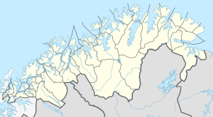 Location of the river  Målselva (Norway) | |
| Location | |
| Country | Norway |
| County | Troms og Finnmark |
| Municipalities | Målselv Municipality |
| Physical characteristics | |
| Source | Lille Rostavatn |
| • location | Rostadnes, Målselv, Troms og Finnmark |
| • coordinates | 69.0218°N 19.5148°E |
| • elevation | 102 metres (335 ft) |
| Mouth | Malangen fjord |
• location | Målsnes, Målselv, Troms og Finnmark |
• coordinates | 69.3065°N 18.5248°E |
• elevation | 0 metres (0 ft) |
| Length | 140 km (87 mi) |
| Basin size | 6,144 km2 (2,372 sq mi) |
| Basin features | |
| River system | Målselvvassdraget |
| Tributaries | |
| • left | Barduelva |
The smaller rivers Divielva, Tamokelva, and Rostaelva converge near the Lille Rostavatn lake to form the Målselva river. Later, the river Barduelva joins it near Fossmoen and Bardufoss. The river drains a watershed of 6,144 square kilometres (2,372 sq mi).[1] The Målselva river passes by the main villages of Bardufoss, Andselv, and Skjold.
References
- Store norske leksikon. "Målselva" (in Norwegian). Retrieved 2010-04-09.
This article is issued from Wikipedia. The text is licensed under Creative Commons - Attribution - Sharealike. Additional terms may apply for the media files.