Sjøvegan
Sjøvegan is the administrative centre of Salangen Municipality in Troms og Finnmark county, Norway. The village is located at the end of the Sagfjorden, a branch of the Salangen fjord. The river Salangselva empties into the fjord at Sjøvegan. The river flows through the lakes Nervatnet and Øvrevatnet just to the east of the village.
Sjøvegan | |
|---|---|
Village | |
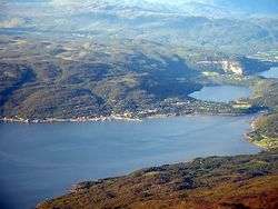 View of the village | |
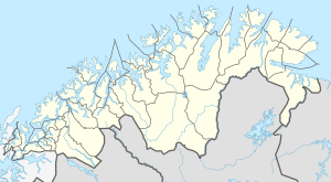 Sjøvegan Location of the village  Sjøvegan Sjøvegan (Norway) | |
| Coordinates: 68°52′25″N 17°50′49″E | |
| Country | Norway |
| Region | Northern Norway |
| County | Troms og Finnmark |
| District | Hålogaland |
| Municipality | Salangen Municipality |
| Area | |
| • Total | 0.8 km2 (0.3 sq mi) |
| Elevation | 38 m (125 ft) |
| Population (2017)[1] | |
| • Total | 780 |
| • Density | 975/km2 (2,530/sq mi) |
| Time zone | UTC+01:00 (CET) |
| • Summer (DST) | UTC+02:00 (CEST) |
| Post Code | 9350 Salangen |
The village is located about 17 kilometres (11 mi) east of European route E6. The nearby town of Setermoen in Bardu Municipality is 25 kilometres (16 mi) east of Sjøvegan and the village of Laberget is located about 3.5 kilometres (2.2 mi) southwest of Sjøvegan.
The 0.8-square-kilometre (200-acre) village has a population (2017) of 780 which gives the village a population density of 975 inhabitants per square kilometre (2,530/sq mi).[1] The home venue of the Salangen IF team is located in Sjøvegan. Salangen Church is also located in the village.
Name
The name is the plural of "Sjøveg" which means vei ned til sjøen or "the way down to the sea".[3]
Media gallery
 Sjøvegan on the right side
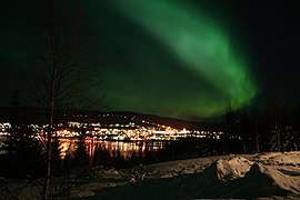 Sjøvegan at night
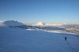
 Fjord leading to Sjøvegan (innermost part of the fjord)
References
- Statistisk sentralbyrå (1 January 2017). "Urban settlements. Population and area, by municipality".
- "Sjøvegan" (in Norwegian). yr.no. Retrieved 2012-09-12.
- Store norske leksikon. "Sjøvegan" (in Norwegian). Retrieved 2010-03-31.