Sunraysia Highway
The Sunraysia Highway (B220) is a 344 kilometres (214 mi) arterial north-south route in western Victoria.[1] The highway extends north a length of 331 km starting from the Western Freeway near Ballarat to the Calder Highway near Ouyen. It is the north-west arterial road, linking Ballarat and Ouyen. (It serves as a secondary 'A' class route Calder Highway).
Sunraysia Highway | |
|---|---|
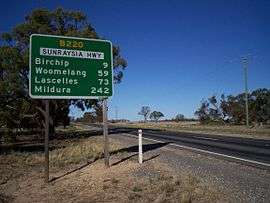 | |
Sunraysia Highway, just outside Birchip. | |
| General information | |
| Type | Highway |
| Length | 344 km (214 mi) |
| Route number(s) | |
| Former route number | |
| Major junctions | |
| NW end | Nunga, Victoria |
| |
| SE end | Ballarat, Victoria |
| Location(s) | |
| Major settlements | Birchip, Donald, St. Arnaud, Avoca |
| Highway system | |
The Sunraysia Highway runs parallel to the Calder Highway, the primary route between Melbourne and Mildura providing an alternative route via Ballarat. The highway was known as the North-Western Highway until the 1960s, when the present name was adopted.
The Sunraysia Highway serves a number of important industries in the region such as agriculture, viticulture, food processing, winemaking and tourism. It forms an important link for these industries to markets and ports in the south of Victoria and South Australia.
The Sunraysia Highway, B220, is a two-lane, two-way road with shoulders. It has no overtaking lanes provided along the highway, as it is designated as a ‘B’ road for its full length.
Towns
- Avoca
- Birchip
- Donald
- Learmonth
- Ouyen
- St. Arnaud
- Stuart Mill
- Woomelang
See also
- Highways in Australia
- Highways in Victoria
References
- VicRoads. "VicRoads – Register of Public Roads (Part A)" (PDF). Government of Victoria. pp. 1006–1007. Archived from the original on 29 December 2014.
External links
![]()
Road infrastructure in Victoria | ||
|---|---|---|
| Freeways |
| |
| Highways |
| |
| Bypass routes | ||
| Tourist routes | ||