Menindee, New South Wales
Menindee, frequently but erroneously spelled "Menindie",[3] is a small town in the far west of New South Wales, Australia, in Central Darling Shire, on the banks of the Darling River, with a sign-posted population of 980 and a 2016 census population of 551.[1]
| Menindee New South Wales | |||||||||
|---|---|---|---|---|---|---|---|---|---|
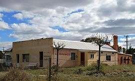 Ah Chung's Bakehouse Gallery | |||||||||
Menindee | |||||||||
| Coordinates | 32°24′0″S 142°26′0″E | ||||||||
| Population | 551 (2016 census)[1] | ||||||||
| Postcode(s) | 2879 | ||||||||
| Elevation | 61.0 m (200 ft) | ||||||||
| Location | |||||||||
| LGA(s) | Central Darling Shire | ||||||||
| State electorate(s) | Barwon | ||||||||
| Federal Division(s) | Parkes[2] | ||||||||
| |||||||||
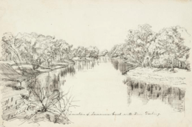
Hermann Beckler (1861)
History
Menindee is the oldest European settlement in western New South Wales, and the first town to be established on the Darling River. The first European to visit the area was the surveyor and explorer Major Thomas Mitchell in 1835. He was followed by Charles Sturt in 1844 and the town was the advance base for the Burke and Wills expedition in 1860.
Burke and Wills
The Burke and Wills expedition camped at Menindee on their journey to cross Australia from Melbourne to the Gulf of Carpentaria. They arrived here on 14 October 1860, crossed the Darling River at Kinchega Station and made Camp XXXIV (their thirty-fourth camp since leaving Melbourne). There was dissent within the party and the deputy-leader George Landells resigned. Robert O'Hara Burke split the party, heading north to Cooper Creek with half the men, stores and animals. The remaining men, stores and animals made a depot camp at Pamamaroo Creek and a sign and cairn mark the site of the camp. This camp was used for the remainder of 1860 and for most of 1861. While in Menindee, Burke stayed at the Maiden's Hotel, which was then owned by Thomas Pain and was known as Pain's Hotel.
Heritage listings
Menindee has a number of heritage-listed sites, including:
- 15 km south-west: Kinchega Woolshed[4]
Population
According to the 2016 census of Population, there were 551 people in Menindee.
- Aboriginal and Torres Strait Islander people made up 36.1% of the population.
- 79.3% of people were born in Australia and 84.3% of people only spoke English at home.
- The most common responses for religion were No Religion 35.3% and Roman Catholic 23.6%.[1]
Geography
Menindee is located where the transcontinental railway line crosses the Darling River. Menindee railway station is serviced by the NSW TrainLink Outback Xplorer passenger train from Sydney to Broken Hill on Monday, returning from Broken Hill to Sydney on Tuesday.[5] The GSR Indian Pacific also stops once weekly in each direction on request.[6] The railway line is about 900 km west of Sydney and about 110 kilometres south-east of Broken Hill.
Situated on the western edge of town is the Kinchega National Park.
Water supply
A weir on the Darling River near Menindee diverts water from the river into a series of shallow, otherwise dry, overflow lakes. The Menindee Lakes, also known as the Menindee Water Storage Scheme, regulate the river flow for irrigation downstream into South Australia.
Menindee residents have complained about the town's "putrid" water quality and claim that cotton growers are removing water from the river during the current drought.[7] Generally the health of river systems is reliant on summer rains. Some locals have already started carting water from other sources. The WaterNSW advised property owners not to water their stock from the Darling.
The river is subject to blooms of blue green algae in summer. Richard Kingsford, Director of the Centre for Ecosystem Science at the University of NSW said the Menindee Lakes had been drained more often than in the past. In July 2018, 23 gigalitres of environmental water was delivered to the Darling River which reconnected parts of the river and flushed out algae.
In early 2019, up to one million native fish were found dead along a 40-kilometre stretch of the river in Menindee, including the large and critically endangered Murray cod. The apparent trigger for these deaths was a sudden drop in temperature, causing much of the algae bloom to decompose. Dissolved oxygen then fell below the levels required by the fish.
Climate
Menindee has a desert climate with an annual average rainfall of just 245.8 mm (9.6 in), however rainfall varies significantly from year to year, with the town often going without rainfall for months on end, but occasional severe rainstorms can cause falls of over 100 mm in a day, the last time this happened being January 2011. Menindee is tied with Bourke in recording the hottest temperature in New South Wales, with a temperature of 49.7 °C (121.5 °F) recorded on 10 January 1939.
| Climate data for Menindee (1876-2012) | |||||||||||||
|---|---|---|---|---|---|---|---|---|---|---|---|---|---|
| Month | Jan | Feb | Mar | Apr | May | Jun | Jul | Aug | Sep | Oct | Nov | Dec | Year |
| Record high °C (°F) | 49.7 (121.5) |
47.2 (117.0) |
43.4 (110.1) |
41.7 (107.1) |
33.3 (91.9) |
28.9 (84.0) |
28.9 (84.0) |
32.3 (90.1) |
39.5 (103.1) |
42.8 (109.0) |
45.4 (113.7) |
48.9 (120.0) |
49.7 (121.5) |
| Average high °C (°F) | 34.4 (93.9) |
33.8 (92.8) |
30.7 (87.3) |
25.6 (78.1) |
20.7 (69.3) |
17.3 (63.1) |
17.0 (62.6) |
19.3 (66.7) |
22.9 (73.2) |
26.5 (79.7) |
30.0 (86.0) |
32.8 (91.0) |
25.9 (78.6) |
| Average low °C (°F) | 18.5 (65.3) |
18.2 (64.8) |
15.2 (59.4) |
10.9 (51.6) |
7.5 (45.5) |
5.0 (41.0) |
4.1 (39.4) |
5.3 (41.5) |
8.0 (46.4) |
11.3 (52.3) |
14.6 (58.3) |
16.8 (62.2) |
11.3 (52.3) |
| Record low °C (°F) | 7.0 (44.6) |
6.4 (43.5) |
3.9 (39.0) |
2.0 (35.6) |
−1.6 (29.1) |
−2.8 (27.0) |
−3.5 (25.7) |
−2.0 (28.4) |
0.2 (32.4) |
1.0 (33.8) |
1.7 (35.1) |
6.0 (42.8) |
−3.5 (25.7) |
| Average rainfall mm (inches) | 24.0 (0.94) |
21.7 (0.85) |
18.8 (0.74) |
16.8 (0.66) |
22.7 (0.89) |
21.4 (0.84) |
18.3 (0.72) |
17.9 (0.70) |
18.4 (0.72) |
22.8 (0.90) |
21.2 (0.83) |
21.8 (0.86) |
245.8 (9.65) |
| Average precipitation days | 2.5 | 2.6 | 2.5 | 2.8 | 4.1 | 4.8 | 5.0 | 4.9 | 3.9 | 3.9 | 3.3 | 2.8 | 43.1 |
| Source: Bureau of Meteorology[8] | |||||||||||||
Transport
Menindee is served by The Outback Xplorer (New South Wales Xplorer) service between Sydney and Broken Hill with one train in each direction per week.[9] Trains head west (to Broken Hill) on Mondays and east on Tuesdays. A community access bus service runs to Broken Hill and return Monday to Friday (except public holidays), run by CDC Broken Hill (formerly Murton's City Bus Pty Ltd).[10] No major highway runs through Menindee but the Barrier Highway between Adelaide and Nyngan runs nearby to the north through Broken Hill.
References
- Australian Bureau of Statistics (27 June 2017). "Menindee (State Suburb)". 2016 Census QuickStats. Retrieved 25 January 2018.

- "Profile of the electoral division of Parkes (NSW)". Australian Electoral Commission. 25 February 2016. Retrieved 12 July 2016.
- "MENINDEE, NOT MENINDIE". The Barrier Miner. Broken Hill, NSW: National Library of Australia. 12 December 1934. p. 4 Edition: HOME EDITION. Retrieved 15 June 2013.
- "Kinchega Woolshed". New South Wales State Heritage Register. Office of Environment and Heritage. H00995. Retrieved 18 May 2018.
- "Western timetable". NSW Trainlink. 7 September 2019.
- "Indian Pacific timetable". Journey Beyond Rail Expeditions. 1 April 2019.
- video shows dead 'century-old fish' SMH 9 January 2019
- "MENINDEE POST OFFICE". Climate statistics for Australian locations. Bureau of Meteorology. March 2013. Retrieved 18 March 2013.
- "Transportnsw.info". transportnsw.info. Retrieved 5 June 2020.
- "| Central Darling Shire". centraldarling.nsw.gov.au. Retrieved 5 June 2020.
External links
| Wikimedia Commons has media related to Menindee, New South Wales. |
- Burke & Wills Web A comprehensive website containing many of the historical documents relating to the Burke & Wills Expedition.
- The Burke & Wills Historical Society The Burke & Wills Historical Society.