Koorlong, Victoria
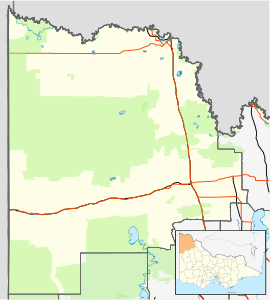
Koorlong is a locality in Victoria, Australia located approximately 15 km south west of Mildura.
| Koorlong Victoria | |||||||||||||||
|---|---|---|---|---|---|---|---|---|---|---|---|---|---|---|---|
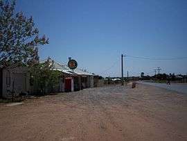 Store at Koorlong | |||||||||||||||
 Koorlong | |||||||||||||||
| Coordinates | 34°17′S 142°05′E | ||||||||||||||
| Population | 366 (2016 census)[1] | ||||||||||||||
| Postcode(s) | 3501 | ||||||||||||||
| Location | |||||||||||||||
| LGA(s) | Rural City of Mildura | ||||||||||||||
| Region | Sunraysia | ||||||||||||||
| State electorate(s) | Mildura | ||||||||||||||
| Federal Division(s) | Mallee | ||||||||||||||
| |||||||||||||||
Located in Koorlong is the 1/8 mile Sunset Strip dragstrip, the Jambaroo Park motorcycle sports complex and the Koorlong Primary School. The Post Office opened on 1 January 1912[3] and continues to operate alongside Koorlong Store, including a bottleshop, general store and takeaway food.
1943 mid-air collision
On 21 January 1943, two RAAF Wirraway trainers collided over the town.[4] 3 crew members were killed, with only the instructor of one aircraft surviving.[4]
References
| Wikimedia Commons has media related to Koorlong, Victoria. |
- Australian Bureau of Statistics (27 June 2017). "Koorlong (State Suburb)". 2016 Census QuickStats. Retrieved 8 December 2017.

- Travelmate Archived 24 March 2007 at the Wayback Machine
- Premier Postal History, Post Office List, retrieved 11 April 2008
- Dunn, Peter. "COLLISION OF TWO WIRRAWAYS OVER KOORLONG, VIC ON 21 JANUARY 1943". www.ozatwar.com. Retrieved 30 January 2013.
This article is issued from Wikipedia. The text is licensed under Creative Commons - Attribution - Sharealike. Additional terms may apply for the media files.