Henty Highway
Henty Highway[2] is a 360 kilometre highway in western Victoria, Australia. It's primarily a north-south route, and consists of a mix of 2 laned country highway standard and 4 lane arterial road within some of the larger towns along the route. The highway formerly ran all the way to meet the Calder Highway at its junction south of Ouyen, but when the Sunraysia Highway was given highway status, the Henty name was truncated back to Lascelles.
Henty Highway | |
|---|---|
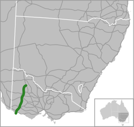 | |
Map of south-eastern Australia with Henty Highway highlighted in green | |
| General information | |
| Type | Highway |
| Length | 360 km (224 mi) |
| Route number(s) | |
| Former route number | |
| Major junctions | |
| North end | |
| |
| South end | |
| Location(s) | |
| Major settlements | Hopetoun, Warracknabeal, Horsham, Hamilton, Heywood |
| Highway system | |
Henty Highway shares other roads along its route (this is called multiplexing), and these include:
- A1 (Princes Highway) from Heywood to Portland North for 27 km
- A8 (Western Highway) at Horsham for 3 km
- B160 (Glenelg Highway) at Hamilton for 3 km
- B240 (Wimmera Highway) from Horsham to Dooen for 10 km
- C188 (Natimuk-Hamilton Road and Penshurst-Dunkeld Road) at Cavendish for 500 m
- C234 (Borung Highway) at Warracknabeal for 1 km
Major intersections and towns
| LGA | Location | km[3] | mi | Destinations | Notes |
|---|---|---|---|---|---|
| Glenelg | Portland | Wellington Road / | Duplex with | ||
| 2.4 | 1.5 | ||||
| 3.7 | 2.3 | ||||
| 4.7 | 2.9 | ||||
| 6.1 | 3.8 | New Street | |||
| Bolwarra | 8.7 | 5.4 | A1 duplex with A200 | ||
| Heywood | 29.5 | 18.3 | |||
| 30.0 | 18.6 | ||||
| Myamyn | 46 | 29 | |||
| Southern Grampians | Hamilton | 86.5 | 53.7 | ||
| 87.5 | 54.4 | ||||
| 88.3 | 54.9 | A200 and B160 duplex | |||
| 90.6 | 56.3 | ||||
| Cavendish | 113 | 70 | |||
| 114 | 71 | ||||
| Horsham | Horsham | 215 | 134 | Henty Highway concurrent with Western Highway through Horsham | |
| 216 | 134 | ||||
| Wimmera River | |||||
| 217 | 135 | Henty and Wimmera Highways duplex for 10km | |||
| 218 | 135 | Henty Highway concurrent with Western Highway through Horsham | |||
| Dooen | 227 | 141 | Henty and Wimmera Highways duplex for 10km | ||
| Byrneville | 244 | 152 | |||
| Yarriambiack | Warracknabeal | 274 | 170 | ||
| Borung Highway duplex through Warracknabeal | |||||
| 275 | 171 | ||||
| Beulah | 309 | 192 | |||
| Hopetoun | 334 | 208 | |||
| 338 | 210 | ||||
| 342 | 213 | ||||
| Lascelles | 359 | 223 | |||
1.000 mi = 1.609 km; 1.000 km = 0.621 mi
| |||||
References
- State Route Numbering System - The former route numbering in rural Victoria, Main Roads Victoria. Retrieved on 14 September 2013.
- Henty Highway (A/B200), Expressway - Paul Rands. Retrieved on 14 September 2013.
- Google (11 February 2017). "Henty Highway" (Map). Google Maps. Google. Retrieved 11 February 2017.
Road infrastructure in Victoria | ||
|---|---|---|
| Freeways |
| |
| Highways |
| |
| Bypass routes | ||
| Tourist routes | ||
This article is issued from Wikipedia. The text is licensed under Creative Commons - Attribution - Sharealike. Additional terms may apply for the media files.