Culgoa
Culgoa is a town in the Mallee region in the north west of the Australian state of Victoria. The town is approximately 319 kilometres (198 mi) from the state capital, Melbourne. At the 2016 census, Culgoa had a population of 101, declining from 339 in 2011.[1]
| Culgoa Victoria | |||||||||||||||
|---|---|---|---|---|---|---|---|---|---|---|---|---|---|---|---|
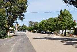 Main Street, Culgoa | |||||||||||||||
 Culgoa | |||||||||||||||
| Coordinates | 35°43′0″S 143°05′0″E | ||||||||||||||
| Population | 101 (2016 census)[1] | ||||||||||||||
| Postcode(s) | 3530 | ||||||||||||||
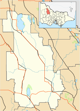
| Location |
| ||||||||||||||
| LGA(s) | Shire of Buloke | ||||||||||||||
| |||||||||||||||
Primary production in the area is predominantly wheat and barley, with some legume and oil crops. Sheep numbers have been down since the drought took hold in the early 2000s.
The Post Office opened on 27 May 1893 as Kaneira shortly after the arrival of the railway and was renamed Culgoa in 1920.[2] In 2006 the post office was relocated to the Culgoa Community Store which is a community owned not for profit business to meet the daily needs of the locals.
In 2003 when it looked like the local store would close the community formed a co-operative and purchased the store to run for themselves. The store provides newspapers, bread, milk, groceries and some takeaway. Computer access is also available to the community.
Golfers may play at the Culgoa Golf Club on the Calder Highway.[3] Other sporting venues include tennis, lawn bowls, netball and football.
In 2008 the local Primary School closed its doors after 98 years of service to the children of the area.
Gallery
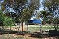 Former primary school
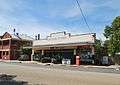 Culgoa community store
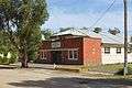 Public hall, built in 1938
 Kaneira Hotel
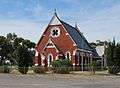 Sacred Heart Roman Catholic church
References
- Australian Bureau of Statistics (31 October 2012). "Culgoa (State Suburb)". 2011 Census QuickStats. Retrieved 7 May 2013.

- Premier Postal History, Post Office List, retrieved 11 April 2008
- Golf Select, Culgoa, retrieved 11 May 2009