Sarishabari Upazila
Sarishabari (Bengali: সরিষাবাড়ী) is an Upazila of Jamalpur District in the Division of Mymensingh, Bangladesh.[2]
Sarishabari সরিষাবাড়ী | |
|---|---|
Upazila | |
 Sarishabari Location in Bangladesh | |
| Coordinates: 24°44.5′N 89°50′E | |
| Country | |
| Division | Mymensingh Division |
| District | Jamalpur District |
| Area | |
| • Total | 263.48 km2 (101.73 sq mi) |
| Population (2011) | |
| • Total | 325,320[1] |
| Time zone | UTC+6 (BST) |
| Postal code | 2050 |
| Website | Official Map of Sarishabari |
Geography

Sarishabari is located at 24.7417°N 89.8333°E. It has 58,254 households and total area 263.48 km².
Demographics
According to the 1991 Bangladesh census, Sarishabari had a population of 289,106. Males constituted 51.66% of the population, while females constituted 48.34% of the population. The population for the age 18 and up was 148,197. Sarishabari had an average literacy rate of 24.4% (7+ years), with a national average of 32.4% literacy rate.[3]
According to the 2011 national census, the total population of Sarishabari is 325,320, and houses 1,235 people per square kilometre, which is the highest in the Jamalpur district.[4]
Administration
Sarishabari has 1 municipality, 8 Unions, 173 Mauzas/Mahallas, and 179 villages.
There is a urea fertilizer factory named Jamuna Fertilizer Co. Ltd which is the largest fertilizer factory in the country. It produces granular urea fertilizer. Jute mills are also located in the Sarishabari area. Alhaz Jute Mills Ltd, AR Jute Mills, Boira Jute Mills and Popular Jute Mill are the most notable in the area.
See also
- Upazilas of Bangladesh
- Districts of Bangladesh
- Divisions of Bangladesh
References
- http://www.citypopulation.de/php/bangladesh-admin.php?adm2id=3985
- Sayed Md. Abdullah Al Mamun Chowdhury (2012), "Sarishabari Upazila", in Sirajul Islam and Ahmed A. Jamal (ed.), Banglapedia: National Encyclopedia of Bangladesh (Second ed.), Asiatic Society of Bangladesh
- "Population Census Wing, BBS". Archived from the original on 2005-03-27. Retrieved November 10, 2006.
- http://203.112.218.65:8008/WebTestApplication/userfiles/Image/District%20Statistics/Jamalpur.pdf
| Upazila/Thana: | ||
|---|---|---|
Headquarters: Mymensingh | ||
| Jamalpur District | 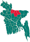 | |
| Mymensingh District | ||
| Netrokona District | ||
| Sherpur District | ||