Nalitabari Upazila
Nalitabari (Bengali: নালিতাবাড়ি) is an Upazila of Sherpur District[1] in the Division of Mymensingh, Bangladesh.
Nalitabari নালিতাবাড়ী | |
|---|---|
Upazila | |
 Nalitabari Location in Bangladesh | |
| Coordinates: 25°5′N 90°11.7′E | |
| Country | |
| Division | Mymensingh Division |
| District | Sherpur District |
| Area | |
| • Total | 327.61 km2 (126.49 sq mi) |
| Population (1991) | |
| • Total | 226,332 |
| • Density | 690/km2 (1,800/sq mi) |
| Time zone | UTC+6 (BST) |
| Website | Official Website |
Geography
Nalitabari is located at 25.0833°N 90.1954°E . It has 42698 households and total area 327.61 km2. Taragonj bajar is the main populated place. All hotels and shops are found here also.
Demographics
As of the 1991 Bangladesh census, Nalitabari has a population of 226332. Males constitute 50.75% of the population, and females 49.25%. This Upazila's eighteen up population is 103043. Nalitabari has an average literacy rate of 19.5% (7+ years), and the national average of 32.4% literate.[2]
Administration
Nalitabari has 12 Unions/Wards, 108 Mauzas/Mahallas, and 138 villages.
See also
- Upazilas of Bangladesh
- Districts of Bangladesh
- Divisions of Bangladesh
References
- Joti Poddar (2012), "Nalitabari Upazila", in Sirajul Islam and Ahmed A. Jamal (ed.), Banglapedia: National Encyclopedia of Bangladesh (Second ed.), Asiatic Society of Bangladesh
- "Population Census Wing, BBS". Archived from the original on 2005-03-27. Retrieved November 10, 2006.
| Upazila/Thana: | ||
|---|---|---|
Headquarters: Mymensingh | ||
| Jamalpur District | 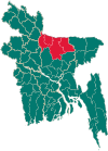 | |
| Mymensingh District | ||
| Netrokona District | ||
| Sherpur District | ||
This article is issued from Wikipedia. The text is licensed under Creative Commons - Attribution - Sharealike. Additional terms may apply for the media files.