Dhobaura Upazila
Dhobaura (Bengali: ধোবাউড়া) is an Upazila of Mymensingh District in the Division of Mymensingh, Bangladesh.[1]
Dhobaura ধোবাউড়া | |
|---|---|
Upazila | |
 Dhobaura Location in Bangladesh | |
| Coordinates: 25°5.5′N 90°32′E | |
| Country | |
| Division | Mymensingh Division |
| District | Mymensingh District |
| Government | |
| • Upazila Chairman | David Rana Chisim |
| Area | |
| • Total | 251.880 km2 (97.251 sq mi) |
| Population (1991) | |
| • Total | 427,913 |
| • Density | 1,700/km2 (4,400/sq mi) |
| Time zone | UTC+6 (BST) |
| Website | Official Map of Dhobaura |
Geography
Dhobaura Upazila (mymensingh district) with an area of 251.880 km2, is bounded by Meghalaya (Indian) on the north, Phulpur and Purbadhala upazilas on the south, Durgapur upazila on the east, Haluaghat upazila on the west. Main rivers are Nitai and Kangsa. There are many hillocks on the north region of the upazila.
Dhobaura is located at 25.0917°N 90.5333°E . It has 44007 households and total area 251.880 km². this Upazila have 7 union.
Demographics
As of the 2011 Bangladesh census, Dhobaura has a population of 427913. Males constitute 47.30% of the population, and females 52.70%. This Upazila's adult population (18 and above) is 113,348. Dhobaura has an average literacy rate of 65%.[2]
According to the 2011 Bangladesh census, Dhobaura had a population of 196,284. Males constituted 49.14% of the population and females 50.86%. Muslims formed 91.38% of the population, Hindus 3.52%, Christians 5.05% and others 0.05%. Dhobaura had a literacy rate of 29.36% for the population 7 years and above.[3]
Administration
Dhobaura thana, now an upazila, was established in 1976. The area of the town is 3.82 km2. The town has one dak bungalow.
Dhobaura has 7 Unions, 99 Mauzas/Mahallas, and 163 villages. Muslim, Hindu and Garo this three religious people live in Dhoboura upazila with together The name of the Union are given in the follow, 1)Dhokinmije Para 2) Gamaritola 3) Dhobaura 4) Purakandolia 5) Gusgaw 6) Guatola 7) Baghber/Munshirhat
Education
Average literacy 65%; male 68% and female 62%. Educational institutions: college 3, high school 20, junior high school 3, madrasa 6, government primary school 43, non-government 44 and kinder garden school 6.
See also
- Upazilas of Bangladesh
- Districts of Bangladesh
- Divisions of Bangladesh
References
- Abdul Motaleb Talukder (2012), "Dhobaura Upazila", in Sirajul Islam and Ahmed A. Jamal (ed.), Banglapedia: National Encyclopedia of Bangladesh (Second ed.), Asiatic Society of Bangladesh
- এক নজরে ধোবাউড়া [Dhobaura at a Glance]. Dhobaura Upazila. Retrieved 7 May 2015.
- "Bangladesh Population and Housing Census 2011: Zila Report – Mymensingh" (PDF). Table P01 : Household and Population by Sex and Residence, Table P05 : Population by Religion, Age group and Residence, Table P09 : Literacy of Population 7 Years & Above by Religion, Sex and Residence. Bangladesh Bureau of Statistics (BBS), Ministry of Planning, Government of the People’s Republic of Bangladesh. Retrieved 14 December 2018.
| Upazila/Thana: |
| |
|---|---|---|
Headquarters: Mymensingh | ||
| Jamalpur District | 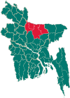 | |
| Mymensingh District | ||
| Netrokona District | ||
| Sherpur District | ||