Posey County, Indiana
Posey County is a county in the southwestern corner of the U.S. state of Indiana. Its southern border is formed by the Ohio River, and the western border by the Wabash River, a tributary. As of 2010, the population was 25,910.[1] The county seat is Mount Vernon.[2]
Posey County | |
|---|---|
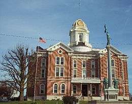 Posey County Courthouse in Mount Vernon | |
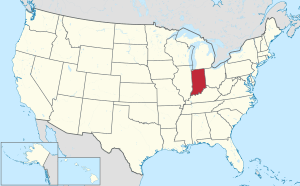
 Location within the U.S. state of Indiana | |
 Indiana's location within the U.S. | |
| Coordinates: 38°01′N 87°52′W | |
| Country | |
| State | |
| Founded | 11 November 1814 |
| Named for | General Thomas Posey |
| Seat | Mount Vernon |
| Largest city | Mount Vernon |
| Area | |
| • Total | 419.32 sq mi (1,086.0 km2) |
| • Land | 409.57 sq mi (1,060.8 km2) |
| • Water | 9.75 sq mi (25.3 km2) 2.33%% |
| Population | |
| • Estimate (2018) | 25,540 |
| • Density | 62.4/sq mi (24.1/km2) |
| Time zone | UTC−6 (Central) |
| • Summer (DST) | UTC−5 (CDT) |
| Congressional district | 8th |
| Website | www |
| |
Posey County is part of the Evansville, IN–KY Metropolitan Statistical Area. The Ports of Indiana-Mt. Vernon, on the Ohio River, is the seventh largest inland port in the nation.
History
After the American Revolutionary War, Posey County was originally considered part of the Northwest Territory of the United States. As part of the Indiana Territory, it was organized in November 1814 from Gibson and Warrick counties. It was named for Revolutionary War Gen. Thomas Posey, who was then serving as Governor of the Territory.[3] Mount Vernon was designated as the county seat in 1825. Its port on the Ohio River continues to be integral to the economy of the state and county.
Like other parts of southern Ohio, Indiana and Illinois, Posey County was first settled by people from the Upper South, many of whom arrived via the Ohio River. Farming was the primary development at first. In the mid- to late 19th century, the county received many German immigrants. The river port had rougher areas of vice, and a higher population of single men, as was typical. African Americans were among the men who worked on ships and at the port.
In October 1878, a mob of 200–300 whites lynched five African-American men, taking them from jail in Mount Vernon, the county seat, and hanging them from trees on the county courthouse grounds. The mob then shot the bodies many times. Four of the men had been indicted as suspects in the rape of three white prostitutes, while the fifth man was killed because he had fatally shot a deputy who tried to arrest his son. Before they left, the mob killed two more African Americans, throwing one to his death into a train's steam engine. This was the largest recorded lynching of African Americans in Indiana's history. No one in the mob was prosecuted, and at each court session for the next three years, the prosecutor asked the judge to "set the case over to the next session". A grand jury was called to investigate the mob action, but with an election pending for the prosecuting attorney, no one was ever indicted. Following years of research, Posey County judge Jim Redwine wrote a novel called Judge Lynch! (2008), based on the events. Redwine sometimes lectures on the riot, inviting his audience to imagine how they would have acted and stressing the injustice done to the African Americans who were denied the right to a fair trial.[4][5]
Mechanization of dock technology has altered the number of workers at the port, but Posey County is still the seventh-largest internal port in the United States, based on the tons of materials handled. Grain from the Midwest is among the products shipped.
Geography
According to the 2010 United States Census, the county has a total area of 419.32 square miles (1,086.0 km2), of which 409.57 square miles (1,060.8 km2) (or 97.67%) is land and 9.75 square miles (25.3 km2) (or 2.33%) is water.[6] The lowest point in the state of Indiana is located on the Ohio River in Posey County, where the Wabash River flows into it.
Adjacent counties
- Gibson County – north and northeast
- Vanderburgh County – east
- Henderson County, Kentucky – southeast
- Union County, Kentucky – south
- Gallatin County, Illinois – southwest
- White County, Illinois – west and northwest
Cities and towns
- Cynthiana
- Griffin
- Mount Vernon, county seat
- New Harmony
- Poseyville
Census-designated place
Other unincorporated places
- Barrett
- Blairsville
- Bufkin
- Caborn
- Dead Mans Crossing[7]
- Erwin
- Farmersville
- Grafton
- Hepburn
- Heusler
- Hovey
- Lippe
- Marrs Center
- New Baltimore
- Oak Grove
- Oliver
- Philip Station
- Prairie
- Rapture
- Saint Philip
- Saint Wendel
- Savah
- Solitude
- Springfield
- Stewartsville
- Upton
- Wadesville
- Welborn Switch
- West Franklin
Transportation
Railroads
River ports
- Ports of Indiana-Mt. Vernon is "the 7th largest inland port in the United States and serves as a major multi-modal hub for the region." It handles more than 4 million trip tons of cargo annually. Southwind Maritime Center is the name of a related port facility, now considered within the complex. This port facility is important to the economy of the state of Indiana as well as to Posey County. It handles shipping of grain, grain products, coal, fertilizer, cement and minerals, from a region that produces a large amount of grain. This is the largest public port within 175 miles of the confluence of the Ohio and Mississippi rivers.[8]
Climate and weather
| Mount Vernon, Indiana | ||||||||||||||||||||||||||||||||||||||||||||||||||||||||||||
|---|---|---|---|---|---|---|---|---|---|---|---|---|---|---|---|---|---|---|---|---|---|---|---|---|---|---|---|---|---|---|---|---|---|---|---|---|---|---|---|---|---|---|---|---|---|---|---|---|---|---|---|---|---|---|---|---|---|---|---|---|
| Climate chart (explanation) | ||||||||||||||||||||||||||||||||||||||||||||||||||||||||||||
| ||||||||||||||||||||||||||||||||||||||||||||||||||||||||||||
| ||||||||||||||||||||||||||||||||||||||||||||||||||||||||||||
In recent years, average temperatures in Mount Vernon have ranged from a low of 23 °F (−5 °C) in January to a high of 87 °F (31 °C) in July, although a record low of −21 °F (−29 °C) was recorded in January 1912 and a record high of 109 °F (43 °C) was recorded in July 1901. Average monthly precipitation ranged from 2.65 inches (67 mm) in September to 5.38 inches (137 mm) in May.[9]
Government
The county government is a constitutional body, and is granted specific powers by the Constitution of Indiana, and by the Indiana Code.
County Council: The county council is the legislative branch of the county government and controls spending and revenue collection in the county. Representatives are elected from single-member districts of roughly equal population in the county. The council members serve four-year terms. They set salaries, the annual budget, and special spending. The council has limited authority to impose local taxes, in the form of an income and property tax that is subject to state level approval, excise taxes, and service taxes.[10][11]
Board of Commissioners: The executive body of the county is a three-person board of commissioners, who are elected at-large (county-wide), to staggered four-year terms. One commissioner serves as president. The commissioners execute the acts legislated by the council, collecting revenue, and managing the day-to-day functions of the county government.[10][11]
Court: The county maintains a small claims court that handles civil cases. The court judge is elected to a four-year term and must be a member of the Indiana Bar Association. The judge is assisted by a constable, who is also elected to a four-year term. In some cases, court decisions can be appealed to the state level circuit court.[11]
County Officials: Other county elected offices include sheriff, coroner, auditor, treasurer, recorder, surveyor, and circuit court clerk Each serves a four-year term. Members elected to county government positions are required to declare party affiliations and to be residents of the county.[11]
| Year | Republican | Democratic | Third parties |
|---|---|---|---|
| 2016 | 67.4% 8,404 | 28.2% 3,521 | 4.4% 542 |
| 2012 | 60.8% 7,430 | 37.1% 4,533 | 2.2% 263 |
| 2008 | 53.3% 6,804 | 45.6% 5,828 | 1.1% 139 |
| 2004 | 65.4% 7,833 | 34.1% 4,085 | 0.6% 68 |
| 2000 | 58.5% 6,498 | 39.9% 4,430 | 1.6% 182 |
| 1996 | 42.3% 4,638 | 45.3% 4,965 | 12.3% 1,350 |
| 1992 | 38.7% 4,435 | 40.4% 4,632 | 20.8% 2,386 |
| 1988 | 57.1% 5,987 | 42.6% 4,468 | 0.3% 35 |
| 1984 | 59.1% 6,472 | 40.6% 4,452 | 0.3% 33 |
| 1980 | 53.7% 6,096 | 39.3% 4,465 | 7.0% 793 |
| 1976 | 49.0% 5,136 | 50.5% 5,298 | 0.5% 54 |
| 1972 | 65.2% 6,771 | 34.6% 3,586 | 0.2% 21 |
| 1968 | 49.7% 5,045 | 38.3% 3,889 | 12.0% 1,216 |
| 1964 | 36.6% 3,573 | 63.1% 6,164 | 0.3% 33 |
| 1960 | 54.5% 5,369 | 45.2% 4,457 | 0.3% 31 |
| 1956 | 59.4% 5,780 | 40.3% 3,919 | 0.3% 25 |
| 1952 | 57.6% 5,293 | 41.7% 3,835 | 0.6% 59 |
| 1948 | 44.4% 3,879 | 54.2% 4,729 | 1.4% 123 |
| 1944 | 50.8% 4,374 | 48.5% 4,183 | 0.7% 62 |
| 1940 | 47.1% 4,514 | 52.4% 5,022 | 0.6% 57 |
| 1936 | 34.7% 3,088 | 63.3% 5,630 | 1.9% 170 |
| 1932 | 33.3% 2,876 | 65.3% 5,641 | 1.5% 127 |
| 1928 | 51.8% 4,396 | 47.7% 4,052 | 0.5% 39 |
| 1924 | 48.8% 4,173 | 48.1% 4,115 | 3.1% 260 |
| 1920 | 49.7% 4,802 | 48.6% 4,695 | 1.7% 161 |
| 1916 | 43.0% 2,291 | 54.8% 2,922 | 2.2% 119 |
| 1912 | 24.0% 1,193 | 55.6% 2,767 | 20.5% 1,021 |
| 1908 | 42.5% 2,444 | 53.6% 3,084 | 3.9% 224 |
| 1904 | 44.3% 2,419 | 51.8% 2,825 | 3.9% 214 |
| 1900 | 43.6% 2,553 | 54.2% 3,177 | 2.2% 129 |
| 1896 | 44.5% 2,526 | 54.7% 3,103 | 0.9% 48 |
| 1892 | 40.0% 2,077 | 51.2% 2,660 | 8.8% 457 |
| 1888 | 45.7% 2,369 | 51.8% 2,684 | 2.5% 131 |
Demographics
| Historical population | |||
|---|---|---|---|
| Census | Pop. | %± | |
| 1820 | 4,061 | — | |
| 1830 | 6,549 | 61.3% | |
| 1840 | 9,683 | 47.9% | |
| 1850 | 12,549 | 29.6% | |
| 1860 | 16,167 | 28.8% | |
| 1870 | 19,185 | 18.7% | |
| 1880 | 20,857 | 8.7% | |
| 1890 | 21,529 | 3.2% | |
| 1900 | 22,333 | 3.7% | |
| 1910 | 21,670 | −3.0% | |
| 1920 | 19,334 | −10.8% | |
| 1930 | 17,853 | −7.7% | |
| 1940 | 19,183 | 7.4% | |
| 1950 | 19,818 | 3.3% | |
| 1960 | 19,214 | −3.0% | |
| 1970 | 21,740 | 13.1% | |
| 1980 | 26,414 | 21.5% | |
| 1990 | 25,968 | −1.7% | |
| 2000 | 27,061 | 4.2% | |
| 2010 | 25,910 | −4.3% | |
| Est. 2018 | 25,540 | [13] | −1.4% |
| US Decennial Census[14] 1790-1960[15] 1900-1990[16] 1990-2000[17] 2010-2013[1] | |||
As of the 2010 United States Census, there were 25,910 people, 10,171 households, and 7,442 families in the county.[18] The population density was 63.3 inhabitants per square mile (24.4/km2). There were 11,207 housing units at an average density of 27.4 per square mile (10.6/km2).[6] The racial makeup of the county was 97.2% white, 0.9% black or African American, 0.3% Asian, 0.2% American Indian, 0.4% from other races, and 1.1% from two or more races. Those of Hispanic or Latino origin made up 1.0% of the population.[18] In terms of ancestry, 43.6% were German, 13.6% were American, 11.6% were Irish, and 11.2% were English.[19]
Of the 10,171 households, 32.7% had children under the age of 18 living with them, 60.4% were married couples living together, 8.5% had a female householder with no husband present, 26.8% were non-families, and 23.3% of all households were made up of individuals. The average household size was 2.52 and the average family size was 2.97. The median age was 41.6 years.[18]
The median income for a household in the county was $47,697 and the median income for a family was $68,722. Males had a median income of $55,786 versus $32,747 for females. The per capita income for the county was $26,727. About 6.0% of families and 8.3% of the population were below the poverty line, including 12.2% of those under age 18 and 8.3% of those age 65 or over.[20]
Education
- Mount Vernon High School - Mt. Vernon
- North Posey High School - Poseyville
Tourism & recreation
- Posey County Stockyard
- Visit Posey County - Posey County
- Brittlebank Park - Mount Vernon
- Harmonie State Park - New Harmony
- Hovey Lake State Fish & Wildlife Area - Mount Vernon
- New Harmony Historic District - New Harmony
- Sherburne Park - Mount Vernon
Representation in other media
See also
References
- "Posey County QuickFacts". US Census Bureau. Archived from the original on 26 January 2016. Retrieved 25 September 2011.
- "Find a County". National Association of Counties. Retrieved 7 June 2011.
- De Witt Clinton Goodrich & Charles Richard Tuttle (1875). An Illustrated History of the State of Indiana. Indiana: R. S. Peale & co. pp. 570.
- "Lynching in America; Supplement: Lynching by County, 3rd ed., 2017, Montgomery, Alabama: Equal Justice Initiative, p. 5" (PDF). Archived from the original (PDF) on 23 October 2017. Retrieved 31 May 2018.
- Barry Cleveland, "Seven killed in Posey County violence", Carmi Times, 07 February 2011; accessed 31 May 2018
- "Population, Housing Units, Area, and Density: 2010 - County". US Census Bureau. Archived from the original on 13 February 2020. Retrieved 10 July 2015.
- Dead Mans Crossing, Black Township IN (Google Maps, accessed 24 June 2020)
- Ports of Indiana-Mt. Vernon website
- "Monthly Averages for Mount Vernon IN". The Weather Channel. Retrieved 27 January 2011.
- Indiana Code. "Title 36, Article 2, Section 3". IN.gov. Retrieved 2008-09-16.
- Indiana Code. "Title 2, Article 10, Section 2" (PDF). IN.gov. Retrieved 2008-09-16.
- Leip, David. "Atlas of US Presidential Elections". uselectionatlas.org. Retrieved 19 May 2018.
- "Population and Housing Unit Estimates". Retrieved July 26, 2019.
- "US Decennial Census". US Census Bureau. Retrieved July 10, 2014.
- "Historical Census Browser". University of Virginia Library. Retrieved July 10, 2014.
- "Population of Counties by Decennial Census: 1900 to 1990". US Census Bureau. Retrieved July 10, 2014.
- "Census 2000 PHC-T-4. Ranking Tables for Counties: 1990 and 2000" (PDF). US Census Bureau. Retrieved July 10, 2014.
- "Profile of General Population and Housing Characteristics: 2010 Demographic Profile Data". US Census Bureau. Archived from the original on 13 February 2020. Retrieved 10 July 2015.
- "Selected Social Characteristics in the US – 2006-2010 American Community Survey 5-Year Estimates". US Census Bureau. Archived from the original on 14 February 2020. Retrieved 10 July 2015.
- "Selected Economic Characteristics – 2006-2010 American Community Survey 5-Year Estimates". US Census Bureau. Archived from the original on 14 February 2020. Retrieved 10 July 2015.
- James M. Redwine, Judge Lynch!, AuthorHouse, 2008
External links
Places adjacent to Posey County, Indiana | |
|---|---|
Evansville, IN–KY Metropolitan Statistical Area | ||
|---|---|---|
| Central City | 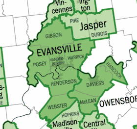 | |
| Municipalities with population over 5,000 in 2010 | ||
| Municipalities with population 1,000-5,000 in 2010 | ||
| Indiana Counties | ||
| Kentucky Counties | ||
The Region of Southwestern Indiana | ||
|---|---|---|
| Central Time Counties | 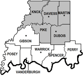 | |
| Eastern Time Counties | ||
| County Seats |
| |
| Metropolitan & Micropolitan Areas |
| |
| Colleges and Universities |
| |
Municipalities and communities of Posey County, Indiana, United States | ||
|---|---|---|
| City | Map of Indiana highlighting Posey County | |
| Towns | ||
| Townships | ||
| CDP | ||
| Other unincorporated communities | ||
| Footnotes | ‡This populated place also has portions in an adjacent county or counties | |

| Authority control |
|
|---|