Jay County, Indiana
Jay County is a county located in the U.S. state of Indiana. As of 2010, the population was 21,253.[1] The county seat is Portland.[2]
Jay County | |
|---|---|
 Jay County Courthouse | |
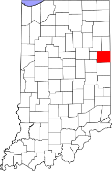 Location within the U.S. state of Indiana | |
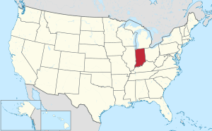 Indiana's location within the U.S. | |
| Coordinates: 40°26′N 85°01′W | |
| Country | |
| State | |
| Founded | 1836 |
| Named for | John Jay |
| Seat | Portland |
| Largest city | Portland |
| Area | |
| • Total | 384.08 sq mi (994.8 km2) |
| • Land | 383.90 sq mi (994.3 km2) |
| • Water | 0.18 sq mi (0.5 km2) 0.05%% |
| Population | |
| • Estimate (2018) | 20,764 |
| • Density | 55/sq mi (21.39/km2) |
| Time zone | UTC−5 (Eastern) |
| • Summer (DST) | UTC−4 (EDT) |
| Congressional district | 3rd |
| Website | www |
| Indiana county number 38 | |
| Jay County Sheriff's Department | |
|---|---|
| Jurisdictional structure | |
| Operations jurisdiction | Jay, Indiana, United States |
| Legal jurisdiction | As per operations jurisdiction |
| General nature |
|
| Agency executives |
|
| Facilities | |
| Jails | 1 |
History
Jay County was formed in 1836. It is the only county in the United States named for John Jay, co-author of The Federalist Papers, Secretary of Foreign Affairs under the Articles of Confederation, and first Chief Justice of the United States. John Jay died in 1829.[3]
Geography
According to the 2010 census, the county has a total area of 384.08 square miles (994.8 km2), of which 383.90 square miles (994.3 km2) (or 99.95%) is land and 0.18 square miles (0.47 km2) (or 0.05%) is water.[4]
Unincorporated communities
Adjacent counties
- Adams County (north)
- Mercer County, Ohio (east)
- Darke County, Ohio (southeast)
- Randolph County (south)
- Delaware County (southwest)
- Blackford County (west)
- Wells County (northwest)
Climate and weather
| Portland, Indiana | ||||||||||||||||||||||||||||||||||||||||||||||||||||||||||||
|---|---|---|---|---|---|---|---|---|---|---|---|---|---|---|---|---|---|---|---|---|---|---|---|---|---|---|---|---|---|---|---|---|---|---|---|---|---|---|---|---|---|---|---|---|---|---|---|---|---|---|---|---|---|---|---|---|---|---|---|---|
| Climate chart (explanation) | ||||||||||||||||||||||||||||||||||||||||||||||||||||||||||||
| ||||||||||||||||||||||||||||||||||||||||||||||||||||||||||||
| ||||||||||||||||||||||||||||||||||||||||||||||||||||||||||||
In recent years, average temperatures in Portland have ranged from a low of 15 °F (−9 °C) in January to a high of 84 °F (29 °C) in July, although a record low of −29 °F (−34 °C) was recorded in January 1985 and a record high of 102 °F (39 °C) was recorded in June 1988. Average monthly precipitation ranged from 1.87 inches (47 mm) in January to 4.40 inches (112 mm) in July.[7]
Government
The county government is a constitutional body, and is granted specific powers by the Constitution of Indiana, and by the Indiana Code.
County Council: The county council is the legislative branch of the county government and controls all the spending and revenue collection in the county. Representatives are elected from county districts. The council members serve four-year terms. They are responsible for setting salaries, the annual budget, and special spending. The council also has limited authority to impose local taxes, in the form of an income and property tax that is subject to state level approval, excise taxes, and service taxes.[8][9]
Board of Commissioners: The executive body of the county is made of a board of commissioners. The commissioners are elected county-wide, in staggered terms, and each serves a four-year term. One of the commissioners, typically the most senior, serves as president. The commissioners are charged with executing the acts legislated by the council, collecting revenue, and managing the day-to-day functions of the county government.[8][9]
Court: The county maintains circuit and superior courts with the latter having a small claims division. Both courts have general jurisdiction with the circuit court having exclusive jurisdiction of juvenile and probate matters. The judges of each court are elected to a six (6) year term and must be admitted to practice law before the state supreme court. In some cases, court decisions can be appealed to the state level circuit court.[9]
County Officials: The county has several other elected offices, including prosecuting attorney, assessor, sheriff, coroner, auditor, treasurer, recorder, surveyor, and circuit court clerk Each of these elected officers serves a term of four years and oversees a different part of county government. Members elected to county government positions are required to declare party affiliations and to be residents of the county.[9]
Jay County is part of Indiana's 3rd congressional district; Indiana Senate district 19;[10] and Indiana House of Representatives district 33.[11]
| Year | Republican | Democratic | Third parties |
|---|---|---|---|
| 2016 | 71.3% 5,697 | 23.7% 1,889 | 5.0% 400 |
| 2012 | 58.8% 4,645 | 38.8% 3,063 | 2.4% 193 |
| 2008 | 52.9% 4,401 | 45.0% 3,748 | 2.1% 174 |
| 2004 | 65.9% 5,427 | 33.3% 2,740 | 0.8% 65 |
| 2000 | 58.4% 4,687 | 39.4% 3,167 | 2.2% 176 |
| 1996 | 44.7% 3,584 | 41.9% 3,356 | 13.4% 1,077 |
| 1992 | 40.8% 3,609 | 36.3% 3,208 | 22.9% 2,019 |
| 1988 | 62.2% 5,363 | 37.3% 3,212 | 0.5% 45 |
| 1984 | 64.9% 5,975 | 34.5% 3,174 | 0.6% 58 |
| 1980 | 58.1% 5,351 | 35.3% 3,256 | 6.6% 610 |
| 1976 | 52.2% 4,606 | 46.8% 4,124 | 1.0% 87 |
| 1972 | 64.2% 6,090 | 35.3% 3,349 | 0.5% 45 |
| 1968 | 51.0% 5,460 | 40.1% 4,290 | 8.9% 955 |
| 1964 | 39.2% 4,439 | 59.9% 6,781 | 0.9% 98 |
| 1960 | 56.7% 6,519 | 42.6% 4,899 | 0.6% 74 |
| 1956 | 59.1% 6,767 | 39.9% 4,571 | 1.0% 116 |
| 1952 | 59.0% 7,270 | 38.6% 4,764 | 2.4% 297 |
| 1948 | 49.3% 5,635 | 48.2% 5,520 | 2.5% 287 |
| 1944 | 53.4% 6,207 | 44.4% 5,166 | 2.2% 256 |
| 1940 | 49.3% 6,478 | 49.8% 6,554 | 0.9% 117 |
| 1936 | 43.7% 5,233 | 54.6% 6,535 | 1.7% 199 |
| 1932 | 42.9% 5,018 | 57.2% 6,693 | 0.0% 0 |
| 1928 | 55.3% 5,998 | 43.9% 4,759 | 0.8% 87 |
| 1924 | 52.8% 5,753 | 44.2% 4,812 | 3.0% 325 |
| 1920 | 53.4% 6,089 | 41.7% 4,759 | 5.0% 566 |
| 1916 | 46.5% 3,075 | 46.4% 3,070 | 7.1% 470 |
| 1912 | 20.4% 1,282 | 44.3% 2,786 | 35.3% 2,222 |
| 1908 | 45.8% 3,256 | 47.4% 3,370 | 6.9% 491 |
| 1904 | 51.8% 3,612 | 38.7% 2,702 | 9.5% 661 |
| 1900 | 48.9% 3,518 | 47.6% 3,422 | 3.5% 254 |
| 1896 | 47.7% 3,473 | 50.5% 3,680 | 1.8% 134 |
| 1892 | 41.8% 2,414 | 40.8% 2,359 | 17.4% 1,005 |
| 1888 | 48.4% 2,811 | 47.2% 2,741 | 4.4% 253 |
Demographics
| Historical population | |||
|---|---|---|---|
| Census | Pop. | %± | |
| 1840 | 3,863 | — | |
| 1850 | 7,047 | 82.4% | |
| 1860 | 11,399 | 61.8% | |
| 1870 | 15,000 | 31.6% | |
| 1880 | 19,282 | 28.5% | |
| 1890 | 23,478 | 21.8% | |
| 1900 | 26,818 | 14.2% | |
| 1910 | 24,961 | −6.9% | |
| 1920 | 23,318 | −6.6% | |
| 1930 | 20,846 | −10.6% | |
| 1940 | 22,601 | 8.4% | |
| 1950 | 23,157 | 2.5% | |
| 1960 | 22,572 | −2.5% | |
| 1970 | 23,575 | 4.4% | |
| 1980 | 23,239 | −1.4% | |
| 1990 | 21,512 | −7.4% | |
| 2000 | 21,806 | 1.4% | |
| 2010 | 21,253 | −2.5% | |
| Est. 2018 | 20,764 | [13] | −2.3% |
| U.S. Decennial Census[14] 1790-1960[15] 1900-1990[16] 1990-2000[17] 2010-2013[1] | |||
As of the 2010 United States Census, there were 21,253 people, 8,133 households, and 5,647 families residing in the county.[18] The population density was 55.4 inhabitants per square mile (21.4/km2). There were 9,221 housing units at an average density of 24.0 per square mile (9.3/km2).[4] The racial makeup of the county was 97.0% white, 0.4% Asian, 0.3% black or African American, 0.1% American Indian, 1.3% from other races, and 0.9% from two or more races. Those of Hispanic or Latino origin made up 2.7% of the population.[18] In terms of ancestry, 34.1% were German, 13.1% were American, 11.7% were English, and 11.6% were Irish.[19]
Of the 8,133 households, 32.8% had children under the age of 18 living with them, 53.6% were married couples living together, 10.4% had a female householder with no husband present, 30.6% were non-families, and 25.6% of all households were made up of individuals. The average household size was 2.58 and the average family size was 3.10. The median age was 39.0 years.[18]
The median income for a household in the county was $47,697 and the median income for a family was $47,926. Males had a median income of $38,142 versus $26,928 for females. The per capita income for the county was $18,946. About 10.0% of families and 13.5% of the population were below the poverty line, including 22.7% of those under age 18 and 7.8% of those age 65 or over.[20]
Literary reference
Jens looked at a map he'd filched from an abandoned gas station. If he was where he thought he was, he'd soon be approaching the grand metropolis of Fiat, by God, Indiana. He managed a smile when he saw that, and declaimed, "And God said, Fiat, Indiana, and there was Indiana."
--Harry Turtledove, Worldwar: In the Balance, New York:Random House (1994), Chapter 14, copyright 1994 by Harry Turtledove. The reference is to the unincorporated town of Fiat near the intersection of Indiana State Routes 1 and 18 in Jay County.
Further reading
- Montgomery, M.W. History Of Jay County, Indiana (1864). Whitefish: Kessinger Publishing (2010). ISBN 1-166-18084-0
References
- "Jay County QuickFacts". United States Census Bureau. Archived from the original on 2011-06-07. Retrieved 2011-09-25.
- "Find a County". National Association of Counties. Archived from the original on 2011-05-31. Retrieved 2011-06-07.
- Gannett, Henry (1905). The Origin of Certain Place Names in the United States. Govt. Print. Off. pp. 168.
- "Population, Housing Units, Area, and Density: 2010 - County". United States Census Bureau. Archived from the original on 2020-02-12. Retrieved 2015-07-10.
- National Atlas Archived 2008-12-05 at the Wayback Machine
- "U.S. Census Bureau TIGER shape files". Archived from the original on 2017-05-23. Retrieved 2017-12-06.
- "Monthly Averages for Portland, Indiana". The Weather Channel. Retrieved 2011-01-27.
- Indiana Code. "Title 36, Article 2, Section 3". IN.gov. Retrieved 2008-09-16.
- Indiana Code. "Title 2, Article 10, Section 2" (PDF). IN.gov. Retrieved 2008-09-16.
- "Indiana Senate District 19". Ballotpedia. Retrieved 2018-08-29.
- "Indiana House Districts". State of Indiana. Retrieved 2011-07-14.
- Leip, David. "Dave Leip's Atlas of U.S. Presidential Elections". uselectionatlas.org. Retrieved 2018-05-17.
- "Population and Housing Unit Estimates". Retrieved July 26, 2019.
- "U.S. Decennial Census". United States Census Bureau. Retrieved July 10, 2014.
- "Historical Census Browser". University of Virginia Library. Retrieved July 10, 2014.
- "Population of Counties by Decennial Census: 1900 to 1990". United States Census Bureau. Retrieved July 10, 2014.
- "Census 2000 PHC-T-4. Ranking Tables for Counties: 1990 and 2000" (PDF). United States Census Bureau. Retrieved July 10, 2014.
- "DP-1 Profile of General Population and Housing Characteristics: 2010 Demographic Profile Data". United States Census Bureau. Archived from the original on 2020-02-13. Retrieved 2015-07-10.
- "DP02 SELECTED SOCIAL CHARACTERISTICS IN THE UNITED STATES – 2006-2010 American Community Survey 5-Year Estimates". United States Census Bureau. Archived from the original on 2020-02-14. Retrieved 2015-07-10.
- "DP03 SELECTED ECONOMIC CHARACTERISTICS – 2006-2010 American Community Survey 5-Year Estimates". United States Census Bureau. Archived from the original on 2020-02-14. Retrieved 2015-07-10.
External links
| Wikimedia Commons has media related to Jay County, Indiana. |
Places adjacent to Jay County, Indiana | |
|---|---|
Municipalities and communities of Jay County, Indiana, United States | ||
|---|---|---|
| Cities | Map of Indiana highlighting Jay County | |
| Towns | ||
| Townships | ||
| Unincorporated communities | ||
| Footnotes | ‡This populated place also has portions in an adjacent county or counties | |

| Authority control |
|
|---|