Randolph County, Indiana
Randolph County is a county located in the U.S. state of Indiana. As of 2010, the population was 26,171.[1] The county seat is Winchester.[2]
Randolph County | |
|---|---|
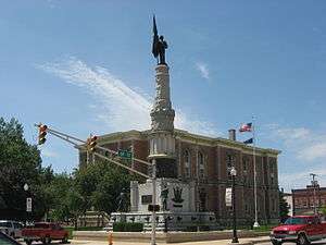 Randolph County Courthouse | |
.jpg) Seal | |
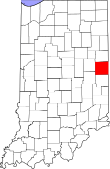 Location within the U.S. state of Indiana | |
 Indiana's location within the U.S. | |
| Coordinates: 40°09′N 85°01′W | |
| Country | |
| State | |
| Founded | 1818 |
| Named for | Peyton Randolph |
| Seat | Winchester |
| Largest city | Winchester |
| Area | |
| • Total | 453.31 sq mi (1,174.1 km2) |
| • Land | 452.38 sq mi (1,171.7 km2) |
| • Water | 0.94 sq mi (2.4 km2) 0.21%% |
| Population | |
| • Estimate (2018) | 24,851 |
| • Density | 57.8/sq mi (22.31/km2) |
| Time zone | UTC−5 (Eastern) |
| • Summer (DST) | UTC−4 (EDT) |
| Congressional district | 6th |
| Website | randolphcounty |
| Indiana county number 68 | |
History
The Indiana General Assembly authorized the formation of Randolph County from Wayne County in January 1818 to take effect in August 1818. The county was almost certainly named for Randolph County, North Carolina, where the area's first settlers came from.[3] That county was named for Peyton Randolph, the first President of the Continental Congress under the Articles of Confederation.[4]
Between 1820 and 1824, the county's territory extended to the Michigan boundary; consequently, the plat for the town of Fort Wayne (now a city) is recorded in Randolph County's Recorder's Office. Randolph County's population grew rapidly in the early years of the nineteenth century. It was also known as a progressive community. As a home to a large number of members of the Society of Friends (Quakers), education and abolitionism became important movements. The county was home to three famous settlements of free African-Americans. The most famous, the Greenville Settlement, in Greensfork Township, was the site of Union Literary Institute, one of the first racially integrated schools in the United States.
Randolph County has been a Republican-stronghold since the 1850s. As such, the county produced two Governors, one Congressman, one U. S. Senator, three Indiana Secretaries of State, and one State Superintendent of Public Instruction between 1858 and 1931. The county's population growth slowed after 1880.
Randolph County answered the problem of rural decline in the early twentieth century by embracing much of the "Country Life Movement." The major act was the movement to consolidate the county's rural schools. This was done under the leadership of Lee L. Driver, a county native who became the nation's leading expert on rural school consolidation. Randolph County became the exemplar of the movement and was the subject of many publications and visits from officials from as far away as Canada and China.
In recent years, residents in Winchester, Union City, and Farmland have sought to revitalize the county through a renewed focus on historic preservation, tourism, and the arts.
Geography
According to the 2010 census, the county has a total area of 453.31 square miles (1,174.1 km2), of which 452.38 square miles (1,171.7 km2) (or 99.79%) is land and 0.94 square miles (2.4 km2) (or 0.21%) is water.[5]
Randolph County is the point of origin for the White River and Whitewater River.
Adjacent counties
- Jay County (north)
- Darke County, Ohio (east)
- Wayne County (south)
- Henry County (southwest)
- Delaware County (west)
Transportation
Cities and towns
Incorporated
Unincorporated

Townships
Nettle Creek (Losantville) and West River (Modoc) Townships were combined to form Union Township.
Attractions
Winchester Speedway (one of the world's oldest and fastest high bank half mile tracks in the world) is located approximately 2 miles west of Winchester on State Road 32
Mrs. Wicks Pie Factory and Restaurant in Winchester
Silvertowne (one of the largest privately owned coin shops in the United States) is located in Winchester
Wilson Wines (local winery near Modoc with tours and special events)
McVey Memorial Forest (Located North of Farmland approximately 6 miles on State Road 1)
Farmers market during the summer on the Winchester Square
Local festivals and events
Mom, Baseball and Apple Pie Festival (Held in Winchester during August annually)
Labor Day Marathon Softball Tournament (Winchester city Park and draws teams from all over the United States to play softball and celebrate the last holiday of Summer. Winchester's population nearly doubles for this weekend)
Madi Gras held annually each fall in Winchester during October
Heritage Days held annually in the fall in Union City.
Airports
- Randolph County Airport (newly expanded in 2010 and 2011)
Climate and weather
| Winchester, Indiana | ||||||||||||||||||||||||||||||||||||||||||||||||||||||||||||
|---|---|---|---|---|---|---|---|---|---|---|---|---|---|---|---|---|---|---|---|---|---|---|---|---|---|---|---|---|---|---|---|---|---|---|---|---|---|---|---|---|---|---|---|---|---|---|---|---|---|---|---|---|---|---|---|---|---|---|---|---|
| Climate chart (explanation) | ||||||||||||||||||||||||||||||||||||||||||||||||||||||||||||
| ||||||||||||||||||||||||||||||||||||||||||||||||||||||||||||
| ||||||||||||||||||||||||||||||||||||||||||||||||||||||||||||
In recent years, average temperatures in Winchester have ranged from a low of 16 °F (−9 °C) in January to a high of 83 °F (28 °C) in July, although a record low of −26 °F (−32 °C) was recorded in January 1994 and a record high of 102 °F (39 °C) was recorded in September 1953. Average monthly precipitation ranged from 1.63 inches (41 mm) in February to 4.34 inches (110 mm) in June.[6]
Government
The county government is a constitutional body, and is granted specific powers by the Constitution of Indiana, and by the Indiana Code.
County Council: The county council is the legislative branch of the county government and controls all the spending and revenue collection in the county. Representatives are elected from county districts. The council members serve four-year terms. They are responsible for setting salaries, the annual budget, and special spending. The council also has limited authority to impose local taxes, in the form of an income and property tax that is subject to state level approval, excise taxes, and service taxes.[7][8]
Board of Commissioners: The executive body of the county is made of a board of commissioners. The commissioners are elected county-wide, in staggered terms, and each serves a four-year term. One of the commissioners, typically the most senior, serves as president. The commissioners are charged with executing the acts legislated by the council, collecting revenue, and managing the day-to-day functions of the county government.[7][8]
Court: The county maintains a small claims court that can handle some civil cases. The judge on the court is elected to a term of four years and must be a member of the Indiana Bar Association. The judge is assisted by a constable who is also elected to a four-year term. In some cases, court decisions can be appealed to the state level circuit court.[8]
County Officials: The county has several other elected offices, including sheriff, coroner, auditor, treasurer, recorder, surveyor, and circuit court clerk Each of these elected officers serves a term of four years and oversees a different part of county government. Members elected to county government positions are required to declare party affiliations and to be residents of the county.[8]
Randolph County is part of Indiana's 6th congressional district and is represented in Congress by Republican Luke Messer.
Randolph County is one of the most consistently Republican counties in the entire United States. Since 1888, the Republican candidate has only failed to carry the county in a presidential election twice. This occurred in 1912 thanks to the strong third party candidacy of Theodore Roosevelt, as well as 1964 where Barry Goldwater was seen as too conservative statewide & nationally in his landslide loss to Lyndon B. Johnson.
| Year | Republican | Democratic | Third parties |
|---|---|---|---|
| 2016 | 71.4% 7,517 | 23.2% 2,446 | 5.3% 560 |
| 2012 | 61.0% 6,218 | 36.9% 3,769 | 2.1% 215 |
| 2008 | 53.5% 5,788 | 44.7% 4,839 | 1.8% 195 |
| 2004 | 64.7% 7,172 | 34.4% 3,812 | 1.0% 108 |
| 2000 | 59.4% 6,020 | 38.6% 3,906 | 2.0% 206 |
| 1996 | 45.2% 4,708 | 39.2% 4,087 | 15.6% 1,625 |
| 1992 | 41.9% 4,937 | 32.8% 3,870 | 25.3% 2,977 |
| 1988 | 62.9% 6,856 | 36.6% 3,990 | 0.6% 62 |
| 1984 | 66.8% 7,793 | 32.6% 3,805 | 0.6% 73 |
| 1980 | 62.7% 7,762 | 32.5% 4,025 | 4.9% 603 |
| 1976 | 55.9% 6,891 | 43.3% 5,330 | 0.8% 99 |
| 1972 | 71.6% 8,754 | 27.9% 3,409 | 0.6% 69 |
| 1968 | 57.1% 7,238 | 31.3% 3,962 | 11.6% 1,467 |
| 1964 | 48.5% 6,551 | 50.4% 6,804 | 1.1% 151 |
| 1960 | 64.9% 9,528 | 34.3% 5,035 | 0.8% 114 |
| 1956 | 65.0% 9,020 | 33.9% 4,701 | 1.1% 152 |
| 1952 | 65.4% 9,150 | 31.9% 4,461 | 2.7% 375 |
| 1948 | 58.0% 7,122 | 37.9% 4,655 | 4.2% 510 |
| 1944 | 61.2% 7,805 | 36.0% 4,590 | 2.9% 363 |
| 1940 | 57.2% 8,033 | 41.2% 5,787 | 1.6% 226 |
| 1936 | 50.3% 6,682 | 48.8% 6,487 | 0.9% 114 |
| 1932 | 49.4% 6,509 | 47.3% 6,223 | 3.3% 434 |
| 1928 | 71.3% 8,368 | 27.8% 3,264 | 0.9% 101 |
| 1924 | 64.1% 7,397 | 32.7% 3,768 | 3.2% 374 |
| 1920 | 65.3% 8,773 | 31.2% 4,198 | 3.5% 468 |
| 1916 | 54.3% 4,054 | 35.9% 2,682 | 9.7% 728 |
| 1912 | 27.3% 1,988 | 29.7% 2,158 | 43.0% 3,129 |
| 1908 | 60.9% 4,792 | 33.1% 2,600 | 6.1% 476 |
| 1904 | 67.5% 5,139 | 25.3% 1,924 | 7.3% 552 |
| 1900 | 65.6% 5,050 | 31.1% 2,393 | 3.4% 259 |
| 1896 | 62.8% 4,674 | 36.0% 2,677 | 1.3% 95 |
| 1892 | 60.4% 4,058 | 29.7% 1,994 | 10.0% 670 |
| 1888 | 65.1% 4,629 | 31.7% 2,256 | 3.2% 225 |
Education
Public schools in Randolph County are administered by the Union School Corporation, Randolph Central School Corporation, Randolph Eastern School Corporation, Randolph Southern School Corporation, and Monroe Central School Corporation.
High schools
- Union High School (Modoc) - Modoc-Union School Corporation
- Randolph Southern High School - Lynn-Randolph Southern School Corporation
- Winchester Community High School - Winchester-Randolph Central School Corporation
- Union City High School - Union City - Randolph Eastern School Corporation
- Monroe Central High School - Parker City - Monroe Central School Corporation
Junior high/middle schools
- Union Jr. High School
- Randolph Southern Jr. High School
- Driver Middle School-Winchester
- West Side Middle School-Union City
- Monroe Central Jr. High School
Elementary schools
- Union Elementary School
- Randolph Southern Elementary School
- Deerfield Elementary School - Winchester
- Baker Elementary School - Winchester
- Williard Elementary School - Winchester
- North Side Elementary School - Union City
- Monroe Central Elementary School
Notable residents
- Congressman Thomas M. Browne.
- John R. Commons, nationally known economist.
- Governor James P. Goodrich.
- Governor Isaac P. Gray.
- Wendell M. Stanley, Nobel Prize Winner in Chemistry.
- Senator James E. Watson.
- Robert Wise (1914–2005), Hollywood director, was born in Winchester.
- Jim Jones (1931–1978), 1970s leader of the Peoples Temple and founder of Jonestown.
- Rick Derringer of the group, The McCoys, who had the hit song, "Hang On Sloopy". He also did "Rock N Roll Hoochie Koo" and toured with the Ringo Starr, All-Star Band.
- Randy Hobbs, also of the McCoys, one of the great bass guitarists in music history. He also played with Jimi Hendrix, and the Johnny and Edgar Winters Bands.
Fictional residents
The Marshalls of Land of the Lost once lived in Harrisville.
Demographics
| Historical population | |||
|---|---|---|---|
| Census | Pop. | %± | |
| 1820 | 1,808 | — | |
| 1830 | 3,912 | 116.4% | |
| 1840 | 10,684 | 173.1% | |
| 1850 | 14,725 | 37.8% | |
| 1860 | 18,997 | 29.0% | |
| 1870 | 22,862 | 20.3% | |
| 1880 | 26,435 | 15.6% | |
| 1890 | 28,085 | 6.2% | |
| 1900 | 28,653 | 2.0% | |
| 1910 | 29,013 | 1.3% | |
| 1920 | 26,484 | −8.7% | |
| 1930 | 24,859 | −6.1% | |
| 1940 | 26,766 | 7.7% | |
| 1950 | 27,141 | 1.4% | |
| 1960 | 28,434 | 4.8% | |
| 1970 | 28,915 | 1.7% | |
| 1980 | 29,997 | 3.7% | |
| 1990 | 27,148 | −9.5% | |
| 2000 | 27,401 | 0.9% | |
| 2010 | 26,171 | −4.5% | |
| Est. 2018 | 24,851 | [10] | −5.0% |
| U.S. Decennial Census[11] 1790-1960[12] 1900-1990[13] 1990-2000[14] 2010-2013[1] | |||
As of the 2010 United States Census, there were 26,171 people, 10,451 households, and 7,300 families residing in the county.[15] The population density was 57.9 inhabitants per square mile (22.4/km2). There were 11,743 housing units at an average density of 26.0 per square mile (10.0/km2).[5] The racial makeup of the county was 96.1% white, 0.4% black or African American, 0.3% American Indian, 0.2% Asian, 1.8% from other races, and 1.1% from two or more races. Those of Hispanic or Latino origin made up 3.0% of the population.[15] In terms of ancestry, 23.7% were German, 13.9% were Irish, 11.5% were American, and 11.4% were English.[16]
Of the 10,451 households, 31.9% had children under the age of 18 living with them, 53.9% were married couples living together, 11.1% had a female householder with no husband present, 30.2% were non-families, and 25.7% of all households were made up of individuals. The average household size was 2.47 and the average family size was 2.93. The median age was 40.8 years.[15]
The median income for a household in the county was $47,697 and the median income for a family was $45,543. Males had a median income of $37,528 versus $28,851 for females. The per capita income for the county was $19,552. About 10.3% of families and 13.2% of the population were below the poverty line, including 20.3% of those under age 18 and 8.7% of those age 65 or over.[17]
References
- "Randolph County QuickFacts". United States Census Bureau. Retrieved 2011-09-25.
- "Find a County". National Association of Counties. Retrieved 2011-06-07.
- "History of Randolph County". Randolph County, Indiana. Archived from the original on October 3, 2011. Retrieved October 21, 2011.
- De Witt Clinton Goodrich & Charles Richard Tuttle (1875). An Illustrated History of the State of Indiana. Indiana: R. S. Peale & Co. pp. 570.
- "Population, Housing Units, Area, and Density: 2010 - County". United States Census Bureau. Archived from the original on 2020-02-12. Retrieved 2015-07-10.
- "Monthly Averages for Winchester, Indiana". The Weather Channel. Retrieved 2011-01-27.
- Indiana Code. "Title 36, Article 2, Section 3". IN.gov. Retrieved 2008-09-16.
- Indiana Code. "Title 2, Article 10, Section 2" (PDF). IN.gov. Retrieved 2008-09-16.
- Leip, David. "Dave Leip's Atlas of U.S. Presidential Elections". uselectionatlas.org. Retrieved 2018-05-20.
- "Population and Housing Unit Estimates". Retrieved July 26, 2019.
- "U.S. Decennial Census". United States Census Bureau. Retrieved July 10, 2014.
- "Historical Census Browser". University of Virginia Library. Retrieved July 10, 2014.
- "Population of Counties by Decennial Census: 1900 to 1990". United States Census Bureau. Retrieved July 10, 2014.
- "Census 2000 PHC-T-4. Ranking Tables for Counties: 1990 and 2000" (PDF). United States Census Bureau. Retrieved July 10, 2014.
- "DP-1 Profile of General Population and Housing Characteristics: 2010 Demographic Profile Data". United States Census Bureau. Archived from the original on 2020-02-13. Retrieved 2015-07-10.
- "DP02 SELECTED SOCIAL CHARACTERISTICS IN THE UNITED STATES – 2006-2010 American Community Survey 5-Year Estimates". United States Census Bureau. Archived from the original on 2020-02-14. Retrieved 2015-07-10.
- "DP03 SELECTED ECONOMIC CHARACTERISTICS – 2006-2010 American Community Survey 5-Year Estimates". United States Census Bureau. Archived from the original on 2020-02-14. Retrieved 2015-07-10.
Places adjacent to Randolph County, Indiana | ||||||||||
|---|---|---|---|---|---|---|---|---|---|---|
| ||||||||||
Municipalities and communities of Randolph County, Indiana, United States | ||
|---|---|---|
| Cities | Map of Indiana highlighting Randolph County | |
| Towns | ||
| Townships | ||
| Unincorporated communities | ||
| Former communities |
| |

| Authority control |
|
|---|