Jasper, Indiana, micropolitan area
The Jasper micropolitan statistical area, as defined by the United States Census Bureau, is an area consisting of two counties in southwestern Indiana, anchored by the city of Jasper. At the 2010 census, the Micropolitan area (μSA) had a population of 54,734 up from a population of 52,511 in the 2000 census.[1] The micropolitan area covers an area of 776 sq mi (2,010 km2).
Jasper, Indiana μSA | |
|---|---|
Micropolitan area | |
| Jasper, Indiana micropolitan statistical area | |
 | |
| Country | United States |
| State | Indiana |
| Counties | Dubois, Pike |
| Area | |
| • Total | 776 sq mi (2,010 km2) |
| • Land | 769 sq mi (1,990 km2) |
| • Water | 7 sq mi (20 km2) |
| Population (2010) | |
| • Total | 54,734 |
| • Density | 67.6/sq mi (26.1/km2) |
| Time zone | UTC-6 (EST) |
| • Summer (DST) | UTC-5 (EDT) |
| Area code(s) | 812 |
Townships
Dubois County
Demographics
At the 2000 census,[2] there were 52,511 people, 19,932 households and 14,419 families residing within the μSA. The racial makeup of the μSA was 97.92% White, 0.13% African American, 0.11% Native American, 0.18% Asian, 0.04% Pacific Islander, 1.17% from other races, and 0.45% from two or more races. Hispanic or Latino of any race were 2.24% of the population.
The median household income was $39,464, and the median family income was $45,881. Males had a median income of $32,226 versus $22,248 for females. The per capita income for the μSA was $18,221.
See also
- Illinois–Indiana–Kentucky tri-state area
- Indiana census statistical areas
References
- "Table 1. Annual Estimates of the Population of Metropolitan and Micropolitan Statistical Areas: April 1, 2000 to July 1, 2009 (CBSA-EST2009-01)". 2009 Population Estimates. United States Census Bureau, Population Division. 2010-03-23. Archived from the original (CSV) on March 26, 2010. Retrieved 2010-03-25.
- "U.S. Census website". United States Census Bureau. Retrieved 2008-01-31.
The Region of Southwestern Indiana | ||
|---|---|---|
| Central Time Counties | 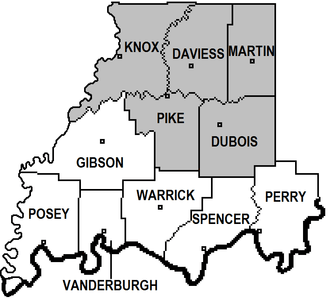 | |
| Eastern Time Counties | ||
| County Seats |
| |
| Metropolitan & Micropolitan Areas |
| |
| Colleges and Universities |
| |