North Danger Reef
North Danger Reef (Vietnamese: Cụm Song Tử) (11°25′N 114°21′E) is one of the seven major reefs / banks / etc. in the Spratly Islands area of the South China Sea. It is the most North Western of the features of the Spratly Islands, located to the NW of Dangerous Ground.
.jpg)
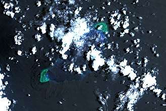
The reef is a large (8.5 nautical miles) approximately circular atoll with a central lagoon (~20m deep). The surrounding reef is shallow.[1]
History
Chiem Thanh fishermen are probably the first people to discover this North Danger Reef. However, it is the Vietnamese who show their presence often here.
From the 15th century onward, Vietnamese kings began to pay attention to the islands in the South China sea.
In 1776, Le Quy Don wrote at Phu Bien Tap Luc about these islands, as well as the establishment and operation of the Paracel fleet (Vietnamese: Hải Đội Hoàng Sa) and the Northern fleet (Vietnamese: Hải Đội Bắc Hải) of Vietnam.
In 1838, Emperor Minh Mang (Vietnam) allowed to measure and draw a map of this sea area. It is called the "Dai Nam Nhat Thong Toan Do", in which it clearly shows the Spratly and Paracel Islands of Vietnam.
When Vietnam was a French colony, the French Government continued to manage North Danger Reef on behalf of Vietnam along with the Paracel and Spratly Islands.
In 1904, the Qing Dynasty (China) measured and published a map of China's provinces (Chinese: 皇朝直省地舆全图). This map clearly shows that the southernmost territory of China is Hainan Island, without Spratly Islands and Paracel Islands.
In 1935, China announced its claims and named the North Danger Reef. It is called: "Gemini" (Chinese: 双子群礁).

In 1954, the French government officially returned North Danger Reef with the entire Spratly and Paracel Islands to the Republic of Vietnam.
In 1958, the Republic of Vietnam Navy built milestones of sovereignty on Southwest Cay and Northeast Cay.
In 1970, the Philippine Navy seized Southwest Cay of Vietnam.
At present, Vietnam troops are managing Southwest Cay. And the Philippines occupies Northeast Cay.
Features of North Danger Reef
Commencing in the NE and travelling anti-clockwise to the SW:
- North Reef (11°28′N 114°23′E)
- North Pass
- Northeast Cay (11°27′N 114°21′E) - light on NE side
- Shira Islet
- Middle Pass
- Southwest Cay (11°26′N 114°20′E) - marked by a light
- West Pass - N
- Jenkins Patches
- West Pass - S
- South Reef (11°23.3′N 114°17.9′E) - SW of the Reef
- South Pass
Continuing anti-clockwise to the East and NE:
- Sabine Patches
- Farquharson Patches
- East Pass
- Day Shoal - NE of reef
- Iroquois Ridge - central N of reef
References
- NGA Chart 93044 shows the area NW of Dangerous Ground
- NGA Chart 93042 shows the detail of North Danger Reef
| Related articles | |||||||||||
|---|---|---|---|---|---|---|---|---|---|---|---|
| Confrontations |
| ||||||||||
| Regions | |||||||||||
| Occupied features | |||||||||||
| Unoccupied features | |||||||||||