Amboyna Cay
Amboyna Cay, also known as An Bang Island, (Vietnamese: Đảo An Bang, Chinese: 安波沙洲; pinyin: Anbo Shazhou, Malay: Pulau Amboyna Kecil; Tagalog: Lagos) and other names, is an island of the Spratly Islands group in the South China Sea located just outside (SW) of the southwest of Dangerous Ground.[1] It is SW of Barque Canada Reef, south of the London Reefs, and NW of Swallow Reef.
 Map of the Spratly Islands showing Amboyna Cay | |
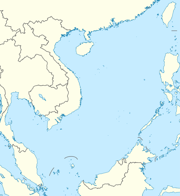 Amboyna Cay Location in the South China Sea | |
| Geography | |
|---|---|
| Coordinates | 7°53′31″N 112°55′17″E 7.8919444°N 112.9213889°E |
| Archipelago | Spratly Islands |
| Area | 1.6 ha (4.0 acres) |
| Length | 160 m (520 ft) |
| Width | 120 m (390 ft) |
| Administration | |
Occupied by Vietnam | |
With an area of 1.6 hectares (4.0 acres), it is the thirteenth largest naturally occurring Spratly island and the sixth largest amongst those occupied by Vietnam.
The island has two parts: the eastern part consists of sand and coral, and the west part is covered with guano. It has a fringing reef. An obelisk, about 2.7 m high, stands on the SW corner. There is little vegetation. It is described by some as heavily fortified.[2] A lighthouse has been operational on the island since May 1995.
The island is also claimed by China, Malaysia, the Philippines and Taiwan.
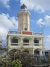 Amboyna Cay Lighthouse
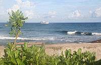 View from Amboyna Cay
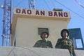 Vietnamese guards on Amboyna Cay
Recent history
In 1978 the Royal Malaysian Navy landed on the island and placed markers. However, the markers were subsequently destroyed by Vietnam who now occupies the island.[3]
On 31 March 1979, forces occupying the cay fired warning shots at a boat transporting six amateur radio operators ("hams") attempting a DX-pedition to Amboyna Cay.
In 1982, a Singapore yacht operated by the owner and his wife transporting four German hams on a DX-pedition to Amboyna Cay was fired upon by Vietnamese forces. One of the hams, Diethelm Mueller, was hit by an artillery round and fell overboard. The yacht burned and the rest of the party drifted for 11 days on debris. Another ham, Gero Band, died of thirst the day before the survivors were rescued by a passing Japanese freighter which took them to Hong Kong.[4]
See also
References
- NGA Chart 93047 showing the South West of Dangerous Ground, www.oceangrafix.com
- "Digital Gazetter of Spratly Islands". Archived from the original on 21 March 2008. Retrieved 2008-03-22.
- Joshua Ho; Sam Bateman (15 February 2013). Maritime Challenges and Priorities in Asia: Implications for Regional Security. Routledge. pp. 74–. ISBN 978-1-136-29820-2.
- "The Spratly Islands DXpedition Gets Wings". arrl.org. November 30, 2010.
| Related articles | |||||||||||
|---|---|---|---|---|---|---|---|---|---|---|---|
| Confrontations |
| ||||||||||
| Regions | |||||||||||
| Occupied features | |||||||||||
| Unoccupied features | |||||||||||