National Register of Historic Places listings in Salem County, New Jersey
List of the National Register of Historic Places listings in Salem County, New Jersey
| Atlantic - Bergen - Burlington - Camden - Cape May - Cumberland - Essex - Gloucester - Hudson - Hunterdon - Mercer - Middlesex - Monmouth - Morris - Ocean - Passaic - Salem - Somerset - Sussex - Union - Warren |
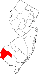
Location of Salem County in New Jersey
This is intended to be a complete list of properties and districts listed on the National Register of Historic Places in Salem County, New Jersey. The locations of National Register properties and districts (at least for all showing latitude and longitude coordinates below) may be seen in an online map.[1]
- This National Park Service list is complete through NPS recent listings posted June 26, 2020.[2]
| [3] | Name on the Register[4] | Image | Date listed[5] | Location | City or town | Description |
|---|---|---|---|---|---|---|
| 1 | Alloways Creek Friends Meetinghouse | 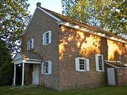 Alloways Creek Friends Meetinghouse |
December 18, 2003 (#03001306) |
Buttonwood Ave, 150 ft. west of Main St. 39°30′08″N 75°27′33″W |
Hancock's Bridge | |
| 2 | Moshe Bayuk House | 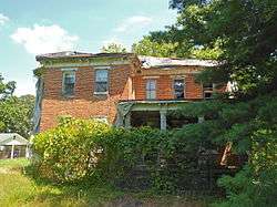 Moshe Bayuk House |
March 27, 2012 (#12000159) |
984 Gershal Ave. 39°30′28″N 75°05′05″W |
Pittsgrove Township | |
| 3 | Richard Brick House | 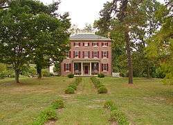 Richard Brick House |
May 13, 1976 (#76001183) |
Northeast of Salem off NJ 45 on Compromise Rd. 39°36′44″N 75°22′56″W |
Salem | |
| 4 | Broadway Historic District | 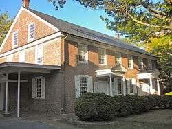 Broadway Historic District |
March 5, 1992 (#92000098) |
Broadway from Front to Yorke Sts. 39°34′11″N 75°28′03″W |
Salem | |
| 5 | Dickinson House | 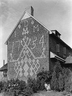 Dickinson House |
February 20, 1975 (#75001156) |
Northeast of Alloway on Brickyard Rd. 39°36′01″N 75°20′02″W |
Alloway Township | |
| 6 | Zaccheus Dunn House |  Zaccheus Dunn House |
August 10, 1977 (#77000905) |
South of Woodstown on East Lake Rd. 39°37′55″N 75°19′32″W |
Woodstown | |
| 7 | Finn's Point Rear Range Light | 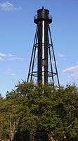 Finn's Point Rear Range Light |
August 30, 1978 (#78001792) |
Northwest of Salem at Fort Mott and Lighthouse Rds. 39°37′01″N 75°32′05″W |
Salem | |
| 8 | Fort Mott and Finns Point National Cemetery District |  Fort Mott and Finns Point National Cemetery District |
August 31, 1978 (#78001793) |
Northwest of Salem on Fort Mott Rd. 39°36′21″N 75°33′08″W |
Salem | |
| 9 | Philip Fries House | 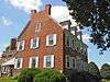 Philip Fries House |
September 28, 1990 (#90001451) |
Cohansey-Daretown Rd. North of Alloway-Friesburg Rd., Alloway Township 39°32′23″N 75°17′32″W |
Alloway Township | |
| 10 | Hancock House | 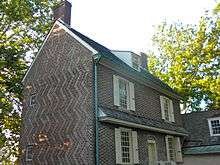 Hancock House |
December 18, 1970 (#70000393) |
Rte. 49 and Front St. 39°30′27″N 75°27′38″W |
Lower Alloways Creek Township | |
| 11 | Hedge-Carpenter-Thompson Historic District | 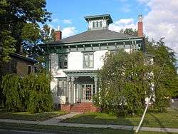 Hedge-Carpenter-Thompson Historic District |
March 26, 2001 (#01000236) |
Bounded by Hedge, Thompson, South Third Sts. and Oak St. Alley 39°34′15″N 75°28′32″W |
Salem | |
| 12 | Benjamin Holmes House | 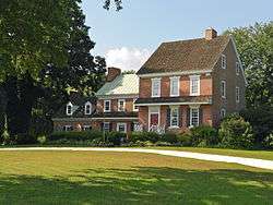 Benjamin Holmes House |
August 31, 1978 (#78001794) |
West of Salem on Fort Elfsborg-Hancock's Bridge Rd. 39°32′43″N 75°30′46″W |
Salem | |
| 13 | James and Mary Lawson House | 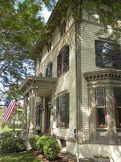 James and Mary Lawson House |
February 16, 2001 (#01000042) |
209 N. Main St. 39°39′20″N 75°19′39″W |
Woodstown | |
| 14 | Market Street Historic District | 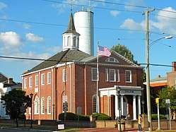 Market Street Historic District |
April 10, 1975 (#75001157) |
Irregular pattern on both sides of Market St. from Broadway to Fenwick Creek 39°34′28″N 75°28′00″W |
Salem | |
| 15 | Marshalltown Historic District | 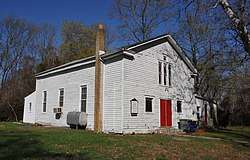 Marshalltown Historic District |
July 17, 2013 (#13000498) |
Marshalltown Rd. & Roosevelt Ave. 39°38′16″N 75°27′12″W |
Mannington Township | African-American rural district[6] |
| 16 | William and Margaret Mecum House |  William and Margaret Mecum House |
March 5, 2018 (#100002172) |
168 Lighthouse Rd. 39°36′58″N 75°31′26″W |
Pennsville Township | |
| 17 | Abel and Mary Nicholson House | _House%2C_Elsinboro_(Salem_County%2C_New_Jersey).jpg) Abel and Mary Nicholson House |
January 16, 1997 (#96001548) |
Jct. of Hancocks Br. and Ft. Elfsborg Rd., Elfinsboro Township 39°31′15″N 75°29′13″W |
Salem | |
| 18 | Sarah and Samuel Nicholson House | 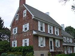 Sarah and Samuel Nicholson House |
February 24, 1975 (#75001158) |
2 miles (3.2 km) south of Salem on Amwellbury Rd. 39°32′28″N 75°29′19″W |
Salem | |
| 19 | Pittsgrove Presbyterian Church | 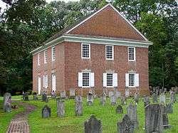 Pittsgrove Presbyterian Church |
September 19, 1977 (#77000904) |
Main St. 39°36′04″N 75°15′38″W |
Upper Pittsgrove Township | |
| 20 | Salem County Insane Asylum | 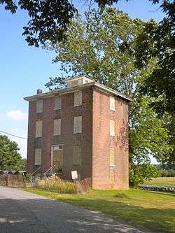 Salem County Insane Asylum |
June 27, 2008 (#08000562) |
900 Route 45 39°37′54″N 75°21′48″W |
Mannington Township | Former asylum building eyed for preservation |
| 21 | Seven Stars Tavern | 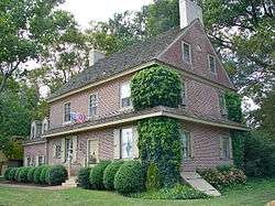 Seven Stars Tavern |
May 17, 1976 (#76001184) |
North of Woodstown at junction of Sharptown-Swedesboro and Woodstown-Auburn Rds. 39°41′08″N 75°20′23″W |
Woodstown | |
| 22 | Joseph Shinn House | 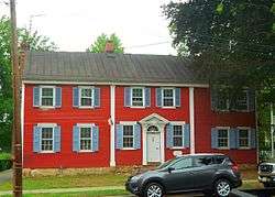 Joseph Shinn House |
March 7, 1979 (#79001518) |
68 N. Main St. 39°39′14″N 75°19′46″W |
Woodstown | |
| 23 | David V. Smith House | 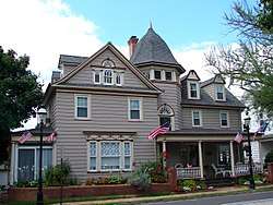 David V. Smith House |
May 17, 1976 (#76001182) |
104 S. Main St. 39°35′36″N 75°10′10″W |
Elmer | |
| 24 | William Smith House |  William Smith House |
February 4, 1994 (#94000008) |
Jct. of NJ 45 and Bassett Rd., Mannington Township 39°36′49″N 75°24′29″W |
Salem | Reported to be destroyed by fire |
| 25 | Joseph Ware House | 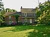 Joseph Ware House |
January 26, 1990 (#89002418) |
134 Poplar St. 39°30′21″N 75°29′09″W |
Hancock's Bridge | |
| 26 | John and Charlotte Wistar Farm | 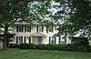 John and Charlotte Wistar Farm |
April 22, 2016 (#15001021) |
120 Harris Rd. 39°36′13″N 75°26′47″W |
Mannington Township | |
| 27 | Caspar & Rebecca Wister Farm | 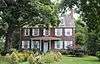 Caspar & Rebecca Wister Farm |
April 22, 2016 (#15001020) |
84 Pointers-Auburn Rd. 39°36′22″N 75°26′36″W |
Mannington Township |
See also
References
- The latitude and longitude information provided in this table was derived originally from the National Register Information System, which has been found to be fairly accurate for about 99% of listings. Some locations in this table may have been corrected to current GPS standards.
- "National Register of Historic Places: Weekly List Actions". National Park Service, United States Department of the Interior. Retrieved on June 26, 2020.
- Numbers represent an ordering by significant words. Various colorings, defined here, differentiate National Historic Landmarks and historic districts from other NRHP buildings, structures, sites or objects.
- "National Register Information System". National Register of Historic Places. National Park Service. April 24, 2008.
- The eight-digit number below each date is the number assigned to each location in the National Register Information System database, which can be viewed by clicking the number.
- Survey Archived 2013-11-02 at the Wayback Machine
| Topics | 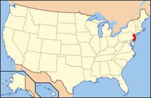 | ||
|---|---|---|---|
| Lists by county | |||
| Lists by city |
| ||
| Other lists | |||
| |||
Municipalities and communities of Salem County, New Jersey, United States | ||
|---|---|---|
| City | Map of New Jersey highlighting Salem County | |
| Boroughs | ||
| Townships | ||
| CDPs | ||
| Other unincorporated communities |
| |
| Wikimedia Commons has media related to National Register of Historic Places in Salem County, New Jersey. |
This article is issued from Wikipedia. The text is licensed under Creative Commons - Attribution - Sharealike. Additional terms may apply for the media files.