National Register of Historic Places listings in Camden County, New Jersey
This is intended to be a complete list of properties and districts listed on the National Register of Historic Places in Camden County, New Jersey. The locations of National Register properties and districts (at least for all showing latitude and longitude coordinates below) may be seen in an online map by clicking on "Map of all coordinates".[1]
- This National Park Service list is complete through NPS recent listings posted June 26, 2020.[2]
| [3] | Name on the Register[4] | Image | Date listed[5] | Location | City or town | Description |
|---|---|---|---|---|---|---|
| 1 | American National Bank | 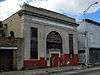 American National Bank |
August 22, 1990 (#90001256) |
1219 Broadway 39°55′49″N 75°07′12″W |
Camden | Demolished |
| 2 | Barclay Farm House |  Barclay Farm House |
January 26, 1978 (#78001753) |
Northeast of Haddonfield near the junction of Interstate 295 and Route 70 39°54′19″N 74°59′53″W |
Cherry Hill | |
| 3 | BARNEGAT (lightship) | _CAMDEN_COUNTY%2C_NEW_JERSEY.jpg) BARNEGAT (lightship) |
November 29, 1979 (#79002317) |
North 7th Street 39°57′21″N 75°06′46″W |
Camden | LV 79 / WAL 506; Was in Philadelphia |
| 4 | Volney G. Bennett Lumber Company | 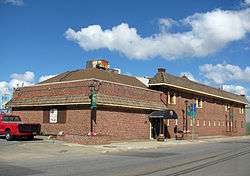 Volney G. Bennett Lumber Company |
August 5, 1993 (#93000749) |
138 Division St. and 845 S. 2nd St. 39°56′06″N 75°07′38″W |
Camden | |
| 5 | Berlin Historic District | 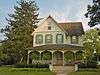 Berlin Historic District |
April 14, 1995 (#95000408) |
Roughly along Washington, E. Taunton, and Haines Aves. and parts of S. White Horse Pike, Jackson Rd., and Jefferson Ave. 39°47′34″N 74°55′43″W |
Berlin | |
| 6 | Blackwood Historic District | 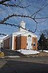 Blackwood Historic District |
July 27, 1989 (#89000996) |
Roughly Church St. from E. Railroad Ave. to Indiana Ave., Blackhorse Pike, and Central Ave. 39°48′02″N 75°03′11″W |
Blackwood | |
| 7 | Bonnie's Bridge | 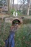 Bonnie's Bridge |
September 13, 1984 (#84002604) |
350 Wayland Rd. 39°54′39″N 75°00′18″W |
Cherry Hill | |
| 8 | Broadway Trust Company | 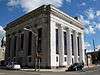 Broadway Trust Company |
August 24, 1990 (#90001284) |
938-944 Broadway 39°56′02″N 75°07′11″W |
Camden | |
| 9 | Building 2, RCA Victor Complex | 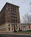 Building 2, RCA Victor Complex |
February 4, 2019 (#100003402) |
201 N. Front St. 39°56′53″N 75°07′34″W |
Camden | |
| 10 | Building 17, RCA Victor Company, Camden Plant | 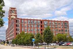 Building 17, RCA Victor Company, Camden Plant |
October 4, 2002 (#02001253) |
1 Market St. 39°56′51″N 75°07′38″W |
Camden | |
| 11 | Building at 525 Cooper Street | 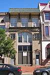 Building at 525 Cooper Street |
August 24, 1990 (#90001286) |
525 Cooper St. 39°56′48″N 75°07′14″W |
Camden | |
| 12 | Burrough-Dover House | 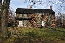 Burrough-Dover House |
October 25, 1973 (#73001089) |
9201 Burrough-Dover Lane (off Haddonfield Rd.) 39°58′24″N 75°01′05″W |
Pennsauken Township | |
| 13 | Camden Fire Insurance Association |  Camden Fire Insurance Association |
August 22, 1990 (#90001262) |
428-432 Federal St. 39°56′38″N 75°07′20″W |
Camden | Demolished.[6] |
| 14 | Camden Free Public Library Main Building | 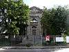 Camden Free Public Library Main Building |
October 15, 1992 (#92001385) |
616 Broadway 39°56′14″N 75°07′06″W |
Camden | |
| 15 | Camden Safe Deposit & Trust Company |  Camden Safe Deposit & Trust Company |
August 22, 1990 (#90001258) |
Market St. and Broadway 39°56′43″N 75°07′09″W |
Camden | |
| 16 | Cattell Tract Historic District | 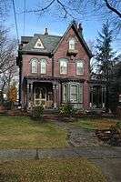 Cattell Tract Historic District |
September 8, 1994 (#94001103) |
Roughly bounded by N. Chestnut Ave., Cove Rd., and Rogers and Leslie Aves. 39°57′16″N 75°02′57″W |
Merchantville | |
| 17 | Centennial House | 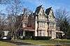 Centennial House |
May 30, 1991 (#91000674) |
17-19 E. Chestnut Ave. 39°57′10″N 75°02′56″W |
Merchantville | |
| 18 | Central Trust Company | 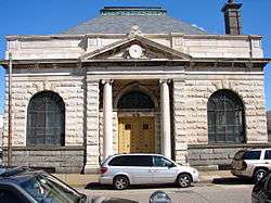 Central Trust Company |
January 5, 2005 (#90001253) |
401 Federal St. 39°56′39″N 75°07′24″W |
Camden | |
| 19 | Chew-Powell House | 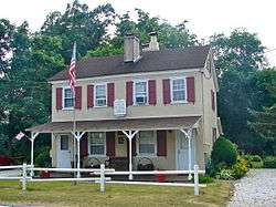 Chew-Powell House |
March 27, 1975 (#75001127) |
500-502 Good Intent Rd. 39°48′23″N 75°04′33″W |
Gloucester Township | |
| 20 | Church of the Immaculate Conception | 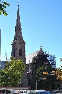 Church of the Immaculate Conception |
December 10, 2003 (#03001277) |
642 Market St. 39°56′41″N 75°07′08″W |
Camden | |
| 21 | Samuel Coles House |  Samuel Coles House |
June 18, 1973 (#73001087) |
1743 Old Cuthbert Rd. 39°54′49″N 74°58′41″W |
Cherry Hill | |
| 22 | Collings-Knight Homestead |  Collings-Knight Homestead |
September 10, 1987 (#87001518) |
500 Collings Ave. 39°54′42″N 75°04′52″W |
Collingswood | |
| 23 | Collingswood Commercial Historic District | 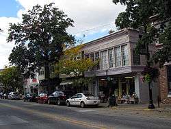 Collingswood Commercial Historic District |
September 13, 1990 (#90001439) |
Roughly Haddon Ave. between Woodlawn and Fern, including adjacent areas on Collings Ave. 39°54′57″N 75°04′06″W |
Collingswood | |
| 24 | Collingswood Residential Historic District | 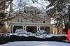 Collingswood Residential Historic District |
September 13, 1990 (#90001436) |
Roughly Knight Park and its bordering properties, including Park Ave. east to Dayton Ave. 39°54′46″N 75°04′40″W |
Collingswood | |
| 25 | Collingswood Theatre | 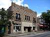 Collingswood Theatre |
June 3, 1982 (#82003269) |
843 Haddon Ave. 39°54′57″N 75°03′58″W |
Collingswood | |
| 26 | Collins and Pancoast Hall | 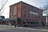 Collins and Pancoast Hall |
February 16, 1984 (#84002608) |
4-8 S. Centre St. 39°57′07″N 75°02′59″W |
Merchantville | |
| 27 | Cooper Grant Historic District | 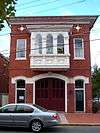 Cooper Grant Historic District |
January 30, 1989 (#87002229) |
Point, N. Front, Linden, Penn, and N. 2nd Sts. Boundary increase: 300 N. Delaware Ave. 39°56′58″N 75°07′32″W |
Camden | |
| 28 | Cooper Library in Johnson Park | 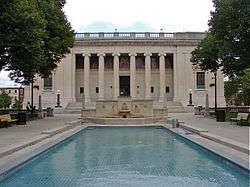 Cooper Library in Johnson Park |
March 11, 1980 (#80002473) |
2nd and Cooper Sts. 39°56′53″N 75°07′31″W |
Camden | |
| 29 | Cooper River Park Historic District | 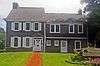 Cooper River Park Historic District |
July 19, 2016 (#16000456) |
Roughly bounded by Kaighn, Roberts, Glover & Narbeth Aves., N. Park, S. Edge Park & S. Park Drs., Kings Hwy. 39°55′33″N 75°05′02″W |
Collingswood | |
| 30 | Cooper Street Historic District | 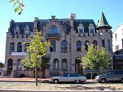 Cooper Street Historic District |
August 7, 1989 (#89001057) |
Cooper St. from 2nd to 7th Sts. 39°56′49″N 75°07′17″W |
Camden | |
| 31 | Joseph Cooper House | 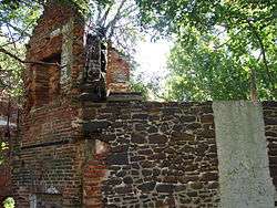 Joseph Cooper House |
March 14, 1973 (#73001086) |
Head of 7th St. in Pyne Point Park 39°57′16″N 75°06′57″W |
Camden | |
| 32 | Arthur Dorrance House | 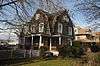 Arthur Dorrance House |
May 13, 1994 (#94000391) |
28 Franklin Ave. 39°57′05″N 75°02′49″W |
Merchantville | |
| 33 | James M. Downey Building | 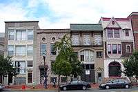 James M. Downey Building |
August 22, 1990 (#90001261) |
521 Cooper St. 39°56′16″N 75°07′14″W |
Camden | |
| 34 | East End Trust Company | 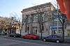 East End Trust Company |
August 22, 1990 (#90001254) |
2614-2616 Federal St. 39°56′46″N 75°05′19″W |
Camden | |
| 35 | Col. Joseph Ellis House |  Col. Joseph Ellis House |
September 23, 1994 (#94001110) |
1009 Sycamore St. 39°52′36″N 75°03′48″W |
Haddon Heights | |
| 36 | Fairview District | 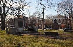 Fairview District |
November 19, 1974 (#74001157) |
Roughly bounded by Newton Creek, Crescent Boulevard, Mt. Ephraim Ave., and Olympia and Hull Rds. 39°54′20″N 75°06′17″W |
Camden | |
| 37 | Federal Building and Courthouse | 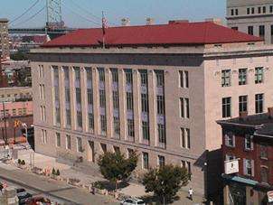 Federal Building and Courthouse |
January 4, 2012 (#11000992) |
401 Market St. 39°56′46″N 75°07′19″W |
Camden | |
| 38 | Finance Building | 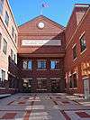 Finance Building |
August 22, 1990 (#90001260) |
549-559 Cooper St. 39°56′48″N 75°07′11″W |
Camden | Demolished.[7] Photo shows the replacement building. |
| 39 | First Camden National Bank & Trust | 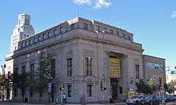 First Camden National Bank & Trust |
August 24, 1990 (#90001285) |
Junction of Broadway and Cooper St. 39°56′42″N 75°07′10″W |
Camden | |
| 40 | Gatehouse at Colestown Cemetery |  Gatehouse at Colestown Cemetery |
May 21, 1975 (#75001128) |
Kings Highway and Church Rd. 39°56′00″N 74°59′24″W |
Cherry Hill | |
| 41 | Glendale Methodist Episcopal Church | 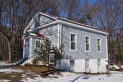 Glendale Methodist Episcopal Church |
August 4, 1995 (#95001000) |
615 Haddonfield-Berlin Rd. (Route 561) at its junction with White Horse Rd. 39°51′14″N 74°58′58″W |
Voorhees Township | |
| 42 | Gloucester City Water Works Engine House | 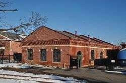 Gloucester City Water Works Engine House |
March 30, 1998 (#98000235) |
Junction of Johnson Boulevard and Gaunt St. 39°53′47″N 75°06′53″W |
Gloucester City | |
| 43 | Glover Fulling Mill Site | 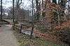 Glover Fulling Mill Site |
September 28, 1990 (#90001452) |
Address Restricted |
Haddon Heights | |
| 44 | Isaac Glover House | 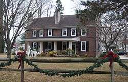 Isaac Glover House |
September 23, 1994 (#94001117) |
1908 New Jersey Ave. 39°52′49″N 75°04′53″W |
Haddon Heights | |
| 45 | Grant A.M.E. Church | 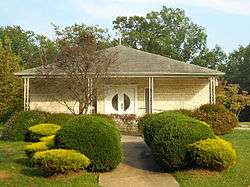 Grant A.M.E. Church |
October 5, 1977 (#77000857) |
4th and Washington Sts. 39°44′06″N 74°52′46″W |
Chesilhurst | Church built in 1896 and destroyed sometime after 1977. The photo shows its replacement. |
| 46 | Greenfield Hall | 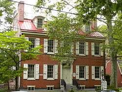 Greenfield Hall |
June 5, 1974 (#74001158) |
343 Kings Highway, E. 39°54′01″N 75°05′11″W |
Haddonfield | |
| 47 | Haddon Fortnightly Club House | 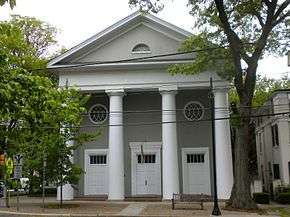 Haddon Fortnightly Club House |
October 26, 1972 (#72000771) |
301 Kings Highway 39°53′59″N 75°01′45″W |
Haddonfield | |
| 48 | Haddonfield Historic District | 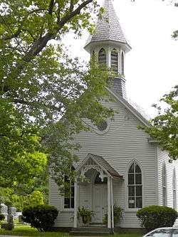 Haddonfield Historic District |
July 21, 1982 (#82003270) |
Roughly bounded by Washington, Hopkins, Summit, and E. Park Aves., and the Kings Highway 39°53′49″N 75°02′00″W |
Haddonfield | |
| 49 | Hadrosaurus foulkii Leidy Site | 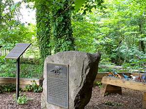 Hadrosaurus foulkii Leidy Site |
October 12, 1994 (#94001648) |
End of Maple Avenue near the Cooper River 39°54′34″N 75°01′40″W |
Haddonfield | |
| 50 | Hillman Hospital House | 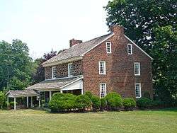 Hillman Hospital House |
July 14, 1977 (#77000858) |
500 3rd Ave. 39°50′15″N 75°03′40″W |
Glendora | |
| 51 | Hinchman-Lippincott House | 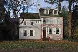 Hinchman-Lippincott House |
February 17, 1995 (#94001121) |
1089 N. Park Ave. 39°52′48″N 75°04′01″W |
Haddon Heights | |
| 52 | Indian King Tavern |  Indian King Tavern |
December 18, 1970 (#70000382) |
233 Kings Highway, E. 39°53′56″N 75°01′52″W |
Haddonfield | |
| 53 | Inter-County Mortgage and Finance Company | 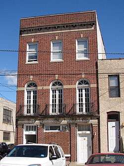 Inter-County Mortgage and Finance Company |
August 22, 1990 (#90001263) |
333 Arch St. 39°56′41″N 75°07′26″W |
Camden | |
| 54 | Kay-Evans Farm | 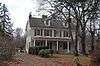 Kay-Evans Farm |
June 28, 2000 (#00000693) |
100 Borton Mill Rd. 39°53′54″N 75°01′13″W |
Cherry Hill | better known as the Croft Farm |
| 55 | Lawnside School | 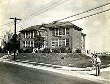 Lawnside School |
March 17, 2015 (#15000092) |
23 N. Warwick Rd. 39°52′06″N 75°02′04″W |
Lawnside Borough | |
| 56 | Long-a-Coming Depot | 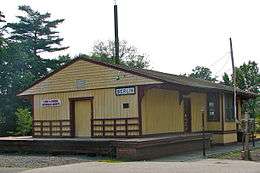 Long-a-Coming Depot |
February 14, 1997 (#97000063) |
Between Washington and E. Taunton Aves., southeast of the junction of Route 73 and E. Taunton Ave. 39°47′38″N 74°55′34″W |
Berlin | |
| 57 | John Lucas House | 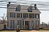 John Lucas House |
March 29, 2019 (#100003591) |
10 Clemonton Rd. E. 39°50′20″N 74°57′51″W |
Gibbsboro | |
| 58 | Macedonia African Methodist Episcopal Church | 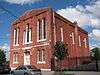 Macedonia African Methodist Episcopal Church |
March 12, 2012 (#12000108) |
261-265 Spruce St. 39°56′06″N 75°07′29″W |
Camden | |
| 59 | Marcouse Building | 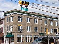 Marcouse Building |
August 24, 1990 (#90001266) |
231 Market St. 39°56′47″N 75°07′28″W |
Camden | |
| 60 | Robert Marshall House | 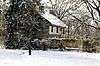 Robert Marshall House |
January 16, 2008 (#07001402) |
510 Almonesson Rd. 39°48′44″N 75°04′50″W |
Gloucester Township | |
| 61 | Peter J. McGuire Memorial and Gravesite |  Peter J. McGuire Memorial and Gravesite |
January 17, 2019 (#100003321) |
Arlington Cemetery, 1620 Cove Rd. 39°58′06″N 75°03′29″W |
Pennsauken Township | |
| 62 | Samuel Mickle House |  Samuel Mickle House |
May 21, 1975 (#75001129) |
345 Kings Highway, E. 39°54′01″N 75°01′41″W |
Haddonfield | |
| 63 | Griffith Morgan House |  Griffith Morgan House |
January 25, 1973 (#73001088) |
234 Griffith Morgan Lane (off River Road) 39°59′24″N 75°02′55″W |
Pennsauken Township | |
| 64 | Peter Mott House |  Peter Mott House |
September 8, 1994 (#94001101) |
Junction of Moore and Gloucester Aves. 39°52′02″N 75°02′10″W |
Lawnside | |
| 65 | Mount Peace Cemetery and Funeral Directing Company Cemetery | 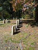 Mount Peace Cemetery and Funeral Directing Company Cemetery |
July 29, 2009 (#08000971) |
329 U.S. Route 30 39°52′13″N 75°02′35″W |
Lawnside | |
| 66 | National State Bank | 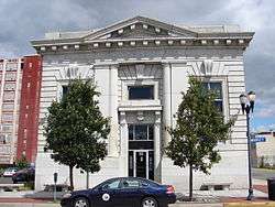 National State Bank |
August 24, 1990 (#90001267) |
123 Market St. 39°56′47″N 75°07′34″W |
Camden | |
| 67 | New Jersey Safe Deposit and Trust Company | 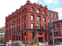 New Jersey Safe Deposit and Trust Company |
August 24, 1990 (#90001265) |
Market and 3rd Sts. 39°56′47″N 75°07′40″W |
Camden | |
| 68 | Newton Friends' Meetinghouse | 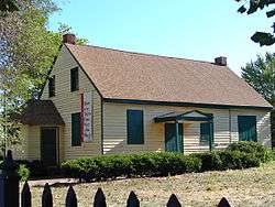 Newton Friends' Meetinghouse |
August 12, 1971 (#71000498) |
722 Cooper St. 39°56′45″N 75°07′01″W |
Camden | |
| 69 | Newton Union Schoolhouse | 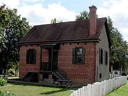 Newton Union Schoolhouse |
October 27, 1988 (#88002122) |
Collings and Lynne Aves. 39°54′31″N 75°05′30″W |
Haddon Township | |
| 70 | The Oaks Historic District | 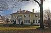 The Oaks Historic District |
July 9, 1997 (#97000772) |
Roughly bounded by W. Maple Ave., Browning Rd., Volan St., and Oak Terrace 39°56′55″N 75°03′32″W |
Merchantville | |
| 71 | Pomona Hall | 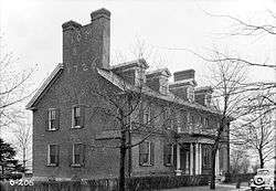 Pomona Hall |
August 12, 1971 (#71000499) |
Park Boulevard and Euclid Ave. 39°55′51″N 75°05′40″W |
Camden | |
| 72 | Ritz Theatre | 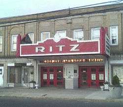 Ritz Theatre |
December 26, 2002 (#02001625) |
915 White Horse Pike 39°54′01″N 75°04′33″W |
Haddon Township | |
| 73 | St. Bartholomew Roman Catholic Church | 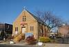 St. Bartholomew Roman Catholic Church |
December 3, 2018 (#100003202) |
751 Kaighn Ave. 39°55′53″N 75°06′50″W |
Camden | |
| 74 | Sears, Roebuck and Company Retail Department Store-Camden | 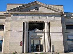 Sears, Roebuck and Company Retail Department Store-Camden |
July 27, 2000 (#00000795) |
1300 Admiral Wilson Boulevard 39°56′37″N 75°06′37″W |
Camden | Demolished in 2013.[8] |
| 75 | Edward Sharp House | 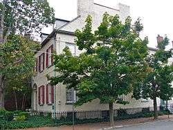 Edward Sharp House |
February 29, 1980 (#80002474) |
200 Cooper St. 39°56′50″N 75°07′30″W |
Camden | |
| 76 | Smith-Austermuhl Insurance Company | 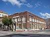 Smith-Austermuhl Insurance Company |
August 24, 1990 (#90001301) |
Northwestern corner of the junction of 5th and Market Sts. 39°56′49″N 75°07′17″W |
Camden | |
| 77 | Solomon Wesley United Methodist Church | 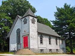 Solomon Wesley United Methodist Church |
April 10, 1989 (#89000241) |
291-B Davistown Rd./Asyla Rd. 39°47′35″N 75°02′46″W |
Blackwood | |
| 78 | South Camden Historic District | 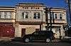 South Camden Historic District |
September 28, 1990 (#90001453) |
Roughly bounded by Jackson St., S. 4th St., Chelton Ave., and Railroad Ave. 39°55′18″N 75°07′13″W |
Camden | |
| 79 | South Camden Trust Company |  South Camden Trust Company |
August 24, 1990 (#90001255) |
Broadway at Ferry St. 39°55′19″N 75°07′12″W |
Camden | |
| 80 | South Jersey Gas, Electric and Traction Company Office Building | 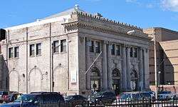 South Jersey Gas, Electric and Traction Company Office Building |
January 5, 2005 (#04001436) |
418 Federal St. 39°56′51″N 75°07′16″W |
Camden | |
| 81 | St. John's Episcopal Church and Burying Ground | 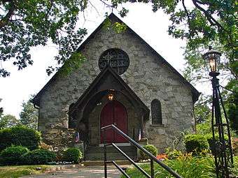 St. John's Episcopal Church and Burying Ground |
November 22, 1980 (#80002475) |
Chews Landing Rd. and Old Black Horse Pike 39°49′56″N 75°03′48″W |
Runnemede | |
| 82 | St. Joseph Polish Catholic Church | 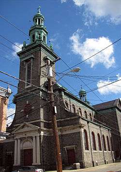 St. Joseph Polish Catholic Church |
December 18, 2003 (#03001307) |
1010 Liberty St. 39°55′49″N 75°06′36″W |
Camden | |
| 83 | Station Avenue Business District | 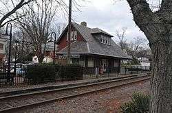 Station Avenue Business District |
November 13, 1989 (#89001945) |
Station Ave. from 7th Ave. to White Horse Pike 39°52′56″N 75°03′32″W |
Haddon Heights | |
| 84 | Stokes-Lee House | 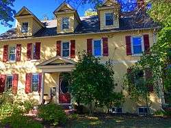 Stokes-Lee House |
September 10, 1987 (#87001519) |
615-617 Lees Ave. 39°54′31″N 75°04′12″W |
Collingswood | |
| 85 | Dr. Henry Genet Taylor House and Office | 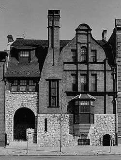 Dr. Henry Genet Taylor House and Office |
August 12, 1971 (#71000500) |
305 Cooper St. 39°56′51″N 75°07′23″W |
Camden | |
| 86 | Thackara House | 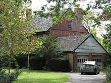 Thackara House |
September 10, 1987 (#87001520) |
912 Eldridge Ave. 39°54′29″N 75°05′17″W |
Collingswood | |
| 87 | Ephraim and Sarah Tomlinson House | 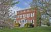 Ephraim and Sarah Tomlinson House |
April 8, 2019 (#100003592) |
710 W. Laurel Rd. 39°49′07″N 75°00′55″W |
Stratford | |
| 88 | Isaac Tomlinson House | 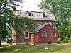 Isaac Tomlinson House |
March 9, 2005 (#05000123) |
834 Blackwood-Clementon Rd. 39°48′16″N 75°00′42″W |
Pine Hill | |
| 89 | USS New Jersey (BB-62) | 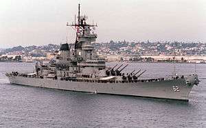 USS New Jersey (BB-62) |
September 17, 2004 (#04000980) |
62 Battleship Place 39°56′31″N 75°07′57″W |
Camden | |
| 90 | Victory Trust Company | Victory Trust Company |
August 24, 1990 (#90001257) |
Broadway and Spruce St. 39°56′06″N 75°07′11″W |
Camden | Demolished. Photo shows the replacement building. |
| 91 | Westmont Theatre | 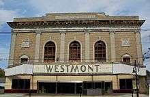 Westmont Theatre |
October 14, 2010 (#10000834) |
49 Haddon Ave. 39°54′46″N 75°03′14″W |
Haddon Township | |
| 92 | White Horse Pike Historic District | 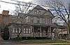 White Horse Pike Historic District |
October 27, 1988 (#88002104) |
Roughly bounded by 4th Ave., High and Haddon Sts., E. Atlantic St., the Kings Highway, and Green St. 39°52′58″N 75°03′24″W |
Haddon Heights | |
| 93 | George Whitman House |  George Whitman House |
October 11, 1990 (#90001482) |
431 Stevens St. 39°56′31″N 75°07′24″W |
Camden | Demolished.[6] Photo shows the neighboring building and the empty lot. |
| 94 | Walt Whitman House | 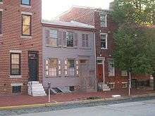 Walt Whitman House |
October 15, 1966 (#66000461) |
330 Mickle Street 39°56′33″N 75°07′26″W |
Camden | |
| 95 | Walt Whitman Neighborhood | 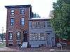 Walt Whitman Neighborhood |
January 20, 1978 (#78001752) |
326–332 Mickle Street 39°56′32″N 75°07′26″W |
Camden | |
| 96 | Wilson Building | 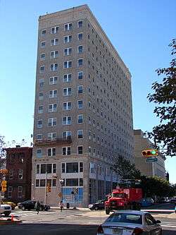 Wilson Building |
August 24, 1990 (#90001259) |
Cooper St. and Broadway 39°56′46″N 75°07′08″W |
Camden | |
| 97 | Woodlynne Log Cabin | 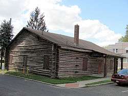 Woodlynne Log Cabin |
August 21, 1997 (#97000933) |
200 block of Cooper Ave. 39°54′58″N 75°05′45″W |
Woodlynne | |
| 98 | A.S. Woodruff and Law Buildings | 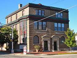 A.S. Woodruff and Law Buildings |
August 24, 1990 (#90001264) |
328-330 Market St. 39°56′45″N 75°07′23″W |
Camden |
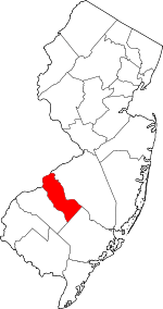
Location of Camden County in New Jersey
| Atlantic - Bergen - Burlington - Camden - Cape May - Cumberland - Essex - Gloucester - Hudson - Hunterdon - Mercer - Middlesex - Monmouth - Morris - Ocean - Passaic - Salem - Somerset - Sussex - Union - Warren |
References
| Wikimedia Commons has media related to National Register of Historic Places in Camden County, New Jersey. |
- The latitude and longitude information provided in this table was derived originally from the National Register Information System, which has been found to be fairly accurate for about 99% of listings. Some locations in this table may have been corrected to current GPS standards.
- "National Register of Historic Places: Weekly List Actions". National Park Service, United States Department of the Interior. Retrieved on June 26, 2020.
- Numbers represent an ordering by significant words. Various colorings, defined here, differentiate National Historic Landmarks and historic districts from other NRHP buildings, structures, sites or objects.
- "National Register Information System". National Register of Historic Places. National Park Service. April 24, 2008.
- The eight-digit number below each date is the number assigned to each location in the National Register Information System database, which can be viewed by clicking the number.
- "New Jersey and National Registers of Historic Places" (PDF). NJ DOP Historic Preservation Office. Archived from the original (PDF) on 4 June 2011. Retrieved 14 September 2010.
- "New Jersey and National Registers of Historic Places" (PDF). NJ Historic Preservation Office. Archived from the original (PDF) on 4 June 2011. Retrieved 11 October 2010.
- http://articles.philly.com/2013-06-07/news/39791217_1_campbell-soup-co-sears-building-former-sears
| Topics | 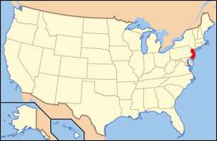 | ||
|---|---|---|---|
| Lists by county | |||
| Lists by city |
| ||
| Other lists | |||
| |||
Municipalities and communities of Camden County, New Jersey, United States | ||
|---|---|---|
| Cities | Map of New Jersey highlighting Camden County | |
| Boroughs | ||
| Townships | ||
| CDPs | ||
| Other unincorporated communities | ||
This article is issued from Wikipedia. The text is licensed under Creative Commons - Attribution - Sharealike. Additional terms may apply for the media files.