National Register of Historic Places listings in Ocean County, New Jersey
List of the National Register of Historic Places listings in Ocean County, New Jersey
| Atlantic - Bergen - Burlington - Camden - Cape May - Cumberland - Essex - Gloucester - Hudson - Hunterdon - Mercer - Middlesex - Monmouth - Morris - Ocean - Passaic - Salem - Somerset - Sussex - Union - Warren |
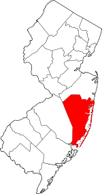
Location of Ocean County in New Jersey
This is intended to be a complete list of properties and districts listed on the National Register of Historic Places in Ocean County, New Jersey. The locations of National Register properties and districts (at least for all showing latitude and longitude coordinates below) may be seen in an online map by clicking on "Map of all coordinates".[1]
- This National Park Service list is complete through NPS recent listings posted June 19, 2020.[2]
Current listings
| [3] | Name on the Register[4] | Image | Date listed[5] | Location | City or town | Description |
|---|---|---|---|---|---|---|
| 1 | Barnegat Light Public School | 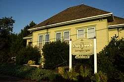 Barnegat Light Public School |
June 7, 1976 (#76001178) |
501 Central Ave. 39°45′35″N 74°06′20″W |
Barnegat Light | |
| 2 | Barnegat Lighthouse | 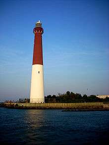 Barnegat Lighthouse |
January 25, 1971 (#71000512) |
North end of Long Beach Island, off Broadway Ave. 39°45′51″N 74°06′23″W |
Barnegat Light | |
| 3 | Bartlett-Rockhill-Bartlett House | January 20, 2012 (#11001041) |
Bartlett Ln. 39°36′04″N 74°20′35″W |
Tuckerton | ||
| 4 | Bay Head Historic District | .JPG) Bay Head Historic District |
February 1, 2006 (#05001566) |
Roughly bounded by Point Pleasant Beach Borough line, Atlantic Ocean, Mantoloking Borough line and Point Pleasant 40°04′18″N 74°02′51″W |
Bay Head | |
| 5 | Beach Haven Historic District |  Beach Haven Historic District |
July 14, 1983 (#83001608) |
Roughly bounded by Bay and Atlantic Avenues, Pearl and 3rd Streets; later roughly bounded by Atlantic, Bay, 5th and Chatsworth 39°33′32″N 74°14′31″W |
Beach Haven | Second set of addresses represents a boundary increase November 19, 2014. Also includes Converse Cottage and Dr. Edward H. Williams House |
| 6 | Capt. Amos Birdsall House |  Capt. Amos Birdsall House |
May 13, 1982 (#82003298) |
234 Washington St. 39°57′08″N 74°11′30″W |
Toms River | |
| 7 | A.A. Brant House |  A.A. Brant House |
May 13, 1982 (#82003294) |
9 Allen St. 39°57′04″N 74°11′43″W |
Toms River | |
| 8 | Cassville Crossroads Historic District | .JPG) Cassville Crossroads Historic District |
August 26, 1982 (#82003291) |
Junction of CR 571 and CR 528 40°06′17″N 74°23′14″W |
Jackson Township | |
| 9 | Cavalry Cottage |  Cavalry Cottage |
September 22, 2006 (#06000871) |
100 Stafford Ave. 39°41′50″N 74°15′19″W |
Stafford Township | |
| 10 | Cedar Bridge Tavern | 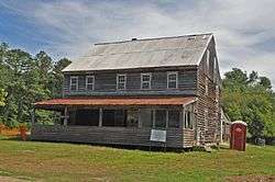 Cedar Bridge Tavern |
August 7, 2013 (#13000586) |
200 Old Halfway Rd.[6] 39°47′00″N 74°21′38″W |
Barnegat Township | |
| 11 | Converse Cottage |  Converse Cottage |
July 14, 1983 (#83001609) |
500 South Atlantic Avenue 39°33′32″N 74°14′23″W |
Beach Haven | Part of Beach Haven MRA |
| 12 | Mary Etta Cox House |  Mary Etta Cox House |
March 9, 2005 (#05000124) |
353 N. Main St. 39°45′13″N 74°13′26″W |
Barnegat | |
| 13 | Crawford House |  Crawford House |
May 13, 1982 (#82003295) |
46 E. Water St. 39°57′03″N 74°11′46″W |
Toms River | |
| 14 | Double Trouble Historic District | 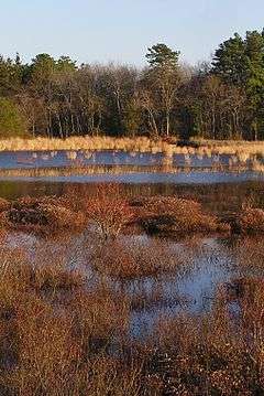 Double Trouble Historic District |
February 23, 1978 (#78001787) |
S of Beachwood off Garden State Pkwy. 39°53′51″N 74°13′37″W |
Bayville | |
| 15 | Falkinburg Farmstead | 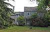 Falkinburg Farmstead |
August 12, 1993 (#93000829) |
28 Westcott Ave., Ocean Township 39°47′03″N 74°11′35″W |
Waretown | |
| 16 | Elizabeth Sculthorp Force House |  Elizabeth Sculthorp Force House |
February 4, 2019 (#100003403) |
26 Hadley Ave. 39°57′10″N 74°11′27″W |
Toms River Township | |
| 17 | Georgian Court |  Georgian Court |
December 20, 1978 (#78001788) |
Lakewood Avenue 40°05′52″N 74°13′37″W |
Lakewood | Also known as George Jay Gould Estate |
| 18 | Capt. George W. Giberson House |  Capt. George W. Giberson House |
August 12, 1982 (#82004693) |
54 E. Water St. 39°57′03″N 74°11′46″W |
Toms River | |
| 19 | Hangar No. 1, Lakehurst Naval Air Station | 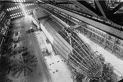 Hangar No. 1, Lakehurst Naval Air Station |
May 23, 1968 (#68000031) |
N of Lakehurst on CR 547 40°01′44″N 74°18′59″W |
Manchester Township | |
| 20 | Horner House |  Horner House |
May 13, 1982 (#82003296) |
44 E. Water St. 39°57′04″N 74°11′47″W |
Toms River | |
| 21 | L. Ron Hubbard Residence at Bay Head |  L. Ron Hubbard Residence at Bay Head |
May 17, 2018 (#100001777) |
44 666 East Ave. 40°03′50″N 74°02′40″W |
Bay Head | |
| 22 | Island Heights Historic District |  Island Heights Historic District |
July 8, 1982 (#82003290) |
Roughly bounded by Toms River, Summit and River Aves. 39°56′26″N 74°08′43″W |
Island Heights | |
| 23 | Little Egg Harbor Friends Meeting House | 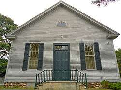 Little Egg Harbor Friends Meeting House |
December 9, 2002 (#02001511) |
21 E. Main St. 39°36′12″N 74°20′29″W |
Tuckerton | |
| 24 | Manahawkin Baptist Church | 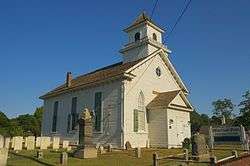 Manahawkin Baptist Church |
April 3, 1973 (#73001131) |
N. Main St. (US 9) and Lehigh Ave. 39°41′55″N 74°15′29″W |
Manahawkin | |
| 25 | Manitou Park School House |  Manitou Park School House |
March 15, 2005 (#05000177) |
167 Third Ave. 39°56′48″N 74°13′03″W |
Berkeley | |
| 26 | Ocean County Courthouse |  Ocean County Courthouse |
August 16, 1983 (#83001610) |
Washington St. 39°57′10″N 74°11′41″W |
Toms River | |
| 27 | Ocean County Jail |  Ocean County Jail |
August 16, 1983 (#83001611) |
Sheriff St. 39°57′12″N 74°11′41″W |
Toms River | |
| 28 | Orient Baptist Church | .JPG) Orient Baptist Church |
August 10, 1977 (#77000902) |
NJ 88 40°04′11″N 74°07′40″W |
Laurelton | |
| 29 | Stewart House |  Stewart House |
May 13, 1982 (#82003297) |
57 E. Water St. 39°57′03″N 74°11′46″W |
Toms River | |
| 30 | Stoutenburgh-Minturn House |  Stoutenburgh-Minturn House |
May 13, 1982 (#82003293) |
86 E. Water St. 39°57′02″N 74°11′36″W |
Toms River | |
| 31 | Strand Theatre | 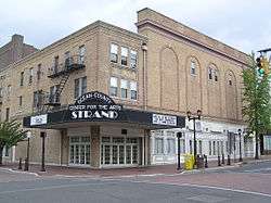 Strand Theatre |
April 22, 1982 (#82003292) |
400 Clifton Ave. 40°05′39″N 74°12′57″W |
Lakewood | |
| 32 | Torrey-Larrabee Store |  Torrey-Larrabee Store |
February 21, 1997 (#97000104) |
11 Union Ave. 40°06′09″N 74°18′34″W |
Lakehurst | |
| 33 | U.S. Life Saving Station Station No. 14 |  U.S. Life Saving Station Station No. 14 |
January 30, 1978 (#78001789) |
S of Seaside Park on Island Beach State Park 39°56′01″N 74°04′17″W |
Seaside Park | |
| 34 | Whitesbog Historic District |  Whitesbog Historic District |
October 27, 1988 (#88002115) |
N of SR 70 and S of Fort Dix 39°57′36″N 74°29′23″W |
Whiting | Extends into Burlington County |
| 35 | Dr. Edward H. Williams House |  Dr. Edward H. Williams House |
July 14, 1983 (#83001612) |
506 South Atlantic Avenue 39°33′30″N 74°14′24″W |
Beach Haven | Part of Beach Haven MRA |
References
- The latitude and longitude information provided in this table was derived originally from the National Register Information System, which has been found to be fairly accurate for about 99% of listings. Some locations in this table may have been corrected to current GPS standards.
- "National Register of Historic Places: Weekly List Actions". National Park Service, United States Department of the Interior. Retrieved on June 19, 2020.
- Numbers represent an ordering by significant words. Various colorings, defined here, differentiate National Historic Landmarks and historic districts from other NRHP buildings, structures, sites or objects.
- "National Register Information System". National Register of Historic Places. National Park Service. April 24, 2008.
- The eight-digit number below each date is the number assigned to each location in the National Register Information System database, which can be viewed by clicking the number.
- Gall, Michael J., and Brock Giordano. Phase I and Extended Phase I Archaeological Investigation: Ocean Bridge Tavern (28-Oc-162). West Long Branch: Monmouth U, 2011-04, 1-5/1-6.
| Wikimedia Commons has media related to National Register of Historic Places in Ocean County, New Jersey. |
| Topics | 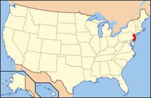 | ||
|---|---|---|---|
| Lists by county | |||
| Lists by city |
| ||
| Other lists | |||
| |||
This article is issued from Wikipedia. The text is licensed under Creative Commons - Attribution - Sharealike. Additional terms may apply for the media files.