National Register of Historic Places listings in Franklin Lakes, New Jersey
The table below includes 14 sites listed on the National Register of Historic Places in the Borough of Franklin Lakes, New Jersey in Bergen County. Latitude and longitude coordinates of the sites listed on this page may be displayed in a map or exported in several formats by clicking on one of the links in the box below the map to the right.[1]
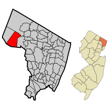
Map of Bergen County, New Jersey, highlighting Franklin Lakes
| Atlantic - Bergen - Burlington - Camden - Cape May - Cumberland - Essex - Gloucester - Hudson - Hunterdon - Mercer - Middlesex - Monmouth - Morris - Ocean - Passaic - Salem - Somerset - Sussex - Union - Warren |
National Register listings elsewhere in Bergen County may be found in separate articles.
- This National Park Service list is complete through NPS recent listings posted June 19, 2020.[2]
Current listings
| [3] | Name on the Register[4] | Image | Date listed[5] | Location | Description |
|---|---|---|---|---|---|
| 1 | Ackerman-Boyd House | 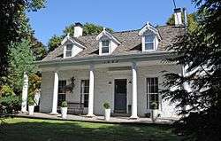 Ackerman-Boyd House |
January 9, 1983 (#83001452) |
1095 Franklin Lake Rd. 40°59′59″N 74°14′14″W |
|
| 2 | Blauvelt House |  Blauvelt House |
August 8, 1985 (#85002590) |
205 Woodside Ave. 41°01′48″N 74°10′49″W |
|
| 3 | De Gray House | 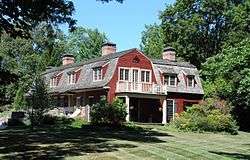 De Gray House |
January 9, 1983 (#83001489) |
650 Ewing Ave. 41°00′07″N 74°11′51″W |
|
| 4 | Packer House |  Packer House |
January 9, 1983 (#83001540) |
600 Ewing Ave. 41°00′17″N 74°11′43″W |
|
| 5 | Albert Pulis House |  Albert Pulis House |
January 9, 1983 (#83001544) |
322 Pulis Ave. 41°01′49″N 74°11′44″W |
|
| 6 | Reaction Motors Rocket Test Facility | 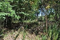 Reaction Motors Rocket Test Facility |
June 6, 1979 (#79001472) |
936 Dogwood Trail 40°59′53″N 74°13′41″W |
|
| 7 | Storms House | 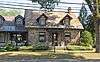 Storms House |
July 24, 1984 (#84002586) |
1069 Franklin Lake Rd. 40°59′56″N 74°14′06″W |
|
| 8 | Van Blarcom House |  Van Blarcom House |
July 24, 1984 (#84002588) |
834 Franklin Lake Rd. 40°59′33″N 74°12′55″W |
|
| 9 | Van Houten House |  Van Houten House |
January 9, 1983 (#83001576) |
778 Vee Dr. 40°59′33″N 74°11′40″W |
Demolished |
| 10 | Van Houten-Ackerman House |  Van Houten-Ackerman House |
January 9, 1983 (#83001573) |
1150 Franklin Lake Rd. 40°59′57″N 74°14′33″W |
|
| 11 | Van Koert-Winters House | 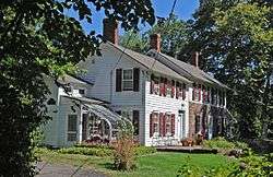 Van Koert-Winters House |
July 24, 1984 (#84002593) |
615 Franklin Ave. 41°00′48″N 74°11′45″W |
|
| 12 | Van Winkle House |  Van Winkle House |
July 24, 1984 (#84002595) |
798 Franklin Lake Rd. 40°59′35″N 74°12′44″W |
|
| 13 | Aaron Winters House |  Aaron Winters House |
July 24, 1984 (#84002599) |
358 Woodside Ave. 41°01′26″N 74°11′19″W |
|
| 14 | Winters-Courter House |  Winters-Courter House |
January 9, 1983 (#83001589) |
831 Circle Ave. 41°01′40″N 74°12′25″W |
References
| Wikimedia Commons has media related to National Register of Historic Places in Bergen County, New Jersey. |
- The latitude and longitude information provided in this table was derived originally from the National Register Information System, which has been found to be fairly accurate for about 99% of listings. Some locations in this table may have been corrected to current GPS standards.
- "National Register of Historic Places: Weekly List Actions". National Park Service, United States Department of the Interior. Retrieved on June 19, 2020.
- Numbers represent an ordering by significant words. Various colorings, defined here, differentiate National Historic Landmarks and historic districts from other NRHP buildings, structures, sites or objects.
- "National Register Information System". National Register of Historic Places. National Park Service. July 9, 2010.
- The eight-digit number below each date is the number assigned to each location in the National Register Information System database, which can be viewed by clicking the number.
| Topics | 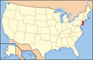 | ||
|---|---|---|---|
| Lists by county | |||
| Lists by city |
| ||
| Other lists | |||
| |||
Municipalities and communities of Bergen County, New Jersey, United States | ||
|---|---|---|
| Cities | 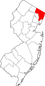 Map of New Jersey highlighting Bergen County | |
| Boroughs |
| |
| Townships | ||
| Villages | ||
| Unincorporated communities | ||
This article is issued from Wikipedia. The text is licensed under Creative Commons - Attribution - Sharealike. Additional terms may apply for the media files.