National Register of Historic Places listings in Burlington County, New Jersey
List of the National Register of Historic Places listings in Burlington County, New Jersey
| Atlantic - Bergen - Burlington - Camden - Cape May - Cumberland - Essex - Gloucester - Hudson - Hunterdon - Mercer - Middlesex - Monmouth - Morris - Ocean - Passaic - Salem - Somerset - Sussex - Union - Warren |
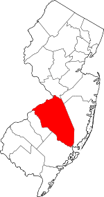
Location of Burlington County in New Jersey
This is intended to be a complete list of properties and districts listed on the National Register of Historic Places in Burlington County, New Jersey. The locations of National Register properties and districts (at least for all showing latitude and longitude coordinates below) may be seen in a map by clicking on "Map of all coordinates".[1]
- This National Park Service list is complete through NPS recent listings posted June 19, 2020.[2]
| [3] | Name on the Register[4] | Image | Date listed[5] | Location | City or town | Description |
|---|---|---|---|---|---|---|
| 1 | Abbott Farm Archeological Site |  Abbott Farm Archeological Site |
December 8, 1976 (#76001158) |
Hamilton-Trenton-Bordentown Marsh, other nearby public and private lands 40°11′10″N 74°43′37″W |
Bordentown and Bordentown Township[6] | Extends into Mercer County. |
| 2 | William R. Allen School | 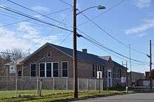 William R. Allen School |
August 8, 1991 (#90001450) |
Junction of Mitchell Avenue and East Federal Street 40°04′26″N 74°51′05″W |
Burlington | |
| 3 | Arney's Mount Friends Meetinghouse and Burial Ground | .JPG) Arney's Mount Friends Meetinghouse and Burial Ground |
January 18, 1973 (#73001083) |
Junction of Mount Holly-Juliustown and Pemberton-Arney's Mount Roads 40°00′33″N 74°41′50″W |
Arney's Mount | |
| 4 | Arneytown Historic District | 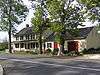 Arneytown Historic District |
December 12, 1977 (#67451850) |
North of Jacobstown 40°06′07″N 74°34′07″W |
Jacobstown | |
| 5 | Atsion Village | 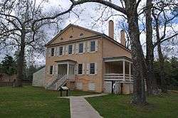 Atsion Village |
October 22, 1974 (#74001154) |
US 206 39°44′27″N 74°43′29″W |
Atsion | |
| 6 | Batsto Village | 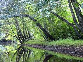 Batsto Village |
September 10, 1971 (#71000495) |
10 miles (16 km) east of Hammonton on CR 542 39°38′28″N 74°38′49″W |
Batsto Village | |
| 7 | Bead Wreck Site | October 18, 1988 (#88001899) |
Address Restricted |
New Gretna | ||
| 8 | Beverly National Cemetery | 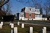 Beverly National Cemetery |
October 15, 1997 (#97001201) |
Bridgeboro Road, junction of Mt. Holly, and Bridgeboro Roads 40°03′16″N 74°55′14″W |
Edgewater Park Township | |
| 9 | Birmingham School | .JPG) Birmingham School |
December 31, 1992 (#92001683) |
Birmingham Road, north of North Branch Rancocas Creek 39°58′47″N 74°42′40″W |
Birmingham | Destroyed by fire in July 1993 |
| 10 | Bishop-Irick Farmstead | .JPG) Bishop-Irick Farmstead |
August 4, 1992 (#92000975) |
17 Pemberton Road 39°56′23″N 74°44′44″W |
Vincentown | |
| 11 | Bordentown Historic District | 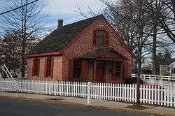 Bordentown Historic District |
June 14, 1982 (#82003264) |
In an irregular pattern within the city limits 40°08′47″N 74°42′41″W |
Bordentown | Boundary increase 2014-09-03. |
| 12 | Breidenhart | .JPG) Breidenhart |
December 22, 1977 (#77000851) |
255 East Main Street 39°58′09″N 74°56′08″W |
Moorestown Township | |
| 13 | J. F. Budd Baby Shoe Factory |  J. F. Budd Baby Shoe Factory |
December 13, 2000 (#00001525) |
231 Penn Avenue 40°04′51″N 74°51′15″W |
Burlington | |
| 14 | Burlington County Prison | .jpg) Burlington County Prison |
June 24, 1986 (#86003558) |
High Street 39°59′47″N 74°47′23″W |
Mount Holly Township | |
| 15 | Burlington Historic District | 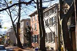 Burlington Historic District |
March 13, 1975 (#75001124) |
Roughly L-shaped, bounded by the Delaware River and High, West Broad, Talbot, and Reed Streets 40°04′43″N 74°51′50″W |
Burlington | |
| 16 | Burlington's Lost Burial Ground | 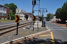 Burlington's Lost Burial Ground |
November 26, 2004 (#04001260) |
Address Restricted 40°04′44″N 74°51′37″W |
Burlington | |
| 17 | Buzby's General Store | 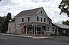 Buzby's General Store |
March 25, 2004 (#04000222) |
3959 CR 563 39°49′09″N 74°32′08″W |
Woodland Township | |
| 18 | Chesterford School | 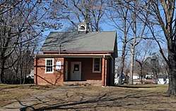 Chesterford School |
December 23, 2009 (#09001155) |
415 W. Main St. 39°57′19″N 75°00′32″W |
Maple Shade | |
| 19 | Cinnaminson Avenue and Spring Garden Street Schools | 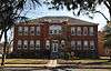 Cinnaminson Avenue and Spring Garden Street Schools |
May 29, 1992 (#92000635) |
Spring Garden Street between Cinnaminson and Parry Avenues 39°59′49″N 75°01′15″W |
Palmyra | |
| 20 | Isaac Collins House | 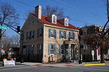 Isaac Collins House |
July 24, 1992 (#92000926) |
201 Broad Street 40°04′42″N 74°52′01″W |
Burlington | |
| 21 | Benjamin Cooper Farm | December 12, 1978 (#78001744) |
Address Restricted |
Moorestown Township | Known also as Savich Farm, no buildings on site. | |
| 22 | Coopertown Meetinghouse | 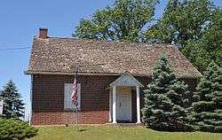 Coopertown Meetinghouse |
May 22, 1978 (#78001750) |
Northwest of Willingboro on Cooper Street 40°02′55″N 74°54′16″W |
Willingboro Township | |
| 23 | Cropwell Friends Meeting House | 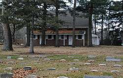 Cropwell Friends Meeting House |
August 14, 1992 (#92000976) |
810 Cropwell Road 39°53′36″N 74°55′32″W |
Evesham Township | |
| 24 | Crosswicks | 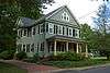 Crosswicks |
May 3, 1976 (#76001146) |
Roughly bounded by Bordentown-Crosswicks and Ellisdale Roads 40°09′07″N 74°38′47″W |
Crosswicks | |
| 25 | Crosswicks Creek Site III | 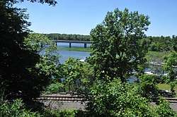 Crosswicks Creek Site III |
November 26, 1990 (#87001795) |
Address Restricted |
Bordentown | |
| 26 | Eayres Plantation and Mill Site | 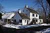 Eayres Plantation and Mill Site |
August 13, 1986 (#86001501) |
Eayrestown-Red Lion and East Bella Bridge Roads 39°56′48″N 74°47′41″W |
Lumberton Township | |
| 27 | Amos Evans House | 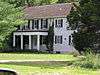 Amos Evans House |
September 2, 1994 (#94001008) |
501 East Main Street 39°53′05″N 74°53′49″W |
Evesham Township | |
| 28 | William and Susan Evans House | .JPG) William and Susan Evans House |
August 14, 1992 (#92000978) |
2 Bill's Lane, Evesham Township 39°52′24″N 74°54′12″W |
Evesham Township | |
| 29 | Evans-Cooper House | .JPG) Evans-Cooper House |
August 26, 1993 (#93000868) |
North Elmwood Road between NJ 70 and Marlton Pike 39°53′22″N 74°53′07″W |
Evesham Township | |
| 30 | Thomas and Mary Evens House | .JPG) Thomas and Mary Evens House |
August 26, 1993 (#93000867) |
South Elmwood Road 39°52′51″N 74°53′19″W |
Evesham Township | |
| 31 | Evesham Friends Meeting House | .JPG) Evesham Friends Meeting House |
April 22, 1982 (#82003268) |
Moorestown-Mt. Laurel and Hainesport-Mt. Laurel Roads (Evesboro Road) 39°56′05″N 74°53′32″W |
Mount Laurel Township | |
| 32 | Farmer's Hall | .JPG) Farmer's Hall |
August 1, 1979 (#79003248) |
Moorestown-Mt. Laurel and Hainesport-Mt. Laurel Roads (Evesboro Road) 39°56′02″N 74°53′32″W |
Mount Laurel Township | |
| 33 | Fenwick Manor | .JPG) Fenwick Manor |
October 25, 1990 (#90001549) |
15 Springfield Road 39°57′53″N 74°37′44″W |
Pemberton Township | |
| 34 | Florence Public School No. 1 | 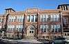 Florence Public School No. 1 |
June 8, 2015 (#15000321) |
203 W. 2nd St. 40°07′19″N 74°48′27″W |
Florence Township | |
| 35 | Thomas French, Jr., House | .JPG) Thomas French, Jr., House |
January 9, 1978 (#78001745) |
512 Camden Avenue 39°57′29″N 74°58′00″W |
Moorestown Township | |
| 36 | Gen. Edward S. Godfrey House | 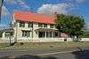 Gen. Edward S. Godfrey House |
February 28, 1997 (#97000064) |
27 Main Street 40°02′50″N 74°33′52″W |
Cookstown | |
| 37 | Green Hill Farm | 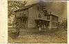 Green Hill Farm |
July 8, 1982 (#82003265) |
Oxmead and Deacon Roads 40°02′43″N 74°48′54″W |
Burlington Township | |
| 38 | Jonathan Haines House | 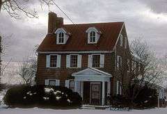 Jonathan Haines House |
June 16, 1976 (#76001147) |
Northeast of Medford on Fostertown Road 39°56′29″N 74°47′05″W |
Medford | |
| 39 | Hanover Furnace | .JPG) Hanover Furnace |
March 1, 1974 (#74001155) |
Address Restricted |
Browns Mills | |
| 40 | High Street Historic District | 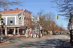 High Street Historic District |
December 15, 1993 (#93001386) |
Roughly, High Street from Pearl Street to Federal Street; 6 West Pearl Street 40°04′38″N 74°51′31″W |
Burlington | Boundary increased 8/25/14. |
| 41 | Thomas Hollinshead House | 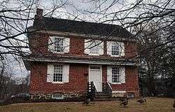 Thomas Hollinshead House |
August 14, 1992 (#92000977) |
18 West Stow Road 39°54′47″N 74°55′26″W |
Marlton | |
| 42 | James and Charles B. Holloway Farm Complex | 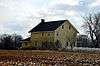 James and Charles B. Holloway Farm Complex |
July 8, 1982 (#82003266) |
Newbold Lane 40°06′47″N 74°38′59″W |
Chesterfield Township | |
| 43 | Francis Hopkinson House | .jpg) Francis Hopkinson House |
July 17, 1971 (#71000496) |
101 Farnsworth Avenue at Park Avenue 40°08′54″N 74°42′50″W |
Bordentown | |
| 44 | John Inskeep Homestead | .JPG) John Inskeep Homestead |
August 26, 1993 (#93000866) |
70 North Locust Ave 39°53′50″N 74°55′00″W |
Marlton | |
| 45 | John Irick House | 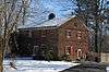 John Irick House |
September 16, 1977 (#77000849) |
East of Burlington, off of the New Jersey Turnpike 40°03′02″N 74°45′48″W |
Burlington | |
| 46 | Ivins-Conover House | 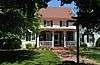 Ivins-Conover House |
April 29, 1977 (#77000852) |
North of Moorestown off U.S. 130 on Cox Road 40°00′10″N 74°55′07″W |
Moorestown Township | |
| 47 | Jacob's Chapel A.M.E. Church | 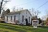 Jacob's Chapel A.M.E. Church |
November 10, 2015 (#13000137) |
311-313 Elbo Ln. 39°55′47″N 74°53′07″W |
Mount Laurel vicinity | |
| 48 | Benjamin Jones House |  Benjamin Jones House |
November 30, 1982 (#82001042) |
Pemberton-Browns Mills Road 39°58′12″N 74°37′31″W |
Pemberton | |
| 49 | Kirby's Mill | .JPG) Kirby's Mill |
August 12, 1971 (#71000497) |
Northeast of Medford at Church and Fostertown Roads 39°55′00″N 74°48′22″W |
Medford | |
| 50 | Log Cabin Lodge | 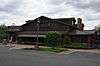 Log Cabin Lodge |
April 12, 1982 (#82003267) |
Stokes and Tabernacle Roads 39°51′49″N 74°48′21″W |
Medford Lakes | Burned down in 1998, photo is of replacement building |
| 51 | Main Street Friends Meeting House | 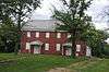 Main Street Friends Meeting House |
August 24, 2011 (#11000589) |
19 South St. 39°53′50″N 74°49′24″W |
Medford vicinity | |
| 52 | Moorestown Friends School and Meetinghouse | .JPG) Moorestown Friends School and Meetinghouse |
July 22, 1988 (#86003796) |
Main Street at Chester Avenue 39°57′49″N 74°56′30″W |
Moorestown Township | |
| 53 | Moorestown Historic District | .JPG) Moorestown Historic District |
August 30, 1990 (#89002295) |
Roughly bounded by Maple Avenue, Chestnust Avenue, Main Street from Zelley Avenue to Locust Street, and Mill Street 39°57′58″N 74°56′13″W |
Moorestown Township | |
| 54 | Morris Mansion and Mill | .JPG) Morris Mansion and Mill |
September 13, 1977 (#77000855) |
Hanover Street 39°58′15″N 74°41′04″W |
Pemberton | |
| 55 | Mount Holly Historic District | .JPG) Mount Holly Historic District |
February 20, 1973 (#73001084) |
Roughly bounded by Prospect, Elm and Top-E-Toy Streets, railroad tracks, Madison and Clifton Avenues 39°59′37″N 74°47′16″W |
Mount Holly Township | |
| 56 | New Jersey Manual Training and Industrial School for Colored Youth | 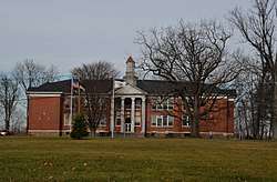 New Jersey Manual Training and Industrial School for Colored Youth |
January 5, 1998 (#97001563) |
North of Burlington Road, west of I-295 40°08′29″N 74°43′25″W |
Bordentown | |
| 57 | New St. Mary's Episcopal Church | 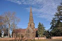 New St. Mary's Episcopal Church |
May 31, 1972 (#72000770) |
North side of Broad Street between Talbot and Wood Streets 40°04′37″N 74°51′43″W |
Burlington | |
| 58 | Barzillai Newbold House | 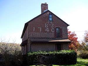 Barzillai Newbold House |
January 26, 1978 (#78001749) |
East of Columbus on Columbus-Georgetown Roads 40°03′56″N 74°40′04″W |
Columbus | |
| 59 | William and Susannah Newbold House | 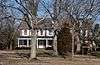 William and Susannah Newbold House |
September 29, 1980 (#80002472) |
East of Georgetown 40°04′55″N 74°37′41″W |
Georgetown | |
| 60 | North Pemberton Railroad Station | 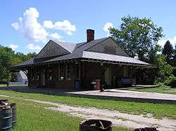 North Pemberton Railroad Station |
May 23, 1978 (#78001746) |
Hanover Street 39°58′36″N 74°40′54″W |
Pemberton | 1892-built former Pennsylvania Railroad station |
| 61 | Oakwood | January 30, 1978 (#78001751) |
West of Wrightstown on Springfield Meeting Road 40°03′07″N 74°38′21″W |
Wrightstown | Destroyed by fire July 20, 2002 | |
| 62 | Old Schoolhouse | 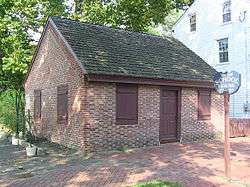 Old Schoolhouse |
November 26, 2008 (#08001108) |
35 Brainerd Street 39°59′41″N 74°47′12″W |
Mount Holly Township | |
| 63 | Alice Paul Birthplace | 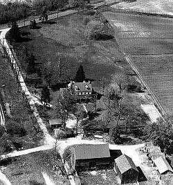 Alice Paul Birthplace |
July 5, 1989 (#89000774) |
128 Hooton Road 39°57′24″N 74°55′50″W |
Mount Laurel Township | Also known as Paulsdale |
| 64 | Peachfield | 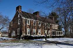 Peachfield |
June 19, 1973 (#73001085) |
N of Mount Holly on Burr Rd. 40°02′06″N 74°48′09″W |
Mount Holly Township | |
| 65 | Pearson-How, Cooper, and Lawrence Houses | 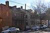 Pearson-How, Cooper, and Lawrence Houses |
April 26, 1978 (#78001743) |
453–459 High Street 40°04′33″N 74°51′27″W |
Burlington | |
| 66 | Pemberton Historic District | .JPG) Pemberton Historic District |
March 22, 1989 (#88000688) |
Roughly bounded by Budd Avenue, Budd's Run, Egbert and Cedar Road, and Rancocas Creek and NJ Central Power and Light Company 39°58′12″N 74°41′01″W |
Pemberton | |
| 67 | Perkins House | 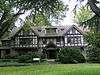 Perkins House |
September 15, 1977 (#77000853) |
Camden Avenue and King's Highway 39°57′34″N 74°57′32″W |
Moorestown Township | |
| 68 | Philadelphia Watch Case Company Building | 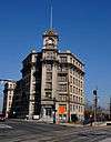 Philadelphia Watch Case Company Building |
January 31, 1978 (#78001747) |
Pavilion and Lafayette Avenues 40°02′24″N 74°57′34″W |
Riverside Township | |
| 69 | Point Breeze | 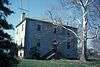 Point Breeze |
August 10, 1977 (#77000848) |
US 206 and Park Street 40°09′22″N 74°42′30″W |
Bordentown | |
| 70 | The Protestant Community Church of Medford Lakes | 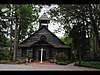 The Protestant Community Church of Medford Lakes |
July 3, 2017 (#100001263) |
100 Stokes Rd. 39°51′44″N 74°48′19″W |
Medford Lakes | |
| 71 | Providence Presbyterian Church of Bustleton | 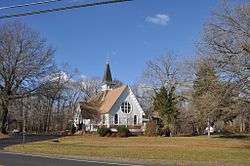 Providence Presbyterian Church of Bustleton |
November 18, 1988 (#87000377) |
Junction of Old York and Burlington-Bustleton Roads 40°05′16″N 74°47′02″W |
Roebling | |
| 72 | Quaker School | 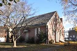 Quaker School |
December 31, 1974 (#74001156) |
York and Penn Streets 40°04′48″N 74°51′22″W |
Burlington | |
| 73 | Rancocas Historic Village | 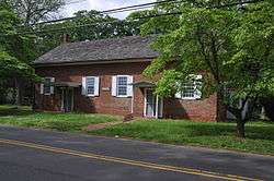 Rancocas Historic Village |
June 5, 1975 (#75001126) |
Irregular pattern bounded north and west by Willingboro line, east to Springside Road and to South 3rd Street 40°00′37″N 74°52′01″W |
Rancocas | |
| 74 | Recklesstown | 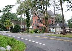 Recklesstown |
August 19, 1975 (#75001125) |
Present town of Chesterfield along Chesterfield-Georgetown Road and CR 528 40°06′49″N 74°38′15″W |
Chesterfield | |
| 75 | Red Dragon Canoe Club | 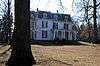 Red Dragon Canoe Club |
February 2, 2001 (#01000041) |
221 Edgewater Avenue 40°04′11″N 74°53′53″W |
Edgewater Park Township | |
| 76 | William Ridgeway House | 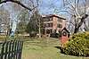 William Ridgeway House |
January 11, 2019 (#100003304) |
149 Juliustown Road 40°00′45″N 74°42′31″W |
Springfield Township | |
| 77 | Riverton Historic District | 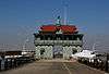 Riverton Historic District |
March 5, 1999 (#99000271) |
Roughly bounded by the Delaware River, Park Avenue, Thomas Avenue, and Fulton Street 40°00′33″N 75°00′50″W |
Riverton | |
| 78 | Roebling Historic District | 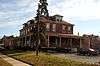 Roebling Historic District |
May 22, 1978 (#78001748) |
Roughly bounded by Roebling Park, South Street, 2nd and 8th Avenues, Roland Street, Alden, Norman Railroad, and Amboy Avenue 40°07′01″N 74°46′30″W |
Roebling | |
| 79 | Rosebud Farm | .JPG) Rosebud Farm |
August 17, 1979 (#79003249) |
East of Jobstown on Springfield Meetinghouse Road 40°02′19″N 74°39′42″W |
Jobstown | |
| 80 | Schoolhouse | 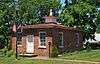 Schoolhouse |
April 21, 1975 (#75001123) |
2 miles (3.2 km) east of Bridgeboro on Salem Road 40°01′49″N 74°53′46″W |
Bridgeboro | |
| 81 | Shamong Hotel | 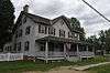 Shamong Hotel |
September 13, 1979 (#79001477) |
Main Street 39°49′05″N 74°32′08″W |
Chatsworth | |
| 82 | Singleton-Lathem-Large House | 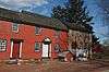 Singleton-Lathem-Large House |
March 7, 1979 (#79001478) |
Northwest of Chesterfield on CR 528 40°08′33″N 74°40′46″W |
Chesterfield Township | |
| 83 | Smith Mansion | .JPG) Smith Mansion |
October 22, 1976 (#76001148) |
12 High Street 39°57′46″N 74°56′51″W |
Moorestown Township | |
| 84 | Thomas Smith House | 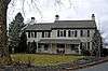 Thomas Smith House |
September 27, 1990 (#90001437) |
1645 Hainesport-Mt. Laurel Road 39°55′08″N 74°54′58″W |
Mount Laurel Township | |
| 85 | Smithville Historic District | .JPG) Smithville Historic District |
May 12, 1977 (#77000856) |
Smithville Rd., Forest, Railroad, Park, and Maple Aves., River St., and Smithville Lake 39°58′57″N 74°45′04″W |
Smithville | |
| 86 | St. Mary of the Lakes Catholic Church | 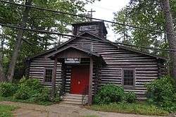 St. Mary of the Lakes Catholic Church |
April 27, 2007 (#07000357) |
108 Stokes Road 39°51′45″N 74°48′19″W |
Medford Lakes | |
| 87 | St. Stephens Episcopal Church | 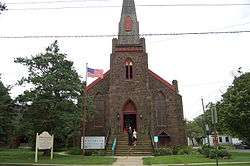 St. Stephens Episcopal Church |
November 25, 1999 (#99001363) |
158 Warren Street 40°03′52″N 74°55′01″W |
Beverly City | |
| 88 | Springside Public School | 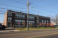 Springside Public School |
March 17, 2015 (#15000091) |
1508 Mount Holly Rd. 40°03′27″N 74°50′51″W |
Burlington Township | |
| 89 | Dr. James Still Office | .JPG) Dr. James Still Office |
November 3, 1995 (#95001190) |
209 Church Road 39°54′56″N 74°49′29″W |
Medford | |
| 90 | Charles Stokes House | 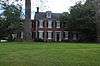 Charles Stokes House |
August 12, 1993 (#93000827) |
600 Beverly-Rancocas Road, Willingboro Township 40°00′44″N 74°52′30″W |
Willingboro Township | |
| 91 | Stokes-Evans House | 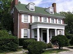 Stokes-Evans House |
August 30, 1994 (#94001009) |
52 East Main Street 39°53′26″N 74°55′03″W |
Marlton | |
| 92 | Taylor-Newbold House | 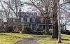 Taylor-Newbold House |
November 18, 1988 (#87001815) |
Off Old York Road (CR 660) 40°06′56″N 74°40′06″W |
Chesterfield Township | |
| 93 | Town Hall | 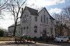 Town Hall |
August 10, 1977 (#77000854) |
40 East Main Street 39°57′51″N 74°56′42″W |
Moorestown Township | |
| 94 | Upper Springfield Meetinghouse | .JPG) Upper Springfield Meetinghouse |
August 24, 1979 (#79001479) |
West of Wrightstown 40°02′40″N 74°38′30″W |
Wrightstown | |
| 95 | Vincentown Historic District | .JPG) Vincentown Historic District |
September 21, 1988 (#87002107) |
Roughly bounded by Mill, Church, Pleasant, Main, and Race Streets, and Red Lion Road 39°56′05″N 74°45′02″W |
Vincentown | |
| 96 | West Hill | 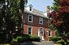 West Hill |
December 18, 2013 (#13000944) |
1114 Oxmead Rd. 40°03′17″N 74°49′38″W |
Burlington | |
| 97 | Whitesbog Historic District | 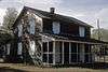 Whitesbog Historic District |
October 27, 1988 (#88002115) |
North of NJ 70 and south of Fort Dix 39°57′34″N 74°30′34″W |
Browns Mills | Extends into Ocean County |
| 98 | Jacob Wills House | 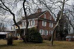 Jacob Wills House |
November 1, 1990 (#89002296) |
Brick Road, west of Evans Road 39°52′46″N 74°54′02″W |
Evesham Township | |
| 99 | Zurbrugg Mansion | 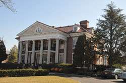 Zurbrugg Mansion |
August 28, 2009 (#09000651) |
531 Delaware Avenue 40°03′03″N 74°37′53″W |
Delanco |
See also
| Wikimedia Commons has media related to National Register of Historic Places in Burlington County, New Jersey. |
References
- The latitude and longitude information provided in this table was derived originally from the National Register Information System, which has been found to be fairly accurate for about 99% of listings. Some locations in this table may have been corrected to current GPS standards.
- "National Register of Historic Places: Weekly List Actions". National Park Service, United States Department of the Interior. Retrieved on June 19, 2020.
- Numbers represent an ordering by significant words. Various colorings, defined here, differentiate National Historic Landmarks and historic districts from other NRHP buildings, structures, sites or objects.
- "National Register Information System". National Register of Historic Places. National Park Service. April 24, 2008.
- The eight-digit number below each date is the number assigned to each location in the National Register Information System database, which can be viewed by clicking the number.
- "2008 Interpretive Plan for Abbott Farm NHL" (PDF). Mercer County Parks Commission. Retrieved 2013-09-19.
| Topics | 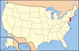 | ||
|---|---|---|---|
| Lists by county | |||
| Lists by city |
| ||
| Other lists | |||
| |||
This article is issued from Wikipedia. The text is licensed under Creative Commons - Attribution - Sharealike. Additional terms may apply for the media files.