Lumberton Township, New Jersey
Lumberton Township is a township in Burlington County, New Jersey, United States. As of the 2010 United States Census, the township's population was 12,559,[8][9][10] reflecting an increase of 2,098 (+20.1%) from the 10,461 counted in the 2000 Census, which had in turn increased by 3,756 (+56.0%) from the 6,705 counted in the 1990 Census.[19]
Lumberton Township, New Jersey | |
|---|---|
| Township of Lumberton | |
 Center of Lumberton | |
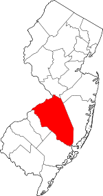
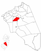 Lumberton Township highlighted in Burlington County. Inset map: Burlington County highlighted in the State of New Jersey. | |
 Census Bureau map of Lumberton Township, New Jersey | |
 Lumberton Township Location in Burlington County 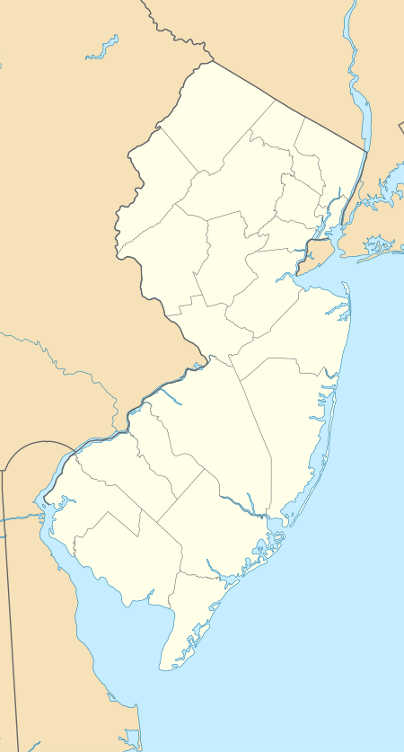 Lumberton Township Location in New Jersey  Lumberton Township Location in the United States | |
| Coordinates: 39.958855°N 74.802478°W[1][2] | |
| Country | |
| State | |
| County | Burlington |
| Incorporated | March 14, 1860 |
| Government | |
| • Type | Township |
| • Body | Township Committee |
| • Mayor | Ryan Tuno (D, term ends December 31, 2020)[4][5] |
| • Administrator | Brandon Umba[4] |
| • Municipal clerk | Bobbie Quinn[6] |
| Area | |
| • Total | 13.056 sq mi (33.817 km2) |
| • Land | 12.924 sq mi (33.474 km2) |
| • Water | 0.132 sq mi (0.343 km2) 1.01% |
| Elevation | 10 ft (3 m) |
| Population | |
| • Total | 12,559 |
| • Estimate (2019)[11] | 12,192 |
| • Rank | 193rd of 566 in state 11th of 40 in county[12] |
| • Density | 971.7/sq mi (375.2/km2) |
| • Density rank | 386th of 566 in state 24th of 40 in county[12] |
| Time zone | UTC−05:00 (Eastern (EST)) |
| • Summer (DST) | UTC−04:00 (Eastern (EDT)) |
| ZIP Code | |
| Area code(s) | 609[15] |
| FIPS code | 3400542060[1][16][17] |
| GNIS feature ID | 0882091[1][18] |
| Website | www |
Lumberton was incorporated as a township by an act of the New Jersey Legislature on March 14, 1860, from portions of Medford Township, Southampton Township and Eastampton Township. Portions of the township were taken on March 12, 1924, to form Hainesport.[20] The township was named for its early lumber industry, with pine trees cut down to supply wood used in Philadelphia.[21][22]
In March 2007, Lumberton was identified as having the most active community of eBay buyers and sellers on a per-capita basis in the United States, with 46,000 items posted on the site over a three-week period by members based in the Lumberton ZIP code 08048.[23][24]
History
The original 17th century farms in the township's southwest revolved around the unincorporated community of Fostertown. The farms had been formed following removal of forest. The village of Lumberton grew out of two bordering towns. Eayrestown, settled by Richard and Elizabeth Eayres in the late 1600s. Eayrestown was the first substantial settlement in this area and became the center for commerce because of its sawmill. The history of some of the homes in Lumberton date back to the times of slavery. Each generation of descendants removed from the first settlers differed in opinion about slavery. The spectrum changed from advocacy and tolerance, to passive and active resistance. Many locals began to advocate for its abolition in New Jersey then nationwide. One home, still located on Creek Road in the township, has been documented as having been a site on the underground railroad. The home was originally built in 1824 by D.B. Cole, a descendant of the founders of old Colestown, New Jersey. The deed to the land where the home sits dates back to 1806 when the Coles purchased the land from the Moores of Moorestown. The story goes, and has been documented in Charles Blockson's Hippocrene Guide to the Underground Railroad, that a fake well that once rested in the backyard of the house served as a chute for slaves to slide down in order to hide from their slavemasters as they fled to Canada.[25] The town was also a site for Project Nike during the Cold War. In the event of a nuclear war, Nike Ajax and Hercules missiles were to be launched from bases in Lumberton and other neighboring bases in order to prevent the Soviet Union from bombing greater Philadelphia.[26]
Geography
According to the United States Census Bureau, the township had a total area of 13.056 square miles (33.817 km2), including 12.924 square miles (33.474 km2) of land and 0.132 square miles (0.343 km2) of water (1.01%).[1][2]
The township borders the Burlington County municipalities of Eastampton Township, Hainesport Township, Medford Township, Mount Holly Township, Mount Laurel Township and Southampton Township.[27][28][29][30]
Unincorporated communities, localities and place names located partially or completely within the township include Brown, Eayrestown, Fostertown and Newbolds Corner.[31]
Demographics
| Historical population | |||
|---|---|---|---|
| Census | Pop. | %± | |
| 1860 | 1,830 | — | |
| 1870 | 1,718 | −6.1% | |
| 1880 | 1,689 | −1.7% | |
| 1890 | 1,799 | 6.5% | |
| 1900 | 1,624 | −9.7% | |
| 1910 | 1,768 | 8.9% | |
| 1920 | 1,571 | −11.1% | |
| 1930 | 905 | * | −42.4% |
| 1940 | 1,007 | 11.3% | |
| 1950 | 1,325 | 31.6% | |
| 1960 | 2,833 | 113.8% | |
| 1970 | 3,945 | 39.3% | |
| 1980 | 5,236 | 32.7% | |
| 1990 | 6,705 | 28.1% | |
| 2000 | 10,461 | 56.0% | |
| 2010 | 12,559 | 20.1% | |
| Est. 2019 | 12,192 | [11][32][33] | −2.9% |
| Population sources: 1860-2000[34] 1860-1920[35] 1860-1870[36] 1870[37] 1880-1890[38] 1890-1910[39] 1910-1930[40] 1930-1990[41] 2000[42][43] 2010[8][9][10] * = Lost territory in previous decade[20] | |||
Census 2010
The 2010 United States Census counted 12,559 people, 4,540 households, and 3,237.020 families in the township. The population density was 971.7 per square mile (375.2/km2). There were 4,719 housing units at an average density of 365.1 per square mile (141.0/km2). The racial makeup of the township was 70.99% (8,916) White, 18.93% (2,378) Black or African American, 0.24% (30) Native American, 4.71% (591) Asian, 0.04% (5) Pacific Islander, 1.55% (195) from other races, and 3.54% (444) from two or more races. Hispanic or Latino of any race were 5.86% (736) of the population.[8]
The 4,540 households accounted 38.7% with children under the age of 18 living with them; 56.2% were married couples living together; 11.0% had a female householder with no husband present, and 28.7% were non-families. Of all households, 24.0% were made up of individuals, and 9.2% had someone living alone who was 65 years of age or older. The average household size was 2.73 and the average family size was 3.28.[8]
In the township, the population age was spread out with 27.4% under the age of 18, 7.8% from 18 to 24, 25.6% from 25 to 44, 28.7% from 45 to 64, and 10.4% who were 65 years of age or older. The median age was 38.5 years. For every 100 females, the population had 92.3 males. For every 100 females ages 18 and older there were 89.1 males.[8]
The Census Bureau's 2006-2010 American Community Survey showed that (in 2010 inflation-adjusted dollars) median household income was $82,250 (with a margin of error of +/- $10,344) and the median family income was $102,276 (+/- $7,854). Males had a median income of $71,475 (+/- $6,369) versus $54,452 (+/- $5,969) for females. The per capita income for the borough was $35,294 (+/- $1,882). About 5.6% of families and 5.0% of the population were below the poverty line, including 6.3% of those under age 18 and 1.3% of those age 65 or over.[44]
Census 2000
As of the 2000 United States Census[16] there were 10,461 people, 3,930 households, and 2,731 families residing in the township. The population density was 813.0 people per square mile (313.8/km²). There were 4,080 housing units at an average density of 317.1 per square mile (122.4/km²). The racial makeup of the township was 78.31% White, 13.75% African American, 0.23% Native American, 3.38% Asian, 0.02% Pacific Islander, 1.90% from other races, and 2.41% from two or more races. Hispanic or Latino of any race were 5.15% of the population.[42][43]
There were 3,930 households out of which 39.2% had children under the age of 18 living with them, 54.9% were married couples living together, 10.9% had a female householder with no husband present, and 30.5% were non-families. 25.1% of all households were made up of individuals and 9.1% had someone living alone who was 65 years of age or older. The average household size was 2.61 and the average family size was 3.17.[42][43]
In the township the population was spread out with 28.1% under the age of 18, 6.2% from 18 to 24, 35.6% from 25 to 44, 19.0% from 45 to 64, and 11.1% who were 65 years of age or older. The median age was 36 years. For every 100 females, there were 91.2 males. For every 100 females age 18 and over, there were 87.6 males.[42][43]
The median income for a household in the township was $60,571, and the median income for a family was $70,329. Males had a median income of $46,045 versus $32,431 for females. The per capita income for the township was $25,789. About 2.6% of families and 3.8% of the population were below the poverty line, including 3.2% of those under age 18 and 5.9% of those age 65 or over.[42][43]
Government
Local government
Lumberton Township is governed under the Township form of New Jersey municipal government, one of 141 of 565 municipalities statewide that use this form, the second-most commonly used form of government in the state.[45] The Township Committee is comprised of five members, who are elected directly by the voters at-large in partisan elections to serve three-year terms of office on a staggered basis, with either one or two seats coming up for election each year as part of the November general election in a three-year cycle.[3][46] At an annual reorganization meeting, the Township Committee selects one of its members to serve as Mayor and another as Deputy Mayor.
As of 2020, members of the Lumberton Township Committee are Ryan Tuno (D, term on committee ends December 31, 2021; term as mayor ends 2020), Deputy Mayor Kendra Hatfield (D, term on committee ends 2021; term as deputy mayor ends 2020), James Dwyer (R, 2020), Sean Earlen (R, 2020) and Rue Ryan (D, 2022).[4][47][48][49][50]
The 2019 election saw local Democrats win with the election of Rue Ryan, giving the Democratic Party a majority on the Township Committee for the first time in more than a decade.[51]
Federal, state and county representation
Lumberton Township is located in the 3rd Congressional District[52] and is part of New Jersey's 8th state legislative district.[9][53][54]
For the 116th United States Congress, New Jersey's 3rd Congressional District is represented by Andy Kim (D, Bordentown).[55] New Jersey is represented in the United States Senate by Democrats Cory Booker (Newark, term ends 2021)[56] and Bob Menendez (Paramus, term ends 2025).[57][58]
For the 2018–2019 session (Senate, General Assembly), the 8th Legislative District of the New Jersey Legislature is represented in the State Senate by Dawn Marie Addiego (R, Evesham Township) and in the General Assembly by Joe Howarth (R, Evesham Township) and Ryan Peters (R, Hainesport Township).[59][60]
Burlington County is governed by a board of chosen freeholders, whose five members are elected at-large in partisan elections to three-year terms of office on a staggered basis, with either one or two seats coming up for election each year; at an annual reorganization meeting, the board selects a director and deputy director from among its members.[61] As of 2018, Burlington County Board of Chosen Freeholders are Director Kate Gibbs (R, Lumberton Township, term as freeholder and as director ends December 31, 2018),[62] Deputy Director Linda Hughes (R, Evesham Township, term as freeholder and as deputy director ends 2018)[63] Tom Pullion (D, Edgewater Park, 2020),[64] Balvir Singh (D, Burlington Township, 2020),[65] and Latham Tiver (R, Southampton Township, 2019).[66][61][67][68] Burlington County's Constitutional Officers are County Clerk Tim Tyler (R, Fieldsboro, 2018),[69][70] Sheriff Jean E. Stanfield (R, Westampton, 2019)[71][72] and Surrogate Mary Ann O'Brien (R, Medford, 2021).[73][74][68]
Politics
As of March 23, 2011, there were a total of 7,481 registered voters in Lumberton Township, of which 2,406 (32.2% vs. 33.3% countywide) were registered as Democrats, 1,827 (24.4% vs. 23.9%) were registered as Republicans and 3,241 (43.3% vs. 42.8%) were registered as Unaffiliated. There were 7 voters registered to other parties.[75] Among the township's 2010 Census population, 59.6% (vs. 61.7% in Burlington County) were registered to vote, including 82.1% of those ages 18 and over (vs. 80.3% countywide).[75][76]
In the 2012 presidential election, Democrat Barack Obama received 3,508 votes here (57.4% vs. 58.1% countywide), ahead of Republican Mitt Romney with 2,504 votes (41.0% vs. 40.2%) and other candidates with 53 votes (0.9% vs. 1.0%), among the 6,108 ballots cast by the township's 7,956 registered voters, for a turnout of 76.8% (vs. 74.5% in Burlington County).[77][78] In the 2008 presidential election, Democrat Barack Obama received 3,756 votes here (59.5% vs. 58.4% countywide), ahead of Republican John McCain with 2,476 votes (39.2% vs. 39.9%) and other candidates with 53 votes (0.8% vs. 1.0%), among the 6,315 ballots cast by the township's 7,661 registered voters, for a turnout of 82.4% (vs. 80.0% in Burlington County).[79] In the 2004 presidential election, Democrat John Kerry received 2,924 votes here (52.1% vs. 52.9% countywide), ahead of Republican George W. Bush with 2,637 votes (46.9% vs. 46.0%) and other candidates with 42 votes (0.7% vs. 0.8%), among the 5,617 ballots cast by the township's 6,832 registered voters, for a turnout of 82.2% (vs. 78.8% in the whole county).[80]
In the 2013 gubernatorial election, Republican Chris Christie received 2,173 votes here (62.2% vs. 61.4% countywide), ahead of Democrat Barbara Buono with 1,235 votes (35.4% vs. 35.8%) and other candidates with 41 votes (1.2% vs. 1.2%), among the 3,493 ballots cast by the township's 7,917 registered voters, yielding a 44.1% turnout (vs. 44.5% in the county).[81][82] In the 2009 gubernatorial election, Republican Chris Christie received 1,847 votes here (49.6% vs. 47.7% countywide), ahead of Democrat Jon Corzine with 1,650 votes (44.3% vs. 44.5%), Independent Chris Daggett with 174 votes (4.7% vs. 4.8%) and other candidates with 32 votes (0.9% vs. 1.2%), among the 3,724 ballots cast by the township's 7,656 registered voters, yielding a 48.6% turnout (vs. 44.9% in the county).[83]
Education
For kindergarten through eighth grade, public school students attend the Lumberton Township School District.[84] With an average increase of 80-100 students per year, Lumberton has been one of the fastest-growing school districts in South Jersey.[85] As of the 2017–18 school year, the district, comprising four schools, had an enrollment of 1,286 students and 101.6 classroom teachers (on an FTE basis), for a student–teacher ratio of 12.7:1.[86] Schools in the district (with 2017-18 enrollment data from the National Center for Education Statistics[87]) are Florence L. Walther School[88] with 217 students (was K-1; K-2 for 2019-20), Ashbrook Elementary School[89] had 237 students in grades 2-3 (closed for renovations in 2019–20 school year[90]), Bobby's Run School[91] with 298 students (was grades 4-5; 3-5 for 2019-20) and Lumberton Middle School[92] with 507 students in grades 6–8.[93][94]
For ninth through twelfth grades, public school students attend the Rancocas Valley Regional High School, a comprehensive regional public high school serving students from five communities encompassing approximately 40 square miles (100 km2) and comprising the communities of Eastampton Township, Hainesport Township, Lumberton Township, Mount Holly Township and Westampton Township.[95][96][97] As of the 2017–18 school year, the high school had an enrollment of 2,052 students and 141.1 classroom teachers (on an FTE basis), for a student–teacher ratio of 14.5:1.[98] The school is located in Mount Holly Township. The district's board of education has nine members who are elected directly by voters to serve three-year terms of office on a staggered basis, with three seats up for election each year as part of the November general election. Seats on the board are allocated based on the population of the five constituent municipalities, with three seats assigned to Lumberton Township.[99][100]
Students from Lumberton Township, and from all of Burlington County, are eligible to attend the Burlington County Institute of Technology, a countywide public school district that serves the vocational and technical education needs of students at the high school and post-secondary level at its campuses in Medford and Westampton Township.[101]
Transportation
_in_Lumberton_Township%2C_Burlington_County%2C_New_Jersey.jpg)
Roads and highways
As of July 2015, the township had a total of 64.82 miles (104.32 km) of roadways, of which 45.61 miles (73.40 km) were maintained by the municipality, 17.11 miles (27.54 km) by Burlington County and 2.10 miles (3.38 km) by the New Jersey Department of Transportation.[102]
New Jersey Route 38 is the main east–west highway serving Lumberton. County Route 541 is the main north–south road.
Public transportation
NJ Transit provides bus service in the township on the 317 route between Asbury Park and Philadelphia, and on the 413 route between Camden and Burlington.[103][104]
BurLink bus service is offered on the B1 route between Beverly and Pemberton.[105]
The Flying W Airport is located 1-mile (1.6 km) southwest of the central business district.[106]
Notable people
People who were born in, residents of, or otherwise closely associated with Lumberton Township include:
- Pat Delany, former mayor of Lumberton who served in the New Jersey General Assembly from 2010 until his resignation in 2011 after disclosure that his wife had sent emails critical of Democratic candidate Carl Lewis.[107][108]
- Ryan Finley (born 1991), professional soccer player who plays as a forward for the Columbus Crew in Major League Soccer.[109]
- Jack Pierce (born 1962), Olympic bronze medalist in the 100-meter high hurdles at the 1992 Olympic Games.[110]
- Clifford Ross Powell (1893–1973), politician who served as Acting Governor of New Jersey in 1935.[111]
- Bobby Sanguinetti (born 1988), professional ice hockey defenseman who plays for HC Lugano in the National League[112]
References
- 2010 Census Gazetteer Files: New Jersey County Subdivisions, United States Census Bureau. Accessed May 21, 2015.
- US Gazetteer files: 2010, 2000, and 1990, United States Census Bureau. Accessed September 4, 2014.
- 2012 New Jersey Legislative District Data Book, Rutgers University Edward J. Bloustein School of Planning and Public Policy, March 2013, p. 103.
- Government, Lumberton Township. Accessed February 26, 2020.
- 2020 New Jersey Mayors Directory, New Jersey Department of Community Affairs. Accessed February 1, 2020.
- Municipal Clerk, Lumberton Township. Accessed October 17, 2019.
- U.S. Geological Survey Geographic Names Information System: Township of Lumberton, Geographic Names Information System. Accessed March 7, 2013.
- DP-1 - Profile of General Population and Housing Characteristics: 2010 for Lumberton township, Burlington County, New Jersey, United States Census Bureau. Accessed June 20, 2012.
- Municipalities Sorted by 2011-2020 Legislative District, New Jersey Department of State. Accessed February 1, 2020.
- Profile of General Demographic Characteristics: 2010 for Lumberton township, New Jersey Department of Labor and Workforce Development. Accessed June 20, 2012.
- QuickFacts for Lumberton township, Burlington County, New Jersey; Burlington County, New Jersey; New Jersey from Population estimates, July 1, 2019, (V2019), United States Census Bureau. Accessed May 21, 2020.
- GCT-PH1 Population, Housing Units, Area, and Density: 2010 - State -- County Subdivision from the 2010 Census Summary File 1 for New Jersey, United States Census Bureau. Accessed July 12, 2013.
- Look Up a ZIP Code for Lumberton, NJ, United States Postal Service. Accessed June 20, 2012.
- Zip Codes, State of New Jersey. Accessed September 16, 2013.
- Area Code Lookup - NPA NXX for Lumberton, NJ, Area-Codes.com. Accessed September 16, 2013.
- U.S. Census website, United States Census Bureau. Accessed September 4, 2014.
- Geographic codes for New Jersey, Missouri Census Data Center. Accessed October 17, 2019.
- US Board on Geographic Names, United States Geological Survey. Accessed September 4, 2014.
- Table 7. Population for the Counties and Municipalities in New Jersey: 1990, 2000 and 2010, New Jersey Department of Labor and Workforce Development, February 2011. Accessed June 20, 2012.
- Snyder, John P. The Story of New Jersey's Civil Boundaries: 1606-1968, Bureau of Geology and Topography; Trenton, New Jersey; 1969. p. 96. Accessed June 20, 2012.
- History of Lumberton Township, New Jersey, Lumberton Township. Accessed September 3, 2015. "Its name came from the fact that Pine trees were abundant in the vicinity and boats and rafts carried lumber and cord wood from the Rancocas Creek to Philadelphia and other places."
- Hutchinson, Viola L. The Origin of New Jersey Place Names, New Jersey Public Library Commission, May 1945. Accessed September 3, 2015.
- Berr, Jonathan. "A South Jersey Town Emerges as a Hub of E-Commerce", The New York Times, March 20, 2007. Accessed November 26, 2013. "But Ms. Pfeiffer didn't recognize Lumberton's place in the Internet marketplace until November, when eBay announced that the largely white-collar town of 12,000 people had the most active community of buyers and sellers on a per-capita basis in the United States.... EBay based its ranking on transactions posted during three weeks in November, when more than 46,000 listings originated from Lumberton and its ZIP code — 08048 — for items ranging from bedding to books to camping equipment."
- Community Counts Winner Announced, eBay, November 29, 2006, backed up by the Internet Archive as of July 6, 2008. Accessed January 7, 2012.
- "Traveling the East Coast Underground Railroad", Traveling with MJ, February 5, 2011. Accessed September 5, 2013. "New Jersey – D.B. Cole House, Creek Rd, Lumberton – Can be seen from the road, and rumored to be open by appointment – Cole used a well to hide runaway slaves by building a room with 20-foot ceilings at the bottom of the well."
- Bender, Donald E. "Lumberton's Cold War Legacy: Nike Missile Battery PH-23/25" Archived 2016-03-03 at the Wayback Machine, Nike Missiles and Missile Sites. Accessed July 14, 2016..
- Areas touching Lumberton Township, MapIt. Accessed February 26, 2020.
- Areas touching Mansfield Township, MapIt. Accessed February 26, 2020.
- Burlington County Map, Coalition for a Healthy NJ. Accessed February 26, 2020.
- New Jersey Municipal Boundaries, New Jersey Department of Transportation. Accessed November 15, 2019.
- Locality Search, State of New Jersey. Accessed May 21, 2015.
- Annual Estimates of the Resident Population for Minor Civil Divisions in New Jersey: April 1, 2010 to July 1, 2019, United States Census Bureau. Accessed May 21, 2020.
- Census Estimates for New Jersey April 1, 2010 to July 1, 2019, United States Census Bureau. Accessed May 21, 2020.
- Barnett, Bob. Population Data for Burlington County Municipalities, 1800 - 2000, WestJersey.org, January 6, 2011. Accessed November 26, 2013.
- Compendium of censuses 1726-1905: together with the tabulated returns of 1905, New Jersey Department of State, 1906. Accessed July 14, 2013.
- Raum, John O. The History of New Jersey: From Its Earliest Settlement to the Present Time, Volume 1, p. 264, J. E. Potter and company, 1877. Accessed July 13, 2013. "Lumberton township contained in 1860, 1,830 inhabitants; and in 1870, 1,718. Lumberton and Hainesport are the principal towns."
- Staff. A compendium of the ninth census, 1870, p. 259. United States Census Bureau, 1872. Accessed July 15, 2013.
- Porter, Robert Percival. Preliminary Results as Contained in the Eleventh Census Bulletins: Volume III - 51 to 75, p. 97. United States Census Bureau, 1890. Accessed July 14, 2013.
- Thirteenth Census of the United States, 1910: Population by Counties and Minor Civil Divisions, 1910, 1900, 1890, United States Census Bureau, p. 335. Accessed June 20, 2012.
- Fifteenth Census of the United States: 1930 - Population Volume I, United States Census Bureau, p. 715. Accessed June 20, 2012.
- Table 6. New Jersey Resident Population by Municipality: 1930 - 1990, New Jersey Department of Labor and Workforce Development. Accessed June 28, 2015.
- Census 2000 Profiles of Demographic / Social / Economic / Housing Characteristics for Lumberton township, Burlington County, New Jersey, United States Census Bureau. Accessed July 14, 2013.
- DP-1: Profile of General Demographic Characteristics: 2000 - Census 2000 Summary File 1 (SF 1) 100-Percent Data for Lumberton township, Burlington County, New Jersey Archived 2020-02-12 at Archive.today, United States Census Bureau. Accessed July 14, 2013.
- DP03: Selected Economic Characteristics from the 2006-2010 American Community Survey 5-Year Estimates for Lumberton township, Burlington County, New Jersey Archived 2020-02-12 at Archive.today, United States Census Bureau. Accessed June 20, 2012.
- Inventory of Municipal Forms of Government in New Jersey, Rutgers University Center for Government Studies, July 1, 2011. Accessed November 18, 2019.
- "Forms of Municipal Government in New Jersey", p. 7. Rutgers University Center for Government Studies. Accessed June 3, 2015.
- 2019 Municipal User Friendly Budget, Lumberton Township. Accessed October 17, 2019.
- November 6, 2018 General Election Summary Report Official Results, Burlington County, New Jersey, updated November 17, 2018. Accessed January 1, 2019.
- November 7, 2017 General Election Summary Report Official Results, Burlington County, New Jersey, updated November 16, 2017. Accessed January 1, 2018.
- November 8, 2016 General Election Summary Report Official Results, Burlington County, New Jersey, updated November 30, 2016. Accessed January 1, 2017.
- "Tuno Assumes Oath in Lumberton (or a New Dawn, Part II)", Insider NJ, January 2, 2020. Accessed February 26, 2020. "Ryan Tuno now has the title of mayor, having used the Dems’ 3-2 committee majority to replace Earlen. Rue Ryan proved the differrence-maker in the 2019 general election, winning the local race to turn Lumberton’s governing body from R to D.... Democratic challenger Rue Ryan hopes to keep her party’s 2018 momentum rolling and flip control of the township committee for the first time in at least a decade by earning her first-ever seat on the committee."
- Plan Components Report, New Jersey Redistricting Commission, December 23, 2011. Accessed February 1, 2020.
- 2019 New Jersey Citizen's Guide to Government, New Jersey League of Women Voters. Accessed October 30, 2019.
- Districts by Number for 2011-2020, New Jersey Legislature. Accessed January 6, 2013.
- Directory of Representatives: New Jersey, United States House of Representatives. Accessed January 3, 2019.
- About Cory Booker, United States Senate. Accessed January 26, 2015. "He now owns a home and lives in Newark's Central Ward community."
- Biography of Bob Menendez, United States Senate, January 26, 2015. "He currently lives in Paramus and has two children, Alicia and Robert."
- Senators of the 116th Congress from New Jersey. United States Senate. Accessed April 17, 2019. "Booker, Cory A. - (D - NJ) Class II; Menendez, Robert - (D - NJ) Class I"
- Legislative Roster 2018-2019 Session, New Jersey Legislature. Accessed January 22, 2018.
- District 8 Legislators, New Jersey Legislature. Accessed January 22, 2018.
- Board of Chosen Freeholders, Burlington County, New Jersey. Accessed June 6, 2018.
- Kate Gibbs, Burlington County, New Jersey. Accessed June 6, 2018.
- Linda Hughes, Burlington County, New Jersey. Accessed June 6, 2018.
- Tom Pullion, Burlington County, New Jersey. Accessed June 6, 2018.
- Balvir Singh, Burlington County, New Jersey. Accessed June 6, 2018.
- Latham Tiver, Burlington County, New Jersey. Accessed June 6, 2018.
- 2018 County Data Sheet, Burlington County, New Jersey. Accessed June 6, 2018.
- A Guide to Burlington County: 2015, Burlington County, New Jersey. Accessed October 22, 2017.
- County Clerk, Burlington County. Accessed July 19, 2017.
- Members List: Clerks, Constitutional Officers Association of New Jersey. Accessed October 22, 2017.
- Sheriff's Department, Burlington County. Accessed July 19, 2017.
- Members List: Sheriffs, Constitutional Officers Association of New Jersey. Accessed October 22, 2017.
- Surrogate, Burlington County. Accessed July 19, 2017.
- Members List: Surrogates, Constitutional Officers Association of New Jersey. Accessed October 22, 2017.
- Voter Registration Summary - Burlington, New Jersey Department of State Division of Elections, March 23, 2011. Accessed December 25, 2014.
- GCT-P7: Selected Age Groups: 2010 - State -- County Subdivision; 2010 Census Summary File 1 for New Jersey Archived 2020-02-12 at Archive.today, United States Census Bureau. Accessed December 25, 2014.
- Presidential November 6, 2012 General Election Results - Burlington County Archived December 26, 2014, at the Wayback Machine, New Jersey Department of State Division of Elections, March 15, 2013. Accessed December 25, 2014.
- Number of Registered Voters and Ballots Cast November 6, 2012 General Election Results - Burlington County Archived December 26, 2014, at the Wayback Machine, New Jersey Department of State Division of Elections, March 15, 2013. Accessed December 25, 2014.
- 2008 Presidential General Election Results: Burlington County, New Jersey Department of State Division of Elections, December 23, 2008. Accessed December 25, 2014.
- 2004 Presidential Election: Burlington County, New Jersey Department of State Division of Elections, December 13, 2004. Accessed December 25, 2014.
- 2013 Governor: Burlington County, New Jersey Department of State Division of Elections, January 29, 2014. Accessed December 25, 2014.
- Number of Registered Voters and Ballots Cast November 5, 2013 General Election Results : Burlington County, New Jersey Department of State Division of Elections, January 29, 2014. Accessed December 25, 2014.
- 2009 Governor: Burlington County Archived 2016-01-13 at the Wayback Machine, New Jersey Department of State Division of Elections, December 31, 2009. Accessed December 25, 2014.
- Lumberton Township Board of Education District Policy 0110 - Identification, Lumberton Township School District. Accessed February 26, 2020. "Purpose: The Board of Education exists for the purpose of providing a thorough and efficient system of free public education in grades K through 8 in the Lumberton Township School District. Composition: The Lumberton Township School District is comprised of all of the area within the municipal boundaries of Lumberton Township."
- Harbach, Louise. "Fast-growing Lumberton District Looks At High-school Alternatives It Could Withdraw From The Rancocas Valley Regional High School District.", The Philadelphia Inquirer, February 19, 1998. Accessed August 13, 2014.
- District information for Lumberton Township Board Of Education, National Center for Education Statistics. Accessed November 1, 2019.
- School Data for the Lumberton Township School District, National Center for Education Statistics. Accessed December 7, 2016.
- Florence L. Walther School, Lumberton Township School District. Accessed February 9, 2020.
- Ashbrook Elementary School, Lumberton Township School District. Accessed February 9, 2020.
- Walsh, Jim. "Lumberton residents to vote Tuesday on $4.9M school improvement plan", Courier-Post, March 11, 2019. Accessed February 9, 2020. "If the 10-year bond is approved, Ashbrook would close for renovations during the 2019-20 school year. It would reopen one year later for students in grades pre-K to second, Florence L. Walther School, which is to receive roof repairs, would close in the 2020-21 school year under the district's plan, said Mark Ritter, business administrator."
- Bobby's Run School, Lumberton Township School District. Accessed February 9, 2020.
- Lumberton Middle School, Lumberton Township School District. Accessed February 9, 2020.
- 2018-2019 Burlington County Public Schools Directory, Burlington County, New Jersey. Accessed February 9, 2020.
- New Jersey School Directory for Lumberton Township School District, New Jersey Department of Education. Accessed December 29, 2016.
- Rancocas Valley Regional High School District 2015 Report Card Narrative, New Jersey Department of Education. Accessed June 1, 2016. "The Rancocas Valley Regional High School (RVRHS) District serves five sending districts covering approximately 40 square miles in Burlington County: Eastampton, Hainesport, Lumberton, Mount Holly and Westampton. RVRHS is situated on a picturesque campus in Mount Holly, the county seat."
- Staff. "Regional School Districts", Burlington County Times, April 26, 2015. Accessed June 1, 2016. "Rancocas Valley Regional - Serves: Eastampton, Hainesport, Lumberton, Mount Holly, Westampton"
- History of the School, Rancocas Valley Regional High School. Accessed June 1, 2016. "The district encompasses approximately 40 square miles (100 km2) and comprises the townships of Eastampton, Hainesport, Lumberton, Mount Holly, and Westampton."
- School data for Rancocas Valley Regional High School, National Center for Education Statistics. Accessed November 1, 2019.
- Comprehensive Annual Financial Report of the Rancocas Valley Regional High School District, New Jersey Department of Education, for year ending June 30, 2018. Accessed February 26, 2020. "The School District is a Type II district located in the County of Burlington, State of New Jersey. As a Type II district, the School District functions independently through a Board of Education (the 'Board'). The Board is comprised of nine members elected to three-year terms. These terms are staggered so that three member's terms expire each year.... The purpose of the School District is to educate students in grades 9 through 12 at its one school."
- School Profile 2019-2020, p. 7. Rancocas Valley Regional High School District. Accessed February 26, 2020. "RVRHS is governed by nine Board members, comprising two representatives each from Mount Holly and Westampton, three from Lumberton, and one each from Eastampton and Hainesport. Board members are elected each November for three-year terms."
- Why Choose BCIT?, Burlington County Institute of Technology. Accessed November 26, 2013.
- Burlington County Mileage by Municipality and Jurisdiction, New Jersey Department of Transportation, July 2015. Accessed October 10, 2016.
- Burlington County Bus/Rail Connections, NJ Transit, backed up by the Internet Archive as of January 28, 2010. Accessed November 26, 2013.
- South Jersey Transit Guide Archived 2018-09-29 at the Wayback Machine, Cross County Connection, as of April 1, 2010. Accessed November 26, 2013.
- BurLINK Bus System, Cross County Connection. Accessed October 17, 2019.
- Flying W Airport, AirNav.com. Accessed September 16, 2013.
- Farrell, Joelle. "Burlco assemblyman Delany to quit in August", Burlington County Times, July 29, 2011. Accessed November 26, 2013. "Assemblyman Pat Delany (R., Burlington) announced his resignation Thursday. He had planned to seek reelection to the seat he was appointed to last year in the Eighth District. Delany, of Lumberton, said family matters demand his full attention, but he would not elaborate."
- Levinsky, David. "Delany's resignation sparked by wife's email" Archived 2011-12-18 at the Wayback Machine, Burlington County Times, August 23, 2011. Accessed November 26, 2013. "Republican officials and Delany confirmed Monday that his resignation was the result of an email his wife, Jennifer, sent to the campaign of Democrat state Senate candidate Carl Lewis."
- Staff. "Soccer / U-17 Barons tie Inter Milan 1-1", The Press of Atlantic City, August 23, 2008. Accessed November 26, 2013. "Ryan Finley, a Lumberton resident and Rancocas Valley High School student, scored for the Barons 30 minutes into the game to make it 1-1."
- Ostrum, Gus. "Former Olympic Star, New Jersey State Champion Jack Pierce Recalls Days in South Jersey", Courier-Post, March 24, 2009. Accessed November 19, 2016. "Today, Pierce's family – including wife Marva, a former track star herself, daughter Sydnee and son Sterling – reside in Lumberton."
- Staff. "Gen. Clifford R. Powell, 80; Jersey Senator Led Guard", The New York Times, March 31, 1973. Accessed October 17, 2019. "Maj. Gen. Clifford R. Powell, a retired commander of the New Jersey National Guard and a former State Senator and Assemblyman, died of a heart attack a Burlington County Memorial Hospital Wednesday. He was 80 years old and lived in Lumberton."
- Hageny, John Christian. "Hockey: Where are they now? Call Lawrenceville's Sanguinetti a Hurricane", NJ.com, February 24, 2013. Accessed February 8, 2018. "Bobby Sanguinetti was born in Trenton, grew up a New York Rangers fan and even wore number 22 for a time in his career in honor of his favorite player, Brian Leetch, while skating at Lawrenceville.... Sanguinetti grew up in nearby Lumberton, N.J. and began his hockey career under Dan O'Brien while skating for the NJ Rockets."
External links
| Wikimedia Commons has media related to Lumberton Township, New Jersey. |
- Lumberton Township website
- Lumberton Historical Society
- Lumberton Township School District
- Lumberton Township School District's 2015–16 School Report Card from the New Jersey Department of Education
- Data for the Lumberton Township School District, National Center for Education Statistics
- Former Lumberton Nike Missile Site